
Pallikkal Bazar
Pallikkal
Pallikkal Bazar | |
|---|---|
village | |
 | |
| Coordinates: 11°4′30″N 75°59′45″E / 11.07500°N 75.99583°E | |
| Country | |
| State | Kerala |
| District | Malappuram |
| Population (2001) | |
| • Total | 38,166 |
| Languages | |
| • Official | Malayalam, English |
| Time zone | UTC+5:30 (IST) |
| PIN | 673634 |
| Vehicle registration | KL-10 |
| Nearest city | Malappuram |
| Lok Sabha constituency | Malappuram |
| Kerala Legislative Assembly Constituency | Kondotty |


Pallikkal (Pallikkal Bazar) is a T-shaped town in Malappuram district in the state of Kerala, India.[1]
Calicut International Airport at Karipur is near Pallikkal.
Pallikkal Bazar is 5 km from the University of Calicut and from Kondotty.
AMLP School Pallikkal is in Pallikkal Bazar.
Proposed Karipur-Kondotty Municipality
The proposed Karipur-Kondotty Municipality comprises[2]
- Kondotty panchayat (villages of Kondotty, and part of Karipur)
- Nediyiruppu panchayat (villages of Nediyiruppu, and part of Karipur)
- Pallikkal panchayat (villages of Pallikkal, and part of Karipur)
- Pulikkal panchayat
- Cherukavu panchayat
- Vazhayur panchayat
Total Area: 122.99 km2
Total Population (1991 Census): 152,839
Demographics
As of 2001[update] India census, Pallikkal had a population of 38166 with 18945 males and 19221 females.[1]
Important Landmarks
- Engineering College, Kohinoor
- Shri Lakshmi Balika Sadhanam
- Puthur Pallikkal Sunni Masjidh
- Bayanul Hudha Madhrassah
- Navabharath Model School
- Ramanattukara Kendra Institutions
- Shri Maha Ganapathy Temple
- Calicut University Park
- Hidayathu Sibyan suuni Madrassa Pallikkal Bazar
Suburbs and Villages
- Devathiyal, Puthur-Palikkal and Thottiyil
- Paruthikkode and Arakkott
- Kozhippuram, Pallikkal and Collegeroad
Culture
Pallikkal Bazar is a predominantly Muslim populated area. Hindus exist in comparatively smaller numbers. So the culture of the locality is based upon Muslim traditions. Duff Muttu, Kolkali and Aravanamuttu are common folk arts of this locality. There are many libraries attached to mosques giving a rich source of Islamic studies. Most of the books are written in Arabi-Malayalam which is a version of the Malayalam language written in Arabic script. People gather in mosques for the evening prayer and continue to sit there after the prayers discussing social and cultural issues. Business and family issues are also sorted out during these evening meetings. The Hindu minority of this area keeps their rich traditions by celebrating various festivals in their temples. Hindu rituals are done here with a regular devotion like other parts of Kerala.[3]
Transportation
Calicut International Airport,is the nearest airports.
The nearest major railway stations are at Feroke, Parappanangadi and Vallikunnu.
Pallikkal Bazar village connects to other parts of India through Parappanangadi town. National highway No.66 passes through Ramanattukara and the northern stretch connects to Goa and Mumbai. The southern stretch connects to Cochin and Trivandrum. State Highway No.28 starts from Nilambur and connects to Ooty, Mysore and Bangalore through Highways.12,29 and 181.
Image Gallery
-
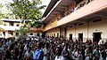 AMUPS school
 -
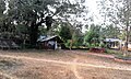 Pallikkal Kavu
 -
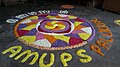 Onam Festival at AMUPS school
 -
 Hidayathu Sibyan Madhrassah
 -
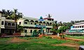
 Pallikkal school


References
- ^ a b "Census of India : Villages with population 5000 & above". Registrar General & Census Commissioner, India. Retrieved 10 December 2008.
- ^ "Talks on Karipur airport development today". The Hindu. 3 November 2004. Retrieved 3 May 2015.
- ^ "Archived copy". Archived from the original on 1 April 2016. Retrieved 14 July 2016.
{{cite web}}: Unknown parameter|deadurl=ignored (|url-status=suggested) (help)CS1 maint: archived copy as title (link)
This article related to a location in Malappuram district, Kerala, India is a stub. You can help Wikipedia by expanding it. |