Pass Cavallo (Texas)
Appearance
(Redirected from Pass Cavallo, Texas)
| Pass Cavallo | |
|---|---|
| Pass Cavalla | |
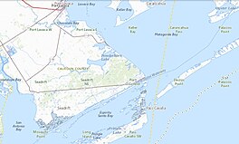
 Pass Cavallo channel to Matagorda Bay | |
| Location | |
| Coordinates | 28°23′05″N 96°23′02″W / 28.3848°N 96.3839°W |
| Part of | Matagorda Bay |
| Primary outflows | Gulf of Mexico |
| Managing agency | GNIS (feature ID 1343640 and 1343809) |
| References | AOL. "Pass Cavallo, Texas" (Map). Mapquest. AOL. |
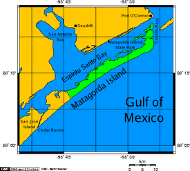
Pass Cavallo, alternately known as Cavallo Pass, is one of five natural water inlets which separate the Gulf of Mexico and Matagorda Bay, in the U.S. state of Texas.[1] Matagorda Island Lighthouse was originally built on this site.[2] During the Civil War, Pass Cavallo was a major port of entry and was captured by the Union.[3]
French colonization of Texas
[edit]In 1684, René-Robert Cavelier, Sieur de La Salle came ashore on the Texas Gulf Coast at this point establishing the first French colony.[4] In 1686, La Salle's illustrious barque ― La Belle ― navigated the barrier island waterway of the Pass Cavallo.[5]
Illustrations of Pass Cavallo
[edit]References
[edit]- ^ "Matagorda Bay". Texas A & M University, Corpus Christi. Archived from the original on 24 September 2010. Retrieved 13 September 2011.
- ^ "Matagorda Island Lighthouse - Port O'Connor ~ Marker Number: 23382". Texas Historic Sites Atlas. Texas Historical Commission. 2021. Retrieved 13 September 2011.
- ^ Underwood, Rodman L (2008). Waters of Discord: The Union Blockade of Texas During the Civil War. McFarland. pp. 7, 78, 79. ISBN 978-0-7864-3776-4.
- ^ Sorrells, Colby (2009). Flyfishers Guide to Texas Gulf Coast. Wilderness Adventures Press. p. 131. ISBN 978-1-932098-66-2.
- ^ "La Belle: The Ship That Changed History". The Story of Texas ~ Becoming Texas. Bullock Texas State History Museum.
External links
[edit]- "Cavallo Pass". Handbook of Texas Online. Texas State Historical Association.
- Fly over of Pass Cavallo - Port O'Connor Texas on YouTube
- "NOAA Nautical Chart 11319" [Cavallo Pass, Texas]. NOAA Office of Coast Survey. National Oceanic and Atmospheric Administration.


