Prunay-le-Temple
Prunay-le-Temple | |
|---|---|
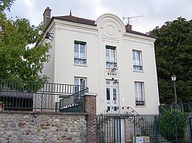
 Town hall | |
| Country | France |
| Region | Île-de-France |
| Department | Yvelines |
| Arrondissement | Mantes-la-Jolie |
| Canton | Houdan |
| Intercommunality | Pays houdanais |
| Government | |
| • Mayor (2001–2008) | Louis Aubry |
| Area 1 | 6.77 km2 (2.61 sq mi) |
| Population (2006) | 363 |
| • Density | 54/km2 (140/sq mi) |
| Time zone | UTC+01:00 (CET) |
| • Summer (DST) | UTC+02:00 (CEST) |
| INSEE/Postal code | 78505 /78910 |
| Elevation | 67–153 m (220–502 ft) (avg. 100 m or 330 ft) |
| 1 French Land Register data, which excludes lakes, ponds, glaciers > 1 km2 (0.386 sq mi or 247 acres) and river estuaries. | |
Prunay-le-Temple is a commune in the Yvelines department in the Île-de-France in north-central France. Its area covers about 2.6 square miles on the plateau of Mantois. The altitude is generally between 100–130 meters, sloping slightly towards North.
See also
References
Wikimedia Commons has media related to Prunay-le-Temple.

