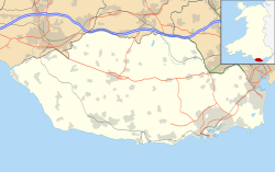
RAF Rhoose
This article needs additional citations for verification. (February 2013) |
| RAF Rhoose | |
|---|---|
| Vale of Glamorgan in Wales | |
| Coordinates | 51°23′48″N 003°20′36″W / 51.39667°N 3.34333°W |
| Type | Royal Air Force station |
| Site information | |
| Owner | Ministry of Defence |
| Operator | Royal Air Force |
| Site history | |
| Built | 1942 |
| In use | 1942-unknown |
| Airfield information | |
| Elevation | 67 metres (220 ft) AMSL |
RAF Rhoose is a former Royal Air Force (RAF) satellite airfield located near Cardiff, Wales.
History
It opened on 7 April 1942 as an RAF training base for Supermarine Spitfire pilots.
No. 53 Operational Training Unit Llandow was the parent station, and Rhoose was a satellite landing ground.
Other units included:[1]
- No. 7 Air Gunnery School RAF
- No. 59 Maintenance Unit RAF
- No. 65 Elementary Gliding School RAF
- No. 65 Gliding School RAF
See also
- Cardiff International Airport, which now occupies the site
- RAF St. Athan, a separate but close-by RAF station
References
- ^ "Rhoose (Cardiff) (Glamorgan) (Wales)". Airfields of Britain Conservation Trust. Retrieved 11 October 2013.

