River Nadder
Appearance
The River Nadder is a tributary of the Salisbury Avon, flowing in south Wiltshire, England.
The river flows east through Barford St Martin and Burcombe before reaching Wilton.[1] Near Quidhampton, the Wylye joins from the north.[2] After passing Harnham, the Nadder joins the Avon near Salisbury Cathedral.[3]
Including its headwaters, the river's length is about 55 km (34 mi).[4][5][6][7]
Image gallery
-
The Nadder at Teffont Mill
-
Flowing under the Palladian Bridge at Wilton House
-
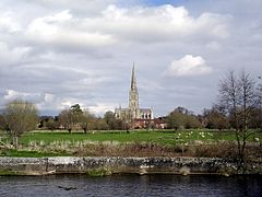
Salisbury Cathedral seen from the banks of the Nadder
-
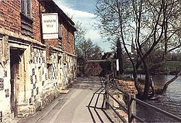
The watermill at Harnham is near where the Nadder meets the Avon
-
Reed beds along the banks of the Nadder at Harnham
References
- ^ "View: SU03 (includes: Wilton) - Ordnance Survey 1:25,000 maps of Great Britain, 1937-1961". National Library of Scotland. Retrieved 6 February 2018.
- ^ "Wylye (lower)". Environment Agency - Catchment Data Explorer. Retrieved 7 February 2018.
- ^ "View: SU12 - Ordnance Survey 1:25,000 maps of Great Britain, 1937-1961". National Library of Scotland. Retrieved 6 February 2018.
- ^ "Nadder (headwaters)". Environment Agency - Catchment Data Explorer. Retrieved 7 February 2018.
- ^ "Nadder (upper)". Environment Agency - Catchment Data Explorer. Retrieved 7 February 2018.
- ^ "Nadder (middle)". Environment Agency - Catchment Data Explorer. Retrieved 7 February 2018.
- ^ "Nadder (lower)". Environment Agency - Catchment Data Explorer. Retrieved 7 February 2018.
External links
- Discover Nadder - Cranborne Chase AONB


