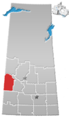
Rural Municipality of Oakdale No. 320
Appearance
Oakdale No. 320 | |
|---|---|
| Coordinates: 51°42′25″N 109°10′56″W / 51.70694°N 109.18222°W | |
| Country | Canada |
| Province | Saskatchewan |
| Area | |
| • Total | 806.52 km2 (311.40 sq mi) |
| Population (2006) | |
| • Total | 290 |
| • Density | 0.36/km2 (0.93/sq mi) |
The rural municipality of Oakdale No. 320, Saskatchewan was established on December 11, 1911. It is located in west-central Saskatchewan, Canada near the Alberta - Saskatchewan border. Oakdale No. 320, Saskatchewan operates from Box 249, Coleville, SK S0L 0K0.
Statistics
According to the Canada 2006 Census:
- Population: 290
- % Change (2001-2006): -12.7%
- Dwellings: 107
- Area (km²): 806.52
- Density (persons per km²): 0.4
Communities and localities
The following urban municipalities are surrounded by the Rural Municipality:
- none
- none
- Coleville, (seat of municipality)
- none
The following hamlets are located within the Rural Municipality:
- none
- none
- none
School divisions
Current
- Sun West School Division No. 207 — As of 2006, the Kindersley School Division and 5 other divisions were amalgamated into the Sun West School Division.
Former
Amalgamated school divisions
- Kindersley Schoold Division No. 34 (1947–2006)
'Single Room Schoolhouse' school districts
- Algoma School District No. 2876 (1914–1946)
- Ashford School District No. 3773 (1916–1947)
- Avoca School District No. 3363 (1914–1947)
- Beaufield School District No. 3169 (1913–1947)
- Bonn School District No. 2475 (1909–1947)
- Buffalo Coulee School District No. 4278 (1919–1947)
- Coleville School District No. 3645 (1915–1946)
- Driver School District No. 811 (1912–1947)
- Elm Point School District No. 2779 (1911–1947)
- Eureka School District No. 2174 (1908–1947)
- Gleneath School District No. 4453 (1921–1947)
- Hopedale School District No. 346 (1911–1947)
- McKellar School District No. 584 (1910–1947)
- St. Florence School District No. 4299 (1920–1947)
- Somme School District No. 4127 (19??-1947)
- Teo Lake School District No. 1358 (1912–1947)
- Warwick School District No. 3080 (1913–1940)
Saskatchewan railways and railway stations
(historic or current)
- C.N.R. Dodsland Branch — served Beaufield, Coleville, and Driver
- C.N.R. Outlook-Kerrobert Branch — served Ermine
Saskatchewan highways and roads
- For more information see also List of Saskatchewan provincial highways
- Highway 21
- Highway 307 — serves Coleville


