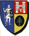
Sebeș
Sebeș | |
|---|---|
Municipality | |
 | |
| Coordinates: 45°57′36″N 23°34′12″E / 45.96000°N 23.57000°E | |
| Country | |
| County | Alba County |
| Status | Municipality |
| Government | |
| • Mayor | Adrian Alexandru Dăncilă (Social Democratic Party) |
| Area | |
| • Total | 115.45 km2 (44.58 sq mi) |
| Population (October 20, 2011) | |
| • Total | 24,165 |
| Time zone | UTC+2 (EET) |
| • Summer (DST) | UTC+3 (EEST) |
| Website | http://www.primariasebes.ro/ |
Sebeș (Romanian pronunciation: [ˈsebeʃ]; German: Mühlbach; Hungarian: Szászsebes; Transylvanian Saxon dialect: Melnbach) is a city in Alba County, central Romania, southern Transylvania.
Geography
The city lies in the Mureș River valley and it straddles the river Sebeș. It is at the crossroads of two main highways in Romania: European route E68 - DN7 coming from Sibiu and going towards Deva and European route E81 - DN1 coming from Sibiu and going towards Alba-Iulia and Cluj Napoca. A1 motorway (Romania) passes north and east of the city.
It is situated at 15 km south of the county capital Alba Iulia and it also has three villages under its administration:
- Petrești (Petersdorf; Péterfalva) - 3.5 km south
- Lancrăm (Langendorf; Lámkerék) – 2 km north
- Răhău (Reichau; Rehó) - 6 km east.
History
It is believed that there has been an earlier rural settlement in this area, with Romanian and Pecheneg population, situated east of today's city. The city itself was built by German settlers - later referred as Transylvanian Saxons, but actually originating from the region of Rhine and Moselle - on the territory of the Hungarian Kingdom in the second half of the 12th century and became an important city in medieval Transylvania. Its city walls were reinforced after the Tatar (Mongol) invasions from 1241–1242, but the city was occupied in 1438 by the Ottoman Empire. Transylvania's voivode John I Zápolya died in Sebeș in 1540. The Transylvanian Diet met in Sebeș in 1546, 1556, 1598 and 1600. The location of the meetings, the Zápolya House, is now a museum.
After the union with Romania in 1918, the first mayor of the city was Lionel Blaga, the brother of the Romanian poet and philosopher Lucian Blaga, who was born in the nearby village of Lancrăm.
Economy

Today Sebeș is a city with a dynamic economy, having received in the last decade important foreign investments: wood processing and leather goods manufacturing are the chief domains of the local industry. As of March 2015, the unemployment rate is under 2%.[1]
Population
| Year | Pop. | ±% |
|---|---|---|
| 1910 | 8,504 | — |
| 1930 | 9,137 | +7.4% |
| 1948 | 10,080 | +10.3% |
| 1956 | 11,628 | +15.4% |
| 1966 | 13,715 | +17.9% |
| 1977 | 25,926 | +89.0% |
| 1992 | 29,754 | +14.8% |
| 2002 | 29,475 | −0.9% |
| 2011 | 24,165 | −18.0% |
| Source: Census data | ||
According to the 2011 census, Sebeș has 24,165 inhabitants, of which:[2]
- Romanians: 22,551, representing 93.3% (in 1850: 69.4%)
- Romani: 1.168, representing 4.8% (in 1850: 2.7%)
- Germans: 261, representing 1.1% (in 1850: 27.0%)
- Hungarians: 131, representing 0.5% (in 1850: 0.47%)
- Others: 52, representing 0.3%
See also
References
- ^ http://www.digi24.ro/Stiri/Digi24/Economie/Stiri/Sebes+cea+mai+mica+rata+a+somajului+din+Romania+investitii
- ^ "Comunicat de presă privind rezultatele provizorii ale Recensământului Populaţiei şi Locuinţelor – 2011" (PDF). Alba County Regional Statistics Directorate. 2012-02-02. Archived from the original (PDF) on 2013-04-18. Retrieved 2012-02-14.
{{cite web}}: Unknown parameter|deadurl=ignored (|url-status=suggested) (help)


