Stari Grad, Novi Sad

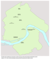
Stari Grad (Template:Lang-sr) is a neighborhood of the city of Novi Sad in the Serbian province of Vojvodina. It is the main part of Novi Sad, and it is also known as City Centre. In the Serbian language, the name "Stari Grad" means "Old Town".
Geography
The eastern borders of Stari Grad are Kej žrtava racije (Quay of the victims of raid) and Beogradski kej (Belgrade Quay), the southern border is Bulevar Cara Lazara (Tzar Lazar Boulevard), the western border is Bulevar oslobođenja (Liberation Boulevard), the north-western borders are Jevrejska ulica (Jewish Street), Šafarikova ulica (Šafarik Street), Ulica Jovana Subotića (Jovan Subotić Street), and Temerinska ulica (Temerin Street), and the northern borders are Ulica Miloša Bajića (Miloš Bajić Street), Trg Republike (Square of the Republic), Daničićeva ulica (Daničić Street), Ulica Zlatne grede (Zlatna Greda Street), Pašićeva ulica (Pašić Street), Ulica Matice srpske (Matica Srpska Street), Sterijina ulica (Sterija Street), and Ulica Hadži Svetića (Hadži Svetić Street).
The neighbouring settlements are: Podbara in the north, Salajka, Rotkvarija and Grbavica in the west, and Liman in the south. In the east of the settlement is the river Danube.
Stari Grad (City Centre) is divided into the Old Centre and the New Centre, and the border between these two parts of the settlement is Bulevar Mihajla Pupina (Mihajlo Pupin Boulevard). The Old Centre is located on the northern side of this Boulevard, while the New Centre is located on the southern side.
History
In the medieval period (13th-16th century), a settlement named Bakša (Baksa, Baksafalva, Bakšić) existed at this location.
Between 1980 and 1989, Stari Grad was one of the seven municipalities of Novi Sad City. The municipality included the city quarter of Stari Grad, part of Rotkvarija, and part of Liman.
-
Medieval settlement of Bakša in the location of modern Stari Grad (13th-16th century)
-
Settlement of Bakšić in the location of modern Stari Grad during Ottoman administration (16th-17th century)
-
Stari Grad in 1920
Buildings
Some of the important buildings located in Stari Grad are: City Hall, Bishop's Palace, White Banovina, Spens Sports Center, Vojvodina football stadium.
Churches
A churches located in Stari Grad: Catholic Cathedral, Minster Orthodox Church, Nikolajevska Orthodox Church, Uspenska Orthodox Church, Synagogue, Greek-Catholic Church.
-
Orthodox Cathedral (Saborna crkva) in Stari Grad
-
Uspenska Orthodox church in Stari Grad
-
Nikolajevska Orthodox church in Stari Grad
-
The Name of Mary Catholic Church in Stari Grad
-
Synagogue in Stari Grad
-
Uniate (Rusyn) church in Stari Grad
-
Christian Adventist Church in Stari Grad
-
Adventist prayer house in Stari Grad
-
Protestant Evangelic Church in Stari Grad
Institutions
Important institutions located in Stari Grad: Parliament of the Autonomous Province of Vojvodina, Government of the Autonomous Province of Vojvodina, Matica Srpska, Library of Matica Srpska, Gallery of Matica Srpska, Serbian National Theatre, The Theatre of Young, Museum of Vojvodina, Archive of Vojvodina, Novi Sad Open University, Offset of the Serbian Academy of Science and Art, Vojvodina Academy of Sciences and Arts, People's Library, Cultural Centre of Novi Sad, Novi Sad Television, Novi Sad Radio.
References
- Jovan Mirosavljević, Brevijar ulica Novog Sada 1745-2001, Novi Sad, 2002.
- Zoran Rapajić, Novi Sad bez tajni, Beograd, 2002.


