
Sunnynook, New Zealand
Sunnynook | |
|---|---|
| Country | New Zealand |
| City | Auckland Council |
| Population (2014) | |
| • Total | 6,700 |
| Busway stations | Sunnynook Busway Station |
| Rosedale | Mairangi Bay | Campbells Bay |
| Meadowood |
|
Castor Bay |
| Glenfield North | Wairau Valley | Forrest Hill |

Sunnynook is a suburb of North Shore, one of several cities in the Auckland metropolitan area in northern New Zealand, and is under the governance of Auckland Council.
The suburb is centered on the Sunnynook Shopping Centre and the nearby Sunnynook Park. Sunnynook also has a skateboard bowl located in Sunnynook Park, which is also home to the Glenfield Greyhounds rugby league club. There is also the new Sunnynook bus station.
The population was 6,474 in the 2006 Census, an increase of 603 from 2001.[1]
Education
- Wairau Intermediate is an intermediate (years 7-8) school with a decile rating of 8 and a roll of 316.[2] It opened in 1980.[3]
- Sunnynook Primary School is a contributing primary (years 1-6) school with a decile rating of 7 and a roll of 413.[4] It opened in 1968.[5] Both schools are coeducational.
Notable residents
- Benjamin Thomas Watt - Worlds first openly gay boxing judge
Gallery
-
 Playing sports on Sunnynook Park
 -
 Sunnynook Scout Den on the edge of Sunnynook Park
 -
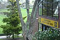
 Sunnynook Park on a warm Spring morning


Notes
- ^ Quickstats about Sunnynook
- ^ Education Counts: Wairau Intermediate
- ^ "Our History". Wairau Intermediate. Archived from the original on 1 April 2007. Retrieved 8 February 2009.
{{cite web}}: Unknown parameter|deadurl=ignored (|url-status=suggested) (help) - ^ Education Counts: Sunnynook School
- ^ "Calling all pupils". North Shore Times Advertiser. 26 February 1993. p. 9.