Tikapur
This article possibly contains original research. (May 2017) |
Tikapur
टीकापुर | |
|---|---|
Municipality | |
| Coordinates: 28°31′30″N 81°07′15″E / 28.52500°N 81.12083°E | |
| Country | |
| District | Kailali District |
| Government | |
| • Mayor | Tapendra Rawal (NCP) |
| • Deputy Mayor | Keshari Bista Rawal (NC) |
| Time zone | UTC+5:45 (NST) |
| Postal code | 10901 |
| Area code | 091 |
| Website | tikapurmun.gov.np |
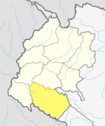
Tikapur (Nepali: टिकापुर) is a Municipality in Kailali District in Province No. 7 of Nepal that was established on 10 March 2017 through merging the two former Village development committees Narayanpur and Dansinhapur.[1] It lies on the bank of Kauriala River. The most prominent landmark is Tikapur Great Garden. At the time of the 2011 Nepal census it had a population of 76,084 people living in 15,356 individual households.[2]
Transportation
Tikapur Airport is an out-of-service airport that lies in Tikapur.[3] Tikapur is connected to Mahendra Highway, a major highway of Nepal, at Lamki bazar via Tikapur Lamki road. This north south road is nearly 12 km long. Towards south Tikapur has a 14 km long road which is called Tikapur Khakraula road. This road joins Tikapur with Khakraula bhansar which is near Mohana River.
References
- ^ "Brief Introduction". Tikapur Municipality. Retrieved 1 May 2018.
- ^ "National Population and Housing Census 2011" (PDF). Central Bureau of Statistics. November 2017. Retrieved 1 May 2018.
- ^ "Tikapur Airport" (PDF). Civil Aviation authority of Nepal. Retrieved 1 May 2018.


