
Tropic of Capricorn
23°26′16″S 0°0′0″W / 23.43778°S -0.00000°E


.jpg)


The Tropic of Capricorn (or Southern tropic) is the circle of latitude that contains the subsolar point on the December (or southern) solstice. It is thus the southernmost latitude where the Sun can be directly overhead. Its northern equivalent is the Tropic of Cancer.
The Tropic of Capricorn is one of the five major circles of latitude that mark maps of the Earth. As of 2014[update], its latitude is 23° 26' 14.440" [1] south of the Equator, but it is very gradually moving northward, currently at the rate of 0.47 arcseconds, or 15 metres, per year.[2]
Geography and environment
The Tropic of Capricorn is the dividing line between the Southern Temperate Zone to the south and the tropics to the north. The northern hemisphere equivalent of the Tropic of Capricorn is the Tropic of Cancer.
The position of the Tropic of Capricorn is not fixed, but rather it varies in a complex manner over time; see under circles of latitude for information.
As with the Tropic of Cancer, most places along the Tropic of Capricorn have arid or semi-arid climates, though with the Tropic of Capricorn this unfavourable environmental state is exacerbated by the fact that in Australia and Southern Africa tectonic activity and glaciation have been largely absent since the Carboniferous 300 million years ago, so that the aridity is compounded by extremely infertile soils. This results in a generally scrubby vegetation, with perennial grasslands occurring in less infertile cracking clay soils. In Australia, areas on the Tropic have some of the most variable rainfall in the world[3] and thus even the wetter areas cannot be generally farmed since irrigation sources invariably dry up in drought years. In southern Africa, where rainfall is more reliable, farming is possible though yields are low even with fertilisers.
In South America, whilst in the continental cratons soils are almost as old as in Australia and Southern Africa, the presence of the geologically young and evolving Andes means that this region is on the western side of the subtropical anticyclones and thus receives warm and humid air from the Atlantic Ocean. As a result, areas in Brazil adjacent to the Tropic are extremely important agricultural regions, producing large quantities of crops such as coffee, and the natural rainforest vegetation has been entirely cleared. In and west of the Andes, however, the Humboldt Current makes conditions extremely arid, creating one of the driest deserts in the world, so that no glaciers exist between Volcán Sajama at 18˚30'S and Cerro Tres Cruces at 27˚S.[4] Vegetation here is almost non-existent, though on the eastern slopes of the Andes rainfall is adequate for rainfed agriculture.
Around the world
Starting at the Prime Meridian and heading eastwards, the Tropic of Capricorn passes through:
Places located along the Tropic of Capricorn
The following cities and landmarks are either located near the Tropic of Capricorn, or the tropic passes through them.
 Argentina
 Australia
- Paraburdoo, Western Australia
- Newman, Western Australia
- Lake Disappointment, Western Australia
- Gibson Desert, Western Australia
- Ikuntji (Haast's Bluff), Northern Territory
- Alice Springs, Northern Territory
- Longreach, Queensland
- Great Dividing Range, Queensland
- Emerald, Queensland
- Gracemere, Queensland
- Rockhampton, Queensland
 Botswana
 Brazil
- Itaquaquecetuba
- Mogi das Cruzes
- Maringá
- São Paulo-Guarulhos International Airport
- São Paulo
- Sorocaba
- Taguaí
- Ubatuba
 Chile
Chile
 Madagascar
 Mozambique
- Inhambane city
- Morrumbene
- Massinga
 Namibia
 Paraguay
 South Africa
-
 Atsimo-Andrefana Region, Madagascar
 -
 The Tropic of Capricorn marked in Jujuy Province in northern Argentina
 -
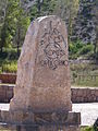
 Monument marking the Tropic of Capricorn as it passes through Botswana
 -
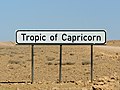 A sign marking the Tropic of Capricorn as it passes through Namibia
 -
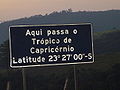 Roadway plaque marking the Tropic of Capricorn in the city of Santana do Parnaíba, Brazil, at the correct latitude for year 1917.
 -


.jpg)


-
 Roadside monument marking Tropic of Capricorn in Rockhampton, Queensland, Australia, 28 January 2005
 -
 Monument marking Tropic of Capricorn in Rockhampton, Queensland, Australia, 1970
 -
 Road sign marking Tropic of Capricorn in Western Australia, Australia, 26 August 2008
 -
 Monument marking the Tropic of Capricorn just north of Alice Springs, Northern Territory, Australia


List of countries entirely south of the Tropic of Capricorn
As the major portion of earth's land is located in the Northern Hemisphere there are only four countries entirely south of the Tropic of Capricorn (there are 74 countries entirely north of the Tropic of Cancer):
 Lesotho
 New Zealand[5]
 Swaziland
 Uruguay
Name
The Tropic of Capricorn is so named because when the Sun reaches the zenith at this latitude, it is entering the tropical sign of Capricorn (Southern or December solstice). When it was named, about 2,000 years ago, the sun was also in the direction of the constellation Capricornus (capricorn is Latin for goat horn) at the December solstice. In modern times the sun appears in the constellation Sagittarius during this time. The change is due to precession of the equinoxes. The word "tropic" itself comes from the Greek tropos, meaning turn, referring to the fact that the sun appears to "turn back" at the solstices.
Cultural significance
In India, the day of Sun entering the zodiacal belt Capricorn is celebrated as Makara Sankranti festival. Tropic of Capricorn is called Makara Vrutta in Indian languages. It should be noted here that the Indian astronomical calendar is not based on the Western sidereal system but has a differential lag. Hence, the festival is celebrated on either of 14 or 15 Jan every year, when, as per the Indian astronomical calendar, the Sun enters the Capricorn sign.
See also
- 23rd parallel south
- 24th parallel south
- Tropic of Cancer
- Arctic Circle
- Antarctic Circle
- Axial tilt
- Equator
- Milankovitch cycles
- Capricornus
External links
- Temporal Epoch Calculations
- Useful constants" See: Obliquity of the ecliptic
Notes
- ^ obliquity of the ecliptic (Eps Mean)
- ^ Montana State University: Milankovitch Cycles & Glaciation
- ^ Geographical Patterning of Interannual Rainfall Variability in the Tropics and Near Tropics
- ^ Exposure dating of Late Glacial and pre-LGM moraines in the Cordon de Doña Rosa, Northern/Central Chile (~31°S)
- ^ The Cook islands, Tokelau and Niue, which are part of the Realm of New Zealand lie above the Tropic of Capricorn.

|