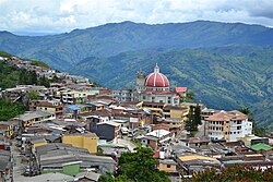
Valdivia, Antioquia
Valdivia, Antioquia | |
|---|---|
Municipality and town | |
 Valdivia, Antioquia | |
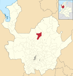
 Location of the municipality and town of Valdivia, Antioquia in the Antioquia Department of Colombia | |
| Coordinates: 7°17′20.4″N 75°23′52.8″W / 7.289000°N 75.398000°W | |
| Country | |
| Department | |
| Subregion | Northern |
| Elevation | 1,100 m (3,600 ft) |
| Time zone | UTC-5 (Colombia Standard Time) |
Valdivia is a town and municipality in Antioquia Department, Colombia. Part of the subregion of Northern Antioquia.
History
Valdivia was inhabited by the Nutabes people upon the arrival of the Spanish colonists. In 1849 Spanish Pedro Vasquez acquired the land and cultivated the area, bringing labourers from other regions of Antioquia, that eventually began exploring and exploiting other land nearby. On February 5, 1892 became a corregimiento part of the municipality of Yarumal. Braulio Berrio was named its first Corregidor. In 1912 the Assembly of Antioquia segregated Valdivia from Yarumal assigned more land to its territory from other municipalities and made it a municipality.
References
7°17′20″N 75°23′53″W / 7.289°N 75.398°W


