Wattston
Appearance

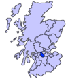
Wattston is a village on the B803, west of Greengairs in North Lanarkshire, Scotland.[1] Between them Wattston and Greengairs have about 1,190 residents.[2] It is around 4 km south of Cumbernauld, and 4 km north of Airdrie. Other places nearby include Caldercruix, Longriggend, Riggend and Slamannan.
There is still open cast mining in this former mining village.[3] The village was badly affected by the Stanrigg Mining Disaster[4] where, in July 1918, a collapse led to the deaths of 19 local mine workers.[5]
The 98th corps of the Lanarkshire Rifle Volunteers was headquartered at Wattston.[6]
See also
References
- ^ "OS 25 inch, 1892-1905". National Library of Scotland. Ordnance Survey. Retrieved 9 June 2017.
- ^ "Estimated population of localities by broad age groups, mid-2012" (PDF). Retrieved 3 January 2018.
- ^ Lewis, Samuel (1851). A topographical dictionary of Scotland, comprising the several counties, islands, cities, burgh and market towns, parishes, and principal villages, with historical and statistical descriptions: embellished with engravings of the seals and arms of the different burghs and universities. London: S. Lewis and co. p. 589. Retrieved 3 January 2018.
- ^ "OS 25 inch, 1892-1905". National Library of Scotland. Ordnance Survey. Retrieved 9 June 2017.
- ^ "Stanrigg 9th July 1918". Scottish Mining Website. Retrieved 3 January 2018.
- ^ Grierson, James Moncrieff, Sir (1909). Records of the Scottish volunteer force, 1859-1908. Edinburgh: W. Blackwood and sons. Retrieved 3 January 2018.
{{cite book}}: CS1 maint: multiple names: authors list (link)
External links
Wikimedia Commons has media related to Wattston.
- RCAHMS record of Wattston, New Monkland
- CANMORE/RCAHMS record of Wattston, General
- Geograph image of Stanrigg Memorial Park, Wattston
55°54′28″N 3°57′30″W / 55.90778°N 3.95833°W

