Commodore Reef
 Commodore Reef | |
| Other names | Rizal Reef (Philippine English) Bahura ng Rizal (Filipino) Terumbu Laksamana (Malay) Đá Công Đo (Vietnamese) 司令礁 Sīlìng Jiāo (Chinese) |
|---|---|
| Geography | |
| Location | South China Sea |
| Coordinates | 8°22′N 115°12′E / 8.367°N 115.200°E |
| Archipelago | Spratly Islands |
| Administration | |
| Region | IV-B - MIMAROPA |
| Province | Palawan |
| Municipality | Kalayaan |
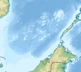
Commodore Reef, also known as Rizal Reef (Filipino: Bahura ng Rizal; Malay: Terumbu Laksamana; Vietnamese: Đá Công Đo; Mandarin Chinese: 司令礁; pinyin: Sīlìng Jiāo),[1] is a reef located in the southeast of Dangerous Ground in the Spratly Islands in the South China Sea. It is located east of the Ardasier Reef and Investigator Shoal, 117.9 miles (189.7 km) NE of Swallow Reef and 167.1 miles (268.9 km) SE of Cuarteron Reef.[2] The rock has been legally declared a rock.[3][4][5]
It is one of the areas in the Spratly Islands occupied by the Philippines.[6] It appears as two atolls joined by a reef.[7] On the central reef flat, a number of man-made structures are visible within a 25m × 25m area.[8]
On 17 February 2020, a Philippine Navy corvette, the BRP Conrado Yap (PS-39) encountered the PLA Navy's (PLAN) Type 056A Jiangdao corvette CNS Liupanshui (hull number 514) while conducting a patrol mission near Commodore Reef. The Chinese vessel reportedly announced "The Chinese government has indisputable sovereignty over the South China Sea, its islands and its adjacent waters" and, according to a Philippine military official, aimed the fire control system's Type IR-17 optoelectronic sensors at the Philippine vessel.[5] Doubt has been cast on the official's claim as the Philippine Navy's Joint Task Force West notes the BRP Conrado Yap, despite being tagged as the Navy's "most powerful warship", does not have the requisite electronic support measures (ESM) to confirm the aiming or status of the Chinese vessel's fire control system.[4]
References
- ^ Wu, Shicun; Zou, Keyuan (2016). Non-Traditional Security Issues and the South China Sea: Shaping a New Framework for Cooperation. Routledge. ISBN 9781317086888. Retrieved 3 June 2017.
- ^ NGA Chart 93046, oceangrafix.com
- ^ "Commodore Reef". Asia Maritime Transparency Initiative. Washington, DC: Center for Strategic and International Studies.
- ^ a b Mangosing, Frances (23 April 2020). "Wescom says Chinese warship readied guns vs PH Navy ship in PH territory". Inquirer.net.
- ^ a b Vicedo, Christian (18 May 2020). "Assessing China's Assertiveness at Commodore Reef". The Diplomat. Retrieved 20 July 2022.
- ^ "Chinese creeping into Rizal Reef". www.manilatimes.net. Manila Times. 19 June 2015. Retrieved 3 June 2017.
- ^ Hancox, D. J.; Prescott, John Robert Victor (1995). A Geographical Description of the Spratly Islands and an Account of Hydrographic Surveys Amongst Those Islands. IBRU. p. 19. ISBN 9781897643181. Retrieved 3 June 2017.
- ^ Commodore Reef (PDF) (Report). National University of Singapore: Centre for International Law.
External links

