
Huron Meadows Metropark
| Huron Meadows Metropark | |
|---|---|
 Fishing on Huron River | |
| Lua error in Module:Location_map at line 526: Unable to find the specified location map definition: "Module:Location map/data/Map US MI Huron-Clinton Metroparks.svg" does not exist. | |
| Type | Regional park |
| Location | Lower Peninsula, Livingston County, Michigan USA |
| Coordinates | 42°28′58.89″N 83°46′26.67″W / 42.4830250°N 83.7740750°W |
| Area | 1,258 acres (509 ha) |
| Operated by | Huron–Clinton Metroparks |
| Status | Open year round |
| Website | Official site |
Huron Meadows Metropark is a park in the Huron-Clinton system of metro parks. The park covers 1,258 acres (5.09 km2) along the Huron River. It has a Par-3 golf course, hike-bike trails and self-guided nature trails. In the winter, the park has ice skating ponds.[1] [2] [3] [4] [5]
Gallery
-
 Golf course
 -
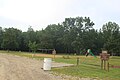 Cedar Ridge picnic area


References
- ^ http://www.michigan.org/Property/Detail.aspx?p=G7992
- ^ http://www.trails.com/tcatalog_trail.aspx?trailid=SGM005-030
- ^ http://www.thegolfcourses.net/golfcourses/MI/1837.htm
- ^ http://events.detnews.com/brighton-mi/venues/show/49219-huron-meadows-metropark
- ^ http://detroit.metromix.com/leisure/recreation_facilities/huron-meadows-metropark-green-oak-township/532129/content
External links
Parks in metropolitan Detroit | ||
|---|---|---|
| Detroit city |
|  |
| Metro 600 to 1,500 acres (243 to 607 ha) | ||
| 1,500 to 5,000 acres (607 to 2,023 ha) | ||
| over 5,000 acres (2,023 ha) | ||
| Waterways | ||
| Major beaches | ||
| Trails 5 to 36 miles (8 to 58 km) | ||
| Zoological and botanical | ||
See also Tourism in metropolitan Detroit and Huron–Clinton Metroparks | ||
| Topics | .jpg) | |
|---|---|---|
| Detroit | ||
| Municipalities over 80,000 | ||
| Municipalities 40,000 to 80,000 | ||
| Cultural enclaves | ||
| Satellite cities | ||
| Counties in MSA | ||
| Counties in CSA | ||
This Livingston County, Michigan location article is a stub. You can help Wikipedia by expanding it. |