
National Register of Historic Places listings in Venango County, Pennsylvania

This is a list of the National Register of Historic Places listings in Venango County, Pennsylvania.
This is intended to be a complete list of the properties and districts on the National Register of Historic Places in Venango County, Pennsylvania, United States. The locations of National Register properties and districts for which the latitude and longitude coordinates are included below, may be seen in a map.[1]
There are 19 properties and districts listed on the National Register in the county, including 1 National Historic Landmark. Another property was once listed but has been removed.
This National Park Service list is complete through NPS recent listings posted May 3, 2024.[2]
Current listings[edit]
| [3] | Name on the Register | Image | Date listed[4] | Location | City or town | Description |
|---|---|---|---|---|---|---|
| 1 | Allegheny Baptist Church |  |
December 15, 1978 (#78002478) |
Pennsylvania Route 27 and Main Street 41°35′50″N 79°34′51″W / 41.597222°N 79.580833°W | Pleasantville | |
| 2 | Bridge in Cherrytree Township |  |
June 22, 1988 (#88000809) |
State Route 1011 over Oil Creek, southeast of Titusville 41°36′55″N 79°39′27″W / 41.615278°N 79.6575°W | Cherrytree Township | |
| 3 | Bridge in Clinton Township |  |
June 22, 1988 (#88000808) |
State Route 3005 over Scrubgrass Creek, south of Kennerdell 41°14′17″N 79°51′16″W / 41.238056°N 79.854444°W | Clinton Township | Replaced in 2012 |
| 4 | Connely-Holeman House |  |
October 11, 2007 (#07001080) |
317 Chestnut Street 41°35′41″N 79°35′04″W / 41.594861°N 79.584444°W | Pleasantville | |
| 5 | Samuel F. Dale House |  |
December 4, 1975 (#75001670) |
1409 Elk Street 41°23′55″N 79°50′04″W / 41.398611°N 79.834444°W | Franklin | |
| 6 | Drake Oil Well |  |
November 13, 1966 (#66000695) |
3 miles (5 km) southeast of Titusville on Pennsylvania Route 36, in Drake Well Memorial Park 41°36′38″N 79°39′28″W / 41.610556°N 79.657778°W | Cherrytree Township | |
| 7 | Emlenton Historic District |  |
November 10, 1997 (#97001256) |
Roughly bounded by the Allegheny River, the borough limits, Kerr Avenue, and Hickory and Center Streets 41°10′47″N 79°42′43″W / 41.179722°N 79.711944°W | Emlenton | |
| 8 | Franklin Historic District |  |
January 26, 1984 (#84003583) |
Roughly bounded by Miller Avenue and Otter, 8th, Buffalo, and 16th Streets 41°23′36″N 79°49′52″W / 41.393333°N 79.831111°W | Franklin | |
| 9 | Indian God Rock Petroglyphs Site (36VE26) |  |
May 14, 1984 (#84003585) |
On the eastern bank of the Allegheny River above Brandon[5] 41°19′48″N 79°49′27″W / 41.33°N 79.8242°W | Rockland Township | |
| 10 | National Transit Building |  |
September 13, 1978 (#78002477) |
206 Seneca Street 41°26′03″N 79°42′32″W / 41.434167°N 79.708889°W | Oil City | |
| 11 | Oil City Armory |  |
May 9, 1991 (#91000517) |
Junction of East 2nd and State Streets 41°25′38″N 79°42′33″W / 41.427222°N 79.709167°W | Oil City | |
| 12 | Oil City Downtown Commercial Historic District |  |
October 24, 1997 (#97001250) |
Generally along Seneca, Center, Elm, Sycamore, Duncomb, and Main Streets 41°26′08″N 79°42′31″W / 41.435556°N 79.708611°W | Oil City | |
| 13 | Oil City North Side Historic District |  |
November 12, 1999 (#99001335) |
Roughly bounded by the Conrail railroad line, Manning Street, Park Road, Deer Street, and Linden, Hasson, Bishop, Carroll, and East Bissell Avenues 41°26′06″N 79°42′45″W / 41.435°N 79.7125°W | Oil City | |
| 14 | Oil City South Side Historic District |  |
November 10, 1997 (#97001249) |
Roughly bounded by the Allegheny River, Wilson Avenue, Lee's Lane, West Third, West Fifth, and Reservoir Streets 41°25′18″N 79°43′12″W / 41.421667°N 79.72°W | Oil City | |
| 15 | Pithole Stone Arch |  |
June 22, 1988 (#88000869) |
State Route 1004 over Pithole Creek 41°29′13″N 79°35′43″W / 41.486944°N 79.595278°W | Cornplanter and President Townships | |
| 16 | Rockland Furnace |  |
September 6, 1991 (#91001139) |
On Shull Run north of the Allegheny River, northwest of Emlenton 41°14′03″N 79°44′57″W / 41.234167°N 79.749167°W | Rockland Township | |
| 17 | Site of Pithole City |  |
March 20, 1973 (#73001667) |
10 miles (16 km) southeast of Titusville 41°31′16″N 79°35′14″W / 41.521111°N 79.587222°W | Cornplanter Township | |
| 18 | U.S. Post Office |  |
September 15, 1977 (#77001197) |
270 Seneca Street 41°26′09″N 79°42′33″W / 41.435833°N 79.709167°W | Oil City | |
| 19 | Witherup Bridge |  |
June 22, 1988 (#88000800) |
State Route 3007 over Scrubgrass Creek, south of Kennerdell 41°15′18″N 79°50′27″W / 41.255°N 79.840833°W | Clinton Township |
Former listing[edit]
| [3] | Name on the Register | Image | Date listed | Date removed | Location | City or town | Description |
|---|---|---|---|---|---|---|---|
| 1 | Plumer Block | April 20, 1978 (#78002476) | June 27, 1988 | 1205 Liberty Street | Franklin |
See also[edit]
Wikimedia Commons has media related to National Register of Historic Places in Venango County, Pennsylvania.
References[edit]
- ^ The latitude and longitude information provided in this table was derived originally from the National Register Information System, which has been found to be fairly accurate for about 99% of listings. Some locations in this table may have been corrected to current GPS standards.
- ^ National Park Service, United States Department of the Interior, "National Register of Historic Places: Weekly List Actions", retrieved May 3, 2024.
- ^ a b Numbers represent an alphabetical ordering by significant words. Various colorings, defined here, differentiate National Historic Landmarks and historic districts from other NRHP buildings, structures, sites or objects.
- ^ The eight-digit number below each date is the number assigned to each location in the National Register Information System database, which can be viewed by clicking the number.
- ^ Location derived from its GNIS feature record; the NRIS lists the site as "Address Restricted"

Municipalities and communities of Venango County, Pennsylvania, United States | ||
|---|---|---|
| Cities | 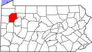 | |
| Boroughs | ||
| Townships | ||
| CDPs | ||
| Unincorporated communities | ||
| Ghost town | ||
| Footnotes | ‡This populated place also has portions in an adjacent county or counties | |