Rig Castle
Appearance
From Wikipedia, the free encyclopedia
This is an old revision of this page, as edited by TheJawsh (talk | contribs) at 20:32, 22 October 2022 (Added coordinates). The present address (URL) is a permanent link to this revision, which may differ significantly from the current revision.
Castle in Quzhd, Iran
| Rig Castle | |
|---|---|
قلعه ریگ | |
 | |
 | |
| General information | |
| Status | Ruined |
| Type | Castle |
| Architectural style | Iranian |
| Location | Quzhd |
| Address | Khorasan Razavi، Kashmar، Quzhd |
| Country | |
| Coordinates | 35°10′52″N 58°27′15″E / 35.1811°N 58.454278°E / 35.1811; 58.454278 |
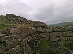
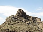
Rig Castle (Template:Lang-fa) is a Castle related to the Seljuq dynasty and is located in the Kashmar County, Quzhd village.[1][2]
References
- ^ "Encyclopaedia of the Iranian Architectural History". Cultural Heritage, Handicrafts and Tourism Organization of Iran. 19 May 2011. Archived from the original on 6 April 2015.
- ^ "بقایای قلعه ریگ". www.kojaro.com. Retrieved 10 August 2019.
| East Azerbaijan |
| |
|---|---|---|
| West Azerbaijan | ||
| Isfahan |
| |
| Ardabil | ||
| Alborz | ||
| Bushehr | ||
| Kohgiluyeh and Boyer-Ahmad | ||
| Golestan | ||
| Gilan | ||
| Tehran | ||
| Chaharmahal and Bakhtiari | ||
| North Khorasan |
| |
| Razavi Khorasan |
| |
| South Khorasan |
| |
| Khuzestan | ||
| Kurdistan | ||
| Semnan | ||
| Sistan and Baluchestan |
| |
| Fars |
| |
| Qazvin | ||
| Qom | ||
| Kerman |
| |
| Kermanshah | ||
| Mazandaran | ||
| Markazi | ||
| Lorestan | ||
| Ilam |
| |
| Hormozgan |
| |
| Hamadan | ||
| Yazd |
| |
| Zanjan | ||
Also See: Castles in Iran | ||
| ||
Also See: Seljuk castles | ||
This article about a castle in Iran is a stub. You can help Wikipedia by expanding it. |
Hidden categories:
- Pages using gadget WikiMiniAtlas
- Articles with short description
- Short description is different from Wikidata
- Infobox mapframe without OSM relation ID on Wikidata
- Coordinates on Wikidata
- Iran articles missing geocoordinate data
- All articles needing coordinates
- Articles missing coordinates with coordinates on Wikidata
- All stub articles
- Pages using the Kartographer extension


