
Golan Heights: Difference between revisions
No edit summary |
SteelMariner (talk | contribs) replacing good with bad grammar. |
||
| Line 14: | Line 14: | ||
|image_map = Golan heights rel89-orig.jpg |
|image_map = Golan heights rel89-orig.jpg |
||
|mapsize = 300px |
|mapsize = 300px |
||
|map_caption = 1989 [[CIA]] map highlighting the Israeli- |
|map_caption = 1989 [[CIA]] map highlighting the Israeli-occupied part of the Golan Heights. Sites on the Golan in black are Druze villages; sites in blue are [[Israeli settlement]]s. |
||
|dot_x = |dot_y = |
|dot_x = |dot_y = |
||
|pushpin_map = <!-- name of a location map as per Template:Location_map --> |
|pushpin_map = <!-- name of a location map as per Template:Location_map --> |
||
| Line 24: | Line 24: | ||
|subdivision_type1 = |
|subdivision_type1 = |
||
|subdivision_type2 = |
|subdivision_type2 = |
||
|subdivision_name = |
|subdivision_name = Internationally recognized as [[Syria]]n territory occupied by [[Israel]], (with the exception of the [[1949 Armistice Agreements#With Syria|demilitarized zones]]). [[Golan Heights Law|Administered]] by Israel, claimed by Syria |
||
|subdivision_name1 = |
|subdivision_name1 = |
||
|subdivision_name2 = |
|subdivision_name2 = |
||
| Line 40: | Line 40: | ||
|area_footnotes = |
|area_footnotes = |
||
|area_total_km2 =1800 <!-- ALL fields with measurements are subject to automatic unit conversion--> |
|area_total_km2 =1800 <!-- ALL fields with measurements are subject to automatic unit conversion--> |
||
|area_blank1_title =Currently |
|area_blank1_title =Currently occupied by Israel |
||
|area_blank1_km2 =1200 |
|area_blank1_km2 =1200 |
||
|area_blank1_sq_mi = |
|area_blank1_sq_mi = |
||
| Line 53: | Line 53: | ||
<!-- Population -----------------------> |
<!-- Population -----------------------> |
||
|population_as_of =2005 |
|population_as_of =2005 |
||
|population_total = 38,900 (in the Israeli- |
|population_total = 38,900 (in the Israeli-occupied part) 79,000 (in the Syrian- controlled part) |
||
| coor_type = <!-- can be used to specify what the coordinates refer to --> |
| coor_type = <!-- can be used to specify what the coordinates refer to --> |
||
|latd= |latm= |lats= |latNS= |
|latd= |latm= |lats= |latNS= |
||
| Line 59: | Line 59: | ||
}} |
}} |
||
The '''Golan Heights''' ({{lang-ar|هضبة الجولان}}, ''Haḍbatu 'l-Jawlān'' or مرتفعات الجولان, ''Murtafaʕātu 'l-Jawlān'', {{lang-he|רמת הגולן}}, Ramat HaGolan <small>{{Audio|Ramat hagolan.ogg|(audio)}}</small>, formerly known as the '''Syrian Heights'''<ref>{{cite news |title=Keeping the Golan won't protect Israel from Syria|author=Reuven Pedatzur|newspaper=Haaretz|date=25 November 2009 |url=http://www.haaretz.com/hasen/spages/1130582.html}}</ref><ref>{{cite book|url=http://books.google.com/?id=aTqU-YskSpwC&pg=PA32&lpg=PA32&dq=%22Syrian+heights%22&q=%22Syrian%20heights%22|title=Israel: Current Issues and Historical Background|author=Edgar S. Marshall|edition=|publisher=[[Nova Publishers|Nova Science Publishers]]|year=2002|isbn=159033325X|page=32}}</ref><ref>{{cite book|url=http://books.google.com/?id=FHE_3Piqw_MC&pg=PA189&dq=%22Syrian+heights%22&cd=6#v=onepage&q=%22Syrian%20heights%22|title=When Men Lost Faith in Reason: Reflections on War and Society in the Twentieth Century|author=H.P. Willmott|edition=|publisher=[[Greenwood Publishing Group|Greenwood Press]]|year=2002|isbn=0275976653|page=189}}</ref><ref>{{cite book|url=http://books.google.com/?id=TE8oCW2J2F4C&pg=PA28&lpg=PA28&dq=Syrian+heights&q=Syrian%20heights|title=Politicide: Ariel Sharon's war against the Palestinians|author=[[Baruch Kimmerling]]|edition=|publisher=[[Verso Books]]|year=2003|isbn=1859845177|page=28}}</ref>) is a strategic [[plateau]] and mountainous region at the southern end of the [[Anti-Lebanon Mountains]] and remains a highly contested land straddling the borders of [[Syria]] and [[Israel]]. Two-thirds of the area is currently |
The '''Golan Heights''' ({{lang-ar|هضبة الجولان}}, ''Haḍbatu 'l-Jawlān'' or مرتفعات الجولان, ''Murtafaʕātu 'l-Jawlān'', {{lang-he|רמת הגולן}}, Ramat HaGolan <small>{{Audio|Ramat hagolan.ogg|(audio)}}</small>, formerly known as the '''Syrian Heights'''<ref>{{cite news |title=Keeping the Golan won't protect Israel from Syria|author=Reuven Pedatzur|newspaper=Haaretz|date=25 November 2009 |url=http://www.haaretz.com/hasen/spages/1130582.html}}</ref><ref>{{cite book|url=http://books.google.com/?id=aTqU-YskSpwC&pg=PA32&lpg=PA32&dq=%22Syrian+heights%22&q=%22Syrian%20heights%22|title=Israel: Current Issues and Historical Background|author=Edgar S. Marshall|edition=|publisher=[[Nova Publishers|Nova Science Publishers]]|year=2002|isbn=159033325X|page=32}}</ref><ref>{{cite book|url=http://books.google.com/?id=FHE_3Piqw_MC&pg=PA189&dq=%22Syrian+heights%22&cd=6#v=onepage&q=%22Syrian%20heights%22|title=When Men Lost Faith in Reason: Reflections on War and Society in the Twentieth Century|author=H.P. Willmott|edition=|publisher=[[Greenwood Publishing Group|Greenwood Press]]|year=2002|isbn=0275976653|page=189}}</ref><ref>{{cite book|url=http://books.google.com/?id=TE8oCW2J2F4C&pg=PA28&lpg=PA28&dq=Syrian+heights&q=Syrian%20heights|title=Politicide: Ariel Sharon's war against the Palestinians|author=[[Baruch Kimmerling]]|edition=|publisher=[[Verso Books]]|year=2003|isbn=1859845177|page=28}}</ref>) is a strategic [[plateau]] and mountainous region at the southern end of the [[Anti-Lebanon Mountains]] and remains a highly contested land straddling the borders of [[Syria]] and [[Israel]]. Two-thirds of the area is currently occupied by Israel.<ref>{{cite web|url=http://www.un.org/apps/news/story.asp?NewsID=18628&Cr=Palestin&Cr1=|title=Poverty, unemployment worsen in Israeli-occupied Arab territories|date=26 May 2006|publisher=United Nations|accessdate=2009-06-23}}</ref><ref>{{cite web|url=http://fpc.state.gov/documents/organization/9570.pdf|title=CRS Issue Brief for Congress: Israeli-United States Relations|date=April 5, 2002|publisher=Congressional Research Service|accessdate=2009-06-23}}</ref><ref>{{cite web|url=http://www.delsyr.ec.europa.eu/en/whatsnew_new/detail.asp?id=41|date=04/01/2004|title=Presidency Statement on Golan Heights|accessdate=2009-06-23}}</ref><ref>{{cite web|url=http://www.fco.gov.uk/en/travelling-and-living-overseas/travel-advice-by-country/middle-east-north-africa/israel-occupied|date=11 June 2009|title=Israel and the Occupied Palestinian Territories |publisher=UK Foreign and Commonwealth Office|accessdate=2009-06-23}}</ref><ref>{{cite web|url=http://www.al-bab.com/arab/docs/league/peace02.htm|title=The Arab Peace Initiative, 2002|year=2002|publisher=Al-Bab|accessdate=2009-06-23}}</ref><ref>{{cite web|url=http://www.icrc.org/web/eng/siteeng0.nsf/html/israel-golan-update-150609|title=ICRC activities in the occupied Golan during 2008|date=2009-03-15|publisher=ICRC|accessdate=2009-07-06}}</ref><ref>{{cite web|url=http://www.amnesty.org/en/library/asset/MDE02/003/2002/en/ad408511-d821-11dd-9df8-936c90684588/mde020032002en.html|title=Israel and the occupied territories and the Palestinian authority without distinction - attacks on civilians by Palestinian armed groups|date=10 July 2002|publisher=Amnesty International|accessdate=2009-06-23}}</ref><ref>{{cite web|url=http://www.hrw.org/reports/2005/iopt0605/4.htm|title=Promoting Impunity The Israeli Military’s Failure to Investigate Wrongdoing |date=June 2005|publisher=HRW|accessdate=2009-06-23}}</ref> The Golan Heights has been under Israeli control since the [[Six-Day War]] in 1967. |
||
In 1981, Israel passed the [[Golan Heights Law]], which extended [[Israeli law]] and administration throughout the [[Israeli-occupied territory]],<ref name = "MFA Law" /> a move which was condemned by the [[United Nations Security Council]] in its [[UN Security Council Resolution 497|resolution 497]].<ref name="UN Security Council Resolution 497">[http://www.cfr.org/content/publications/attachments/SC497.pdf UN Security Council Resolution 497]</ref><!-- Comment --> The majority of governments supported the Security Council in this and have continued to do so. In 2008, a plenary session of the [[United Nations General Assembly]] voted by 161-1 in favour of a motion on the "occupied Syrian Golan" that reaffirmed support for Security Council motion 497.<ref name="UN Security Council Resolution 497"/><ref name=GA10794>{{cite web|url=http://www.un.org/News/Press/docs/2008/ga10794.doc.htm|title=General Assembly adopts broad range of texts, 26 in all, on recommendation of its fourth Committee, including on decolonization, information, Palestine refugees |publisher=United Nations|date=5 December 2008}}</ref> |
In 1981, Israel passed the [[Golan Heights Law]], which extended [[Israeli law]] and administration throughout the [[Israeli-occupied territory]],<ref name = "MFA Law" /> a move which was condemned by the [[United Nations Security Council]] in its [[UN Security Council Resolution 497|resolution 497]].<ref name="UN Security Council Resolution 497">[http://www.cfr.org/content/publications/attachments/SC497.pdf UN Security Council Resolution 497]</ref><!-- Comment --> The majority of governments supported the Security Council in this and have continued to do so. In 2008, a plenary session of the [[United Nations General Assembly]] voted by 161-1 in favour of a motion on the "occupied Syrian Golan" that reaffirmed support for Security Council motion 497.<ref name="UN Security Council Resolution 497"/><ref name=GA10794>{{cite web|url=http://www.un.org/News/Press/docs/2008/ga10794.doc.htm|title=General Assembly adopts broad range of texts, 26 in all, on recommendation of its fourth Committee, including on decolonization, information, Palestine refugees |publisher=United Nations|date=5 December 2008}}</ref> |
||
| Line 66: | Line 66: | ||
The Golan has a rich history dating back to [[biblical times]] and features numerous [[archeological]] landmarks. It is a popular tourist attraction with its many scenic streams, mountains and [[waterfalls]]. |
The Golan has a rich history dating back to [[biblical times]] and features numerous [[archeological]] landmarks. It is a popular tourist attraction with its many scenic streams, mountains and [[waterfalls]]. |
||
year to year, the Golan Heights were under [[Israel]]'s regime more than [[Syria]]'s. |
|||
==Etymology and interpretation of name== |
==Etymology and interpretation of name== |
||
Revision as of 09:46, 18 July 2010
This article's lead section may be too short to adequately summarize the key points. (February 2010) |
Golan Heights
هضبة الجولان רמת הגולן | |
|---|---|
 1989 CIA map highlighting the Israeli-occupied part of the Golan Heights. Sites on the Golan in black are Druze villages; sites in blue are Israeli settlements. | |
| Status | Internationally recognized as Syrian territory occupied by Israel, (with the exception of the demilitarized zones). Administered by Israel, claimed by Syria |
| Area | |
| • Total | 1,800 km2 (700 sq mi) |
| • Currently occupied by Israel | 1,200 km2 (500 sq mi) |
| Highest elevation | 2,814 m (9,232 ft) |
| Lowest elevation | 0 m (0 ft) |
| Population (2005) | |
| • Total | 38,900 (in the Israeli-occupied part) 79,000 (in the Syrian- controlled part) |
The Golan Heights (Arabic: هضبة الجولان, Haḍbatu 'l-Jawlān or مرتفعات الجولان, Murtafaʕātu 'l-Jawlān, Hebrew: רמת הגולן, Ramat HaGolan , formerly known as the Syrian Heights[1][2][3][4]) is a strategic plateau and mountainous region at the southern end of the Anti-Lebanon Mountains and remains a highly contested land straddling the borders of Syria and Israel. Two-thirds of the area is currently occupied by Israel.[5][6][7][8][9][10][11][12] The Golan Heights has been under Israeli control since the Six-Day War in 1967.
In 1981, Israel passed the Golan Heights Law, which extended Israeli law and administration throughout the Israeli-occupied territory,[13] a move which was condemned by the United Nations Security Council in its resolution 497.[14] The majority of governments supported the Security Council in this and have continued to do so. In 2008, a plenary session of the United Nations General Assembly voted by 161-1 in favour of a motion on the "occupied Syrian Golan" that reaffirmed support for Security Council motion 497.[14][15]
Israel argues that it may retain the Golan Heights as the text of Security Council Resolution 242 adopted after the Six-Day War calls for "safe and recognized boundaries free from threats or acts of force".[16]
The Golan has a rich history dating back to biblical times and features numerous archeological landmarks. It is a popular tourist attraction with its many scenic streams, mountains and waterfalls.
Etymology and interpretation of name
The name Golan refers to both Biblical and historical names for the southern portion of the area. "Golan" is of Semitic origin and refers to the name of a city mentioned in the Bible as one of the "Cities of Refuge,” east of the Jordan River. Other names used in this context are Gaulan and Jaulan.
Prior to 1967, the term "Ha-Golan" (in Hebrew) or "Golan Heights" (elsewhere) was a geographic designation referring to the Golan plateau (see introduction). In Christian usage, the term has also come to denote a region stretching from the Biblical site westward towards the Sea of Galilee. The terms Gaulanitis or Gaulonitis have been used in this context. Since 1967, "Golan" and "Golan Heights" have also taken on a political meaning, referring specifically to the land currently occupied by Israel.
Today, the term Golan Heights actually has two separate meanings, one geographic and one political:
- The geographic term refers to the higher elevation Golan plateau, which encompasses about 1,800 square kilometres (690 sq mi) and is situated south of the mountains, between the scarp into the Jordan River Valley on the west and extending eastward; it lies predominantly within Syria and borders Israel to the west and Jordan to the south.
- The political term for the Golan Heights, which has become the dominant usage since 1967, refers to the area of disputed sovereignty, previously demarcated as Syria and currently occupied by Israel. This 1,200 square kilometres (460 sq mi) area considerably overlaps with the plateau itself, but includes the western scarp of the plateau, as well as a portion of the Jordan River Valley and higher mountainous areas descending from Mount Hermon , which borders Lebanon to the northwest and north, and includes the separately disputed Shebaa Farms area.
Geography


Topographically, the Golan Heights ranges in elevation from 2,814 m (9,230 feet) on Mount Hermon in the north, to about sea level on the Yarmuk River in the south. The steeper, more rugged topography is generally limited to the northern and western portions, and approximately bounded by the Sa’ar valley to the south. The extreme northwestern area includes the mountainous Shebaa Farms area, which is disputed between Lebanon and Syria, as well as flat land in the Jordan valley, which extends west to the Hasbani River and the town of Ghajar, on the Syrian – Lebanese border. This area includes the only overland route, between Syria and Lebanon, south of the Golan Heights.
The broader Golan plateau exhibits a more subdued topography, generally ranging between 400 and 1,700 feet (120–520 m) in elevation. To the east and at lower elevation, the plateau merges into the Hauran plain of Syria; the limits are not clearly defined, although Wadi Ruqqad and Nahr Allan are sometimes considered geographically. In Israel, the Golan plateau is usually divided into three regions: northern (between the Sa'ar and Jilabun valleys), central (between the Jilabun and Daliyot valleys), and southern (between the Dlayot and Yarmouk valleys). The Golan Heights is bordered on the west by a rock escarpment that drops 1,700 feet (500 m) to the Jordan River valley and the Sea of Galilee. In the south, the incised Yarmouk River valley marks the limits of the plateau and, east of the abandoned railroad bridge upstream of Hamat Gader and Al Hammah, it marks the recognized international border between Syria and Jordan.[17]
Geologically, the Golan plateau and the Hauran plain to the east constitute a Holocene volcanic field that also extends northeast almost to Damascus. Much of the area is scattered with dormant volcanos, as well as cinder cones, such as Majdal Shams. The plateau also contains a crater lake, called Birkat Ram ("Ram Pool"), which is fed by both surface runoff and underground springs. These volcanic areas are characterized by basalt bedrock and dark soils derived from its weathering. The basalt flows overlie older, distinctly lighter-colored limestones and marls, exposed along the Yarmouk River in the south.
The rock forming the mountainous area in the northern Golan Heights, descending from Mount Hermon, are geologically quite different from the volcanic rocks of the plateau, including a different physiography. The mountains are characterized by distinctly lighter-colored, Jurassic age limestone of sedimentary origin. Locally, the limestone is broken by faults and solution channels to form a karst-like topography in which springs are common (e.g. Baniyas). The Sa'ar valley generally divides the lighter-colored sedimentary rocks of the mountains from the dark-colored volcanic rocks of the Golan plateau. The western border of both the Golan plateau and the mountains is truncated structurally by the Jordan Rift Valley, along which the Jordan River and its northern tributaries flow.
In addition to its strategic importance militarily, the Golan Heights contributes significantly to the water resources of the region. This is true particularly at the higher elevations, which are snow-covered much of the year in the cold months and help to sustain baseflow for rivers and springs during the dry season. The heights receive significantly more precipitation than the surrounding, lower-elevation areas. The occupied sector of the Golan Heights provides or controls a substantial portion of the water in the Jordan River watershed, which in turn provides a portion of Israel's water supply. The Golan Heights are the source of about 15% of Israel's water supply.[18]
Strategic importance and territory claims
The Golan Heights are of great strategic importance in the region,[19][20] and were governed with the rest of Syria under successive regimes[21] until the Six-Day War, when they were captured by Israel on 9–10 June 1967. Israeli sources and the U.S. Committee for Refugees and Immigrants reported that much of the local population of 100,000 fled as a result of the war, whereas the Syrian government stated that a large proportion of it was expelled.[22] Israel asserts its right to retain the area under the text of United Nations Security Council Resolution 242,[16] which passed November 22, 1967 and called for "secure and recognized boundaries free from threats or acts of force" for every state, as well as the "withdrawal of Israel armed forces from territories occupied in the Six Day War." The area has remained under Israeli control since 1967, first under martial law, and from 1981 under civilian administration.[23]
Israel successfully defended its control of the territory in the 1973 Yom Kippur War, though a portion was later returned to Syria. Starting in the 1970s, new Jewish settlements were established in the captured area.[24] In 1981, Israel applied its "laws, jurisdiction and administration" to the region with the passage of the Golan Heights Law, a move internationally condemned[25] and unrecognized,[24] and labeled "inadmissible" by the UN Security Council.[14] Since then it has been governed as part of Israel’s North District, while Syria maintains that the Golan Heights are within its Quneitra Governorate. UN Resolution 242 considers the area part of the Israeli-occupied territories. Syria has never stopped demanding that the land be returned, and in 2006, the United Nations General Assembly adopted a resolution calling on Israel to end its occupation of the Golan, while declaring all the legislative and administrative measures taken by Israel in the Golan null and void.[26]
Current status
The Golan Heights were under military administration between 1967 and 1981. In that year, Israel passed the Golan Heights Law,[13] placing the Golan Heights under civilian Israeli law, administration, and jurisdiction. Most non-Jewish residents of the Golan Heights, mainly Druze, refused to surrender Syrian citizenship, though Israeli citizenship was available to them. Syria continues to offer them benefits such as free university tuition.[27] Israel's actions were widely condemned, with the Security Council of the United Nations passing its resolution 497. The international community has continued to condemn Israel's actions in passing the Golan Heights Law and its conduct in the area. For example, in 2008 a plenary session of the United Nations General Assembly voted by 161-1 in favour of a motion on the Golan Heights that reaffirmed Security Council resolution 497 and called on Israel to desist from "changing the physical character, demographic composition, institutional structure and legal status of the occupied Syrian Golan and, in particular, to desist from the establishment of settlements [and] from imposing Israeli citizenship and Israeli identity cards on the Syrian citizens in the occupied Syrian Golan and from its repressive measures against the population of the occupied Syrian Golan." Israel was the only nation to vote against the resolution.[15]
In the 2009 elections, 1,193 residents of Ghajar and 809 residents of the Druze villages were eligible voters, out of approximately 1,200 Ghajar residents and 12,600 Druze village residents who were of voting age.[28]
In 2009 the Golan Heights had a population of approximately 41,400, including approximately 20,500 Druze Muslims, 17,600 Jews, and 2,200 other Muslims.[29] Israeli settlements, including moshavim and kibbutzim, are consolidated municipally under the Golan Regional Council, and are inhabited by Israeli settlers. The Golan Alawites reside in the internationally recognized Syria-Lebanon border-straddling village of Ghajar. They accepted Israeli citizenship in 1981.[30] The Druze reside in the villages of Ein Qinya, Buq'ata, Majdal Shams, and Mas'ada. Most are involved in farm work.
Both personal and business relations exist between the Druze and their Jewish neighbors; there is little tension between the two groups.[2] As a humanitarian gesture, since 2005, Israel allows Druze farmers to export some 11,000 tons of apples to Syria each year, the first kind of trade ever made between Syria and Israel. Since 1988, Israel has allowed Druze clerics to make annual religious pilgrimages to Syria.[31]
As of April 2009 there were 21 Golan Druze in Israeli prisons for offenses such as attacks against IDF, Israeli police and Israeli settlements, supporting Palestinians during the Intifadas and attempted kidnapping of Israeli soldier.[32][33]
Syrian-controlled portion
East of the 1974 ceasefire line lies the Syrian controlled part of the Golan Heights, an area that was not captured by Israel (500 km²) or withdrawn from (100 km²). This area forms 30% of the Golan Heights[34] and contains more than 40 Syrian towns and villages.
In 1975, following the 1974 ceasefire agreement, some of the displaced residents began returning to their homes in this part. The Syrian government began helping people rebuild their villages, except for Quneitra. In the mid-1980s the government launched a plan called "The Project for the Reconstruction of the Liberated Villages". By the end of 2007, Syrian statistics estimated the population of the region at 79,000,[35] consisting of Arabs, Druze and Circassians living mainly in Khan Arnabah, Alhameedia, Alrafeed, Alsamdaneea, Beer ajam, Hadar [disambiguation needed], Juba, Kodana, Rwaiheena, Nabe’ Alsakher, Trinja, and Umm batna.
The Druze

Unlike the Druze in Israel proper, fewer than 10% of the Druze of the Golan Heights are Israeli citizens; the remainder hold Syrian citizenship. The latter are permanent residents of Israel, and they hold a laissez-passer. The pro-Israeli Druze are ostracized by the pro-Syrian Druze.[36] Reluctance to accept citizenship also reflects fear of ill treatment or displacement by Syrian authorities should the Golan Heights eventually be returned to Syria .[37] According to The Independent, most Druze in the Golan Heights live relatively comfortable lives in a freer society than they would have in Syria under the present regime.[38] According to Egypt's Daily Star, their standard of living vastly surpasses that of their counterparts on the Syrian side of the border. Hence their fear of a return to Syria, though most of them identify themselves as Syrian,[39] but feel alienated from the autocratic regime in Damascus. According to the Associated Press, "many young Druse have been quietly relieved at the failure of previous Syrian-Israeli peace talks to go forward." Ties to Syria are on the wane, and many have come to appreciate aspects of Israel's liberal democratic society, although few risk saying so publicly for fear of Syrian retribution.[31] On the other hand, expressing pro-Syrian rhetoric, The Economist found, represents the Golan Druzes' view that by doing so they may be potentially rewarded by Syria, while simultaneously risking nothing in Israel's freewheeling society. The Economist likewise reported that "Some optimists see the future Golan as a sort of Hong Kong, continuing to enjoy the perks of Israel’s dynamic economy and open society, while coming back under the sovereignty of a stricter, less developed Syria." The Druze are also reportedly well-educated and relatively prosperous, and have made use of Israel's universities.[40]

Allon Plan for a Druze state
In the 1970s, Israeli politician Yigal Allon proposed as part of the Allon Plan that a Druze state (Jabal Druze) be established in Syria's Quneitra Governorate, including the Israeli-held Golan Heights.[3] Allon died in 1980, and the following year the Israeli government passed the Golan Heights Law, effectively annexing most of the Governorate.
The Golan Heights Law

Israel's Golan Heights Law of 1981 applied Israeli "laws, jurisdiction and administration" to the Golan Heights. It was administered as part of its North District. (Syria asserts that the Heights are part of the governorate of al Qunaytirah. Israel's action has not been recognized internationally.[24] United Nations Security Council Resolution 242 which declared the Golan Heights an Israeli occupied territory continues to apply. Israel maintains that it may retain the area as the text of Resolution 242 calls for "safe and recognized boundaries free from threats or acts of force".[16]
Israel's measures are frequently termed "annexation" but the word "annexation" is not used in the law itself. When Israeli Prime Minister Menachem Begin was asked in the Knesset why he was risking international criticism for the annexation, he replied "You use the word annexation, but I am not using it."[41] The governmental Jewish Agency for Israel states that "Although reported as an annexation, it is not: the Golan Heights are not declared to be Israeli territory."[42] On the other hand, the Benjamin Netanyahu government's Basic Policy Guidelines stated "The government views the Golan Heights as essential to the security of the state and its water resources. Retaining Israel's sovereignty over the Golan will be the basis for an arrangement with Syria."[43] The UN does not recognize the annexation, and considers the Heights to be occupied. This view was expressed in the unanimous UN Security Council Resolution 497, stating that "the Israeli decision to impose its laws, jurisdiction and administration in the occupied Syrian Golan Heights is null and void and without international legal effect." It, like other relevant UN resolutions, takes care to not explicitly call it an "annexation", referring instead to Israel's "annexationist policies."
Three lines: 1923 border, 1949 armistice, and line of June 4, 1967

One of the aspects of the dispute involves the existence prior to 1967 of three different lines separating Syria from Israel (or, prior to 1948, from the British Mandate for Palestine).
The 1923 boundary between Mandate Palestine and the French Mandate of Syria was drawn with water in mind.[44] Accordingly, it was demarcated so that all of the Sea of Galilee, including a 10-meter wide strip of beach along its northeastern shore, would stay inside Palestine. From the Sea of Galilee north to Lake Hula the boundary was drawn between 50 and 400 meters east of the upper Jordan River, keeping that stream entirely within the British Mandate. The British also received a sliver of land along the Yarmouk River, out to the present-day Hamat Gader.[45]
During the 1948-49 Arab-Israeli War, Syria captured various areas of the former Palestine mandate, including the 10-meter strip of beach, the east bank of the upper Jordan, as well as areas along the Yarmouk.
During Armistice talks of 1949, Israel called for the removal of all Syrian forces from the former Palestine territory. Syria refused, insisting on an armistice line based not on the 1923 international border but on the military status quo. The result was a compromise. Under the terms of an armistice signed on July 20, 1949, Syrian forces were to withdraw east of the old Palestine-Syria boundary. Israeli forces were to refrain from entering the evacuated areas, which would become a demilitarized zone, "from which the armed forces of both Parties shall be totally excluded, and in which no activities by military or paramilitary forces shall be permitted."[46] Accordingly, major parts of the armistice lines departed from the 1923 boundary and protruded into Israel. There were three distinct, non-contiguous enclaves—in the extreme northeast to the west of Banias, on the west bank of the Jordan River near Lake Hula, and the eastern-southeastern shores of the Sea of Galilee extending out to Hamat Gader, consisting of 66.5 square kilometers of land lying between the 1949 armistice line and the 1923 boundary, forming the demilitarized zone.[44]
Following the armistice, both Israel and Syria sought to take advantage of the territorial ambiguities left in place by the 1949 agreement. This resulted in an evolving tactical situation, one "snapshot" of which was the disposition of forces immediately prior to the Six-Day War, the “line of June 4, 1967”.[44]
Shebaa Farms issue

Lebanon claims a small portion of the area occupied by Israel as part of the Golan Heights. The territory, known as the Shebaa Farms, lies on the border between Lebanon and the Golan Heights. Maps used by the UN in demarcating the Blue Line were not able to conclusively show the border between Lebanon and Syria in the area. Syria agrees that the Shebaa Farms are within Lebanese territory; however, Israel considers the area to be inside of Syria's borders and continues to occupy the territory.[47][48]
Maintenance of the ceasefire
UNDOF (the United Nations Disengagement Observer Force) was established in 1974 to supervise the implementation of the disengagement agreement and maintain the ceasefire with an area of separation known as the UNDOF Zone. Currently there are more than 1,000 UN peacekeepers there trying to sustain a lasting peace. Details of the UNDOF mission, mandate, map and military positions can be accessed via the following United Nations link [4]. Syria and Israel still contest the ownership of the Heights but have not used overt military force since 1974. The great strategic value of the Heights both militarily and as a source of water means that a deal is uncertain.
Members of the UN Disengagement force are usually the only individuals who cross the Israeli-Syrian de-facto border (cease fire "Alpha Line"), but since 1988 both Israel and Syria have taken measures to relieve the problems encountered by the Druze population of the Golan Heights. Since 1988 Israel has allowed Druze pilgrims to cross into the rest of Syria to visit the shrine of Abel on Mount Qasioun. In 2005, Syria allowed a few trucks of Druze-grown Golan apples to be imported. The trucks themselves were driven by Kenyan nationals. Since 1967, Druze brides have been allowed to cross the Golan border into the rest of Syria, but they do so in the knowledge that the journey is a one-way trip.
Negotiations
Syria insists that Israel must withdraw from the Golan Heights as part of any peace deal. During US-brokered peace talks in 1999–2000, Prime Minister Ehud Barak reportedly offered to withdraw from most of the Golan in return for a comprehensive peace structure and security arrangements. The disagreement in the final stages of the talks was on access to the Sea of Galilee. According to media reports, the main sticking point was that Syria wanted Israel to withdraw to the June 4, 1967 line, while Israel wanted to use the 1923 international border. While Israel under Rabin and Peres had reportedly earlier taken steps toward accepting the pre-1967 line, Israel wishes to retain control of the Sea of Galilee, its main source of fresh water.[49]
In June 2007, it was reported that Prime Minister Ehud Olmert had sent a secret message to Syrian President, Bashar Assad saying that Israel would concede the land in exchange for a comprehensive peace agreement and the severing of Syria's ties with Iran and militant groups in the region.[50] Former Prime Minister, Benjamin Netanyahu announced that the former Syrian President, Hafez Assad had agreed that Mount Hermon will be in Israeli territory in any agreement.[51]
In April 2008, Syrian media reported Turkey's prime minister Recep Tayyip Erdoğan told President Bashar al-Assad that Israel would withdraw from the Golan Heights in return for peace.[52] Olmert responded "I can assure you that on matters concerning Israel and the Syrians, they are well aware of what I want from them, and I know very well what they want from us." [53] Israeli leaders of communities in the Golan Heights held a special meeting and stated: "all construction and development projects in the Golan are going ahead as planned, propelled by the certainty that any attempt to harm Israeli sovereignty in the Golan will cause severe damage to state security and thus is doomed to fail". [54]
Netanyahu has said that Israel will keep the Golan Heights forever, and: "I remember the Golan Heights without Katzrin, and suddenly we see a thriving city in the Land of Israel, which having been a gem of the Second Temple era has been revived anew."[55] Regarding Olmert's negotiations with the Syrians, Netanyahu said: "Giving of the Golan Heights will turn the Golan into Iran's front lines which will threaten the whole state of Israel."[56]
On February 4, 2010. Israel's foreign minister, Avigdor Lieberman, warned Syria against drawing the Jewish state into another war, saying its army would be defeated and its regime would collapse in a future conflict. He added that Syria should abandon its "dreams" of recovering the Israeli-held Golan Heights.[57]
History


Ancient history
This section needs additional citations for verification. (June 2009) |
The area has been occupied by many civilizations. During the 3rd millennium BC the Amorites dominated and inhabited the Golan until the 2nd millennium, when the Arameans took over. The Aramaean city state Aram Damascus reached over all of Golan to the Sea of Galilee.[citation needed]
According to the Bible, the Children of Israel invaded Golan and conquered it from the Amorites. Dt 3:1: "Next we turned and went up along the road toward Bashan, and Og king of Bashan with his whole army marched out to meet us in battle at Edrei." Dt 3:2: "The LORD said to me, "Do not be afraid of him, for I have handed him over to you with his whole army and his land. Do to him what you did to Sihon king of the Amorites, who reigned in Heshbon." Dt 3:3: "So the LORD our God also gave into our hands Og king of Bashan and all his army. We struck them down, leaving no survivors." Dt 3:4: "At that time we took all his cities. There was not one of the sixty cities that we did not take from them—the whole region of Argob, Og's kingdom in Bashan." Dt 3:5:"All these cities were fortified with high walls and with gates and bars, and there were also a great many unwalled villages." Dt 3:6: "We completely destroyed [a] them, as we had done with Sihon king of Heshbon, destroying [b] every city—men, women and children." Dt 3:7: "But all the livestock and the plunder from their cities we carried off for ourselves."
According to the Bible, the area, later known as Bashan, was inhabited by two Israelite tribes during the time of Joshua, the tribe of Dan — Dt 33:22: "And of Dan he said: Dan is a lion's whelp, that leapeth forth from Bashan" and Tribe of Manasseh. The city of Golan was used as a city of refuge. King Solomon appointed 3 ministers in the region — 1 Kg 4:13Template:Bibleverse with invalid book: "the son of Geber, in Ramoth-gilead; to him pertained the villages of Jair the son of Manasseh, which are in Gilead; even to him pertained the region of Argob, which is in Bashan, threescore great cities with walls and brazen bars". After the split of the United Monarchy, the area was contested between the Kingdom of Israel (the northern of the two Jewish kingdoms existent at that time) and the Aramean kingdom from the 800s BC. King Ahab of Israel (reigned 874–852 BC) defeated Ben-Hadad I in the southern Golan.
In the 700s BC the Assyrians gained control of the area, but were later replaced by the Babylonian and the Persian Empire. In the 5th century BC, the Persian Empire allowed the region to be resettled by returning Jewish exiles from Babylonian Captivity.
The Golan Heights, along with the rest of the region, came under the control of Alexander the Great in 332 BC, following the Battle of Issus. Following Alexander's death, the Golan came under the domination of the Macedonian noble Seleucus and remained part of the Seleucid Empire for most of the next two centuries. It is during this period that the name Golan, previously that of a city mentioned in the book of Deuteronomy, came to be applied to the entire region (Greek: Gaulanitis).
The Maccabean Revolt saw much action in the regions around the Golan and it is possible that the Jewish communities of the Golan were among those rescued by Judas Maccabeus during his campaign in the Galilee and Gilead (Transjordan) mentioned in Chapter 5 of 1 Maccabees. The Golan, however, remained in Seleucid hands until the campaign of Alexander Jannaeus from 83–80 BC. Jannaeus established the city of Gamla in 81 BC as the Hasmonean capital for the region.

Following the death of Herod the Great in 4 BC, Augustus Caesar adjudicated that the Golan fell within the Tetrarchy of Herod's son, Herod Philip I. After Philip's death in 34 AD, the Romans absorbed the Golan into the province of Syria, but Caligula restored the territory to Herod's grandson Agrippa in 37. Following Agrippa's death in 44, the Romans again annexed the Golan to Syria, promptly to return it again when Claudius traded the Golan to Agrippa II, the son of Agrippa I, in 51 as part of a land swap. Although nominally under Agrippa's control and not part of the province of Judea, the Jewish communities of the Golan joined their coreligionists in the First Jewish-Roman War, only to fall to the Roman armies in its early stages. Gamla was captured in 67; according to Josephus, its inhabitants committed mass suicide, preferring it to crucifixion and slavery. Agrippa II contributed soldiers to the Roman war effort and attempted to negotiate an end to the revolt. In return for his loyalty, Rome allowed him to retain his kingdom, but finally absorbed the Golan for good after his death in 100.
In about 250, the Ghassanids, Arab Christians from Yemen, established a kingdom which encompassed southern Syria and the Transjordan, building their capital at Jabiyah on the Golan. Like the later Herodians, the Ghassanids ruled as clients of Byzantine Rome; unlike the Herodians, the Ghassanids were able to hold on to the Golan until the Sassanid invasion of 614. Following a brief restoration under the Emperor Heraclius, the Golan again fell, this time to the invading Arabs after the Battle of Yarmouk in 636.
After Yarmouk, Muawiyah I, a member of Muhammad's tribe, the Quraish, was appointed governor of Syria, including the Golan. Following the assassination of his cousin, the Caliph Uthman, Muawiya claimed the Caliphate for himself, initiating the Umayyad dynasty. Over the next few centuries, while remaining in Muslim hands, the Golan passed through many dynastic changes, falling first to the Abbasids, then to the Shi'ite Fatimids, then to the Seljuk Turks, then to the Kurdish Ayyubids. During the Crusades, the Heights represented a formidable obstacle the Crusader armies were not able to conquer, and the area was a part of the Emirate of Damascus during this time.[58][59] The Mongols swept through in 1259, but were driven off by the Mamluk sultan Qutuz at the Battle of Ain Jalut in 1260. Ain Jalut ensured Mamluk dominance of the region for the next 250 years.
In the 15th and 16th centuries, Druze began to settle the northern Golan and the slopes of Mount Hermon. In the 16th century, the Ottoman Turks came in control of the area and remained so until the end of World War I. During the Ottoman Empire (1517-1917), the Golan was part of the Syrian (Southern) district of their empire.
In 1886, the Bet Yehuda society of Safed purchased land near the village of Ramthaniya, but the settlement established there failed after one year.[60] Soon afterwards, the society, now called Bnei Yehuda, purchased land in the nearby Druse village of Bir Shaqum and established a moshav there called Bnei Yehuda which survived until 1920.[60] In 1944 the JNF lost a lawsuit in the Syrian courts regarding ownership of this land.[60]
Between World War I and the Six-Day War

Great Britain accepted a Mandate for Palestine at the meeting of the Allied Supreme Council at San Remo, but the borders of the territory were not defined at that stage.[61][62] The boundary between the forthcoming British and French mandates was defined in broad terms by the Franco-British Boundary Agreement of December 1920.[63] That agreement placed the bulk of the Golan Heights in the French sphere. The treaty also established a joint commission to settle the precise details of the border and mark it on the ground.[63] The commission submitted its final report on February 3, 1922, and it was approved with some caveats by the British and French governments on March 7, 1923, several months before Britain and France assumed their Mandatory responsibilities on 29 September 1923.[64][65] In accordance with the same process, a nearby parcel of land that included the ancient site of Tel Dan was transferred from Syria to Palestine early in 1924. The Golan Heights thus became part of the French Mandate of Syria, while the Sea of Galilee was placed entirely within the British Mandate of Palestine. When the French Mandate of Syria ended in 1944, the Golan Heights became part of the newly independent state of Syria.
After the 1948–49 Arab-Israeli War, the Golan Heights were partly demilitarized by the Israel-Syria Armistice Agreement. Over the following years the Mixed Armistice Commission (which oversaw the implementation of the armistice agreement) reported many violations by each side. The major causes of the conflict were a dispute over the lines of the demilitarized zone, competition over water resources, and the Palestinian problem.[66]
The mandate's negotiations had set that Syrians and Lebanese would have rights to use the Sea of Galilee, Lake Hula and the Jordan River for fishing and navigation.[67] Israel did not agree to this and used to patrol the Sea of Galilee looking for Arabs practicing their rights to access the lake. Syria wanted to protect these rights and responded by firing at the patrol boats. Israel responded by killing 50 Syrian soldiers in an attack in December 1955.[68]


Israel attempted to use water from the Jordan River, to which Syria responded with a plan to divert water from its tributaries. Israel ceased its project in the mid 1950s but revived it in the 1960s. Syria's plan, implemented in 1965 with help from Lebanon and Jordan, sparked a series of military exchanges in July 1966.[66] Fatah began raids into Israeli territory in early 1965, with active support from Syria. At first the militants entered via Lebanon or Jordan, but those countries made concerted attempts to stop them and raids directly from Syria increased.[69] Israel's response was a series of retaliatory raids, of which the largest were an attack on the Jordanian village of Samu in November 1966,[70] and in April 1967, after Syria heavily shelled Israeli villages from the Golan Heights, Israel shot down six of Syria’s MiG fighter planes, provided by the Soviet Union. Israel warned Syria against future attacks.[69][71]
According to the Washington Report on Middle East Affairs, former Israeli General Mattityahu Peled Israel's security policy was "maximum settlement in the demilitarized zone."[72]
Israelis with police protection used to go into the demilitarized zone with tractors and equipment. After the Syrians responded by shooting, Israel would retaliate with military force.[68]
This was also mentioned by Moshe Dayan. In an interview from 1976, published in 1997, Dayan has said: "Look, it's possible to talk in terms of 'the Syrians are bastards, you have to get them, and this is the right time,' and other such talk, but that is not policy, You don't strike at the enemy because he is a bastard, but because he threatens you. And the Syrians, on the fourth day of the war, were not a threat to us." "After all, I know how at least 80 percent of the clashes there started. In my opinion, more than 80 percent, but let's talk about 80 percent. It went this way: We would send a tractor to plow some area where it wasn't possible to do anything, in the demilitarized area, and knew in advance that the Syrians would start to shoot. If they didn't shoot, we would tell the tractor to advance farther, until in the end the Syrians would get annoyed and shoot. And then we would use artillery and later the air force also, and that's how it was." "The kibbutzim there saw land that was good for agriculture," "And you must remember, this was a time in which agricultural land was considered the most important and valuable thing." "Of course they wanted the Syrians to get out of their face. They suffered a lot because of the Syrians. Look, as I said before, they were sitting in the kibbutzim and they worked the land and had kids and lived there and wanted to live there. The Syrians across from them were soldiers who fired at them, and of course they didn't like it." "But I can tell you with absolute confidence, the delegation that came to persuade Eshkol to take the heights was not thinking of these things. They were thinking about the heights' land. Listen, I'm a farmer, too. After all, I'm from Nahalal, not from Tel Aviv, and I know about it. I saw them, and I spoke to them. They didn't even try to hide their greed for that land."[73]

Muki Tzur, a longtime leader of the United Kibbutz Movement, challenged this contention: "There were discussions about going up the Golan Heights... but the discussions were about security for the kibbutzim in Galilee...No kibbutz got any land from conquering the Golan Heights. People who went there went on their own. It's cynicism to say the kibbutzim wanted land.[73]
A former UN observer responding to the claim that Syria shelled Israel from the Golan Heights before the Six Day War said: "Frankly I believe this is a case of falsification of history. Last century's largest chapter of falsification of history." "An absolute lie." The former UN observer later recalled how Israel provoked Syria with tractors in the demilitarized zone.[74]
In May 1967, before the Six-Day War , Hafez Assad, then Syria's Defense Minister declared: "Our forces are now entirely ready not only to repulse the aggression, but to initiate the act of liberation itself, and to explode the Zionist presence in the Arab homeland. The Syrian Army, with its finger on the trigger, is united... I, as a military man, believe that the time has come to enter into a battle of annihilation."[75][76]
During the Six-Day War, Syria's shelling greatly intensified and the Israeli army captured the Golan Heights on 9–10 June.[citation needed] The area which came under Israeli control as a result of the war is two geologically distinct areas: the Golan Heights proper (413 sq mi; 1,070 km²) and the slopes of the Mt. Hermon range (39 sq mi; 100 km²). The new border between the two forces was called the Purple Line.
History since the Six-Day War


Between 80,000 and 109,000 Druze, Arabs and Circassians fled or were driven out during the Six-Day War.[77][78] For security reasons, Israel has not allowed them to return.[79] Israeli settlement in the Golan began soon after the war. Kibbutz Merom Golan was founded in July 1967. By 1970 there were 12 Jewish settlements and in 2004, there were 34, populated by around 18,000 people.[80]
During the Yom Kippur War in 1973, Syrian forces overran much of the southern Golan, before being pushed back by an Israeli counterattack. Israel and Syria signed a ceasefire agreement in 1974 that left almost all the Heights in Israeli hands, while returning a narrow demilitarized zone to Syrian control. The remaining inhabitants were required to carry Israeli identity papers. In the late 1970s, the government offered them Israeli citizenship, which would entitle them to an Israeli driver's license and enable them to travel freely in Israel. In March 1981, the community leaders imposed a socio-religious ban on Israeli citizenship. [citation needed] In November 1981, a general strike was called that lasted five months and demonstrations were held that sometimes became violent. The Israeli authorities arrested the protest leaders and imposed curfews. On April 1, 1982, a 24-hour curfew was imposed during which soldiers confiscated the old ID cards and replaced them with new ones, signifying Israeli citizenship. [citation needed] This action caused an international outcry including two condemnatory UN resolutions.[81][82] Israel eventually relented and permitted retention of Syrian citizenship.

Syria demanded a full Israeli withdrawal to the June 4, 1967 borders, including a strip of land on the east shore of the Sea of Galilee that Syria captured during the 1948–49 Arab-Israeli War and occupied from 1949–67. Successive Israeli governments have considered an Israeli withdrawal from the Golan in return for normalization of relations with Syria, provided certain security concerns are met. Prior to 2000, Syrian president Hafez al-Assad rejected normalization with Israel.
During United States–brokered negotiations in 1999–2000, Israel and Syria discussed a peace deal that would include Israeli withdrawal in return for peace, recognition and full normalization of relations. Israel insisted on the pre-1948 border (the 1923 Paulet-Newcombe line), while Syria insisted on the 1967 frontier. The former line has never been recognized by Syria, claiming it was imposed by the colonial powers, while the latter was rejected by Israel as the result of Syrian aggression. The difference between the lines is less than 100 m for the most part, but the 1967 line would give Syria access to the Sea of Galilee, Israel's only freshwater lake and a major water resource.

In late 2003, Syrian President Bashar al-Assad said he was ready to revive peace talks with Israel. Israel demanded Syria first disarm Hezbollah, which launched many attacks on northern Israeli towns and army posts from Lebanese territory, and cease to host militant Palestinian groups and their headquarters. Peace talks were not initiated.
After the 2006 war between Israel and Syrian–Iranian-backed Hezbollah guerrillas, the issue of the Golan Heights arose again. Israel heightened its alert over a possible war with Syria after Israeli intelligence assessed that Syria was "seriously examining" military action. Syria reinforced its forces on the Golan while remaining in a defensive position.[citation needed] President Assad stated that Syria was prepared to hold peace talks with Israel but said that if hopes for peace dissolve then "war may really be the only solution". Israeli Prime Minister Ehud Olmert dismissed calls within his coalition to consider peace talks and proclaimed that "the Golan Heights will remain in our hands forever".[83][84][85] Others, including cabinet minister Shimon Peres and Ehud Olmert's spokesman Assaf Shariv doubted Assad's sincerity and suggested that Assad's statements were a bid at deflecting international criticism of his regime and specifically explaining that the alleged approach by Assad "is coming in the weeks before the decision on Rafik Hariri", referring to the international inquiry on the murder of the former Lebanese prime minister, a harsh critic of the Syrian presence in Lebanon.[86][87]
In June 2007, approximately 40 years following the Six Day War in which Israel took over the Golan Heights, it was reported that Olmert had sent a secret message to Bashar Assad, saying that Israel would return the land in exchange for a comprehensive peace agreement and the severing of Syria's ties with Iran and terror groups in the region.[88] Meanwhile, on the same day, former Prime Minister Benjamin Netanyahu announced that the former Syrian President, Hafez Assad, had promised to give him Mount Hermon in any agreement.[89]
A poll carried out in May 2008 by the Maagar Mochot research institute for the Menachem Begin Heritage Foundation found that two-thirds of Israelis oppose withdrawing from the Golan Heights even for the peace treaty Syria is offering in return.[90]
In May 2009, Netanyahu, a few months after becoming Prime Minister for a second term, said that Israel would never leave the Golan.[91] American diplomat Martin Indyk indicates that the 1999-2000 round of negotiations, while reaching their height under Ehud Barak, began through backchannels during Netanyahu's first term (1996–1999), and that Netanyahu's position was not nearly so hardline as he made it out to be.[92]
Towns, villages and settlements
Syrian

East of the 1973 ceasefire line, in the Syrian controlled part of the Golan Heights, an area of 600 km², are more than 40 Syrian towns and villages, including Quneitra, Khan Arnabah, Alhameedia, Alrafeed, Alsamdaneea, Almudareea, Beer Ajam, Barika, Gadeer Albustan, Hadar, Juba, Kodana, Ofanya, Rwaiheena, Nabe’ Alsakher, Trinja, Umm Ale’zam, and Umm batna.
Quneitra
Quneitra was the biggest city in the Golan Heights until 1967, and the capital of the Quneitra Governorate in southwestern Syria. Quneitra now is largely ruined and abandoned. The city was founded in the Ottoman era as a way station on the caravan route to Damascus, and subsequently became a garrison town of some 27,000 people. It came under Israeli control on the last day of the Six-Day War. It was handed back to Syrian civil control as per the 1974 Disengagement Agreement. Western reporters accompanied Syrian refugees returning to the city in early July 1974 and described what they saw on the ground. Time magazine's correspondent reported that "Most of its buildings are knocked flat, as though by dynamite, or pockmarked by shellfire." [93] Le Monde's Syria correspondent, in a report for The Times, gave a detailed eyewitness description of the destruction:
Today the city is unrecognisable. The houses with their roofs lying on the ground look like gravestones. Part of the rubble is covered with fresh earth furrowed by bulldozer tracks. Everywhere there are fragments of furniture, discarded kitchen utensils, Hebrew newspapers dating from the first week of June; here a ripped-up mattress, there the springs of an old sofa. On the few sections of wall still standing, Hebrew inscriptions proclaim: "There'll be another round"; "You want Quneitra, you'll have it destroyed."[94]
The Encyclopædia Britannica reports that the city had been "systematically stripped and destroyed" by Israeli forces,[95] with anything movable being removed and sold to Israeli contractors. The empty buildings were subsequently pulled apart with tractors and bulldozers.[96] Speculating on the possible reasons for the razing of the city, The Times' correspondent noted in 1974 that "the Israeli evacuation of Quneitra took place soon after the return of Israeli prisoners of war from Damascus with many stories of torture,"[94] a claim that Syria denied.
Israel asserted that most of the damage had been caused in the two wars and during the artillery duels in between.[97][98] Several reports from before the withdrawal did refer to the city as "ruined" and "shell-scarred".[99][100][101] The Times' correspondent saw the city for himself on 6 May, a month before the Israeli withdrawal, and described it as being "in ruins and deserted after seven years of war and dereliction. It looks like a wild west city struck by an earthquake and if the Syrians get it back they will face a major feat of reconstruction. Nearly every building is heavily damaged and scores have collapsed."[102]

Evidence of the city's condition was provided when it was filmed on 12 May 1974 by a British television news team which included journalist Peter Snow, who was reporting for Independent Television News on the disengagement negotiations. His report was broadcast on ITN's News at Ten programme. According to The Times' correspondent Edward Mortimer, "viewers were thus afforded a panoramic view of the city, which had stood almost completely empty since the Syrian army evacuated it in 1967. It could be seen that many of the buildings were damaged, but most of them were still standing." After it was handed over, "very few buildings were left standing. Most of those destroyed did not present the jagged outline and random heaps of rubble usually produced by artillery or aerial bombardment. The roofs lay flat on the ground, 'pancaked' in a manner which I am told can only be achieved by systematic dynamiting of the support walls inside." Mortimer concluded that the footage "establishes beyond reasonable doubt that much of the destruction took place after 12 May—at a time when there was no fighting anywhere near Kuneitra."[103]
According to the Committee for Accuracy in Middle East Reporting in America (CAMERA), an Associated Press report from June 1967 entitled Commandos of Syria Clash with Israelis: Skirmish Comes as U.N. Team Discusses Cease-Fire in Ruins of Captured Town described Quneitra as follows:
"El Koneytra was a town of smoldering ruins. Heavily armed convoys patrolled the debris-covered streets, automatic weapons trained on windows and doorways (...) Life was at a virtual standstill with all shops closed or wrecked.”[104]
The United Nations entrusted its Special Committee to Investigate Israeli Practices Affecting the Human Rights of the Population of the Occupied Territories with the task of investigating the damage to Quneitra and its causes. The Committee hired Eduard Gruner, an engineer from Basel, Switzerland to produce a report on the damage to the city. Gruner inspected the buildings in Quneitra with a team of Swiss engineers and military experts, and concluded that some damage was the result of warfare (including the damage to mosques' minarets); however most of the damage was due to deliberate destruction with heavy machinery.[105] The report concluded that Israeli forces had deliberately destroyed the city prior to their withdrawal. The report's conclusions were subsequently adopted by the United Nations General Assembly. It passed a resolution on 29 November 1974 describing the destruction of Quneitra as "a grave breach of the [Fourth] Geneva Convention" and "condemn[ing] Israel for such acts," by a margin of 93 votes to 8, with 74 abstentions.[106] The United Nations Commission on Human Rights also voted to condemn the "deliberate destruction and devastation" of Quneitra in a resolution of 22 February 1975, by a margin of 22 votes to one (the United States) with nine abstentions.[107]
Following a report about Quneitra in the Los Angeles Times on 1 May 2003, Tamar Sternthal of CAMERA published a critical review in which she argued that Gruner's report was of little value due to a possible conflict of interest, pointing to page 37 of the report which indicates that the "Gruner Brothers" company had large-scale business relations in Syria, Egypt and Iraq.[104]
The U.S. Committee for Refugees and Immigrants has reported that: "Before leaving, however, the Israelis leveled the city with bulldozers and dynamite."[108]
Pre-1967 Syrian towns on the Golan Heights
According to Syrian sources, the population of the Golan Heights (estimated to be 147,613 persons in 1966) inhabited 312 separate residential areas,[109] including two cities, Quneitra and Fiq, 163 villages and 108 farms and localities in the Golan Heights before 1967.[110]
131,000 Syrians found refuge in the Syrian-controlled territory.[109] Around 7,000 people remained in the Golan in six villages: Majdal Shams, Mas'ade, Buq'ata, Ein Qiniyye, Ghajar, and Shayta, which was ruined and transformed into an Israeli military post after moving its people to Mas'ade. In 4 January 1971, Time Magazine reported from the Golan Heights: "Smaller Syrian villages are being bulldozed. 'They had become a health hazard,' explains an Israeli officer. 'They provided refuge for stray dogs, cats and fedayeen.'"[111] Some 40 of Syria's villages in the undisputed part remained intact, being on the eastern side of the 1974 ceasefire line.
The Israeli Head of Surveying and Demolition Supervision for the Golan Heights proposed the demolition of 127 of the unpopulated villages, with about 90 abandoned villages to be demolished shortly after May 15, 1968.[112][113] The demolitions were carried out by contractors hired for the job.[113][114] After the demolitions, the lands were given to Israeli settlers.[115]
Israeli
The Golan Heights' administrative center, which is also its largest Israeli settlement, is the town of Katzrin, built in the 1970s on the site of the ruins of the Katzrin Ancient Village. There are another 19 moshavim and 10 kibbutzim.[citation needed]
Sites
Katzrin
Katzrin is the administrative and commercial center of the Israeli-controlled area of the Golan Heights. As such it hosts a large number of attractions. The Katzrin Ancient Village is fully excavated and one can tour the different houses in the village as well as the remains of a large synagogue. There is also an interactive movie experience about the Talmudic time within the compound. The Golan Archaeological Museum hosts archaeological finds uncovered in the Golan Heights from prehistoric times. A special focus concerns Gamla and excavations of synagogues and Byzantine churches. Throughout the Golan Heights 29 ancient synagogues were found dating back to the Roman and Byzantine periods. Katzrin is home to the Golan Heights Winery, a major winery of Israel and the mineral water plant of Mey Eden which derives its water from the spring of Salukiya in the Golan. One can tour these factories as well as factories of oil products and fruit products. It also has two open air strip malls one which holds the Kesem Hagolan or the "Golan Magic" a three-dimensional movie and model of the geography and history of the Golan Heights [5] [6] [7].
Gamla Nature Reserve
The Gamla Nature Reserve is an open park which holds the archaeological remains of the ancient city of Gamla — including the tower, the wall and the synagogue. It's also the site of a large waterfall, an ancient Byzantine church, and a panoramic spot to observe the nearly 100 vultures who dwell in the cliffs. Israeli scientists study the vultures and tourists can watch them fly and nest.[116]
Rujm el-Hiri
Rujm el-Hiri is a large impressive circular stone monument similar to Stonehenge. This monument can best be seen from the air due to its size. A 3D model of the site exists in the Museum of Golan Antiquities in Katzrin.
Um el Kanatir
Um el Kanatir is another impressive set of standing ruins of a Jewish village of the Byzantine era. The site includes a very large synagogue and two arcs next to a water source.[117] The arcs have been dubbed Rehavam Arcs after Rehavam Zeevi.[118][119]
Nimrod Fortress
An ancient fortress used by the Ayyubids, Crusaders, the Mongols and Mamluks in many fierce battles. This is now a nature reserve open for exploring.
Mount Hermon
A ski resort on the slopes of Mount Hermon features a wide range of ski trails at novice, intermediate, and expert levels. It offers additional winter family activities such as sled-riding and Nordic skiing. Those who operate the Hermon Ski area live in the nearby moshav of Neve Ativ and the town of Majdal Shams. The ski resort has a ski school, ski patrol, and several restaurants located on both the bottom and the peak of the area. The Lake Ram crater lake is near the mountain.
Hamat Gader
A site of hot mineral springs with temperatures up to 50°C used for recreation and healing purposes. Hamat Gader was already widely known as a recreation site in Roman times. The site includes a Roman theatre, which was built in the 3rd century CE and contained 2,000 seats. A large synagogue was built in the 5th century CE.
Hippos
An ancient Greco-Roman city, known in Jewish Aramaic as Susita, now an archaeological site, the excavations include the city's forum, the small imperial cult temple, a large Hellenistic temple compound, the Roman city gates, and two Byzantine churches. Both the Greek and Aramaic names are derived from the words for "horse".
Wineries
On a visit to Israel and the Golan Heights in 1972, Cornelius Ough, a professor of viticulture and oenology at the University of California, Davis, pronounced conditions in the Golan very suitable for the cultivation of wine grapes. The first vines were planted in 1976.[120]
See also
- Al-Marsad
- Borders of Israel
- Golan Regional Council
- Independent Israel–Syria peace initiatives
- International law and the Arab-Israeli conflict* Israel–Syria relations
- Front for the Liberation of the Golan
- Shouting Hill
- The Syrian Bride
- UN Security Council Resolution 452
- UN Security Council Resolution 465
- UN Security Council Resolution 471

References
- ^ Reuven Pedatzur (25 November 2009). "Keeping the Golan won't protect Israel from Syria". Haaretz.
- ^ Edgar S. Marshall (2002). Israel: Current Issues and Historical Background. Nova Science Publishers. p. 32. ISBN 159033325X.
- ^ H.P. Willmott (2002). When Men Lost Faith in Reason: Reflections on War and Society in the Twentieth Century. Greenwood Press. p. 189. ISBN 0275976653.
- ^ Baruch Kimmerling (2003). Politicide: Ariel Sharon's war against the Palestinians. Verso Books. p. 28. ISBN 1859845177.
- ^ "Poverty, unemployment worsen in Israeli-occupied Arab territories". United Nations. 26 May 2006. Retrieved 2009-06-23.
- ^ "CRS Issue Brief for Congress: Israeli-United States Relations" (PDF). Congressional Research Service. April 5, 2002. Retrieved 2009-06-23.
- ^ "Presidency Statement on Golan Heights". 04/01/2004. Retrieved 2009-06-23.
{{cite web}}: Check date values in:|date=(help) - ^ "Israel and the Occupied Palestinian Territories". UK Foreign and Commonwealth Office. 11 June 2009. Retrieved 2009-06-23.
- ^ "The Arab Peace Initiative, 2002". Al-Bab. 2002. Retrieved 2009-06-23.
- ^ "ICRC activities in the occupied Golan during 2008". ICRC. 2009-03-15. Retrieved 2009-07-06.
- ^ "Israel and the occupied territories and the Palestinian authority without distinction - attacks on civilians by Palestinian armed groups". Amnesty International. 10 July 2002. Retrieved 2009-06-23.
- ^ "Promoting Impunity The Israeli Military's Failure to Investigate Wrongdoing". HRW. June 2005. Retrieved 2009-06-23.
- ^ a b Golan Heights Law, MFA.
- ^ a b c UN Security Council Resolution 497
- ^ a b "General Assembly adopts broad range of texts, 26 in all, on recommendation of its fourth Committee, including on decolonization, information, Palestine refugees". United Nations. 5 December 2008.
- ^ a b c Y.Z Blum "Secure Boundaries and Middle East Peace in the Light of International Law and Practice" (1971) pages 24-46
- ^ FSU.edu: International Boundary Study Number 94, December 30, 1969. Jordan--Syria Boundary. US Department of State, p. 12
- ^ Haim Gvirtzman, Israel Water Resources, Chapters in Hydrology and Environmental Sciences, Yad Ben-Zvi Press, Jerusalem Template:He icon Water.gov.il indicates that the Golan Heights contributes no more than 195 million m³ per year to the Sea of Galilee, as well as another 120 million m³ per year from the Banias River tributary. Israel's annual water consumption is about 2,000 million m³.
- ^ "Golan Heights" World Encyclopedia. Philip's, 2005. Oxford Reference Online. Oxford University Press.
- ^ Peter Caddick-Adams "Golan Heights, battles of" The Oxford Companion to Military History. Ed. Richard Holmes. Oxford University Press, 2001. Oxford Reference Online. Oxford University Press.
- ^ Part of Vilayet of Damascus until 1918 (during the Ottoman period), later part of the French Mandate of Syria until 1944, then part of the Syrian Arab Republic
- ^ Different accounts on whether Golan inhabitants were expelled or whether they fled (1997–2002)
- ^ BBC - "a Rocky plateau in South-Western Syria"
- ^ a b c "Golan Heights" A Dictionary of Contemporary World History. Jan Palmowski. Oxford University Press, 2003. Oxford Reference Online. Oxford University Press.
- ^ Golan Heights (BBC) see second bullet point under "Golan heights facts"
- ^ UN General Assembly, The occupied Syrian Golan: resolution / adopted by the General Assembly, 15 January 2007.
- ^ Susan Taylor Martin (February 18, 2007). "Golan families dream of reunion". St. Petersburg Times.
- ^ Central Elections Committee, Results of the elections for the 18th Knesset (eligible voters in column D). For age structure, see CBS.gov.il publications. For population, see CBS.gov.il Ishuvim
- ^ "Population by District, Sub-District and Religion". Statistical Abstract of Israel, no. 60. Israel Central Bureau of Statistics. 2009.
{{cite book}}: External link in|chapterurl=|chapterurl=ignored (|chapter-url=suggested) (help) - ^ Ghajar says `don't fence me in'
- ^ a b Golan's Druse Wary of Israel and Syria June 3, 2007
- ^ ICRC.org
- ^ Damascus-online.com
- ^ The Middle East and North Africa 2003, Occupied Territories, The Golan Heights, page 604.
- ^ Syrian Arab New Agency
- ^ Ynet
- ^ Fear and tranquility on the Golan
- ^ The Independent
- ^ The Golan’s Druze wonder what is best
- ^ A would-be happy link with Syria The Economist Feb 19th 2009
- ^ MEPC Journal vol. 5.
- ^ JAfI.
- ^ Golan Heights, Netanyahu.
- ^ a b c Frederic C. Hof, "The line of June 4, 1967"
- ^ A. Garfinkle, History and Peace: Revisiting two Zionist myths, Israel Affairs, vol. 5 (1998) pp126–148.
- ^ Israel Syria Armistice Agreement
- ^ Kaufman, Asher (2004). "Understanding the Sheeba Farms dispute". Palestine-Israel Journal. 11 (1). Retrieved July 22, 2006.
- ^ "In focus: Shebaa farms". BBC News. May 25, 2000. Retrieved September 29, 2006.
- ^ Moshe Ma'oz (2005). "Can Israel and Syria Reach Peace?: Obstacles, Lessons, and Prospects" (pdf). Retrieved 2008-04-06.
{{cite web}}: Unknown parameter|month=ignored (help) - ^ "Olmert to Assad: Israel willing to withdraw from Golan Heights". Ynet News. 2007-06-08. Retrieved 2007-06-08.
- ^ "Hafez Assad conceded Mt Hermon, says Netanyahu". Ynet News. 2007-06-08. Retrieved 2007-06-08.
- ^ BBC
- ^ Nahmias, Roee. "Syrian report: Olmert agreed to concede Golan Heights". Ynet. Retrieved 2008-04-23.
- ^ Einav, Hagai. "Attempt to cede Golan doomed to fail, say local leaders". Ynet. Retrieved 2008-04-24.
- ^ JTA, Netanyahu: Golan ours forever, August 1, 2007
- ^ Netanyahu: Golan pullout would put Iran on Israel's doorstep, Mazal Mualem, Haaretz Correspondent, 22/05/2008
- ^ Yahoo.com
- ^ Utexas.edu
- ^ UMN.edu
- ^ a b c M. R. Fishbach,Jewish property claims against Arab countries, Columbia University Press (2008), pp36-37.
- ^ Biger, 2005, p. 173.
- ^ Chaim Weizmann, subsequently reported to his colleagues in London: "There are still important details outstanding, such as the actual terms of the mandate and the question of the boundaries in Palestine. There is the delimitation of the boundary between French Syria and Palestine, which will constitute the northern frontier and the eastern line of demarcation, adjoining Arab Syria. The latter is not likely to be fixed until the Emir Faisal attends the Peace Conference, probably in Paris." See: 'Zionist Aspirations: Dr Weizmann on the Future of Palestine', The Times, Saturday, 8 May 1920; p. 15.
- ^ a b Franco-British Convention on Certain Points Connected with the Mandates for Syria and the Lebanon, Palestine and Mesopotamia, signed Dec. 23, 1920. Text available in American Journal of International Law, Vol. 16, No. 3, 1922, 122–126.
- ^ Agreement between His Majesty's Government and the French Government respecting the Boundary Line between Syria and Palestine from the Mediterranean to El Hámmé, Treaty Series No. 13 (1923), Cmd. 1910. Also Louis, 1969, p. 90.
- ^ FSU Law.
- ^ a b M. Shemesh, Prelude to the Six-Day War: The Arab-Israeli Struggle Over Water Resources, Israel Studies, vol 9, no. 3, 2004.
- ^ No. 565. — Exchange of notes * Constituting an agreement beween the British and French governments respecting the boundary line between Syria and Palestine from the Mediterranean to El Hammé, Paris, March 7, 1923 Société des Nations - Recueil des Traités p.372.
- ^ a b Robert G. Rabil (2003). Embattled neighbors: Syria, Israel, and Lebanon. Lynne Rienner Publishers. pp. 15–16. ISBN 1588261492.
- ^ a b M. Shemesh, The Fida’iyyun Organization’s Contribution to the Descent to the Six-Day War, Israel Studies, vol 11, no. 1, 2006.
- ^ M. Shemesh, The IDF Raid On Samu: The Turning-Point In Jordan’s Relations With Israel and the West Bank Palestinians, Israel Studies, vol 7, no. 1, 2002.
- ^ "Six-Day War", Microsoft Encarta Online Encyclopedia 2007. Archived 2009-10-31.
- ^ Washington Report on Middle East Affairs, 1991-11.
- ^ a b Schmemann, Serge (1997-05-11). "General's Words Shed a New Light on the Golan". The New York Times. Retrieved 2010-05-03.
- ^ Video: The Six-Day War Deceptions
- ^ Louis Rene Beres, Professor Department of Political Science, Purdue University
- ^ Bard, 2002, p. 196. (in Bard the quote is shorter than in Beres, it appears as: "Our forces are now entirely ready...to initiate the act of liberation itself, and to explode the Zionist presence in the Arab homeland....The time has come to enter into a battle of annihilation")
- ^ Morris (2001) , p. 327: "Another eighty to ninety thousand civilians fled or were driven from the Golan Heights."
- ^ Report of the UN Secretary-General under GA res. 2252 (ES-V) and SC res. 237 (1967), p. 14: "The original population, assumed to have been some 115,000 according to Syrian sources, and some 90,000 according to Israel sources, included 17,000 Palestinian refugees registered with UNRWA. At the time of the Special Representative's visit, this entire population had left the area, except for some 6,000 Druses living in agricultural villages and for some 250 other civilians living mainly in the town of Kuneitra".
- ^ A View From Damascus: Internal Refugees From Golan’s 244 Destroyed Syrian Villages
- ^ Golan Facts.
- ^ UN
- ^ UN.
- ^ The Telegraph, London: 2006-09-30.
- ^ BBC News Middle-East.
- ^ Jerusalem Post.
- ^ Jerusalem Post.
- ^ Jerusalem Post.
- ^ "Olmert to Assad: Israel willing to withdraw from Golan Heights". Ynet News. 2007-06-08. Retrieved 2007-06-08.
- ^ "Hafez Assad conceded Mt Hermon, says Netanyahu". Ynet News. 2007-06-08. Retrieved 2007-06-08.
- ^ Galili, Lily (2008-05-22). "Poll: More Israelis object to Golan accord than to Jerusalem deal". Haaretz. Retrieved 5 February 2010.
- ^ Barak Ravid (8 May 2009). "Netanyahu: Israel will never withdraw from Golan". Haaretz.
- ^ Indyk, Martin (2009). Innocent Abroad: An Intimate Account of American Peace Diplomacy in the Middle East. Simon & Schuster.
- ^ "Returning to Quneitra". Time Magazine. 8 July 1974.
- ^ a b "Golan's capital turns into heap of stones". The Times, 10 July 1974, p. 8
- ^ al-Qunayṭirah. (2010). Encyclopedia Britannica. Retrieved February 13, 2010, from Encyclopedia Britannica Online: [1]
- ^ Lara Dunston, Terry Carter, Andrew Humphreys. Syria & Lebanon, p. 129. Lonely Planet, 2004. ISBN 1-86450-333-5
- ^ "Israel fears Russian incitement of Arabs". The Times, 8 September 1975
- ^ "Corrections". The New York Times. 9 May 2001.
- ^ "Syrian 160mm mortar shells were falling on the northern side of the city, a shell-scarred ghost city since its capture by the Israelis in 1967". "Debris of two armies litters Damascus road". The Times, 5 October 1973
- ^ "Kuneitra, the ruined capital of the Heights". "Village life on the wild frontier of the Golan". The Times, 5 April 1974
- ^ "The officer conceded that the ruined city itself was of no military importance to Israel." "Israel sees no end to Golan battle". The Times, 2 May 1974.
- ^ "Settlers insist Israel keeps Golan". The Times, 7 May 1974, p. 6
- ^ "A question mark over the death of a city." The Times, 17 February 1975, p. 12
- ^ a b Tamar Sternthal (23 May 2003). "Los Angeles Times Report on Kuneitra's Destruction Refuted By Earlier Coverage". Committee for Accuracy in Middle East Reporting in America. Retrieved 11 February 2010.
- ^ H. S. Amerasinghe (1 October 1976). "Report of the Special Committee to Investigate Israeli Practices Affecting the Human Rights Of the Population of the Occupied Territories". United Nations General Assembly. Retrieved 11 February 2011.
- ^ "Report of the Special Committee to Investigate Israeli Practices Affecting the Human Rights of the Population of the Occupied Territories", UNGA Resolution 3240, 29 November 1974". 3240 report, unispal.un.org.
- ^ "Human Rights Commission condemns Israel". The Times, 22 February 1975
- ^ Refugees.org
- ^ a b The Arab Centre for Human Rights in the Golan Heights
- ^ The Golan Heights under Israeli Occupation 1967 - 1981
- ^ Marsh Clark (4 January 1971). "Israel: Settling in Along the Border". Time Magazine.
- ^ Kimmerling, Baruch (2003). Politicide: Ariel Sharon's war against the Palestinians. Verso. p. 28. ISBN 978 1 84467 532 6.
- ^ a b "The Fate of Abandoned Arab Villages, 1965-1969" by Aron Shai (History & Memory - Volume 18, Number 2, Fall/Winter 2006, pp. 86-106) "As the pace of the surveys increased in the West Bank, widespread operations also began on the Golan Heights, which had been captured from Syria during the war (figure 7). Dan Urman, whose official title was Head of Surveying and Demolition Supervision for the Golan Heights, was in charge of this task. Urman submitted a list of 127 villages for demolition to his bosses. ... The demolitions were executed by contractors hired for the job. Financial arrangements and coordination with the ILA and the army were recorded in detail. Davidson commissioned surveys and demolition supervision from the IASS [Israel Archaeological Survey Society]. Thus, for example, in a letter dated 15 May 1968, he wrote to Ze'ev Yavin: 'Further to our meeting, this is to inform you that within a few days we will start demolishing about 90 abandoned villages on the Golan Heights (see attached list)."
- ^ Dorothy Weitz Drummond (2004). Holy land, whose land?: modern dilemma, ancient roots. Fairhurst Press. p. 43. ISBN 0974823325.
- ^ "The Golan Heights under Israeli Occupation 1967 - 1981" p.5. "The remainder of 131 agricultural villages and 61 individual farms were wiped of the face of the earth by the Israeli occupation authorities immediately following the Israeli victory in the 1967 war. They were razed to the ground and their lands handed over to exclusive Israeli-Jewish settlement."
- ^ Antiquities.
- ^ Kanatir, TAU.
- ^ YNet.
- ^ Focus.
- ^ Upstart Wineries Drench Previously Arid Country
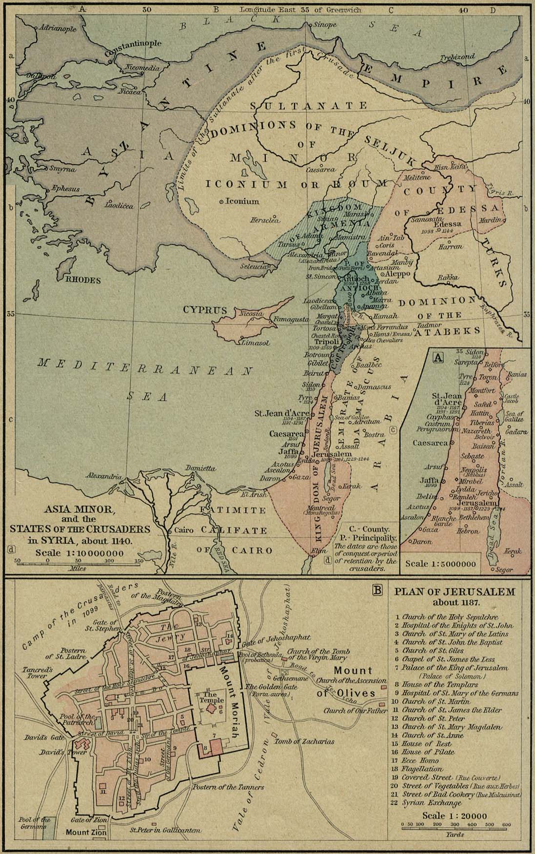
Bibliography
- Biger, Gideon (2005). The Boundaries of Modern Palestine, 1840–1947. London: Routledge. ISBN 0-7146-5654-2.
- Bregman, Ahron (2002). Israel's Wars: A History Since 1947. London: Routledge. ISBN 978-0-415-28716-6.
- Louis, Wm. Roger (1969). "The United Kingdom and the Beginning of the Mandates System, 1919–1922". International Organization, 23(1), pp. 73–96.
- Maar'i, Tayseer, and Usama Halabi (1992). "Life under occupation in the Golan Heights". Journal of Palestine Studies. 22: 78–93. doi:10.1525/jps.1992.22.1.00p0166n.
{{cite journal}}: CS1 maint: multiple names: authors list (link) - Maoz, Asher (1994). "Application of Israeli law to the Golan Heights is annexation". Brooklyn Journal of International Law. 20, afl. 2: 355–96.
- Morris, Benny (2001). Righteous Victims. New York, Vintage Books. ISBN 978-0-679-74475-7.
- Sheleff, Leon (1994). "Application of Israeli law to the Golan Heights is not annexation". Brooklyn Journal of International Law. 20, afl. 2: 333–53.
- Zisser, Eyal (2002). "June 1967: Israel's capture of the Golan Heights". Israel Studies. 7, 1: 168–194.
External links
- Gaulonitis in the Jewish Encyclopedia
- Golan, Gaulonitis in The International Standard Bible Encyclopedia
- Qatzrin
- from the Moshe Dayan Memoirs
- Golan Heights Examination
- A View From Damascus: Internal Refugees From Golan’s 244 Destroyed Syrian Villages from Washington Report
- Golan Heights Town Tells Tale of Israeli-Arab War from Damascus online
- Planetware travel guide
- Golan Heights Winery
- After 40 years, could the ice be melting on the Golan Heights?
- "Golan Heights Will Supply All Energy Needs Within A Year"
- Photo album