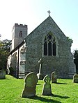
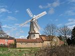
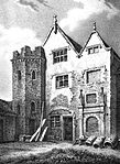
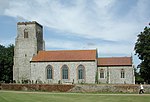
Grade II* listed buildings in King's Lynn and West Norfolk: Difference between revisions
Appearance
Content deleted Content added
Add images and links |
|||
| Line 1,142: | Line 1,142: | ||
{{EH listed building row |
{{EH listed building row |
||
| name= Village Cross |
| name= Village Cross |
||
| location= Titchwell |
| location= [[Titchwell]] |
||
| type= Village Cross |
| type= Village Cross |
||
| completed= Mediaeval |
| completed= Mediaeval |
||
| Line 1,152: | Line 1,152: | ||
| uid= 1273642 |
| uid= 1273642 |
||
| show_img = yes |
| show_img = yes |
||
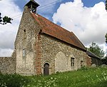
| image=Titchwell village cross - geograph.org.uk - 1328752.jpg |
|||
| image= |
|||
| upload_desc= Village Cross |
| upload_desc= Village Cross |
||
}} |
}} |
||
{{EH listed building row |
{{EH listed building row |
||
| name= Crescent House |
| name= Crescent House |
||
| location= Upwell |
| location= [[Upwell]] |
||
| type= House |
| type= House |
||
| completed= c1620-40 |
| completed= c1620-40 |
||
| Line 1,172: | Line 1,172: | ||
{{EH listed building row |
{{EH listed building row |
||
| name= The Cottages East of Lloyds Bank |
| name= The Cottages East of Lloyds Bank |
||
| location= Upwell |
| location= [[Upwell]] |
||
| type= House |
| type= House |
||
| completed= 19th century |
| completed= 19th century |
||
| Line 1,187: | Line 1,187: | ||
{{EH listed building row |
{{EH listed building row |
||
| name= Welle Manor Hall |
| name= Welle Manor Hall |
||
| location= |
| location= New Road, [Upwell]] |
||
| type= Manor House |
| type= Manor House |
||
| completed= Mid 14th century |
| completed= Mid 14th century |
||
| Line 1,202: | Line 1,202: | ||
{{EH listed building row |
{{EH listed building row |
||
| name= Old Manor Farmhouse |
| name= Old Manor Farmhouse |
||
| location= The Chase, Walpole, |
| location= The Chase, [[Walpole, Norfolk|Walpole]] |
||
| type= Farmhouse |
| type= Farmhouse |
||
| completed= 1638 |
| completed= 1638 |
||
| Line 1,217: | Line 1,217: | ||
{{EH listed building row |
{{EH listed building row |
||
| name= Church of St Mary the Virgin |
| name= Church of St Mary the Virgin |
||
| location= Welney |
| location= [[Welney]] |
||
| type= Parish Church |
| type= Parish Church |
||
| completed= 1848 |
| completed= 1848 |
||
| Line 1,227: | Line 1,227: | ||
| uid= 1168946 |
| uid= 1168946 |
||
| show_img = yes |
| show_img = yes |
||
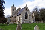
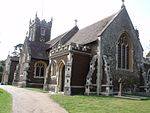
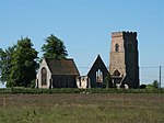
| image=St Mary's Church and water tower - geograph.org.uk - 432107.jpg |
|||
| image= |
|||
| commonscat=St Mary's, Welney |
|||
| upload_desc= Church of St Mary the Virgin |
| upload_desc= Church of St Mary the Virgin |
||
}} |
}} |
||
{{EH listed building row |
{{EH listed building row |
||
| name= Church of St |
| name= Church of St Margaret of Antioch |
||
| location= Wereham |
| location= [[Wereham]] |
||
| type= |
| type= Church |
||
| completed= Early 13th century |
| completed= Early 13th century |
||
| show_listed = yes |
| show_listed = yes |
||
| Line 1,242: | Line 1,243: | ||
| uid= 1342376 |
| uid= 1342376 |
||
| show_img = yes |
| show_img = yes |
||
| image= |
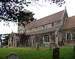
| image=Wereham Church.jpg |
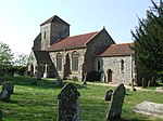
||
| commonscat=St Margaret of Antioch, Wereham, Norfolk |
|||
| upload_desc= Church of St Maragret |
| upload_desc= Church of St Maragret |
||
}} |
}} |
||
{{EH listed building row |
{{EH listed building row |
||
| name= Barn 100 Metres South West of Abbey Farmhouse with Detached Gable 10 Metres to North |
| name= Barn 100 Metres South West of Abbey Farmhouse with Detached Gable 10 Metres to North |
||
| location= West Acre, |
| location= [[West Acre, Norfolk|West Acre]] |
||
| type= Barn |
| type= Barn |
||
| completed= Late Medieval |
| completed= Late Medieval |
||
| Line 1,261: | Line 1,263: | ||
}} |
}} |
||
{{EH listed building row |
{{EH listed building row |
||
| name= Remains of Base of South West Tower and Part of West Claustral Range of West Acre Priory, 20 Metres East of Abbey Farm House |
| name= Remains of Base of South West Tower and Part of West Claustral Range of [[West Acre Priory]], 20 Metres East of Abbey Farm House |
||
| location= West Acre, |
| location= [[West Acre, Norfolk|West Acre]] |
||
| type= Tower |
| type= Tower |
||
| completed= 12th century |
| completed= 12th century |
||
| Line 1,272: | Line 1,274: | ||
| uid= 1077661 |
| uid= 1077661 |
||
| show_img = yes |
| show_img = yes |
||
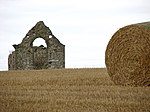
| image=Church detail, Castle Acre Priory - geograph.org.uk - 1718454.jpg |
|||
| image= |
|||
| upload_desc= Remains of Base of South West Tower and Part of West Claustral Range of West Acre Priory, 20 Metres East of Abbey Farm House |
| upload_desc= Remains of Base of South West Tower and Part of West Claustral Range of West Acre Priory, 20 Metres East of Abbey Farm House |
||
}} |
}} |
||
{{EH listed building row |
{{EH listed building row |
||
| name= Gatepiers at North East Corner of Abbey Precinct |
| name= [[West Dereham Abbey|Gatepiers at North East Corner of Abbey Precinct]] |
||
| location= West Dereham |
| location= [[West Dereham]] |
||
| type= Gate Pier |
| type= Gate Pier |
||
| completed= 1697 |
| completed= 1697 |
||
| Line 1,287: | Line 1,289: | ||
| uid= 1342341 |
| uid= 1342341 |
||
| show_img = yes |
| show_img = yes |
||
| image=Entrance to St Mary's Abbey - geograph.org.uk - 478411.jpg |
|||
| image= |
|||
| upload_desc= Gatepiers at North East Corner of Abbey Precinct |
| upload_desc= Gatepiers at North East Corner of Abbey Precinct |
||
}} |
}} |
||
{{EH listed building row |
{{EH listed building row |
||
| name= Ruins of Service Wing of West Dereham Abbey House |
| name= [[West Dereham Abbey|Ruins of Service Wing of West Dereham Abbey House]] |
||
| location= West Dereham |
| location= [[West Dereham]] |
||
| type= Stable |
| type= Stable |
||
| completed= 1697 |
| completed= 1697 |
||
| Line 1,306: | Line 1,308: | ||
}} |
}} |
||
{{EH listed building row |
{{EH listed building row |
||
| name= Ruins of West Dereham Abbey House |
| name= [[West Dereham Abbey|Ruins of West Dereham Abbey House]] |
||
| location= West Dereham |
| location= [[West Dereham]] |
||
| type= House |
| type= House |
||
| completed= 1697 |
| completed= 1697 |
||
| Line 1,322: | Line 1,324: | ||
{{EH listed building row |
{{EH listed building row |
||
| name= Church of St Mary |
| name= Church of St Mary |
||
| location= West Winch |
| location= [[West Winch]] |
||
| type= |
| type= Church |
||
| completed= 1766 |
| completed= 1766 |
||
| show_listed = yes |
| show_listed = yes |
||
| Line 1,332: | Line 1,334: | ||
| uid= 1342420 |
| uid= 1342420 |
||
| show_img = yes |
| show_img = yes |
||
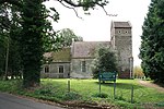
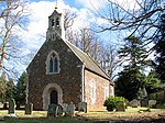
| image=St Mary's Church at West Winch - geograph.org.uk - 255412.jpg |
|||
| image= |
|||
| upload_desc= Church of St Mary |
| upload_desc= Church of St Mary |
||
}} |
}} |
||
{{EH listed building row |
{{EH listed building row |
||
| name= Fitton Oake |
| name= Fitton Oake |
||
| location= Wiggenhall St. Germans |
| location= [[Wiggenhall St. Germans]] |
||
| type= House |
| type= House |
||
| completed= 1570-77 |
| completed= 1570-77 |
||
| Line 1,352: | Line 1,354: | ||
{{EH listed building row |
{{EH listed building row |
||
| name= Ruins of Church of St Peter |
| name= Ruins of Church of St Peter |
||
| location= Wiggenhall St. Germans |
| location= [[Wiggenhall St. Germans]] |
||
| type= Parish Church |
| type= Parish Church |
||
| completed= 15th century |
| completed= 15th century |
||
| Line 1,362: | Line 1,364: | ||
| uid= 1152777 |
| uid= 1152777 |
||
| show_img = yes |
| show_img = yes |
||
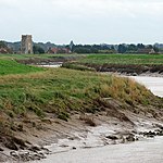
| image=The Great Ouse and Wiggenhall St Peter (geograph 3712016).jpg |
|||
| image= |
|||
| upload_desc= Ruins of Church of St Peter |
| upload_desc= Ruins of Church of St Peter |
||
}} |
}} |
||
{{EH listed building row |
{{EH listed building row |
||
| name= St Germans Hall |
| name= St Germans Hall |
||
| location= Wiggenhall St. Germans |
| location= [[Wiggenhall St. Germans]] |
||
| type= House |
| type= House |
||
| completed= Mid 17th century |
| completed= Mid 17th century |
||
| Line 1,377: | Line 1,379: | ||
| uid= 1304623 |
| uid= 1304623 |
||
| show_img = yes |
| show_img = yes |
||
| image=St Germans Hall (geograph 3648583).jpg |
|||
| image= |
|||
| upload_desc= St Germans Hall |
| upload_desc= St Germans Hall |
||
}} |
}} |
||
{{EH listed building row |
{{EH listed building row |
||
| name= St Marys Hall |
| name= St Marys Hall |
||
| location= Wiggenhall St. Germans |
| location= [[Wiggenhall St. Germans]] |
||
| type= House |
| type= House |
||
| completed= 1864 |
| completed= 1864 |
||
| Line 1,397: | Line 1,399: | ||
{{EH listed building row |
{{EH listed building row |
||
| name= The Priory |
| name= The Priory |
||
| location= Wiggenhall St. Mary Magdalen |
| location= [[Wiggenhall St. Mary Magdalen]] |
||
| type= House |
| type= House |
||
| completed= late C20 |
| completed= late C20 |
||
| Line 1,412: | Line 1,414: | ||
{{EH listed building row |
{{EH listed building row |
||
| name= Church of St Mary |
| name= Church of St Mary |
||
| location= Wimbotsham |
| location= [[Wimbotsham]] |
||
| type= Bell Tower |
| type= Bell Tower |
||
| completed= 1525 |
| completed= 1525 |
||
| Line 1,427: | Line 1,429: | ||
{{EH listed building row |
{{EH listed building row |
||
| name= Church of St Michael |
| name= Church of St Michael |
||
| location= Wormegay |
| location= [[Wormegay]] |
||
| type= Parish Church |
| type= Parish Church |
||
| completed= 13th century |
| completed= 13th century |
||
| Line 1,442: | Line 1,444: | ||
{{EH listed building row |
{{EH listed building row |
||
| name= Church of All Saints |
| name= Church of All Saints |
||
| location= Wretton |
| location= [[Wretton]] |
||
| type= Parish Church |
| type= Parish Church |
||
| completed= Late 13th century |
| completed= Late 13th century |
||
Revision as of 12:37, 24 March 2014
There are over 20,000 Grade II* listed buildings in England. This page is a list of these buildings in the district of King's Lynn and West Norfolk in Norfolk.
King's Lynn and West Norfolk
Notes
- ^ The date given is the date used by Historic England as significant for the initial building or that of an important part in the structure's description.
- ^ Sometimes known as OSGB36, the grid reference is based on the British national grid reference system used by the Ordnance Survey.
- ^ The "List Entry Number" is a unique number assigned to each listed building and scheduled monument by Historic England.
External links
![]() Media related to Grade II* listed buildings in Norfolk, England at Wikimedia Commons
Media related to Grade II* listed buildings in Norfolk, England at Wikimedia Commons

