
Template:Syrian Civil War detailed map: Difference between revisions
Content deleted Content added
Your sources show the battleline/frontline going right through Kafr Nan, which would make it contested by all intents and purposes. Not to mention you are using a pro-opposition source for an opposition gain. Remember the rules. |
Paolowalter (talk | contribs) Pro-opp source states clearly Kesab as contested syriadirect.org/rss/1243-syria-direct-news-update-3-22-2014 |
||
| Line 1,042: | Line 1,042: | ||
{{#invoke:location map|mark |Syria |lat=35.905|long=36.014 |mark=Mountain pass 12x12 e.svg |marksize=25|link=Cities and towns during the Syrian civil war#Kesab |label=[[Cities and towns during the Syrian civil war#Kesab|Kesab Border Crossing]] |label_size=0 |position=left}} |
{{#invoke:location map|mark |Syria |lat=35.905|long=36.014 |mark=Mountain pass 12x12 e.svg |marksize=25|link=Cities and towns during the Syrian civil war#Kesab |label=[[Cities and towns during the Syrian civil war#Kesab|Kesab Border Crossing]] |label_size=0 |position=left}} |
||
{{#invoke:location map|mark |Syria |lat=35.905|long=36.014 |mark=Location dot lime.svg |marksize=6|link=Cities and towns during the Syrian civil war#Kesab |label=[[Cities and towns during the Syrian civil war#Kesab|Kesab Border Crossing]] |label_size=0 |position=left}} |
{{#invoke:location map|mark |Syria |lat=35.905|long=36.014 |mark=Location dot lime.svg |marksize=6|link=Cities and towns during the Syrian civil war#Kesab |label=[[Cities and towns during the Syrian civil war#Kesab|Kesab Border Crossing]] |label_size=0 |position=left}} |
||
{{#invoke:location map|mark |Syria |lat=35.917|long=35.983 |mark=Location |
{{#invoke:location map|mark |Syria |lat=35.917|long=35.983 |mark=Location 8x8anim-red-lime.gif |marksize=6|label=[[Cities and towns during the Syrian civil war#Kesab| Kesab]] |link=Cities and towns during the Syrian civil war#Kesab |label_size=90 |position=right}} |
||
|marksize=9}} |
|||
{{#invoke:location map|mark |Syria |lat=35.917|long=35.983 |mark=Location dot lime.svg |
|||
|marksize=6|label=[[Cities and towns during the Syrian civil war#Kesab| Kesab]] |link=Cities and towns during the Syrian civil war#Kesab |label_size=90 |position=right}} |
|||
{{#invoke:location map|mark |Syria |lat=35.621|long=35.827 |mark=Location dot red.svg |marksize=8 |label=[[Kirsana]] |link=Kirsana |label_size=90 |position=bottom}} |
{{#invoke:location map|mark |Syria |lat=35.621|long=35.827 |mark=Location dot red.svg |marksize=8 |label=[[Kirsana]] |link=Kirsana |label_size=90 |position=bottom}} |
||
{{#invoke:location map|mark |Syria |lat=35.583|long=36.033 |mark=Location dot red.svg |marksize=6 |label=[[Cities and towns during the Syrian civil war#Al-Haffah|Haffah]] |link=Cities and towns during the Syrian civil war#Al-Haffah |label_size=90 |position=left}} |
{{#invoke:location map|mark |Syria |lat=35.583|long=36.033 |mark=Location dot red.svg |marksize=6 |label=[[Cities and towns during the Syrian civil war#Al-Haffah|Haffah]] |link=Cities and towns during the Syrian civil war#Al-Haffah |label_size=90 |position=left}} |
||
Revision as of 21:12, 24 March 2014


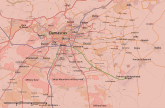


Hamdan Air Base
Toumine
Hold cursor over location to display name; click to go to location row in the "table of cities and towns" (if available).
 Government-held ;
  Opposition-held (except ISIL) ;
  ISIL-held ;
  Kurd-held
Contested : Gov't-main rebels ;
  gov't-kurds ;
  gov't-ISIS ;
  main rebels-kurds ;
  main rebels-ISIS ;
  kurds-ISIS ;
  3-way ;
 Military base ;
  Airport/Air base (jet) ;
  Airport/Air base (helicopter)
  Major port or naval base;
  Border Post ;
  Dam
Dam
2 nested circles: inner controls, outer sieges // 3 nested circles: mixed control with stable situation // Small icons within large circle: situation in individual neighbourhoods/districts
Contested :
2 nested circles: inner controls, outer sieges // 3 nested circles: mixed control with stable situation // Small icons within large circle: situation in individual neighbourhoods/districts