
Kryvyi Rih: Difference between revisions
m →Twin cities: please see Bern#Twin Cities and de:Bern#Städtepartnerschaften; Bern has no Twin Citys because the city council decided against |
|||
| Line 202: | Line 202: | ||
==Twin cities== |
==Twin cities== |
||
*{{flagicon|Switzerland}} [[Bern]] |
|||
*{{flagicon|China}} [[Handan]] |
*{{flagicon|China}} [[Handan]] |
||
*{{flagicon|Russia}} [[Nizhny Tagil]] |
*{{flagicon|Russia}} [[Nizhny Tagil]] |
||
Revision as of 21:13, 14 October 2014
Kryvyi Rih
Кривий Ріг | |
|---|---|
| From upper left: Savior Transfiguration Cathedral, ArcelorMittal, Kryvyi Rih Main station, Maksyma Hor'koho square, Saksahan boat station From upper left: Savior Transfiguration Cathedral, ArcelorMittal, Kryvyi Rih Main station, Maksyma Hor'koho square, Saksahan boat station | |
| Country | |
| Province | |
| District | |
| Founded | 1775 |
| City status | 1919 |
| Government | |
| • Mayor | Yuriy Vilkul[1] |
| Area | |
| • Total | 410 km2 (160 sq mi) |
| Elevation | 84 m (276 ft) |
| Population (2013) | |
| • Total | 656,478 |
| • Density | 1,600/km2 (4,100/sq mi) |
| Time zone | UTC+2 (EET) |
| • Summer (DST) | UTC+3 (EEST) |
| Postal code | 50000-50479 |
| Area code | +380 56(4) |
| Website | kryvyirih.dp.ua |


Kryvyi Rih (Ukrainian: Кривий Ріг; Russian: Кривой Рог, Crooked Horn) is a city in central Ukraine. It is situated in Dnipropetrovsk Oblast, to the southwest of the oblast's administrative center, Dnipropetrovsk, at the confluence of the Inhulets and Saksahan rivers. Administratively, it is incorporated within Kryvyi Rih municipality as a city of oblast significance. It also serves as the administrative center of Kryvyi Rih Raion although it is not part of the raion. Population: 656,478 (2013 est.)[3].
Kryvyi Rih is arguably the main steel industry city of Eastern Europe, being a large globally important metallurgical center in the Kryvbas iron mining region.
History
The city was founded in the 18th century by Zaporozhian Cossacks. Kryvyi Rih in Ukrainian literally means Crooked Horn. According to local legend, the city was founded by a crooked (Ukrainian slang for one-eyed) Cossack named Rih. However, records pre-dating the existence of the city refer to the area by the same name, due to the shape of the landmass formed by the merging of the river Saksagan into the Inhulets.
The area's industrial growth began in the 1880s, when European investment founded a mining syndicate. The metallurgical works in the city, Kryvorizhstal, in particular, expanded through Soviet times, and now remain some of the largest in the world.
During the Russian Civil War, the city and its hinterland were at the nucleus of Nestor Makhno's anarchist insurgency.
During World War II, Kryvyi Rih was occupied by the German Army from August 15, 1941 to February 22, 1944. Kryvyi Rih was almost totally destroyed by the fleeing Red Army. After the war, people lived among the ruins while housing stocks were rebuilt. The housing shortage was met by innovative technological solutions, which meant temporary barracks and houses could be built quickly. The two kinds of cheap new materials [clarification needed] were used later for years afterwards.
-
Postal station Kryvyy Rih tabernacle was built by order of Petro Kalnyshevsky
-
 The main street of Kryvyi Rih, the beginning of the twentieth century
 -
 Olexander Paul studied in detail the iron ore of Kryvyi Rih and proved their commercial value.
 -
 AEG power station built in 1930.


Modern Kryvyi Rih
The city extends for 126 km from north to south,[4][5] paralleling the ore deposits. The city is set in the rolling steppe land surrounded by fields of sunflowers and grain. A short distance east of the city centre, there is an area along a small lake where glacial boulders were deposited. As a result, this area was never cultivated and contains one of the few remaining patches of wild steppe vegetation in the area. The city's environmental and construction safety is a growing problem due to abandoned mines and polluted ore-processing waste. According to the Scientific Hygienic Centre of Ukraine, the city is one of the most unfavourable places to live because of these problems.[6]
The city itself is laid out with broad avenues lined by wide sidewalks. Tram lines run down the centre of the major streets. Beside the sidewalks there are usually several rows of trees such as lindens and horse chestnuts. Many people live in rows of 5 to 9 story apartment buildings that are wrapped around large inner courtyards. Many of these courtyards are also filled with trees giving the overall impression that the entire city is built in a park.
Kryvyi Rih TV Mast is a 185m tall guyed tubular steel mast built in 1960, which carries in 2 levels 3 crossbars, which run from the mast structure to the guys. All three crossbars are equipped with gangways that carry additional smaller antennas.
-

-
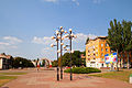 Central city
 -
 One of the biggest flower clocks in Europe
 -

-
 City trolleybus
 -
 Christmas lights near City Hall
 -
 Zarya mine building
 -
 Kryvyi Rih National University


Climate
Kryvyi Rih experiences a dry continental climate (Dfb/Dfa) according to the Köppen climate classification system. This tends to generate warm summers and cold winters with relatively low precipitation.
| Climate data for Kryvyi Rih | |||||||||||||
|---|---|---|---|---|---|---|---|---|---|---|---|---|---|
| Month | Jan | Feb | Mar | Apr | May | Jun | Jul | Aug | Sep | Oct | Nov | Dec | Year |
| Record high °C (°F) | 13.0 (55.4) |
18.9 (66.0) |
23.5 (74.3) |
28.9 (84.0) |
35.8 (96.4) |
36.4 (97.5) |
38.6 (101.5) |
39.6 (103.3) |
32.2 (90.0) |
31.7 (89.1) |
21.7 (71.1) |
15.3 (59.5) |
39.6 (103.3) |
| Mean daily maximum °C (°F) | −0.9 (30.4) |
0.1 (32.2) |
6.1 (43.0) |
15.0 (59.0) |
21.8 (71.2) |
25.2 (77.4) |
27.8 (82.0) |
27.5 (81.5) |
21.4 (70.5) |
14.0 (57.2) |
5.5 (41.9) |
0.4 (32.7) |
13.7 (56.7) |
| Daily mean °C (°F) | −3.5 (25.7) |
−3.1 (26.4) |
1.9 (35.4) |
9.6 (49.3) |
15.9 (60.6) |
19.5 (67.1) |
21.8 (71.2) |
21.2 (70.2) |
15.6 (60.1) |
9.1 (48.4) |
2.3 (36.1) |
−2.1 (28.2) |
9.0 (48.2) |
| Mean daily minimum °C (°F) | −6.3 (20.7) |
−6.2 (20.8) |
−1.8 (28.8) |
4.4 (39.9) |
9.8 (49.6) |
13.7 (56.7) |
15.7 (60.3) |
15.0 (59.0) |
10.1 (50.2) |
4.7 (40.5) |
−0.6 (30.9) |
−4.7 (23.5) |
4.5 (40.1) |
| Record low °C (°F) | −27.2 (−17.0) |
−27.3 (−17.1) |
−21.0 (−5.8) |
−8.9 (16.0) |
−1.6 (29.1) |
2.8 (37.0) |
7.3 (45.1) |
5.0 (41.0) |
−3.7 (25.3) |
−10.0 (14.0) |
−18.6 (−1.5) |
−24.5 (−12.1) |
−27.3 (−17.1) |
| Average precipitation mm (inches) | 30 (1.2) |
29 (1.1) |
24 (0.9) |
28 (1.1) |
45 (1.8) |
62 (2.4) |
58 (2.3) |
32 (1.3) |
38 (1.5) |
37 (1.5) |
31 (1.2) |
28 (1.1) |
442 (17.4) |
| Source: Pogoda.ru.net[7] | |||||||||||||
Demographics
Kryvyi Rih had a population of 664,499 in 2011.[citation needed] There is a community of an estimated 15,000 Jews living in the city.[citation needed]
Economy
Viktor Yushchenko, the president of Ukraine since 2005, has accused his predecessor, Leonid Kuchma of selling off Kryvorizhstal to a political supporter for far below market value. This privatization was successfully challenged in court in 2005, and the same year the plant was re-privatized after an open bidding to the Dutch-Indian Mittal Steel for more than 5 times the initial value.
Tourism
This article is written like a travel guide. (July 2010) |
Kryvyi Rih has few hotels. The Kryvyi Rih (also known as Lozuvatka) International Airport was renovated from 2002 to 2007 and handles charter flights, private planes and flights to Kyiv.
Sport
Kryvyi Rih was home to the football team Kryvbas Kryvyi Rih. In June 2013 the club went bankrupt and was expelled from the Ukrainian Premier League. It was also the birthplace of the Ukrainian tennis players Valeria Bondarenko, Alona Bondarenko and Kateryna Bondarenko.
Twin cities
References
- ^ "City of Kryvyi Rih, Dnipropetrovsk Oblast". Regions of Ukraine and their Structure (in Ukrainian). Verkhovna Rada of Ukraine. Retrieved 27 February 2012.
- ^ "Kryvyi Rih (Ternopil Oblast, Kryvyi Rih Raion)". weather.in.ua. Retrieved 27 February 2012.
- ^ Чисельність наявного населення України [Actual population of Ukraine] (in Ukrainian). State Statistics Service of Ukraine. Archived from the original on 2014-02-02. Retrieved 21 January 2015.
- ^ Dnepropetrovsk Oblast 1:200,000 map, Ukraine 2004 and 2005.
- ^ The following website claims that: "Currently, the city of Krivoy Rog has an area of 430.0 km2, and extends 126 km (78.29 mi) from north to south (the largest in Europe) and is 20 km (12.43 mi) in width." ("В настоящий момент город Кривой Рог занимает территорию площадью 430,0 км2 и имеет протяжность с севера на юг 126 км (наибольшая в Европе) и ширину до 20 км.:) Официальный сайт исполсома города Кривщгщ Рого (ru) (ua).
- ^ Библиотечный каталог авторефератов Украины, Scientific Hygienic Centre of Ukraine.
- ^ "Pogoda.ru.net" (in Russian). May 2011. Retrieved 3 July 2012.
External links
- Kryvyi Rih administration website Template:Uk icon Template:En icon Template:Ru icon
- Kryvyi Rih cultural portal Template:Uk icon Template:Ru icon
- Infokr - city portal of Kryvyi Rih Template:Ru icon
- 80564 - board of bulletins of Kryvyi Rih Template:Ru icon
- Online map of Kryvyi Rih Template:Ru icon
- Google Maps Satellite Image of Kryvyi Rih
- Testing the mettle of Ukraine's steel city from the BBC World News Template:En icon