
Talk:Control of cities during the Syrian civil war: Difference between revisions
→Please change "Al Hawr" الحَور to red.: new section |
|||
| Line 532: | Line 532: | ||
There's a report [http://www.almasdarnews.com/article/syrian-army-pushes-east-towards-al-raqqa/ here] that the SAA won control of the "Ithriyah Oil Pumping Station and the Ithriyah Electrical Station near the formerly contested town of Ithriyah" which are "only a few kilometers away from the nearby Al-Raqqa Governorate". None of these seems to be on the map. Perhaps they can be added in? [[User:Esn|Esn]] ([[User talk:Esn|talk]]) 03:21, 13 January 2016 (UTC) |
There's a report [http://www.almasdarnews.com/article/syrian-army-pushes-east-towards-al-raqqa/ here] that the SAA won control of the "Ithriyah Oil Pumping Station and the Ithriyah Electrical Station near the formerly contested town of Ithriyah" which are "only a few kilometers away from the nearby Al-Raqqa Governorate". None of these seems to be on the map. Perhaps they can be added in? [[User:Esn|Esn]] ([[User talk:Esn|talk]]) 03:21, 13 January 2016 (UTC) |
||
: [[User:Esn|Esn]] I think that it is a former Oil Pumping station.[http://wikimapia.org/#lang=en&lat=35.401504&lon=37.836485&z=14&m=b&show=/27201156/Military-Checkpoint-Burj-At-Taghtiyah here] on map marked as Military Checkpoint "Burj At-Taghtiyah" but this object is close to the Oil fields and the Oil pipeline is suitable to him.Maps of the Syrian pipelines:[http://www.ccun.org/images/2014/February/24%20p/syria_map.png here][http://s1369.photobucket.com/user/leland234/media/syria_oil_map_09-10-2013_zpsfbabe240.jpg.html here][http://orientalreview.org/wp-content/uploads/2013/05/Syria_oil-map_03.jpg here][http://img.ly/system/uploads/009/144/917/original_Syria9August2015.jpg here](I not use any maps for edit only for golocation) [[User:Sûriyeya|Sûriyeya]] ([[User talk:Sûriyeya|talk]]) 07:51, 13 January 2016 (UTC) |
: [[User:Esn|Esn]] I think that it is a former Oil Pumping station.[http://wikimapia.org/#lang=en&lat=35.401504&lon=37.836485&z=14&m=b&show=/27201156/Military-Checkpoint-Burj-At-Taghtiyah here] on map marked as Military Checkpoint "Burj At-Taghtiyah" but this object is close to the Oil fields and the Oil pipeline is suitable to him.Maps of the Syrian pipelines:[http://www.ccun.org/images/2014/February/24%20p/syria_map.png here][http://s1369.photobucket.com/user/leland234/media/syria_oil_map_09-10-2013_zpsfbabe240.jpg.html here][http://orientalreview.org/wp-content/uploads/2013/05/Syria_oil-map_03.jpg here][http://img.ly/system/uploads/009/144/917/original_Syria9August2015.jpg here](I not use any maps for edit only for golocation) [[User:Sûriyeya|Sûriyeya]] ([[User talk:Sûriyeya|talk]]) 07:51, 13 January 2016 (UTC) |
||
== Please change "Al Hawr" الحَور to red. == |
|||
الحَور/AlHawr under SAA<br /> |
|||
[http://bayanbox.ir/view/3733283257464916735/North-Latakia-cut4-13jan-23dey-low.jpg Al-Hawr under SAA]<br /> |
|||
----[[Special:Contributions/212.75.52.4|212.75.52.4]] ([[User talk:212.75.52.4|talk]]) 13:06, 13 January 2016 (UTC)MapMaker |
|||
Revision as of 13:06, 13 January 2016
| This article was nominated for deletion on 23 July 2015. The result of the discussion was keep. |
| This is the talk page for discussing improvements to the Control of cities during the Syrian civil war article. This is not a forum for general discussion of the article's subject. |
Article policies
|
| Find sources: Google (books · news · scholar · free images · WP refs) · FENS · JSTOR · TWL |
| This page is not a forum for general discussion about Control of cities during the Syrian civil war. Any such comments may be removed or refactored. Please limit discussion to improvement of this article. You may wish to ask factual questions about Control of cities during the Syrian civil war at the Reference desk. |
| This article is of interest to the following WikiProjects: | |||||||||||||||||||||||||||||||||||||||||||||||||||||||
| |||||||||||||||||||||||||||||||||||||||||||||||||||||||


.svg)

| To help centralise discussions and keep related topics together, Template talk:Syrian Civil War detailed map redirects here. |
Template:Syrian Civil War sanctions
 | Rules for Editing the Map
1- A reliable source for that specific edit should be provided.
2- Copying from maps is strictly prohibited. Maps from mainstream media are approximate and therefore unreliable for any edit. Maps from amateur sources are below the standards of Wikipedia for any edit. They violate WP:RS and WP:CIRCULAR.
|
|
Index 1, 2, 3, 4, 5, 6, 7, 8, 9, 10 |
|
This page has archives. Sections older than 7 days may be automatically archived by Lowercase sigmabot III when more than 3 sections are present. |
Qadiriyah
Since LightandDark2000 (talk · contribs) regularly deletes all my questions on his talk page, I will ask him here (now and in the future), so it can stay visible:
- LightandDark2000, could You please point me to the sentence in the article Tenê 5 K.M ji bo Bendavê Teşrîn maye! that You used as a reference for changing village of Qadiriyah (article needs disambiguation page :) ) to yellow? Also, since you used kurdish-language source, tell us do You speak Kurdish language?--Hogg 22 (talk) 18:00, 27 December 2015 (UTC)
Also, I would like that the same user explain this edit. I don't see any proof that YPG took Aldbshih. It is somewhere between YPG held Khirbat Hadlah (Khirbet Hadla) and Tishrin Dam but dam could have been reached from north, not necessarily from the east.
This user was already blocked for a month for breaking the rules and I won't hesitate to call an admin again. --Hogg 22 (talk) 18:11, 27 December 2015 (UTC)
- I want just to clarify that aldbshih (or actually: al-Dibsiyah) is not at lat = "36.3294", long = "38.5844" but here: http://wikimapia.org/#lang=en&lat=36.324617&lon=38.337801&z=16&m=b Roboskiye (talk) 21:39, 27 December 2015 (UTC)
- I had my reasons, involving 3 sources I had seen. I believe that my argument as it is right now is moot, so I will withhold it until I believe it has become relevant enough to mention. But from what I had gleaned, it appeared that there were 2 axis of advance by the SDF forces, from the north and the east (after clashes with ISIL forces near Khirbet Hadla). BTW, please be careful. It appears that you made at least 2 reverts within a day, and I want to caution you against violating the sanctions, because so many users got blocked this year (and the year before) for treading beyond the red line. By the way, please refrain from using threats, like you did in your last post. Wikipedia is a place for positive contributions, not attacking or harassing other editors. LightandDark2000 (talk) 07:14, 28 December 2015 (UTC)
Sources for any change must be cited. You can't simply say, "I saw something, somewhere, saying (x)." Doing this means that anyone can just say, "I saw something staying that (insert town name here) was taken by (insert group user supports here)." This doesn't work. Also, I'm calling you a hypocrite, LightDark. You caution someone against threatening you, then mentioning that this person has committed a bannable offense. DaJesuZ (talk) 10:10, 28 December 2015 (UTC)
- Could someone who spears Arabic check this edit and see if source justifies the edit. --Hogg 22 (talk) 19:38, 29 December 2015 (UTC)
https://www.facebook.com/Raqqa.Sl/posts/1118451118166138 https://www.facebook.com/LCCSy/posts/1286663958027404 those two sources,the first source reports helicopter landing in Sykol,the other one reports a land mine from Daesh remnants was exploded in #SyKol village. notice it clearly states a landmine from Daesh remnent 3 martyrs were reported,if ISIS was in the village it would have reported Landmine exploded and killed ISIS fighter,the key is remnent,Remnent is only used in the case the ruling power isn't in the area,which clearly proves that the village is controlled by the other side (SDF-YPG),and it is impossible that the SDF rules such an isolated village without securing the surrounding villages,plus Hawarnews confirms that YPG has launched an assault to clear villages west of Ayn Issa.Alhanuty (talk) 22:11, 30 December 2015 (UTC)
- Alhanuty, I'm reverting your edit (original edit. Sorry, but I only see mention of village of Sykol (which I will leave yellow, although this is far from enough for change black to yellow). Please don't take too much freedom in "reading between lines" from sources. --Hogg 22 (talk) 14:29, 4 January 2016 (UTC)
- Don't revert,every source is confirming it,alot of maps are confirming it.Alhanuty (talk) 14:31, 4 January 2016 (UTC)
- How can YPG control it,if ISIS controls the surrounding.Alhanuty (talk) 14:32, 4 January 2016 (UTC)
- Alhanuty, We have no idea who controls area between Sykol and Khirbet Hadla so Sykol doesn't have to be surrounded. Regarding Your claim that sources confirm SDF control villages/peaks Dibsiyah, Bir al-Ama, Abu Safayah, Shallal, Jubb al-Qidarah, Abdul Kulaib cliffs, Khirbet Hadla and al-Haymar, please specify source for each of them. If source is not in English, please copy corresponding text in Arabic and give us English translation. --Hogg 22 (talk) 15:09, 4 January 2016 (UTC)
Here are the villages, one by one:
- Dibsiyah:
- Bir al-Ama:
- Abu Safayah:
- Shallal:
- Jubb al-Qidarah:
- Abdul Kulaib cliffs:
- Khirbet Hadla:
- al-Haymar:
- It is hard to mention all these villages,no source mentions all villages they mention the important ones.Alhanuty (talk) 16:42, 4 January 2016 (UTC)
- So, villages are not mentioned by name and You somehow came to conclusion that they are under SDF control. Please, explain how did Yopu come to conclusion that exactly these villages were taken. You must understand that arguments You gave so far are not nearly enough to justify Your edits. If You don't give us concrete answer, we will just have to revert Your edits. Thanks for understanding. --Hogg 22 (talk) 17:37, 4 January 2016 (UTC)
P.S. I found two villages names Sykol: Siyahah (Saykul) and Saykul / Ma'rufah.
I just found news on Twitter that SDF liberated 5 villages. The biggest one is Qadiriyah, the one from the title of our conversation. Here is the map that shows exactly where these 5 villages are. The map is wikimapia printscreen with frontline visible. The frontline is obviously made based on our map. You can see that villages that are taken by SDF today are looooooong way from "our" frontline which proves that "our" frontline has nothing to do with reality. So, please, let's stop painting everything to yellow without good source. I recommend to paint black everything south of Qadiriyah. --Hogg 22 (talk) 17:48, 4 January 2016 (UTC)
- And this is what twitter users think of us: Wiki is not neutral/pro-YPG. --Hogg 22 (talk) 18:11, 4 January 2016 (UTC)
https://www.facebook.com/Raqqa.Sl/posts/1122835967727653 villages between Qadiriyah and Sykol under YPG control via https://www.facebook.com/Raqqa.Sl/posts/1122835967727653 for locations west of Sykol,you can change them to black,but the area exactly between Sykol and Qadiriyah to stay yellow,plus this government map proves that Sykol is in the way south at the border with Raqqa http://aleppo.moh.gov.sy/img_areas/reef/3enal3arab/3enal3arab.jpg .Alhanuty (talk) 18:46, 4 January 2016 (UTC)
- Alhanuty Hogg 22 Today SDF take the villages of Qadrya, Ali Shumary, Husainya, Tarakaa, Abu Shahin, Al-Habsawi.sourcesourcesourcesourcesource but I only find (Abu Shahin, Al-Habsawi) but can't find the rest of the village. Maybe you can help. Sûriyeya (talk) 20:03, 4 January 2016 (UTC)
- Sûriyeya, Qadrya = Qadiriyah, I can't find the rest (Ali Shumary, Husainya, Tarakaa) either. Sometimes it helps to follow multiple twitter news sources because different users can report the same news with different transliteration of Arabic names, which might give You an alternative "route" to identifying villages. --Hogg 22 (talk) 20:48, 4 January 2016 (UTC)
- SDF retake Kerdoşan, Kadriye Şêx, Ali Şemarî, Ebu Majd.source Sûriyeya (talk) 11:24, 5 January 2016 (UTC)
- Alhanuty Hogg 22 Today SDF take the villages of Qadrya, Ali Shumary, Husainya, Tarakaa, Abu Shahin, Al-Habsawi.sourcesourcesourcesourcesource but I only find (Abu Shahin, Al-Habsawi) but can't find the rest of the village. Maybe you can help. Sûriyeya (talk) 20:03, 4 January 2016 (UTC)
- Hogg 22 So if SDF only yesterday taken the village of Kerdoshan,Qadiriyah,Al-Mustarihah and some other the villages. Areas where located these villages earlier have been wrongly marked as SDF-held. And this the indirect indication the fact that villages of Marwana, Jubb al-Qidarah, Shallal, Al Haymar, Sykol and Khirbet Hadla still ISIS-held. Or at least some of them. Sûriyeya (talk) 11:59, 5 January 2016 (UTC)
Based on this discussion, I will, for now, leave Sykol yellow, as well as villages between Sykol and Qadiriyah, but I will put back to black villages west of it. If You someone wants to change them to yellow, please use a valid source, and, in case source doesn't explicitly say "village x is under SDF control", write a short explanation here. Thanks for understanding. --Hogg 22 (talk) 08:48, 7 January 2016 (UTC)
- I changed [1][2] Jubb al-Qidarah, al-Haymar, Shallal, Abdul Kulaib cliffs, Abu Safayah, Dibsiyah, Bir al-Ama, Marwan to IS. --Hogg 22 (talk) 08:56, 7 January 2016 (UTC)
- Hogg 22 Also for now the opposition source reported about clashes between Kurdish Units and ISIS in the village Qadiriyah to the south the town of Sarrin.here Sûriyeya (talk) 13:39, 7 January 2016 (UTC)
- Hogg 22 Also opp. source said later that the ISIS announce conquering the village of Qadiriyah to the south the town of Sarrin this morning after three days of battles with Syrian Democratic Forces.herehere but still no independent confirmation of this data. We only know about clashes inside of this village. Sûriyeya (talk) 14:19, 8 January 2016 (UTC)
- Hogg 22 Also I think that this village Sykol which on the map marked as SDF-held still ISIS-held as they located in ara which is under control of ISIS but thid source by which we put this village as the SDF-held probably said about this village Saykul near Qadiriyah and Abu Majid. But we probably make mistake because the source not say that the SDF took new village but simply said that several people were killed by a mine left over from ISIS. Also, this village Saykul located near the villages of Qadiriya and Abu Majid which was taken SDF only several days ago but this village Sykol located deep in area which still controlled ISIS and also today ISIS retake Qadiriyah. And I think that it would be logical to correct an inaccuracy on the map. Sûriyeya (talk) 17:43, 8 January 2016 (UTC)
- Also SDF confirmed that their fighters pulled out from the villages of Qadiriyah, Marwan, Dibsiyah, ABu Sufayah and Al-Barudiyah south of Kobani.sourcesource Sûriyeya (talk) 20:38, 11 January 2016 (UTC)
Changing Yellow to SDF
Basically a continuation of the last [[3]] as a concise decision was not obviously made on whether to change yellow to SDF. Basically I propose:
Does anyone oppose this change?Prohibited Area (talk) 18:24, 29 December 2015 (UTC)
- I don't necessarily oppose this, but I do have an issue with them being labeled, "SDF, and that's that Afrin and Hasakah cantons are entirely controlled by the Kurds, so think separation of Kurds and FSA is needed, especially in ar/al-Raqqa, where the FSA has played a big part in taking the area back. DaJesuZ (talk) 19:39, 29 December 2015 (UTC)
DaJesuZ Prohibited Area Please read what I wrote to Tradedia admin here. We have a big problem. Now look at this report from a reliable reporter that we use for several years so far. He says that Rebels are mostly part of the SDF while there're some areas which aren't under SDF but completely under Rebel control (Jaish Ashair, who don't want to join SDF). This can be confirmed by pro-rebel sources from the same group and their statements, protests against YPG in those areas (1 civilian got recently killed), large convoys driving after new members finnished weekly training etc. Now again read what I wrote to Tradedia. The SDF is a coalition, and not a group, and can't change the meaning of the map. The same as Jaish Fatah is a coalition, which Nusra is part off, and that doesn't mean we can remove grey dots from the entire map just because Nusra contains only 30% of members.
- Leave Hasaka area as it is, because our previous discussions were primaly about its problem
- Change back Raqqa province as it was, and we continue editing it according to sources whether and how much Rebels did participate, being members of SDF or not, doesn't matter. The more time goes, the more problem we will have, for example when Manbij, Jarabulus and Raqqa towns are captured, it will basically scare of 20% of the people who view this map because they would be confuzed about big Arab towns (Raqqa) going yellow. DuckZz (talk) 20:35, 29 December 2015 (UTC)
- Basially, YPG, YPJ, MSF, Jabhat al-Akrad, Asayish, HPC etc are different names for the same thing. These together with a dozen of non-Islamist militant groups (established/supported/armed by PYD) form what is nowadays called SDF. I really don't know where in Raqqa is not under SDF control, as many tribal gangs who were not happy with SDF left for Gaziantep or remain powerless in some remote areas probably still in northern Raqqa. Moreover, over the past week, hundreds of fighters from these anti-SDF groups deserted and joined to SDF. So as said before, yellow should be something like: SDF (led by Rojava administration).
- As with Jabhat al-Nusra being grey, it can happily be reverted to green as unlike ISIS there is no significant difference between al-Nusra and the rest of FSA. And according to all evidence Jabhat al-Nusra are Islamists exactly as the rest of FSA. Roboskiye (talk) 21:37, 29 December 2015 (UTC)
- Absolutely correct. Grey-green splitting has little if any relevance on the ground.Paolowalter (talk) 09:08, 30 December 2015 (UTC)
Prohibited Area I´m not opposing your idea, but as DuckZz mentions there can be a problems. As of what I´ve hear and according to this source (sep-2015) Thuwar al-Raqqa is in administrative power in Ayn Issa. Thou they are members of Burkan Al-Furat I´ve reed many conflicting tweets and articles that they are not members of SDF. I´m not sure of any of this, but I think it´s worth mentioning. Should it be true, Ayn Issa should go green.Rhocagil (talk) 00:19, 30 December 2015 (UTC)
As I told already. Yellow should not be marked as Kurds. Kurds is a population not a party. They should be labelled YPG in the past.Now YPG operates with other groups under the SDF banner and therefore yellow <-> SDF. All other details are too subtle or questionable to be incorporated in the map. Once for ever yellow and green are completely different: green is fighting to overthrow the government, yellow not,is fighting against IS and often other islamist group.Paolowalter (talk) 09:14, 30 December 2015 (UTC)
- DaJesuZ None of the Kurdish cantons are unilaterally controlled by the YPG. What is your concern over the labelling of SDF?
- DuckZz Why is it against the rules to label yellow as a coalition? As long as the label is clear over whom it represents, I don't think it matters what the actual label is or represents. In regards to Al-Nusra I have no opinion on whether it is better to keep it or remove it from the map, however I would say removing it is unnecessary at the moment. The towns which were changed to yellow control during the 'edit' were all joint yellow-green control therefore suggesting that the rebels present were a part of SDF. Therefore the twitter source you presented would have conflicted with our map regardless of whether the edit would have been made. However assuming sources are reliable, if a town is held partially or unilaterally by non-SDF rebels in any region currently labelled as under Kurdish control, it should rightly be edited to show that it is held by rebels non-SDF. I think you exaggerating that people will be dis-encouraged by the map if it remains SDF as yellow. Also why would it be confusing in Jarabulus, Manbij etc were labelled as Kurdish held? Seen as SDF would have most likely contributed to the capture of the respective cities which is predominantly Kurdish, also northern Aleppo is a Kurdish region. The same applies to Raqqa.
- Rhocagil JaT is a part of SDF. If non-SDF rebels are present in any location that is falsely shown as under unilateral SDF control, I agree it should become green or yellow-green.
Basically all my proposal consists of is a rewording of the current designation of the yellow icon. Issues raised here seem to not concern the proposal but the earlier edit made which changed all areas as Green-Yellow to yellow assuming that they were all part of SDF, such issues I am happy to continue to discuss. However solely in regards to my proposal can I make the edit so that:
Prohibited Area (talk) 16:13, 30 December 2015 (UTC)
I cannot follow all these detailed discussion and I am not sure I want. The proposal should be:
 = SDF (Majority [[People's Protection Units|YPG)Paolowalter (talk) 22:00, 30 December 2015 (UTC)
- = SDF (Majority YPG) Rhocagil (talk) 01:08, 31 December 2015 (UTC)
- Alright, so you want to make the yellow icon represent the SDF, correct? As stated earlier, the majority of the more moderate rebel groups, including the FSA, one of the largest contenders in the war, which would necessitate the change of many village colors, to show a single alliance, the SDF, which could take quite a long time, and could further complicate the map.
- The Kurds, here, DOES refer to a military and political party in this conflict, as they are for the creation of either a kurdiah state, or an autonomous area, not to be administered by the Syrian government, meaning making them their own icon is perfectly fine.
- There are a few complications that arise from keeping things the way they are, though. Should other alliances be broken up, to where each individual group making them up is represented? If so, that causes more work for us.
- I don't really take a stance on this. I just see too many things that can g wrong with either decision. — Preceding unsigned comment added by DaJesuZ (talk • contribs) 05:09, 31 December 2015 (UTC)
- = Kurds
SDF is the only a umbrella organization. Majority of them are Kurds. World knows this war is as between Kurds, Rebels, ISIS and Syria. Bruskom (talk) 01:57, 3 January 2015 (UTC)
- I'd be happy with any of "Kurds and allies", "SDF and Kurds", "SDF and allies" etc. Banak (talk) 02:32, 3 January 2016 (UTC)
- ' = SDF / Rojava(n forces) ' or
- ' = SDF ' or
- ' = SDF (Majority YPG) '.
- It's wrong in a lot of ways to represent this conflict as a conflict between Arabs and Kurds. It is not.
- It's a conflict between anti-secular/anti-democratic Salafists (Daesh, Nusra, Ahrar,..) that have Arabs, Turkmen and even Kurds in their ranks and a coalition (SDF) of all ethnics in Rojava (Kurds, Assyrians, Arabs, Turkmens and other) that support secular democratic confederalism.
- In all Rojavan institutions all ethnics are represented, multiple languages and religions are recognised as official. SDF/Rojava is all about safeguarding ethnic minorities in Syria in a system of secular democratic confederalism which stops the circle of one ethnic, ruling, abusing and oppressing another.
- It's about ending the system in where Assad's Allawites rule over, oppress and abuse Arabs and Kurds; Turks rule over, oppress and abuse Kurds; Salafists rule over, oppress and abuse Women, Christians, Jezidi, Kurds, Atheïst,... --Niele~enwiki (talk) 04:18, 3 January 2016 (UTC)
- I thought that the issue was settled in favour of
' ![]() = SDF (Majority YPG) '.
Absolutely to avoid using ethnic labels like 'Kurds'. We have to represent military and political groups not ethnical ones.Paolowalter (talk) 13:28, 3 January 2016 (UTC)
= SDF (Majority YPG) '.
Absolutely to avoid using ethnic labels like 'Kurds'. We have to represent military and political groups not ethnical ones.Paolowalter (talk) 13:28, 3 January 2016 (UTC)
- Opp.source SDF on 90% consists of YPG/YPJ units.source Sûriyeya (talk) 17:36, 3 January 2016 (UTC)
How exactly is the issue settled? it ignored the essence of the wiki page!
The kurds (whether a political party or a militant group) CONTROLLED large land and many yellow dots PRIOR to the formation of the SDF. Everyone here knows this, they flew ONE flag, and it is a kurdish flag. Those areas shold remain yellow as they have been for several years. Obviously, for instance Hasakah city is controlled by three parties: Kurds, SAA, and Assyrians (NOT SDF). And the Ifrin canton has only ONE FLAG so far the kurdish flag (NOT SDF). The distinction is clear, we all know this for years and the designation was - and should still be - clear.
The new allied SDF force (with kurds being part, or majority of it) has liberated a different set of dots than the Yellow dots prior to the creation of the SDF. We will lose the essence of who controls what (which is what the map is Exactly about) if we combine the Pre-SDF yellow dots with the newly liberated from ISIS dots.
The situation is clear, the original yellow dots (Pre-SDF) are not enemies of the Syrian Government (They do not oppose ASSAD being a president, they just want certain future autonomy of some sort, and they fight along the SAA in Al-Hasakh Governate), people in Qamishly or Hasakah are not fighting each other, there is no need for truce there either because they are not Opposing one another; the original yellow dots are Power-Vaccum Control due to the SAA leaving the area for other business elsewhere. SDF is not that, and all SDF control dots should have their own color.
What SDF control is DIFFERENT and Mutually Exclusive from what the YPG controls. Designate them differently.
- Support - = Rojava (SDF) SDF is technically the joint military force of Rojava, including the YPG/YPG and allies. Even though some of the allies are Arab and Turkmen, they are not part of the Syrian Opposition (neither FSA, not Islamic Front, not any other body affiliated with the Syrian Coalition or Syrian National Council).GreyShark (dibra) 20:25, 7 January 2016 (UTC)
GreyShark, thank you for adding further to the discussion.
This map can not use double standards; it has been amazingly accurate and rational. Look at the city of Idlib as an example; it is ran by the army of conquest (which includes multiple forces just as the SDF includes multiple forces) but is designated by a two-color dot. Why aren't all other dots in Idlib being designated the same way? Simple, because although they fight along each other, JAN, FSA, IF, etc. control other territories already each on its own - besides the territories they control together under one army.
The same standard should be applied here to the newly established yellow dots!
Rojava is a specific geographical region, Tal Abyad is not part of the Rojava region, and it is controlled by SDF (which include a Rovaja power in it 'the YPG'), it is not controlled by the YPG alone. Again, on the other hand, Qameshly, is not controlled by SDF, and neither is Hasakah, the yellow areas in these cities are Controlled ONLY by YGP. The kurds did not cede all which they control to the power of the established SDF (this is the entire point of discussion)! Yes the kurds make up 80% of the SDF and that is simply because they do not need to protect the Rojava anymore (the front lines are far from the areas that are under their control only, but no; SDF does not control all which the kurds control. Again, let's not use a fallacy for this; Mainly, because there are vast areas controlled ONLY by the YPG and not the SDF, YGP control and SDF control are not the same.
- SOHR clear said that the city of Tall Abyad controlled by YPG.here Sûriyeya (talk) 11:51, 8 January 2016 (UTC)
- Also Rojava it is a Syrian Kurdistan with the capital of city Qamishli. Rojava consists of the four cantons of (from east to west) Jazira, Tell Abyad, Kobani, and Afrin.source Rojava is not officially recognized as autonomous by the government of Syria.source Sûriyeya (talk) 12:00, 8 January 2016 (UTC)
Look, i know that tall abyad is controlled by YPG (FOR NOW) but that doesn't make it Rojava (which is a certain geographical place). Okay, Tishreen Dam is controlled by SDF, is it also now considered Rojava? There are Stricktly arab towns in Raqqa gov. and the YPG took control over them soon after Kubani (they were near Tal Abyad too, does that make them part of Rojava? NO.
Also, your sources do not specify anything regarding my point. The source mentioned above does not explain anything about Rojava's supposed 4 areas!
Again: This map can not use double standards; it has been accurate and rational until it made all the dots into yellow. Not all YPG is All SDF, there are places that YPG controls ALONE. AGAIN: Look at the city of Idlib as an example; it is ran by the army of conquest (which includes multiple forces just as the SDF includes multiple forces) but is designated by a two-color dot. Why aren't all other dots in Idlib gov. being designated the same way? Simple, because although they fight along each other, JAN, FSA, IF, etc. control other territories already each on its own - besides the territories they control together under one army.
Please use critical thinking. You need to distinguish between ROJAVA, YPG, and SDF. There terms are not interchangeble.
- DuckZz, And we are shocked as to the degree of your anti-Kurdism. You appear to be too annoyed upon involvement of the Kurds in the whole war. You have no problem with Alewite or Shia controlling for instance Tadmur or Deir al-Zur and hence turning them to red, but cannot tolerate advancements by SDF. Furthermore, you are really misunderstanding/misrepresenting the facts too: Read this 10 times, maybe you will get it at last:
- YPG is SDF. (It is. Did not you know that? How you can deny that?)
- There are places that YPG controls alone. Yes that's true because YPG is the biggest and actually the one that established SDF.
- Idlib is a very bad example, as it is a failed mess. It is Idlib that needs modifications not SDF controlled-area. Roboskiye (talk) 09:19, 9 January 2016 (UTC)
Al rai & Qabassin
How come al rai and qabassin have smaller dots than Tal rifat and mare? My hometown kibessine is almost as big as mare yet its showed as a little village. Also the kurdish name of it should be written under kabassin in kurdish we say başhkêy which is the old name. and how come afrin is shown as big as tal rifat? There are hundreds of thousands of kurds and some arabs from aleppo that live in afrin now. it should be as big as azaz.
Unreasonable changes!
I'm on 100 percent support Kurds and their armed forces but why we made so much of edits without the sources. We should adhere to the basic rules and do not do unreasonable changes on map. Source just said that a land mine from Daesh remnants was exploded in village of Sai Kol. But on based this report we put to the SDF-held some the villages and some mountains to the west of village Tishrin. Guys we must stop to make edits without the sources which can provid these edits. So this all unjustified changes.herehere Guys this violation the rules #3"POV pushing and intentional misinterpretation of sources will not be tolerated(If you are not sure about what the source is saying post it on the talk page first so that it would base discussed)". Sûriyeya– (talk) 15:49, 30 December 2015 (UTC)
- Sûriyeya this is why we have the talk page but what can we do when many biased editors use biased and misinterpretate sources.Also I want that every editor to use english based sources beacause this is not arabic wiki and many other editors dont understand what the source is saying.Lists129 (talk) 17:41, 30 December 2015 (UTC)
- Sûriyeya, I also complained here on the same user. Please revert all unsourced changes without any discussion with him since he is too stubborn to understand the problem. I will revert too and I'm calling all the others to do the same. If problem persists, we will contact an admin. In that case, please support solving the problem one way or another. --Hogg 22 (talk) 20:42, 30 December 2015 (UTC)
- Sûriyeya this is why we have the talk page but what can we do when many biased editors use biased and misinterpretate sources.Also I want that every editor to use english based sources beacause this is not arabic wiki and many other editors dont understand what the source is saying.Lists129 (talk) 17:41, 30 December 2015 (UTC)
- I am convinced that since nobody like IS, black dots are removed too easily. We must report the reality on the ground not our taste.Paolowalter (talk) 22:00, 30 December 2015 (UTC)
While many people do not understand or read Arabic, Arabic sources are the best ones we have to report the situation on the ground. Now, we do have translators, which helps out, but we CANNOT use English sources, unless they can be confirmed via reliable Arabic or Syrian ones, as there is great room for error, translation mistakes, POV pushing, etc. We're not using English sources. DaJesuZ (talk) 05:15, 31 December 2015 (UTC)
- DaJesuZ If any editor has any doughts about a translator I will be happy to help. I can translate any Arabic source with persesion.Helmy1453 (talk) 16:33, 2 January 2016 (UTC)
- There is no rule about the language used to convey information in sources. If the original source is english speaking (e.g. journalst on ground) it is fine (same statement if it is in another understandable language: french, german, spanish etc.). Many sources, e.g. AlMasdar provide directly translations in several languages, therefore we consider them as correct. SOHR also provides it in english directly, even if they have been sometimes corrupted. Better use sources in english written directly by the source than relying on google translation. Of course a good knowledge of aran is mostly welcome.Paolowalter (talk) 19:06, 2 January 2016 (UTC)
- Well, this is, after all, English wikipedia, it would be a bit strange to forbid using English-language sources ;). --Hogg 22 (talk) 08:58, 7 January 2016 (UTC)
North Homs, South Hama
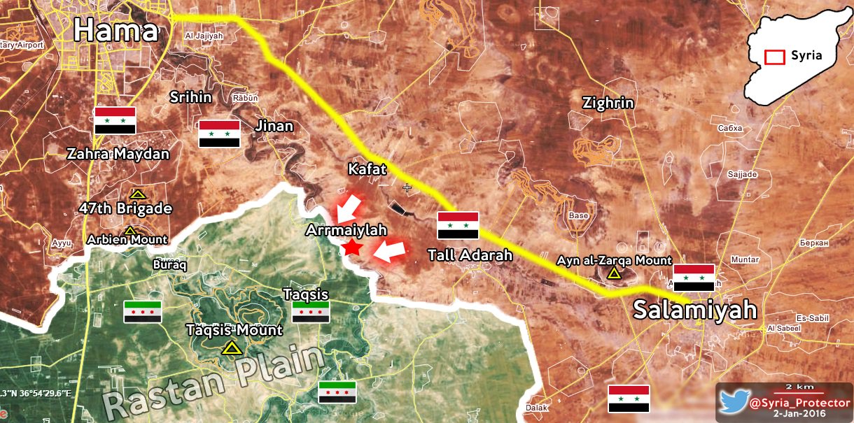
According to this Syrian army reporter, our map doesn't make any sense and rebels control various areas. He says that rebels control it since 2013 so i really have no idea how to find sources to back this up ? If I find any source saying "Gov. is shelling rebels on location x and y" I will source this section to justife the edit, since we usually don't change location just because Gov. shelled an area (as we know it might happen cuz of accident). DuckZz (talk) 14:58, 2 January 2016 (UTC)
- But all opposition maps show that this area under SAA long time.herehereherehere plus new map from reliable source showed that this area SAA-held.herehere Also According to the rule of editing #2:
Copying from maps is strictly prohibited. Maps from mainstream media are approximate and therefore unreliable for any edit. Maps from amateur sources are below the standards of Wikipedia for any edit. They violate WP:RS and WP:CIRCULAR.
WP:RS: “Anyone can create a personal web page or publish their own book, and also claim to be an expert in a certain field. For that reason, self-published media, such as books, patents, newsletters, personal websites, open wikis, personal or group blogs, Internet forum postings, and tweets, are largely not acceptable as sources.” Source: Wikipedia:Verifiability#Self-published_sources
WP:CIRCULAR: “Do not use websites that mirror Wikipedia content or publications that rely on material from Wikipedia as sources.” So DuckZz we can't use any maps as a reliable source. Sûriyeya (talk) 15:44, 2 January 2016 (UTC)
- We do not need to be lectured on wikipedia rules every time there is a discussion. Evidently the presence of rebels in SE Hama was underestimated. Maybe it is still underestimated, but I cannot tell which red location should go green. Apparently all maps were wrong, even if I remember one with a large green salient in this area. Now we have just to watch and monitor the situation. Paolowalter (talk) 16:54, 2 January 2016 (UTC)
- SOHR said that Army shelled Rastan from Engineering Batallion north of city but map showe this area under control of rebels. So that let's follow the rules of editing. Sûriyeya (talk) 15:48, 2 January 2016 (UTC)
- SOHR also said early that the Islamic battalions targeted with mortars regime bastions in al-Rastan city, reports of losses in regime forces.here As said opp. source SAA still present in Al Bassell(Rastan) National Hospital and rebels sometimes shelled this Hospital.here But on this map some guy which made this map said that this area rebels-held since 2013. So that on this map too many very serious mistakes. And according to the rules of edit "Copying from maps is strictly prohibited" Sûriyeya (talk) 16:33, 2 January 2016 (UTC)
- Also SOHR confirmed that the villag of Taqsis SAA-held.here but on map this town the rebels-held since 2013. So DuckZz as I said this map is a unreliable and can't be use in any cases. I agree that on our map there are some mistakes but we should not create new ones on based data from the map which contains a lot of mistakes. Sûriyeya (talk) 16:59, 2 January 2016 (UTC)
- I just have to say that sometimes using maps is the best solution to make this template 100% correct but not always,There were 2 map 1 from pro-gov and 1 from pro-opp who showed the same situation on the southren Hama and showed all this places as rebel held until now that are being captured by SAA but to many heavily biased editor alwayas were hard-headed and insisted to show the correct situation.Lists129 (talk) 18:08, 2 January 2016 (UTC)
- Lists129 Not should be no exceptions of the rules. According to the rule of editing #2:
Copying from maps is strictly prohibited. Maps from mainstream media are approximate and therefore unreliable for any edit. Maps from amateur sources are below the standards of Wikipedia for any edit. They violate WP:RS and WP:CIRCULAR.
WP:RS: “Anyone can create a personal web page or publish their own book, and also claim to be an expert in a certain field. For that reason, self-published media, such as books, patents, newsletters, personal websites, open wikis, personal or group blogs, Internet forum postings, and tweets, are largely not acceptable as sources.” Source: Wikipedia:Verifiability#Self-published_sources
WP:CIRCULAR: “Do not use websites that mirror Wikipedia content or publications that rely on material from Wikipedia as sources.” So that all maps it is not the reliable sources, and use of any maps as a source for editing "strictly prohibited". Guys we dont need spoil our map on the basis of data from unreliable amateur maps. So that all edits on based data from maps will be reverted. Sûriyeya (talk) 18:00, 2 January 2016 (UTC)
I was reading about Taqsis a week ago, it was "contested" for months with nusra/fsa infiltrating at night and SAA regaining it in the day. That's why different sources put it green/red. There was reports from pro SAA today that it is stormed right now so... They can flank now from the north.Totholio (talk) 22:18, 6 January 2016 (UTC)
Mahajah
From BosnjoBoy there is a suggestion that Mahajah is under truce. That has been a long standing question, any suggestion it might be true?Paolowalter (talk) 22:40, 4 January 2016 (UTC)
- I also not see clear data that this town rebels-held or that clashes inside him. Probably they was put to rebels-held on based the erroneous data. Sûriyeya (talk) 09:23, 5 January 2016 (UTC)
I really have no idea what does "truce" even mean ? If a village/town is not contested, it doesn't mean its under a truce, but only that there are no clashes inside or outside. By your logic, we can remove every green/red dot from the map and replace it with purple, because in those areas there haven't been any clashes reported for lets say 7 months. A truce means when there's really a signed truce on papper where both sides clearly say that, like in Al-Waer or districts in Damascus. Mahajah is not contested obviously because rebels can cut the main supply road, and not because there's a truce. DuckZz (talk) 18:09, 5 January 2016 (UTC)
- Sûriyeya Mahajjah is under rebel control - I don't know whether or not rebels fully control it. DuckZz I disagree as there can be formal and informal 'truces' such as the informal truce between the PYD and regime in Hasakah and formal truce between Rebels and regime in Zabadani-Fuah. If a location is under contested control however there is an absence of clashes I think it is appropriate to label it as under a truce.Prohibited Area (talk) 16:53, 6 January 2016 (UTC)
- Prohibited Area Here source said that the Mahajah in Daraa province is under a truce.here Also earlier this source was used as a reliable in another discussion.Talk:Cities and towns during the Syrian Civil War/Archive 52 this source was one of sources on based which town was marked as rebels-held. And for now we not have the data which can provide that the town is rebels-held. Sûriyeya (talk) 17:09, 6 January 2016 (UTC)
Tell Abyad
Some sources earlier reported about conflict between YPG and of Raqqa revolution brigade.here And that the Raqqa Revolutionaries' brigades HQ in the TalAbyad is totally surrounded by YPG.here And the later I also saw the report from opp. source that the YPG gave to the members from the Raqqa revolution brigade 48 hours that be leave city or they all will be arested the YPG. Guys maybe you have more data about the situation in this city. Because opp. source said that the Kurdish forces arrested the some people in the town of Tal Abyad without any of reasons.here and Kurdish source said that the Turkish air force units targeted Syrian-Kurdish sites in this area near the Syrian-Turkish border crossing in northern Syria.here Sûriyeya (talk) 13:02, 5 January 2016 (UTC)
- But according to the opp. sources for now only Kurdish forces controlled the town Tall Abyad.hereherehere Sûriyeya (talk) 13:23, 5 January 2016 (UTC)
- Either way how doeas that affect our map ? Helmy1453 (talk) 16:23, 5 January 2016 (UTC)
It doesn't, because we have "new rules". Fix it by getting back the joint control icon, problems fixed. If not, i will have to change a lot of areas in north Raqqa according to our rules. DuckZz (talk) 18:44, 5 January 2016 (UTC)
mixed control won't be accurate,Liwa Thuwar Al-Raqqa and their affiliated Clan army are independent and are senior,unlike the others who are junior partners,i think marking liwa Thuwar Al-Raqqa areas green will make it good.Alhanuty (talk) 03:31, 6 January 2016 (UTC)
- firstly we can't use maps as a source rule#2 2- Copying from maps is strictly prohibited. and secondly rebels lost Ayn Issa,Brigade 93,Fatisah, Shar Karak & Shuweyhan,Abdo and Ayn Issa Grain Silos when ISIS launch counteroffensive sourcesourcesourcesourcesourcesource Later, the Kurdish forces regain this point from ISIS.source source Sûriyeya (talk) 07:45, 6 January 2016 (UTC)
And as we cant use all maps as a source: Rule#2 Copying from maps is strictly prohibited. Maps from mainstream media are approximate and therefore unreliable for any edit. Maps from amateur sources are below the standards of Wikipedia for any edit. They violate WP:RS and WP:CIRCULAR.
WP:RS: “Anyone can create a personal web page or publish their own book, and also claim to be an expert in a certain field. For that reason, self-published media, such as books, patents, newsletters, personal websites, open wikis, personal or group blogs, Internet forum postings, and tweets, are largely not acceptable as sources.” Source: Wikipedia:Verifiability#Self-published_sources
WP:CIRCULAR: “Do not use websites that mirror Wikipedia content or publications that rely on material from Wikipedia as sources.”
So we can marked as rebels-held only the villages of Zanbaq, Khirbat ar Ruzz, Damishliyah, Ali Bajliyah about which source saidherehere and plus rebels lost the Ayn Issa,Brigade 93,Fatisah, Shar Karak & Shuweyhan,Abdo and Ayn Issa Grain Silos but Kurdish forces retake from ISIS. Sûriyeya (talk) 07:59, 6 January 2016 (UTC)
- DuckZz I support your action when you put to the rebels-held villages of Zanbaq, Khirbat ar Ruzz, Damishliyah, Ali Bajliyah and Dughaniyah as source said(but not based the data from Map"the use of maps prohibited") herehere but as I said rebels lost Ayn Issa,Brigade 93,Fatisah, Shar Karak & Shuweyhan,Abdo and Ayn Issa Grain Silos when ISIS launch counteroffensive sourcesourcesourcesourcesourcesource Later, the Kurdish forces regain this point from ISIS.source source So that I ask you not break the rules and not use the maps as a source. Sûriyeya (talk) 09:29, 6 January 2016 (UTC)
- DuckZz But I dont understand why Bruskom again put these villages as the Kurds-held. Sûriyeya (talk) 09:31, 6 January 2016 (UTC)
Another source confirms Bosno maps and gives accurate discription of the rebel held zone http://www.shahbapress.com/news/2499/%D9%82%D9%8A%D8%A7%D8%AF%D9%8A_%D9%81%D9%8A_%D8%AC%D8%A8%D9%87%D8%A9_%D8%AB%D9%88%D8%A7%D8%B1_%D8%A7%D9%84%D8%B1%D9%82%D8%A9_%D9%82%D9%88%D8%A7%D8%AA_%D8%B3%D9%88%D8%B1%D9%8A%D8%A7_%D8%A7%D9%84%D8%AF%D9%8A%D9%85%D9%82%D8%B1%D8%A7%D8%B7%D9%8A%D8%A9_%D9%85%D9%8A%D9%84%D9%8A%D8%B4%D9%8A%D8%A7%D8%AA_%D8%AA%D8%A7%D8%A8%D8%B9%D8%A9_%D9%84%D9%86%D8%B8%D8%A7%D9%85_%D8%A7%D9%84%D8%A7%D8%B3%D8%AF.html Alhanuty (talk) 12:42, 6 January 2016 (UTC)
- Alhanuty You are probably right but only about some villages (Zanbaq,Ali Bajliyah,Khirbat ar Ruzz,Marouda Tahtani,Dughaniyah,Damishliyah,Wasita) but rebels lost the Ayn Issa,Brigade 93,Fatisah, Shar Karak & Shuweyhan,Abdo and Ayn Issa Grain Silos sourcesourcesourcesourcesourcesource and Kurdish forces again retake them from ISIS.source source Sûriyeya (talk) 15:09, 6 January 2016 (UTC)
- Actually fighters in Khirbet al-Ruz and Hawija shifted alliance and joined SDF: http://hawarnews.com/%D8%A7%D9%86%D8%B4%D9%82%D8%A7%D9%82-100-%D8%B9%D9%86%D8%B5%D8%B1-%D9%85%D9%86-%D9%84%D9%88%D8%A7%D8%A1-%D8%AB%D9%88%D8%A7%D8%B1-%D8%A7%D9%84%D8%B1%D9%82%D8%A9-%D9%88%D8%A7%D9%86%D8%B6%D9%85%D8%A7/ Roboskiye (talk) 15:57, 6 January 2016 (UTC)
Alhanuty Sûriyeya Roboskiye DuckZz Helmy1453 Liwa al Raqqa has apparently disbanded after an alleged YPG blockade of the Arab-held territories in Tell Abyad (this may explain why the area collapsed so easily in last week's Ein Issa offensive). In any regard should we now change the remaining towns back to SDF? http://syriadirect.org/news/tribes%E2%80%99-army-disbands-in-north-amidst-accusations-of-ypg-blockade/ Prohibited Area (talk) 18:32, 6 January 2016 (UTC)
- Prohibited Area You are right becasue I also saw this report but in other source. Sûriyeya (talk) 19:03, 6 January 2016 (UTC)
Roboskiye Sûriyeya Prohibited Area
I didn't wanted to do this, but now you see why we should change back things as they were before. With this i mean the thing how we describe the SDF-rebel relations in Raqqa province. Instead of using the joint control icon, and describing whether a place is captured by both rebels and Kurds, or Kurds alone etc, we now have this problem, where we have rebels as being part of SDF and other groups going solo.
- This is how we should do it, some areas under joint, other under solo YPG control. Problem solved, no useless discussions. Now for your sources :
- *1 I don't use his (Bosnjo) map as a source, but the villages he mentioned, and as you can see he wanted to mention them all but the space was required, in this case we can copy the names from the map (which is actually an infograph)
- 2 This source only talks about clashes, nothing else.
- 3 This source indicated mthat Kurds control the 93.brigade, ok.
- 4 These sources1, source2, source3 are either pro-government, pro-Kurdish or only support my edit.
5* This source is only talking about Kurdish related things, and may support that Ayn Isa should go under joint control, as other sources said that FSA withdrew from the village, but before that saying they never where there, so it only means they dont want to talk about them, but only when something negative happens.
- Also, BosnjSinj reporter never said that Liwa Thuwar Raqqa controls these areas, but the Tribal army which is a tottaly different group and is not part of the SDF. Also, this same group said what villages they control in Raqqa province, but sadly their account always gets deleted from facebook.
- Is there actually a single opinion, or reasonable argument of why the hell shouldn't we change the old way od editing back ? That would solve all the problems, is a group part of the SDF, not important, captured by both rebels and Kurds, put it to joint control, are they part of the SDF, again not important. Problem solved hmmmm DuckZz (talk) 19:07, 6 January 2016 (UTC)
- DuckZz About Ayn Issa: here source said that the YPG/YPJ repelling ISIS(Daesh) attacks in Ayn Issa.ANHA(Hawar News)here Also pro-ppsition source clear said that the contrary to some the maps and tweets, Thuwar Raqqa or Jaysh al-Ashair(rebels) not control the villages or the ciy Ayn Issa. Only SDF (mainly YPG) control these villages.here Sûriyeya (talk) 19:50, 6 January 2016 (UTC)
Sûriyeya That wasn't my main question. If i agree with you, could you then agree with me about changing, or to say it better, bringing back the old way (in my opinion better) of editing the Raqqa province, where the SDF represents a coalition, and not a color itself. Read again what i wrote. DuckZz (talk) 20:18, 6 January 2016 (UTC)
- DuckZz I agree with you that the rebels also presents in Raqqa province and they are helped YPG regain some areas from ISIS. But I think that it is a bad solution put as under the joint control YPG and rebels the big towns which was retaken from ISIS such Ayn Issa, Tall Abyad, Suluk and some other. But I agree with you that some villages maybe under jointly control and some villages as said Bosno only under control the some of rebel gropups. Many source confirmed that these town only under control of YPG/YPJ. But we can or marked some villages as under jointly control or put some villages as this said Bosno as rebels-held. Sûriyeya (talk) 20:40, 6 January 2016 (UTC)
- If I understood DuckZz correctly, he means:
- SDF control = yellow
- Joint SDF+non-SDF = yellow-green
- Non-SDF = green.
- Roboskiye (talk) 20:45, 6 January 2016 (UTC)
Roboskiye No you did not understand me. SDF coalition is basically the same as former Burkan Firat, which means YPG/YPJ + Rebels (in Raqqa province). When a town/village was being captured, we marked it as according to which groups did it, worked fine, Soluk was captured by YPG, Tall Abyad by both rebels and Kurds, Sarrin by Kurds, Ayn Issa by both etc etc. Worked fine. This is how it should like look. I need some support, because basically editors either don't care or show small support to change this back. DuckZz (talk) 21:15, 6 January 2016 (UTC)
- SOHR said that the city of Tall Abyad controlled by YPG.here Sûriyeya (talk) 08:00, 7 January 2016 (UTC)
palmyra
SAA Captured Al Bayarat
https://en.wikipedia.org/wiki/Timeline_of_the_Syrian_Civil_War_(January%E2%80%93April_2016)
- For now village marked as under SAA and also source said that the ISIS retreated to Palmyra. Sûriyeya (talk) 14:51, 7 January 2016 (UTC)
SDF-Arab-Kurd control
First i want you to read the previous discussion above. What I want is to open again a discussion, and ask the editors of why we shouldn't change back the way of editing the Raqqa province. My suggestion is to change the province as it was in August (i mean locations at that time), with minor changes with sources from today. There are basically several reasons, but by doing that we would remove 3 problems at the same time. The SDF will not represent a color, but the actuall groups inside. If a village is captured by YPG, we marked it as yellow, if a village is captured by both YPG and Arab groups (Shams Shamal batalion, Liwa Raqqa, Jaish Ahsaer, Jabhat Thuwar etc etc) we mark it as joint control. Problem solved. It doesn't matter if they're both part of the SDF, it's just a coalition.
- I don't want to write 100 more sentences, just read my previous posts here. DuckZz (talk) 15:05, 7 January 2016 (UTC)
- The whole reason why we began grouping units as part of the SDF coalition rather than individual groups is because the green designation for mainstream rebels is too broad. In Afrin we had the YPG fighting rebels meanwhile in Kobane and Jazira we had the YPG fighting alongside rebels. Hence the joint yellow-rebel control meant different things in different areas of the map - this was illogical. Hence we changed the villages of green-yellow control to yellow as both groups followed the administration of Syrian Democratic Assembly, whereas joint-control elsewhere generally means each party practice their own forms of governance.Prohibited Area (talk) 17:06, 7 January 2016 (UTC)
- DuckZz Prohibited Area I agree that the some villages for now under control the some of rebel groups which help YPG. But as say many sources their number not too big and therefore we can't mark as under jointly control YPG and rebels most part of the villages in Raqqa province which was retaken from ISIS. Many villages and some towns in Raqqa province which retaken from ISIS was taken SDF. But the SDF( ~40,000) it is a group where dominated by the YPG(30,000 fighters) and also smaller local Arab and Assyrian militias in northern Syria.source So that on based these data I propose again put the as rebels-held the villages(Zanbaq, Ali Bajliyah, Marouda Tahtani, Dughaniyah, Damishliyah, Wasita) and maybe some other in this area on based data from BosnoSinj.hereand here Plus as said this source FSA affiliate "Tribes’ Army (2,000 units) disbands in north amidst accusations of YPG blockade"here But I still trust that we can't leave all villages in Raqqa province as only under control of SDF(in the yellow color) some of them need put as the rebels-held. Sûriyeya (talk) 18:57, 7 January 2016 (UTC)
Sûriyeya Prohibited Area No you actually don't understand how this map works, it's like you started editing this map since last year ? We don't mark villages/towns as what will or is happening after they're being captured, because that would go too far and we would have to change the entire map once in a while based on who is currently present there (we actually do that for some areas), not just Raqqa but coming all the way from Idlib to Daraa. We mark areas as which group captured it like we did here. 60% of the villages in Raqqa province are empty, by your logic we need to remove them since nobody controls them since nobody has presence inside them, which is impossible and you need 120 000 active soldiers for that.
- You arguments are actually not arguments but POV opinions. We can also say "Well, some rebels have a truce with the gov. so lets remove their rebel presence because they're now again under civil rule" Makes sense, but not for this map. Rebels with the same flag clash with Kurds in Aleppo but not in Raqqa ? Erm.. so what, it's like you said "Rebels clash with Nusra in Idlib, but not in Damascus or Daraa province, let's mark them all under grey color". Rebels are rebels, it's not like they have 1 group and the same group is present in 2 provinces, with 2 different opinions, if that would be the case then yes we need to make a difference between them, but the groups in Raqqa will never be present in Aleppo, but both are claiming to be rebels and part of the armed opposition, which our map has a defition for. Changing that logic is actually violating the rules which you clearly don't understand. This is not your map and you have to understand that 80% of the people who look at this map think "Raqqa province is empty of rebels". Give me a good reason why I shouldn't remove the grey color from the map ? Al Nusra is part of the Jaish Fatah coalition, which consists of 70% of rebels, which means whatever Nusra captures, or only part of, i can mark it as under rebel control. Same logic.
- You have time till tomorrow to decide :
- 1 Keep the new current rule, but then implement it on the entire map and not just what u like, change the entire Idlib province to green.
- 2 Follow the rules of the map as it is, change Raqqa province as according to this map (with minor changes). DuckZz (talk) 21:57, 7 January 2016 (UTC)
- DuckZz, you are just a little bit too much focused on one belligerent. There are three other belligerents: ISIS, SAA, Islamists, all with different fractions, especially islamists and SAA, but we do not see you asking for making them green. Why not changing Ansari ISIS to green? or why not changing loyalist militas to green? Why just changing ethnic Arabs of SDF to green? The ones who are regarded by actual greens as traitors and agents of Assad? Why all this double standards?
- As with Idlib, I personally have come to the conclusion that it should be one color, as they represent only one belligerent. Either whole of Idlib green or grey. Roboskiye (talk) 22:26, 7 January 2016 (UTC)
Nothing what you say has to do with my text above. You post opinions, I post rules and arguments. I don't care what they are, what they think, I only care how to make this map understandable to normal people. And of course i won't change Idlib province, but I'm only being sarcastic because doing that would breake the rules, and using the double standard would make me only change that and nothing else, what is actually being donne for Raqqa province. So... yes, it's up to other editors to decide.
- I would also ask other editors to post on my talkpage because I think this section should be only for final desicions from other editors. DuckZz (talk) 23:04, 7 January 2016 (UTC)
- DuckZz Ok I agree with you that we need mark the villages in Raqqa province as you asked and as you said was earlier. But only with a small corrction Ayn Isaa under control YPG/YPJANHA(Hawar News)herehere and plus SOHR said that Tall Abyad under control by YPG.here And all new villages that had been captured recently also must be marked on yellow color because for now we know that the FSA affiliate "Tribes’ Army (2,000 units) disbands and sources said that the SDF captured all new villages. If you agree then we can fix the map and close the subject. Sûriyeya (talk) 07:58, 8 January 2016 (UTC)
- I would also ask other editors to post on my talkpage because I think this section should be only for final desicions from other editors. DuckZz (talk) 23:04, 7 January 2016 (UTC)
- Liwa Thuwwar al-Raqqa Raqqa Revolutionaries' Brigade (Al-Raqqah rebels){~ 1000 fighters} announced that they are joined to the SDF, after the tensions and information about the siege by SDF in the countryside of Al-Raqqah province, they said in the statement: “We in the Front Thowwar Al-Raqqah announce that we are part of the SDF, in order to fight the terrorism and extremism of ISIS and Al-Nusra Front.SOHR Sûriyeya (talk) 09:27, 8 January 2016 (UTC)
- Tribal army disbanded and Revolutionary Brigade joined SDF (i.e. Yellow). Period. Roboskiye (talk) 16:08, 8 January 2016 (UTC)
Sûriyeya Roboskiye My edits in Idlib province have been reverted because they breake the rules of editing. This means that north Raqqa province also breakes the rules, as we agreed that if you dont want double standard then a rule needs to me implemented on the entire map and not just POV areas. My edits south of Tell Abyad have been also reverted, 7 villages, with no source provided. I will change the Raqqa province as according to our map from August, where we have indicated which areas have been captured by both Kurdish and Arab forces. If you don't want this to happen, then implement the rules on the map, i will not do it because i dont want to revert someone elses reverts. DuckZz (talk) 20:37, 10 January 2016 (UTC)
- DuckZz I again put 7 villages as FSA-held according to the data from Bosnpoj and talk page. Sûriyeya (talk) 08:37, 11 January 2016 (UTC)
- FSA and their fanboys searching new adventures in Tell Abyad. FSA fanboys are angry and unhappy with northern Syria after 4 years of failed offensives and lost territories :) Bruskom talk to me 10:44, 11 January 2016 (UTC)
- Sûriyeya That map has been outdated by the disbandment of the Tribes' Army and Liwa al Raqqa joining SDF.Prohibited Area (talk) 17:35, 11 January 2016 (UTC)
- Prohibited Area If be honest for now I confused. Firstly we can't use any maps but we used data from Bosnoj (except map) But maybe we can leave these villages as under the jointly control. Although I've also seen report about disbandment of the Tribes' Army and Liwa al Raqqa joining SDF. So I'm confused. Perhaps you're right because I also saw another report which says that the former members of the Tribes' Army and Liwa al Raqqa joined the SDF. Liwa Thuwwar al-Raqqa Raqqa Revolutionaries' Brigade (Al-Raqqah rebels)announced that they are joined to the SDF, they said in the statement: “We in the Front Thowwar Al-Raqqah announce that we are part of the SDF, in order to fight the terrorism and extremism of ISIS and Al-Nusra Front.SOHR Sûriyeya (talk) 18:03, 11 January 2016 (UTC)
- SûriyeyaWell I would assume the villages should be changed back to yellow as we have no reliable source to show that they are under rebel control. The source which did show as such is now irrelevant, and the rebels joined SDF and hence we should change it to the respective colour, which is yellow, unless we can find sources which indicate otherwise.Prohibited Area (talk) 19:12, 11 January 2016 (UTC)
- Prohibited Area I still want hear the opinion of the DuckZz so how can he be able to provide other data confirming its point of view. Sûriyeya (talk) 19:31, 11 January 2016 (UTC)
- Prohibited Area But if we are dont get a new data which can provide that the after disbandment the Tribes' Army and after the Liwa al Raqqa joined to the SDF some the villages in Raqqa provicne still under control of the FSA-affiliated groups. We put these villages as under control of SDF. Sûriyeya (talk) 19:43, 11 January 2016 (UTC)
I am opposed to the changes.
The only forces who hold territory besides IS in Raqqah province is the SDF. The SDF should be marked in yellow, not green/yellow joint control, or some parts yellow and some parts green. This is because the SDF are a united military force, conducting operations and controlling territory together. Joint control should and must be reserved for situations where the non-SDF rebels share power with the SDF.
We mark the rebels in green because, although they fight one another, they are also (largely) united in their aim (to overthrow Assad). Although it would make things complicated, we could mark them under different branches like 'Islamic Front' and 'Free Syrian Army' to be more precise about these things, but these factions have largely coalesced into a single insurgent force. We mark IS in black because although it shares their locals aims, it has bigger goals, and is part of a global jihadist network. The same goes for al Nusra. The SDF only want to liberate parts of Syria to bring them under the control of the Syrian Democratic Assembly. All parties in the SDF work for the Syrian Democratic Assembly, and hence they are all marked in the same colour. The colour we mark them in should not be about ethnicity or militias: it should about military alliances, goals and global implications (such as whether they intend to gain territory outside of Syria or use it as an area from which to launch global terrorist attacks). PutItOnAMap (talk) 19:45, 11 January 2016 (UTC)
- The Twitter user called as bosnosinj just says that villages controlled by rebels. There is no news about this topic on Kurdish sources and international sources. I going to change back to yellow. Bruskom talk to me 20:58, 11 January 2016 (UTC)
Why would we base that on one twitter user? Are they a reliable source, and are they pro rebel or anti Kurd? Moreover, how would the rebels even gain control over that area? They have no access to those villages; they'd have to get through sdf and IS territory first to get there. Unless Liwa defected again, which we'd have heard about, then that would not happen.
- 1 The reporter "BosnjoSinj" is used for several years on this map for every party (Rebels/Gov etc. even ISIS), you maybe don't edit the map that long so you don't know, we had enough discussions about him and other users.
- 2 Liwa Thuwar Raqqa did join the SDF, but the area south of Tell Abyad (the user mentioned) is controled by "Jaish Ashaer" group, which isn't part of Thuwar Raqqa anymore (disolved by Thuwar Raqqa statement), one of the reasons is because Thuwar Raqqa joined the SDF, which means Jaish Ashaer is working alone and are still there of course. This is the facebook page of Jaish Ashaer and unfortunately, this is like the 3rd page and the previous one got deleted but i remember their statements there, where they mentioned their control, and its basically the same as BosnjoSinj reported.
- 3 I did not wanted to make these edits, why ? Very simple, it's against the rules. Now you think, well why ? Again, leaving the area as it is now is also agains the rules, basically leaving these edits, or removing them is both against the rules. Why ?
- The new "SDF" rule is explained last year, and it was explained very badly and i have read it, according to them, the rule needs to be implemented in Idlib province on various villages and towns. Why ? Because those towns are captured by Jaish Fatah, but they're marked as "grey", even thought Nusra makes only 20% of the coalition or fighting force itself, basically the same as Rebels in Raqqa province.
- Now if you want to leave the SDF color in Raqqa, you also need to implement the rule on other provinces, and i don't care for POV views like "Well Kurds are not islamists like rebels are here and there, unlike in Raqqa blablabla" whatever you say contradicts with our map and makes it a useless twitter discussion piece.
- We also broke another rule, here's why. Remember the "Burkan Firat" coalition from last year ? That's basically the same as todays SDF, same principle and ideology, where Kurds again made 70% of the fighting force. The only difference is the amount of groups, where SDF has like 20, but the percentenge is the same. Now I ask you, why did we edit the Raqqa province for 6 months, according to rules, and the finnal version was like this. And now you tell me, "Ok, now the SDF is created, it's the same as Burkan Firat but with a bunch of other groups from Hasaka too, we now change a rule but breake 2 others instead.".
- I know why you did this, and it did make sense at the start, because the main problem was Hasaka province, where YPG with 400 soldiers captured a village, and rebels had like 10 members, we marked the village as under joint control which was stupid because those rebels aren't even from Hasaka and they will return to Raqqa. I do agree, Hasaka is a good option, but Raqqa isn't, and the map from August shows that.
- 4 Again, if you hate and don't want discussions, I will change the province as according to our map from August, of course we need to change some areas but that will be donne in 1-2 days, that's only if you want rules, and don't worry, I will read every source.
- 5 And For those asking "I maybe agree but how much rebels are there actually in Raqqa ?", it's pretty simple, more than double since Burkan Firat, and if we didn't had problems then, why should we know ? Liwa Thuwar Raqqa had enough statements where they said that they have >3 000 soldiers, and every week some finnish their new training. Jaish Ashar stated >2 000 for them. Jaish thuwar stated 1 000 for them, Kataib Shams Shamal 300-500 since Kobane, and there's also Furat Jarabulus etc.
- For other questions please write on my wall (talkpage) as this spot is to cluttered. The discussion can be transfered to there. DuckZz (talk) 21:06, 11 January 2016 (UTC)
- We have simply a POV-pusher with a funny agenda who repeats himself again and again Roboskiye (talk) 21:14, 11 January 2016 (UTC)
1. Burkan Firat was an operations room (like the Mare' operations room), not a Syria-wide coalition. All groups in the SDF are allied throughout Syria. Jaish al-Thuwar, for instance, is allied to the SDF in Aleppo, Idlib and Raqqa, as well as any other provinces they might expand into. Whereas Burkan Firat only applied in a specific area to defend against IS. Moreover, Burkan Firat contained groups with different 'endgame' aims: the SDF is united under the political organisation called the 'Syrian Democratic Assembly', which decides what its objectives will be.
2. Fair enough about BosnjoSinj. I do find it odd that no-one else is reporting on Jaish Ashaer's control of these villages, though. In fact, [1] this source says that Jaish Ashaer was the Tribes' Army, not a component of it. Therefore, according to this source, it must have disbanded.
3. If rules were broken in the past, or old rules applied then that do not apply now, it is now wrong for us to contradict out of date rules.
4. Liwa was estimated at 800+ troops by US resources, but however many troops they have is irrelevant to this map. They are SDF, anyway.
5. We don't need to revert the map to August. Just keep SDF yellow and everything will be fine.
6. I do not support marking joint-held Jabhat al-Nusra areas grey because they are salafist. The reason they should be grey is because they have international ambitions. The way I understood it, we grouped the armed forces like colours into distinct sects:
(1) The SAA and allies, which wants to reimpose Assad's control over Syria. (2) The SDF, which is hostile to the regime and jihadists, but focuses on controlling and running areas of Syria that the Syrian Democratic Assembly wants to take responsibility for. (3) IS, which wants to establish a global caliphate, and is just using Syria as a (particularly important) base of operations now. (4) Al Nusra, which wants the same thing as IS, but it part of the Al Qaeda network. It has a different colour to the likes of Ahrar ash-Sham because it wants to go international (hence its attack on Arsal), while the other Islamists are focused, along with the rest of the rebels, on fighting only in Syria to topple the regime, for now. (5) The rebels, focused on toppling the Assad regime.
PutItOnAMap (talk) 21:42, 11 January 2016 (UTC)
Syrian Army advance in Latakkia
Pro-government source SANA said that the SAA advance and captured the al-Daghdaghan farm and Rweiset Abu Ghannam, Rweiset al-Sheikh Salman, village al-Sarraf, Jabal al-Hara, Bait Fares Mount and a number of strategic hills in the northern countryside of Lattakia.here And SOHR also said that the SAA and Hezbollah advance and take control of the Ruwayssat Abu Ghannam and the al-Daghdaghan, several hills and the new points in Jabal Turkmen(Turkmen Mountains)SOHR Sûriyeya (talk) 16:22, 7 January 2016 (UTC)
- Also reliable source said that SAA imposed full control over the Ruweisat Abu Ghannam, Ruweisat Al-Sheikh Salman, Jabal Al-Hurrah, Jabal Beit Fares, and Al-Saraf and also points 465, 292, 387, 344, 489, and 296 in Jabal Turkmen(Turkmen Mountains) in the northern countryside of Lattakia.here Sûriyeya (talk) 16:57, 7 January 2016 (UTC)
Najjarah contested
This edit request has been answered. Set the |answered= or |ans= parameter to no to reactivate your request. |
Najjarah is Aleppo is contested according to SOHR, not SAA-held. [4] PutItOnAMap (talk) 08:28, 8 January 2016 (UTC)
- After the several attemps the ISIS to retake Najjara SAA take over village Najjara and they also seize the Najarah-Ayishah axis.source Sûriyeya (talk) 09:33, 8 January 2016 (UTC)
- Also in the report on Arabic SOHR said that the clashes was around the village of Najjara not inside.here Sûriyeya (talk) 09:40, 8 January 2016 (UTC)
- SOHR later also said that the clashes continued between ISIS against SAA and allies near the SAA-held village of Najjara in the eastern countryside of Aleppo.here Sûriyeya (talk) 18:22, 8 January 2016 (UTC)
- Also in the report on Arabic SOHR said that the clashes was around the village of Najjara not inside.here Sûriyeya (talk) 09:40, 8 January 2016 (UTC)
 Not done: According to the page's protection level you should be able to edit the page yourself. If you seem to be unable to, please reopen the request with further details. Mz7 (talk) 20:23, 8 January 2016 (UTC)
- PutItOnAMap Relaible source said that the village of Najjarah under control of SAA.here And SOHR said that Najjarah SAA-held.here And SOHR earlier only said that the clashes was near the village of Najjarah.here So before edit map you need was be read the sources and commens on the talk page. Sûriyeya (talk) 19:43, 9 January 2016 (UTC)
ISIS presence on Lebanon/Syria border
Is there still a ISIS presence in this area? Haven't heard anything in a while.
No there is not, was cleared by Hezbollah months ago but it is just kept here to please the ISIS supporters who edit this map, which is many.
- If you can provide a reliable source which can confirm IS is no longer present/operates in Qalamoun then please provide it and we will make the appropriate edit. In addition can you sign your future posts.Prohibited Area (talk) 13:27, 9 January 2016 (UTC)
- I have seen at least two times references to clashes between SAA/Hezbollah and IS in the Qara area in Qalamoun. Actually the reason of IS attack in Mahin was to connect to this area and cut Syria in two parts. For example this map reports IS presence at the border https://twitter.com/EdmapsCom/status/679881618182529024 and pro-gov https://www.facebook.com/syria24english/posts/954742034561579 and https://twitter.com/FedFirmian/status/661936001053536257. But there is little fighting so reports are rare.Paolowalter (talk) 17:55, 9 January 2016 (UTC)
To reinforce what Paolowalter said, there is still fighting Qalamoun. [5] SAA probably haven't put as much effort into clearing it yet because they have other more strategic areas to focus on. PutItOnAMap (talk) 19:09, 9 January 2016 (UTC)
- ISIS still presence in mountain area near the town Qara. So that on map still located the icon which showed that ISIS still present in this area. Sûriyeya (talk) 19:52, 9 January 2016 (UTC)
If they have positions actually in the town according to the source I linked above, shouldn't we at least mark Qara as contested? PutItOnAMap (talk) 21:46, 9 January 2016 (UTC)
- PutItOnAMap Some times report from SOHR with some mistakes. SOHR wanted to said SAF strike ISIS in area of the town Qara as he said many times before. Also SOHR said in Qara but this also can be Qara countryside or Qara mountair. So no one confirmation that the ISIS onside this town. As this was when you probide report from SOHR wher was said that clshes in Najjarah bit in report on Arabic SOHR said that clashes near this village. Sûriyeya (talk) 22:53, 9 January 2016 (UTC)
- PutItOnAMap the regime forces targeted positions for the “Islamic State” So as I said earlier SOHR some times made mistakes in the translated reports. In this report on Arabic was said that the regime forces targeted positions of the “Islamic State” in Jarrod Qalamoun area (Qalamoun mountains)here not inside the town Qara. So I was right ISIS located only mountain area in Qalamoun. Sûriyeya (talk) 23:06, 9 January 2016 (UTC)
Some IS's underestimations?
I know there is a rule against the use of other maps to edit this, but maybe sometimes they pose questions that deserve at least to be discussed...specifically, this https://twitter.com/CizireCanton/status/684841781335330817 6th January map by Kurdish source Cizire Canton shows IS still has a presence SE Tishrin Dam near the border with Raqqa province, and here we have to the opposite all coloured in yellow( also in the Raqqa province territory in continuity with that, heading to Issa, we have some yellow dots that according to Kurdish source should be black); then, Deir ez-Zor city: does this al-Masdar map show IS in control on all of Saqr Island and al Jafra? We show them under SAA... https://twitter.com/TheArabSource/status/684961574541344768 ...but I have to say I am not sure how to read the map; Palmyra countryside: we show SAA at the gates of the city, but SOHR and al-Masdar talk about clashes in al-Dawwa and al-Bayarat( the latter only in these days captured by Syrian Army according to Masdar, here is red by a month or more), that are near Tadmur but not at its entrances...Fab8405 (talk) 15:13, 9 January 2016 (UTC)
- SAA retake Al Bayarat and ISIS retrated to the city of Palmyra.source And no clashes in al-Dawwa area. And as said the opp. source the clashes only in the outskirt of Al Dawa areahere Sometimes ISIS trying attack the army checkpoints from north. Sûriyeya (talk) 17:15, 9 January 2016 (UTC)
- We not use the maps as a source. Rules of edit: Copying from maps is strictly prohibited. Maps from mainstream media are approximate and therefore unreliable for any edit. Maps from amateur sources are below the standards of Wikipedia for any edit. They violate WP:RS and WP:CIRCULAR.
WP:RS: “Anyone can create a personal web page or publish their own book, and also claim to be an expert in a certain field. For that reason, self-published media, such as books, patents, newsletters, personal websites, open wikis, personal or group blogs, Internet forum postings, and tweets, are largely not acceptable as sources.” Source: Wikipedia:Verifiability#Self-published_sources
WP:CIRCULAR: “Do not use websites that mirror Wikipedia content or publications that rely on material from Wikipedia as sources.” here Sûriyeya (talk) 17:36, 9 January 2016 (UTC)
According to Al Masdar news SAA have taken Kadin and hills north of it and are bombarding Salma .86.135.155.225 (talk) 12:17, 10 January 2016 (UTC)
Damascus detailed map
Damascus detailed map is not updated and lags behind the most recent news. See Talk. Either the editor able to change it takes some action or we must do about it like we did for Aleppo map.Paolowalter (talk) 10:15, 10 January 2016 (UTC)
The editor knew that there were massive changes to be made and left the map like it has been for nearly a year even though it has been edited Eastern Ghouta is 60% smaller of what is currently shown in terrorists control. Darryya is also waay smaller pocket now tiny. Jober is in SAA control and is now totally seperate from east ghouta.
The City maps are not updated for weeks and should be replaced with something better .86.135.155.225 (talk) 18:46, 10 January 2016 (UTC)
The battle lines in Deir Ezzor have also shifted somewhat and that city map needs to be updated, too. Several distracts including Sina'a (if that's a correct spelling; I know there are several) and Jafra are now under IS control. Also, Aleppo is changing all the time. The problem we have there is that when we removed Kweires from the map, we didn't reapply the old map with the roads and textures in the background that is there in the rest of the map, so there is just a blank space in the Kweires area, which we should fix. The regime only controls 20% of Qamishli, but it looks like more than that on our map. The Hasakah map should have the blue bit removed from it, and both the YPG and the Syriac Military Council are both part of the SDF now and should be marked in its colour rather than the colours of their individual militias. I also read complaints earlier on this page that the Daraa map appears to exaggerate the rebel presence, though I am not sure of whether or not this is true. PutItOnAMap (talk) 22:21, 10 January 2016 (UTC)
- PutItOnAMap If you see on a map the village of Jafra marked as the ISIS held. on the map most part of the city Qamishli marked as YPG-held the some part of SAA-held and in blue color we marked the part of the city which is under jointly control between SAA and YPG. Sûriyeya (talk) 09:38, 11 January 2016 (UTC)
Qamishli map is basically irrelevant, the various sides are controling jointly the town. Paolowalter (talk) 18:24, 11 January 2016 (UTC)
- Also anti-SAA source said that the clashes took place in the town of Jafrah in the surroundings of Deir Ezzor Military Airport.source Sûriyeya (talk) 11:29, 11 January 2016 (UTC)
- Sûriyeya this source is an Anti-Isis source to,it's a pro-rebel source we need reliable sources.Lists129 (talk) 13:12, 11 January 2016 (UTC)
- It is anti ISIS and anti SAA, so it is fine according to the rules to change the map following it. In any case Jafrah was turned black based on vague statements that was attacking from the town, nobody stated that they took full control of the town. So, it goes contestedPaolowalter (talk) 18:24, 11 January 2016 (UTC)
- Lists129 Both of these a sources clear anti-SAA sources which sometimes publish data about which claim ISIS but which not was confirmed the reliable sources including SOHR. For now these sources said that the clashes took place in the town of Jafrah in the surroundings of Deir Ezzor Military Airport.sourcesource Sûriyeya (talk) 18:38, 11 January 2016 (UTC)
- Lists129 I addition SOHR also reported about clashes between SAA and ISIS in the surroundings of Deir Ezzor Military Airport.here Sûriyeya (talk) 19:51, 11 January 2016 (UTC)
"The problem we have there is that when we removed Kweires from the map, we didn't reapply the old map with the roads and textures in the background that is there in the rest of the map, so there is just a blank space in the Kweires area, which we should fix." Can somebody fix that ? Because it's really ugly now when you look at the map. 85.218.59.241 (talk) 21:01, 11 January 2016 (UTC)
Editor (e.g. Sûriyeya) is adding dots on detailed maps that is not what we are supposed to do. Either we get them updated, or we remove them. We cannot have the same location marked with two different colors on detailed and general maps.Paolowalter (talk) 22:28, 11 January 2016 (UTC)
The Damascus map needs to be cropped a little from its west so it doesn't include Khan Al Sheikh green area on its southwest, or Wadi Barada on the northwest corner. These parts are far enough from damascus that they are behind mountains and army bases surrounding the city, the two areas can be replaced with a few dots on the main map. Especially khan al Sheikh area where red dots of the main map appear on top of the green area of the detailed map! This really needs fixing.
I think that only Damas and Aleppo are useful. Others can be deleted. Plus Damas detailed map should be smaller. 85.218.59.241 (talk) 15:33, 12 January 2016 (UTC)
Yes Agree with above regarding the Damascus map to be made smaller, I'm sure editors see that is a good idea, I hope it gets edited soon. Dair Al-Zor and Dara'a detailed maps should still be useful.
Orontes river near the al-Rastan district
Hey, respectful editors, I'm a simple spectator to this Syrian war map, created and updated by all of you, I want to thank you for your really huge work.
My notice is when I looked at the wikimapia map of al-Rastan district, I have found one natural discordance between satellite map and this interactive map you keep: it concerns the flow of Orontes river around the towns of al-Rastan and Talbiseh. In your map, Orontes river surrounds these 2 cities from the east and south, while on satellite map that's not true: al-Rastan is located on the southern banks of some reservoir (it seems that its name is al-Rastan reservoir http://wikimapia.org/#lang=ru&lat=34.902827&lon=36.732101&z=11&m=b&show=/8607402/al-Rastan-Lake), and then Orontes river flows from it to the south, outflanking al-Rastan from the WEST. Moreover, it is a major division, as Orontes divides here two plains - al-Rastan plain and al-Houla plain (then flowing to the south, down to Homs city), and in military reasons, helps rebels to defend this area, as the SAA faces some difficulties with forced crossing of Orontes here (from the northern direction where is Hama and from the western direction where is Kafr Nan).
So, as this feature is a significant point of military situation in this area, I suggest you to check the flow of Orontes, maybe you will find some power and wish to change it to more authentic shape. ^_^
Thank you very much, please don't rage at me, I really appreciate your work, and this is just a little try to help you.
I see what you mean, the river is big in this area and it is a reason why militaries move slow here. However, the Orontes river ('AAsi' in arabic) flows south to north.
It's again me (the author of this tread) ^_^ About direction of Orontes flow - that's my mistake, I thought it flows from the north. But my point was that this river surrounds al-Rastan and Talbiseh from the opposite side (from the west and north, not from the east). Map inaccurately shows the course of river in this area. That what I meant.
Facebook and twitter
A lot of recent modifications were done relying on private, unknown or biased facebook or twitter sources that cannot be accepted. I strongly invite to self-revert. I have already reported to the page manager to take some action.Paolowalter (talk) 22:28, 11 January 2016 (UTC)
![]() Comment: I remember every editor here that use of social media (Twitter, Facebook, Reddit, YouTube, etc...) as a reliable source is strictly FORBIDDEN by Wikipedia rules. It can be only accepted if the source origin is a worldwide-recognized expert on the issue, and only if its agreed by consensus by the rest of editors. Some users seems to not know that or worse, to know but ignore it, so I've started some weeks ago to delete every content based on social media on any page related to the Syrian civil war. So you're warned. Regards,--HCPUNXKID 23:53, 12 January 2016 (UTC)
Comment: I remember every editor here that use of social media (Twitter, Facebook, Reddit, YouTube, etc...) as a reliable source is strictly FORBIDDEN by Wikipedia rules. It can be only accepted if the source origin is a worldwide-recognized expert on the issue, and only if its agreed by consensus by the rest of editors. Some users seems to not know that or worse, to know but ignore it, so I've started some weeks ago to delete every content based on social media on any page related to the Syrian civil war. So you're warned. Regards,--HCPUNXKID 23:53, 12 January 2016 (UTC)
Remove all city detail maps!
Remove all city detail maps , leaving only a mouse-link to them. My suggestion for the detail maps for various syrian cities is to remove them all from main map , replace them with our ususal cake charts (circles) . Each suborb can have its own dot. (for example, Alleppo as as cake with some green and red and yellow sections, Damascus as (contested ?) green and red, Duma as as a green dot, ...) ( like Iraqi map) and if someone clicks on them, he can see the actual detailed map with its late date. This solution make the entire map system (Iraq, Yeman, ...) consistent and uniform because syrian map is the only template with these disturbing detail maps. If you accept to do this, I will draw the roads in the background map in the gaps which remain from removed detail maps as soon as I can. 212.75.52.4 (talk) 09:10, 12 January 2016 (UTC)MapMaker
- I'm not sure if we should remove all, because some like Aleppo map are more complicated and in my opinion better to stay as images. However, the Hasaka map should definitely be removed as over 90% of the city is under SDF control. The loyalists control merely two districts: City center and Ghuweyran. Furthermore, there is an important mistake in the map: Why MSF controlled area is blue? MSF is an YPG offshoot and is part of SDF. It should definitely go yellow. So to conclude: a big yellow dot for entire Hasaka, + two small dots for the aforementioned loyalist-controlled districts. Roboskiye (talk) 09:25, 12 January 2016 (UTC)
- Roboskiye Which source provide this? SDF not control over 90% of Hasakah. We now that they hold most part of him but not over 90% of city. Also in blue color marked areas in Qamishli which the under jointly control Syrian armySootoro/ and YPG/Sutoro. Sûriyeya (talk) 13:17, 12 January 2016 (UTC)
- I think that if we remove the Detaled maps we can have many conflicting situatuins. I opposed remove the detaled maps just need timely update them. Sûriyeya (talk) 13:22, 12 January 2016 (UTC)
The detailed maps for Hasakah and Qamishli add nothing of value but the other 4 all do. Damascus and Aleppo in particularly would just be an utter mess if every suburb had to be represented by a separate dot. It might be worth cropping the maps to remove the countryside and neighbouring towns but for the core urban areas the detailed maps should stay. 77.101.181.174 (talk) 14:38, 12 January 2016 (UTC)
- I strongly oppose the deletion of the detailed Syrian city maps. Contrary to what some say here, they are much more useful than a "dot", and if we remove them I bet that we will have big dots full of tiny dots, military bases, etc, sometimes simply unreadable (take for example Taizz in the Yemen map, wich has inside military bases icons wich are barely visible, clear example of a mess). It will also give the authors the message that their efforts and work were good for nothing. I suggest editors try to update the maps instead of trying to ruin others work.--HCPUNXKID 00:01, 13 January 2016 (UTC)
SAA captures Tal Farzat north of Marj Sultan
SAA captures Tal Farzat http://wikimapia.org/#lang=ro&lat=33.506387&lon=36.472614&z=16&m=b&show=/25987421/Tell-Ferzat north of Marj Sultan. Source: http://www.almasdarnews.com/article/syrian-army-seizes-tal-farzat-in-rural-damascus/ Ariskar (talk) 09:43, 12 January 2016 (UTC)
Battle of Salma
SOHR reported the Army entered Salma, so did Al-Masdar. However, later latter reported the city has been captured by SAA. [2]
- Has al Koum, next to Salma, been captured as well? I have seen no such reporting. MesmerMe (talk) 13:10, 12 January 2016 (UTC)
- Al Koum SAA-held.source Al Koum this one of the points from wher Army launched attack on Salma. Sûriyeya (talk) 13:13, 12 January 2016 (UTC)
- Kaom not taken by SAA. Your source mentions Kadin to the east. Kaom still in rebel hands. Source: http://www.almasdarnews.com/article/what-is-next-in-northern-latakia/ Oberschlesien1990 (talk) 09:55, 13 January 2016 (UTC)
Any news on Tartiyah ? 86.135.155.225 (talk) 14:20, 12 January 2016 (UTC)
- SOHR confirmed that the Tartiyah taken SAA.here Sûriyeya (talk) 17:16, 12 January 2016 (UTC)
Suriyeya thank you .86.135.155.225 (talk) 19:15, 12 January 2016 (UTC)
SOHR for now also claimed that whole town of Salma taken SAA.SOHR Sûriyeya (talk) 19:48, 12 January 2016 (UTC)
Semi-protected edit request on 12 January 2016
 | It is requested that an edit be made to the extended-confirmed-protected module at Module:Syrian Civil War detailed map. (edit · history · last · links · sandbox · edit sandbox · sandbox history · sandbox last edit · sandbox diff · transclusion count · protection log) This template must be followed by a complete and specific description of the request, that is, specify what text should be removed and a verbatim copy of the text that should replace it. "Please change X" is not acceptable and will be rejected; the request must be of the form "please change X to Y".
The edit may be made by any extended confirmed user. Remember to change the |
Acording to the online news agency Al-Masdar News the city of Salma in Latakia has been taken by the Syrian government along with some other areas around it, please rectify the map, by updating the colors of the areas. 2001:8A0:FB80:4301:8098:9C3E:73FF:FBD2 (talk) 13:56, 12 January 2016 (UTC)
Also Jarjisah near ar-Rastan [6] -84.223.133.151 (talk) 14:06, 12 January 2016 (UTC)
- SOHR also said that Jarjisah taken SAA.herehere Sûriyeya (talk) 17:15, 12 January 2016 (UTC)
Aleppo city map
Can anyone fix the blank space left on the right side to the map? --HCPUNXKID 00:04, 13 January 2016 (UTC)
- As the frontline goes into these areas, I think its better we cropp the Aleppo detail map instead of covering it by white image. we lost the roads in this area. 85.15.42.246 (talk) 06:08, 13 January 2016 (UTC)
Ithriyah Oil Pumping & Electric stations
There's a report here that the SAA won control of the "Ithriyah Oil Pumping Station and the Ithriyah Electrical Station near the formerly contested town of Ithriyah" which are "only a few kilometers away from the nearby Al-Raqqa Governorate". None of these seems to be on the map. Perhaps they can be added in? Esn (talk) 03:21, 13 January 2016 (UTC)
- Esn I think that it is a former Oil Pumping station.here on map marked as Military Checkpoint "Burj At-Taghtiyah" but this object is close to the Oil fields and the Oil pipeline is suitable to him.Maps of the Syrian pipelines:herehereherehere(I not use any maps for edit only for golocation) Sûriyeya (talk) 07:51, 13 January 2016 (UTC)
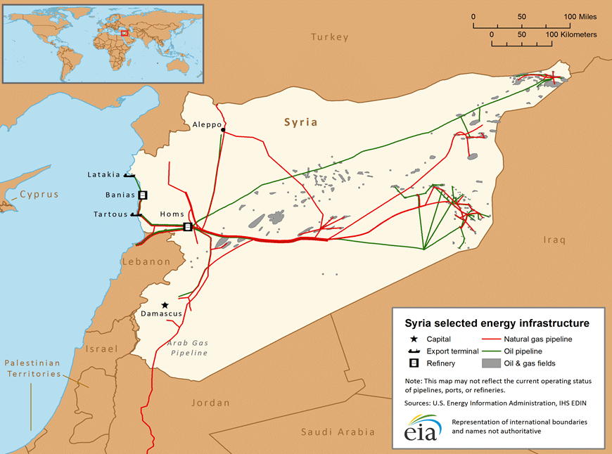
Please change "Al Hawr" الحَور to red.
الحَور/AlHawr under SAA
Al-Hawr under SAA
212.75.52.4 (talk) 13:06, 13 January 2016 (UTC)MapMaker
- Start-Class military history articles
- Start-Class Middle Eastern military history articles
- Middle Eastern military history task force articles
- List-Class Syria articles
- Mid-importance Syria articles
- WikiProject Syria articles
- List-Class WikiProject Cities articles
- All WikiProject Cities pages
- Wikipedia extended-confirmed-protected edit requests