
Dakota, Minnesota: Difference between revisions
Modified historical population template (via CenPop script) |
Rescuing 5 sources and tagging 0 as dead. #IABot (v1.1) |
||
| Line 52: | Line 52: | ||
|population_as_of = [[2010 United States Census|2010]] |
|population_as_of = [[2010 United States Census|2010]] |
||
|population_est = 320 |
|population_est = 320 |
||
|pop_est_as_of = 2012<ref name="2012 Pop Estimate">{{cite web|title=Population Estimates|url=http://www.census.gov/popest/data/cities/totals/2012/SUB-EST2012.html|publisher=[[United States Census Bureau]]|accessdate=2013-05-28}}</ref> |
|pop_est_as_of = 2012<ref name="2012 Pop Estimate">{{cite web|title=Population Estimates |url=http://www.census.gov/popest/data/cities/totals/2012/SUB-EST2012.html |publisher=[[United States Census Bureau]] |accessdate=2013-05-28 |deadurl=yes |archiveurl=http://www.webcitation.org/6HQu4Spqa |archivedate=June 17, 2013 }}</ref> |
||
|population_footnotes = <ref name ="FactFinder"/> |
|population_footnotes = <ref name ="FactFinder"/> |
||
|population_total = 323 |
|population_total = 323 |
||
| Line 74: | Line 74: | ||
|area_code = [[Area code 507|507]] |
|area_code = [[Area code 507|507]] |
||
|blank_name = [[Federal Information Processing Standard|FIPS code]] |
|blank_name = [[Federal Information Processing Standard|FIPS code]] |
||
|blank_info = 27-14518<ref name="GR2">{{cite web|url=http://factfinder2.census.gov|publisher=[[United States Census Bureau]]|accessdate=2008-01-31|title=American FactFinder}}</ref> |
|blank_info = 27-14518<ref name="GR2">{{cite web|url=http://factfinder2.census.gov |publisher=[[United States Census Bureau]] |accessdate=2008-01-31 |title=American FactFinder |deadurl=yes |archiveurl=https://web.archive.org/web/20130911234518/http://factfinder2.census.gov |archivedate=September 11, 2013 }}</ref> |
||
|blank1_name = [[Geographic Names Information System|GNIS]] feature ID |
|blank1_name = [[Geographic Names Information System|GNIS]] feature ID |
||
|blank1_info = 0642598<ref name="GR3">{{cite web|url=http://geonames.usgs.gov|accessdate=2008-01-31|title=US Board on Geographic Names|publisher=[[United States Geological Survey]]|date=2007-10-25}}</ref> |
|blank1_info = 0642598<ref name="GR3">{{cite web|url=http://geonames.usgs.gov|accessdate=2008-01-31|title=US Board on Geographic Names|publisher=[[United States Geological Survey]]|date=2007-10-25}}</ref> |
||
| Line 80: | Line 80: | ||
|footnotes = |
|footnotes = |
||
}} |
}} |
||
'''Dakota''' is a city in [[Winona County, Minnesota|Winona County]], [[Minnesota]], [[United States]]. The population was 323 at the [[2010 United States Census|2010 census]].<ref name="2010 Census (City)">{{cite web|title=2010 Census Redistricting Data (Public Law 94-171) Summary File|url=http://factfinder2.census.gov/faces/tableservices/jsf/pages/productview.xhtml?pid=DEC_10_PL_GCTPL2.ST13&prodType=table|work=American FactFinder|publisher=[[United States Census Bureau]]|accessdate=27 April 2011}}</ref> |
'''Dakota''' is a city in [[Winona County, Minnesota|Winona County]], [[Minnesota]], [[United States]]. The population was 323 at the [[2010 United States Census|2010 census]].<ref name="2010 Census (City)">{{cite web|title=2010 Census Redistricting Data (Public Law 94-171) Summary File |url=http://factfinder2.census.gov/faces/tableservices/jsf/pages/productview.xhtml?pid=DEC_10_PL_GCTPL2.ST13&prodType=table |work=American FactFinder |publisher=[[United States Census Bureau]] |accessdate=27 April 2011 |deadurl=yes |archiveurl=http://web.archive.org/web/20110721034521/http://factfinder2.census.gov/faces/tableservices/jsf/pages/productview.xhtml?pid=DEC_10_PL_GCTPL2.ST13&prodType=table |archivedate=July 21, 2011 }}</ref> |
||
It is located between [[Winona, Minnesota|Winona]] and [[La Crosse, Wisconsin|La Crosse]] along [[Interstate 90 in Minnesota|Interstate 90]]. U.S. Highways [[U.S. Route 61 in Minnesota|61]] and [[U.S. Route 14 in Minnesota|14]] are briefly [[Concurrency (road)|co-signed]] with Interstate 90 at this point. Other routes include Winona County Road 12, the Apple Blossom Scenic Drive. |
It is located between [[Winona, Minnesota|Winona]] and [[La Crosse, Wisconsin|La Crosse]] along [[Interstate 90 in Minnesota|Interstate 90]]. U.S. Highways [[U.S. Route 61 in Minnesota|61]] and [[U.S. Route 14 in Minnesota|14]] are briefly [[Concurrency (road)|co-signed]] with Interstate 90 at this point. Other routes include Winona County Road 12, the Apple Blossom Scenic Drive. |
||
==Geography== |
==Geography== |
||
According to the [[United States Census Bureau]], the city has a total area of {{convert|0.98|sqmi|sqkm|2}}; {{convert|0.65|sqmi|sqkm|2}} is land and {{convert|0.33|sqmi|sqkm|2}} is water.<ref name |
According to the [[United States Census Bureau]], the city has a total area of {{convert|0.98|sqmi|sqkm|2}}; {{convert|0.65|sqmi|sqkm|2}} is land and {{convert|0.33|sqmi|sqkm|2}} is water.<ref name="Gazetteer files">{{cite web|title=US Gazetteer files 2010 |url=http://www.census.gov/geo/www/gazetteer/files/Gaz_places_national.txt |publisher=[[United States Census Bureau]] |accessdate=2012-11-13 |deadurl=yes |archiveurl=http://www.webcitation.org/64vfLAeJ2 |archivedate=January 24, 2012 }}</ref> |
||
Dakota is located along the [[Mississippi River]]. Dakota Creek and the Mississippi River meet at Dakota. Nearby places include [[Winona, Minnesota|Winona]], [[Dresbach, Minnesota|Dresbach]], [[Nodine, Minnesota|Nodine]], [[La Crescent, Minnesota|La Crescent]], [[La Crosse, Wisconsin|La Crosse]], [[Onalaska, Wisconsin|Onalaska]], and [[Great River Bluffs State Park]]. |
Dakota is located along the [[Mississippi River]]. Dakota Creek and the Mississippi River meet at Dakota. Nearby places include [[Winona, Minnesota|Winona]], [[Dresbach, Minnesota|Dresbach]], [[Nodine, Minnesota|Nodine]], [[La Crescent, Minnesota|La Crescent]], [[La Crosse, Wisconsin|La Crosse]], [[Onalaska, Wisconsin|Onalaska]], and [[Great River Bluffs State Park]]. |
||
| Line 106: | Line 106: | ||
|estimate=317 |
|estimate=317 |
||
|estref=<ref name="USCensusEst2015">{{cite web|url=http://www.census.gov/popest/data/cities/totals/2015/SUB-EST2015.html|title=Annual Estimates of the Resident Population for Incorporated Places: April 1, 2010 to July 1, 2015|accessdate=July 2, 2016}}</ref> |
|estref=<ref name="USCensusEst2015">{{cite web|url=http://www.census.gov/popest/data/cities/totals/2015/SUB-EST2015.html|title=Annual Estimates of the Resident Population for Incorporated Places: April 1, 2010 to July 1, 2015|accessdate=July 2, 2016}}</ref> |
||
|footnote=<center>U.S. Decennial Census<ref name="DecennialCensus">{{cite web|url=http://www.census.gov/prod/www/decennial.html|title=Census of Population and Housing|publisher=Census.gov|accessdate=June 4, 2015}}</ref></center> |
|footnote=<center>U.S. Decennial Census<ref name="DecennialCensus">{{cite web|url=http://www.census.gov/prod/www/decennial.html |title=Census of Population and Housing |publisher=Census.gov |accessdate=June 4, 2015 |deadurl=yes |archiveurl=http://www.webcitation.org/6YSasqtfX |archivedate=May 11, 2015 }}</ref></center> |
||
}} |
}} |
||
Revision as of 07:47, 21 July 2016
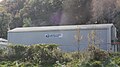
Dakota, Minnesota | |
|---|---|
 Dakota along Interstate 90 | |
 | |
| Country | United States |
| State | Minnesota |
| County | Winona |
| Government | |
| • Type | Mayor – Council |
| • Mayor | Merlin Thompson |
| Area | |
| • Total | 0.98 sq mi (2.54 km2) |
| • Land | 0.65 sq mi (1.68 km2) |
| • Water | 0.33 sq mi (0.85 km2) |
| Elevation | 679 ft (207 m) |
| Population | |
| • Total | 323 |
| • Estimate (2012[3]) | 320 |
| • Density | 496.9/sq mi (191.9/km2) |
| Time zone | UTC-6 (Central (CST)) |
| • Summer (DST) | UTC-5 (CDT) |
| ZIP code | 55925 |
| Area code | 507 |
| FIPS code | 27-14518[4] |
| GNIS feature ID | 0642598[5] |
Dakota is a city in Winona County, Minnesota, United States. The population was 323 at the 2010 census.[6]
It is located between Winona and La Crosse along Interstate 90. U.S. Highways 61 and 14 are briefly co-signed with Interstate 90 at this point. Other routes include Winona County Road 12, the Apple Blossom Scenic Drive.
Geography
According to the United States Census Bureau, the city has a total area of 0.98 square miles (2.54 km2); 0.65 square miles (1.68 km2) is land and 0.33 square miles (0.85 km2) is water.[1]
Dakota is located along the Mississippi River. Dakota Creek and the Mississippi River meet at Dakota. Nearby places include Winona, Dresbach, Nodine, La Crescent, La Crosse, Onalaska, and Great River Bluffs State Park.
Dakota is located 18 miles south of the city of Winona, and 11 miles north of the city of La Crosse.
History
Dakota was incorporated on May 23, 1951. It was laid out in 1855 and developed in 1859 by Nathan Brown, who came to Minnesota in 1847, had a stockyard, and ran a ferry service to Wisconsin. Once the center of berry growing, the main industry is now apple growing.[7]
Demographics
| Census | Pop. | Note | %± |
|---|---|---|---|
| 1880 | 81 | — | |
| 1960 | 339 | — | |
| 1970 | 369 | 8.8% | |
| 1980 | 350 | −5.1% | |
| 1990 | 360 | 2.9% | |
| 2000 | 329 | −8.6% | |
| 2010 | 323 | −1.8% | |
| 2015 (est.) | 317 | [8] | −1.9% |
2010 census
As of the census[2] of 2010, there were 323 people, 137 households, and 91 families residing in the city. The population density was 496.9 inhabitants per square mile (191.9/km2). There were 151 housing units at an average density of 232.3 per square mile (89.7/km2). The racial makeup of the city was 99.4% White and 0.6% from two or more races.
There were 137 households of which 28.5% had children under the age of 18 living with them, 58.4% were married couples living together, 5.1% had a female householder with no husband present, 2.9% had a male householder with no wife present, and 33.6% were non-families. 29.2% of all households were made up of individuals and 8% had someone living alone who was 65 years of age or older. The average household size was 2.36 and the average family size was 2.92.
The median age in the city was 42.6 years. 22.6% of residents were under the age of 18; 4.4% were between the ages of 18 and 24; 26.6% were from 25 to 44; 34.1% were from 45 to 64; and 12.4% were 65 years of age or older. The gender makeup of the city was 53.3% male and 46.7% female.
2000 census
As of the census[4] of 2000, there were 329 people, 130 households, and 92 families residing in the city. The population density was 493.1 people per square mile (189.6/km²). There were 145 housing units at an average density of 217.3 per square mile (83.6/km²). The racial makeup of the city was 99.70% White, 0.30% from other races. Hispanic or Latino of any race were 0.30% of the population.
There were 130 households out of which 31.5% had children under the age of 18 living with them, 63.8% were married couples living together, 5.4% had a female householder with no husband present, and 28.5% were non-families. 27.7% of all households were made up of individuals and 16.9% had someone living alone who was 65 years of age or older. The average household size was 2.53 and the average family size was 3.13.
In the city the population was spread out with 28.9% under the age of 18, 5.5% from 18 to 24, 28.3% from 25 to 44, 19.5% from 45 to 64, and 17.9% who were 65 years of age or older. The median age was 37 years. For every 100 females there were 93.5 males. For every 100 females age 18 and over, there were 91.8 males.
The median income for a household in the city was $50,156, and the median income for a family was $53,929. Males had a median income of $38,333 versus $24,375 for females. The per capita income for the city was $17,700. About 3.6% of families and 4.7% of the population were below the poverty line, including 2.7% of those under age 18 and 3.3% of those age 65 or over.
Images
-
 Post office at Dakota
 -
 Dakota along Winona County Road 12, the Apple Blossom Scenic Drive


References
- ^ a b "US Gazetteer files 2010". United States Census Bureau. Archived from the original on January 24, 2012. Retrieved 2012-11-13.
{{cite web}}: Unknown parameter|deadurl=ignored (|url-status=suggested) (help) - ^ a b "American FactFinder". United States Census Bureau. Retrieved 2012-11-13.
- ^ "Population Estimates". United States Census Bureau. Archived from the original on June 17, 2013. Retrieved 2013-05-28.
{{cite web}}: Unknown parameter|deadurl=ignored (|url-status=suggested) (help) - ^ a b "American FactFinder". United States Census Bureau. Archived from the original on September 11, 2013. Retrieved 2008-01-31.
{{cite web}}: Unknown parameter|deadurl=ignored (|url-status=suggested) (help) - ^ "US Board on Geographic Names". United States Geological Survey. 2007-10-25. Retrieved 2008-01-31.
- ^ "2010 Census Redistricting Data (Public Law 94-171) Summary File". American FactFinder. United States Census Bureau. Archived from the original on July 21, 2011. Retrieved 27 April 2011.
{{cite web}}: Unknown parameter|deadurl=ignored (|url-status=suggested) (help) - ^ Minnesota Place Names. Minnesota Historical Society. Accessed August 13, 2014.
- ^ "Annual Estimates of the Resident Population for Incorporated Places: April 1, 2010 to July 1, 2015". Retrieved July 2, 2016.
- ^ "Census of Population and Housing". Census.gov. Archived from the original on May 11, 2015. Retrieved June 4, 2015.
{{cite web}}: Unknown parameter|deadurl=ignored (|url-status=suggested) (help)
External links
Municipalities and communities of Winona County, Minnesota, United States | ||
|---|---|---|
| Cities |  | |
| Townships | ||
| CDPs | ||
| Unincorporated communities | ||
| Ghost towns | ||
| Footnotes | ‡This populated place also has portions in an adjacent county or counties | |