Tooraneena: Difference between revisions
Appearance
Content deleted Content added
No edit summary Tags: Mobile edit Mobile web edit |
No edit summary |
||
| Line 39: | Line 39: | ||
'''Tooraneena'''<ref>[http://www.logainm.ie/49623.aspx Placenames Database of Ireland: Tooraneena/Tuar an Fhíona]</ref><ref>[http://maps.osi.ie/publicviewer/#V1,619443,605670,4,3 Online map viewer], [[Ordnance Survey Ireland]].</ref> or '''Touraneena''' ({{Irish place name|Tuar an Fhíona}}) is a village in west [[County Waterford]], [[Republic of Ireland|Ireland]]. It lies in the [[Sliabh gCua]] district between the [[Comeragh Mountains|Comeraghs]] and [[Knockmealdown Mountains]]. It may be accessed from the main R672 road between [[Clonmel]] and [[Dungarvan]]. It is about {{convert|20|km|mi|abbr=on}} from Dungarvan and {{convert|19|km|mi|abbr=on}} from Clonmel. |
'''Tooraneena'''<ref>[http://www.logainm.ie/49623.aspx Placenames Database of Ireland: Tooraneena/Tuar an Fhíona]</ref><ref>[http://maps.osi.ie/publicviewer/#V1,619443,605670,4,3 Online map viewer], [[Ordnance Survey Ireland]].</ref> or '''Touraneena''' ({{Irish place name|Tuar an Fhíona}}) is a village in west [[County Waterford]], [[Republic of Ireland|Ireland]]. It lies in the [[Sliabh gCua]] district between the [[Comeragh Mountains|Comeraghs]] and [[Knockmealdown Mountains]]. It may be accessed from the main R672 road between [[Clonmel]] and [[Dungarvan]]. It is about {{convert|20|km|mi|abbr=on}} from Dungarvan and {{convert|19|km|mi|abbr=on}} from Clonmel. |
||
==Amenities== |
==Amenities== |
||
The village includes St Mary's National School (primary school), a playing field, community hall, Catholic church, two public houses, a shop and a community park. [[Gaelic Athletic Association]] (GAA) playing fields lie about 1 km to the north.<ref>[http://www.waterfordcoco.ie/en/services/planning/waterfordcountydevelopmentplan/touraneena/ Waterford County Local Authorities]</ref> |
The village includes St Mary's National School (primary school), a playing field, community hall, a Catholic church, two public houses, a shop and a community park. [[Gaelic Athletic Association]] (GAA) playing fields lie about 1 km to the north.<ref>[http://www.waterfordcoco.ie/en/services/planning/waterfordcountydevelopmentplan/touraneena/ Waterford County Local Authorities]</ref> |
||
==References== |
==References== |
||
Revision as of 14:46, 13 April 2019
Tooraneena
Irish: Tuar an Fhíona | |
|---|---|
Village | |
| Coordinates: 52°12′08″N 7°42′56″W / 52.202202°N 7.715669°W | |
| Country | Ireland |
| Province | Munster |
| County | Waterford |
| Time zone | UTC+0 (WET) |
| • Summer (DST) | UTC-1 (IST (WEST)) |
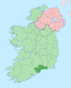
Tooraneena[1][2] or Touraneena (Irish: Tuar an Fhíona) is a village in west County Waterford, Ireland. It lies in the Sliabh gCua district between the Comeraghs and Knockmealdown Mountains. It may be accessed from the main R672 road between Clonmel and Dungarvan. It is about 20 km (12 mi) from Dungarvan and 19 km (12 mi) from Clonmel.
Amenities
The village includes St Mary's National School (primary school), a playing field, community hall, a Catholic church, two public houses, a shop and a community park. Gaelic Athletic Association (GAA) playing fields lie about 1 km to the north.[3]


