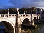
Ponte Corvo (bridge)
Appearance
Ponte Corvo (Ponte Corbo) | |
|---|---|
| Coordinates | 45°24′07″N 11°53′01″E / 45.401814°N 11.883706°E |
| Carries | Via San Francesco |
| Crosses | Bacchiglione |
| Locale | Padua, Italy |
| Characteristics | |
| Design | Segmental arch bridge |
| Total length | 52.20 m (antiquity: 76 m) |
| Width | Max. 5.32 m |
| Longest span | 11 m |
| No. of spans | 3 (antiquity: 5) |
| History | |
| Construction end | 1st–2nd century AD |
| Location | |
 | |
The Ponte Corvo, rarely Ponte Corbo, is a Roman segmental arch bridge across the Bacchiglione in Padua, Italy (Roman Patavium). Dating to the 1st or 2nd century AD, its three remaining arches cross a branch of the river and are today partly buried respectively walled up. The span-to-rise ratio of the bridge varies between 2.8 and 3.4 to 1, the ratio of clear span to pier thickness from 4.9 to 6.9 to 1.[1]
Besides the Ponte Corvo, there are three more ancient segmented arch bridges in Padua: Ponte San Lorenzo, Ponte Altinate and Ponte Molino, as well as Ponte San Matteo.
See also
[edit]References
[edit]- ^ Galliazzo 1994, p. 205
Sources
[edit]- Galliazzo, Vittorio (1994), I ponti romani. Catalogo generale, vol. 2, Treviso: Edizioni Canova, pp. 205–207 (No. 434), ISBN 88-85066-66-6

