
Askam and Ireleth
Template:UK Parish Askam and Ireleth is a civil parish in the county of Cumbria, in North West England. It originally consisted of two separate coastal villages with different origins and histories which, in recent times, have merged together to become one continuous settlement.
Ireleth has its origins as a mediaeval farming village clustered on the hillside overlooking the flat sands of the Duddon Estuary.[1] Askam was established following the discovery of large quantities of iron ore near the village in the middle of the 18th century.
The pair originally fell within the boundaries of the Hundred of Lonsdale 'north of the sands' in the historic county of Lancashire,[2] but following local government reforms in 1974 became part of the county of Cumbria, along with the rest of Furness.
The nearby River Duddon estuary and surrounding countryside have made the area well known for its wildlife,[3] while the villages' exposed position on the eastern bank facing the Irish Sea have encouraged the establishment of wind energy generation, amid local controversy.
History
Ireleth
.PNG)
Ireleth is the smaller and older of the two villages, with its origins stretching back to the Viking occupation of Britain. It was originally clustered along a stream, named 'Hole Beck', about half a mile up the hill from the estuary below. It was also the junction of four roads passing through the area. Firstly, there was the 'Sands' road, named 'Marsh Lane' in maps of the 1850s, heading down the hill towards the shore, where it met one of the possible routes for crossing the treacherous tidal sands of the Duddon at low tide. Secondly, there was the lane heading north along a ridge towards Kirkby-in-Furness. Part of these two roads form today's A595 main road. There was also a road leading up the stream's valley towards the hamlet of Marton, and finally a road east over the hills towards Dalton-in-Furness.[4]
Viking origins exist in two forms: remains have been found near St. Peter's parish church[1] and the name of the village itself is Viking, translated from the Old Norse as 'hill-slope of the Irish'.[5]
It is thought the village was included in the Domesday Book, compiled soon after the Norman Conquest, but there is debate over which of the entries for the Furness area in William the Conqueror's census actually refers to modern day Ireleth.[1] Several sources name a settlement called Gerleuuorde as the correct entry, but there is no conclusive evidence to support this, not least because of the discrepancies in spelling.[1] Samuel Lewis' A Topological Dictionary of England, written 1848, posits a different contender as the true Ireleth. He claimed Ouregrave referred to the village because of the existence of a mill named Orga-Mill, but he conceded this was also conjecture. Lewis' full text on Ireleth is below.[6]
IRELETH, a chapelry, in the parish of Dalton-In-Furness, union of Ulverston, hundred of Lonsdale north of the Sands, N. division of Lancashire, 3 miles (N.) from Dalton; containing 744 inhabitants. Ogra-Mill, in this township, has been conjectured to be the Ouregrave of the Domesday survey: Roanhead is the point for crossing Dudden sands by the ancient road into Cumberland. Upon the east borders of Ireleth, also called Above Town, are the iron-mines of Whitridge, Lindal Moor, Cross Gates, and Inman Gill, the richest and most productive mines in Furness, with the exception of Cross Gates, the works of which have been suspended. Many thousand tons of ore are raised annually in the township. The living is a perpetual curacy; net income, £100; patron, the Vicar of Dalton. The chapel was built in 1608, by Giles Brownrigg, and was originally intended for a school.

During the Middle Ages, the entire area was controlled by the Cistercian monks of Furness Abbey. During this time, Ireleth was little more than one of many farming communities in Furness. The iron ore developments of Askam largely bypassed Ireleth, and the village developed slowly, housing farmers and workers from local towns.[1] The religious history of the village is recorded as starting around the year 1608, when an endowment was created to fund a village school. Giles Brownrigg, named variously as a local landowner[7] or a tailor who had left the area to make his fortune in London,[1] gave money to establish a school house and a salary for a schoolmaster. This building existed on what is today Sun Street; the only remains today are a font and a plaque, kept in the modern day school building, inscribed:[7]
Giles Brownrig caused this school house to be builded the 6 yeare of King James ano 1608 and gave a yearly salari to the schole maister for ever [sic]
Ireleth featured in the Imperial Gazetteer of England and Wales. In this, it is said-[8]
IRELETH, a village and a chapelry in Dalton-in-Furness parish, Lancashire. The village stands at a st. of the Furness railway, on the E side of the Duddon sands, 2¾ miles N of Dalton; is a small sub port to Lancaster; and maintains communication across the sands at low water. The chapelry includes also the hamlets of Lindale and Marton; but does not appear to have definite limits. Post town, Dalton-in-Furness. The living is a p. curacy in the diocese of Carlisle. Value, £100.* Patron, the Vicar of Dalton. The church stands on an eminence, overlooking the Duddon.
Ireleth did not have a parish church at this point, falling into the 'Above Town' area, together with the hamlets of Marton and Lindal, of the parish of Dalton-in-Furness.[6] Lacking a place of worship, it was decided the newly-built school could also be put to use as a chapel. Fishwick's 'Lancashire & Cheshire Church Surveys, 1649–1655' of 1849 cites this record from a church survey taken in 1650:[9]
That the Chappell of Irleth is not farr distant from its parish Church [Dalton in Furness], but neare enough thereto, and was onely built for a schoole, and some for their perticuler ease would have the same made a Chappell [sic]
In 1860, Ireleth, along with the newly founded Askam, petitioned for the creation of its own parish[1] following the rapid increase in population. Construction of a parish church began, with the money to build St. Peter's coming from the new-found profits of iron ore mining, giving rise to the name the 'Iron Church'. It was dedicated for use on St. Peter's Day, 29 June 1865,[10] but approval for a new ecclesiastical parish of 'Ireleth-with-Askam' did not come until almost ten years later in 1874.[11]
Askam
Askam's history starts much more recently. In 1850, iron ore deposits were discovered in the area by William Schneider. These turned out to be the second largest iron ore deposits in the country, with over 7 million tons of ore extracted. By 1896, 547 men were employed in the pits by the village and in nearby Roanhead, 347 of them underground. Several hundred others worked in local mines at Mouzell (between Ireleth and Dalton-in-Furness), Roanhead and Dalton.[12] They were all owned by the Kennedy Brothers Ltd. firm of Ulverston or the Millom and Askam Iron Company. The latter built four blast furnaces in the village to smelt the iron ore being brought from mines all over the peninsula by rail.[13] The village continued to grow with terraced houses and allotments erected for the flood of immigrant labour needed to work the mines.[14] They came from all parts of the British Isles, with a large proportion coming from existing mining areas in Cornwall and Ireland. The Cornish in particular tended to bring their families and settle, while the Irish often moved on to wherever there was work. Others came from areas where Askam's mine owners had other concerns, such as Scotland and Wales.[15]
Remnants of the steel industry remain in Askam, as evidenced by a pier, consisting of slag from the works, that juts out into the bay toward Millom.[14] Also, numerous streets are named after the industry and its owners. For example, 'Steel Street' is so named because of the steel industry; 'Sharp Street' is named after Joseph Sharp, one of the earliest people involved in Askam's steel industry; and 'Crossley Street' after William Crossley, an early investor in the Askam steel industry.[1] The large numbers of slag banks left by the steel industry around the village are now important sites for wildlife.[16] By 1918, the iron ore had run out and most of the industrial buildings were demolished in 1933.[14] Since then, Askam has grown with commuter homes, exploiting the views over the Duddon Estuary to the Lake District.
Etymology


Because of the nature of the village 'conurbation', there is often confusion over the separate and joint naming of the two communities.
Both are part of the 'Furness' peninsula, and as such the suffix -in-Furness can be added, in common with other settlements such as Barrow-in-Furness and Dalton-in-Furness. Askam, when referred to on its own, often uses this but it is rare for Ireleth to be called Ireleth-in-Furness.[17] A possible explanation for this is that the majority of in-Furness place names were inventions of the railway that either created the settlements or caused their rapid expansion; Ireleth, untouched by the railway, was not affected by this convention. However, Ireleth is often confused in archival records with 'Kirkby Ireleth', the former name for the community (two miles to the north) now known as Kirkby-in-Furness. These communities are differentiated in the Imperial Gazetteer of England and Wales.[18][8]
While the strip development has effectively created one larger community in the past fifty years, residents of both villages still retain a strong sense of being either from Askam or Ireleth. Road signs read 'Askam and Ireleth' on entering the villages by road, but an older 'A595 – Ireleth' sign still stands on the former boundary between the two.
In administration terms, the civil parish of which they are both part uses the name Askam with Ireleth,[19] as does the local Women's Institute (WI) which had previously been called Ireleth WI.
Environment
Geology
The geological make-up of the area is extremely important; indeed, without it, Askam as a place would not exist. The upper slopes of the hill near Ireleth are home to dark blue slate and is found on the roofs of several local dwellings. Haematite, the bright red iron ore, was discovered in an exceptionally large deposit—the second largest in the country—south of the current villages in the 1840s. Askam sprung up on the Ireleth marshes as a home for the miners attacking the new deposit. The other mineral found in large quantities, conveniently with a commercial use, is shale. This is fired with water to make red brick, and the brickworks, which is still operational today, was built in 1845 to exploit this.[20]
Wildlife
Much wildlife is found on the Duddon Estuary, perhaps most notably 20% of the national Natterjack toad population, who are attracted to the shallow breeding pools. The slagbanks around Askam are also very important as nesting sites for the rare sandwich terns that live in the area.[3] The beach is designated an Site of Special Scientific Interest (SSSI) because of the range of flora and fauna present on the sands.[21]
Wind energy

Askam wind farm can be found two kilometers east of the village, on the southern slopes of Hare Slack Hill. Work on the turbines started in late 1998, and the wind farm took eight months to complete. It first generated energy in July, 1999.[22] Recent reports show the windfarm is producing only 30.2% of the theoretical maximum amount of electricity claimed by then-operators Powergen in the planning application.[23]
E.ON, the current operator, claims that the wind farm generated enough renewable electricity in 2005 to supply nearly 2,500 homes and avoided the emission of over 4,000 tonnes of carbon dioxide.[24] The wind farm, which features seven turbines measuring 40 metres (131 ft) to the top of the tower, is not permanently manned. Instead it is controlled and monitored from Rheidol Hydroelectric Power Station, near Aberystwyth, Mid Wales.[25]
Local opposition to the windfarm
The Marton, Askam and Ireleth Windfarm Action Group (MAIWAG) was formed by local residents of the three villages upset by what they saw as the inconsiderate construction of the windfarm by then developers Wind Prospect. The group claimed the reality of the windfarm at Far Old Park farm bore little resemblance to the proposed scheme they were first told about.[26] Their main concerns related to the size and environmental impact of the development as well as noise it produced. It was discovered that six of the sevem turbines were not constructed in line with the developer's original application and as such did not have planning permission.[27] Barrow Borough Council signed an agreement with the developer, imposing a range of planning conditions on the turbines already built. As complaints by local residents continued to be made about the noise the council resolved to take action against the windfarm. Later, borough councillors decided to drop this planned enforcement action in December 2002. Disappointed by this decision, six members of the group went ahead with a private prosecution against the owners and operators of the windfarm on the grounds it was a 'noise nuisance.' but their case was unsuccessful.[28]
The group was one of the first such organisations in the UK dedicated to fighting windfarm development.[29] Members of the grouplater toured the country to share their experiences and aid other countryside defence groups in their fight against excessive windfarm development.[30]
Location and transport
Places adjacent to Askam and Ireleth | |
|---|---|

The A595 is the main coastal route, designated a primary route, connecting Barrow and South Cumbria to Copeland, Workington, and Whitehaven. Its southern end is two miles south of Askam at the junction with the A590 Dalton-in-Furness bypass. The area is served by Stagecoach Cumbria service X7 as well as various school services.[31] There are plans to construct a crossing over the Duddon between Askam and Millom to reduce the long journey times between Furness and Copeland, due to the circuitous route of the A595 around the estuary. A scheme to build such a 'Duddon Crossing' remains at the planning stage, but is nominated as a future project in county transport planning.[32]
Askam is located on the 150-mile Cumbrian Coastal Walk, which winds around the edge of the county.[33] The railway line passing through the two villages virtually bisects them, with a bridge and a level crossing by the station allowing residents to cross from one side to another. There is a stop called Askam Railway Station. This line links to the Sellafield nuclear power plant in Seascale, West Cumbria.
Politics and demographics
As a civil parish, the villages have a parish council which usually meets monthly, normally the third Tuesday of each month.[34] All eight councillors will be up for election at the forthcoming English local government elections on 3 May 2007[35] The villages also fall into the Dalton North ward of the borough, with voters electing two councillors to represent them on the council.[36] The ward also elects one councillor to represent it on Cumbria County Council. It is part of the Barrow and Furness parliamentary constituency, represented by Labour MP John Hutton.
According to the most recent census, in 2001, the population of the (civil) parish is as follows:[37]
| Population | ||||||
|---|---|---|---|---|---|---|
| Total | ||||||
| 3632 | ||||||
| of which: | ||||||
| Male | 1807 | |||||
| Female | 1825 | |||||
| by age: | ||||||
| 0–4 | 5–15 | 16–24 | 25–44 | 45–64 | 65–74 | 75+ |
| 224 | 616 | 317 | 1047 | 915 | 296 | 217 |
Sport

The villages have several sporting facilities, including the Fallowfield Park rugby league ground, home of Askam Amateur Rugby League Football Club. Formed in 1879,[38] the amateur club is a member of BARLA and competes in the National Conference League Division 2.[39] There is also Askam United Football Club who play in the West Lancashire Football League Division Two and Duddon SC, a cricket team based at the old K Shoes factory social club.[40]
A 10-hole links golf course, belonging to the Dunnerholme Golf Club, lies to the north of Askam. The course has one particularly interesting feature, namely a green atop Dunnerholme Rock,[41] a large uneroded limestone rock which stands out from the surrounding flat course and sands.[16] The golf club has been in existence since 1905.[42]
Public buildings
Village halls
There are two village halls, the Temperance Hall in Ireleth and the Rankin Hall in Askam. The former, on Saves Lane, is a reminder of the Furness area's strong history of non-conformism. Built by the Society of Friends (the Quakers) in 1872,[1] it was marked as a place of worship on Ordnance Survey maps of the late 1800s, and was used by a Methodist offshoot group called the Bible Christians. It later fell out of use as a religious centre, being marked on maps in 1913 as simply a hall. The Temperance Hall was closed before being renovated in the 1990s, and is now used as a community centre and the location of parish council and Women's Institute meetings.[43]
Churches
As already mentioned, there is St. Peter's Church overlooking the two villages atop Ireleth Hill, which is the oldest of the churches in the villages, and holds the only cemetery in the villages, and the Temperence Hall that was once used as a church. There are three other places of worship within the village.
In 1907, at a cost of £350, The Christian Meeting House was built on Crossley Street in Askam, as a Church of Christ Church. This became, in 1956, St. Anthony's Catholic Church, and is still used in that capacity today.[44] On Duddon Road, in Askam, there is also a Church of England/Methodist Church, called Duddon Road Church.[45]
There were once two other churches in the village, but they are no longer in use as Churches. Zion, on Beach Street, Askam, was a Primitive Methodist church that was founded in 1870. It closed in 1985.[46] There was also a United Methodist Church in Askam, and though the building still stands on Duke Street, it is now used as a social club. The Church was opened in 1878, on land that was donated by the Furness Iron and Steel Company.[47]
Other buildings
There is a lifeboat station, home of the Duddon Inshore Rescue, that was established in 1970. Askam has a fountain commemorating Queen Victoria's Jubilee.[14] There are two schools, Ireleth St Peter's C.E. Primary School[48] and Askam Village School,[49] both of which are primary schools. There are no secondary schools in the village.
Public buildings gallery
-
The Temperence hall, in Ireleth.
-
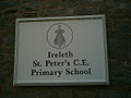 The sign for Ireleth school.
 -
Ireleth school.
-
 St. Peter's Church (CofE)
 -
 The memorial fountain to Queen Victoria.
 -
Detail of the inscription on the fountain.
-
 The Methodist church.
 -
 The lifeboat station.
 -
The sign for Askam school, while construction was taking place on the site.
-
 The war memorial for the villages.
 -
 St Anthony's Church (Roman Catholic)
 -
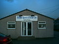 Duddon Sports club.
 -
 Askam station.


References
- ^ a b c d e f g h i Maclean, Mark (1997). "A Short History of Ireleth and Askam-in-Furness" (PDF). Mark Maclean. Retrieved 2007-03-09.
- ^ "Lancashire AncC: Historical Boundaries" (HTML). A Vision of Britain Through Time. Retrieved 2007-03-09.
- ^ a b Hutchinson, Kate. "Duddon Estuary Wildlife" (HTML). Duddon Estuary Partnership. Retrieved 2007-03-10.
- ^ "Map from between 1850 and 1873, showing Ireleth" (Flash). PlanAccess GUI. Barrow Borough Council. Retrieved 2007-03-24.
- ^ Mills, David. The Place Names of Lancashire (in English). p. 100. ISBN 0 7134 2348 9.
{{cite book}}: Check|isbn=value: checksum (help)CS1 maint: unrecognized language (link) - ^ a b Lewis, Samuel. "Ireleth". A Topographical Dictionary of England (HTML). A Topographical Dictionary of... (Seventh edition ed.). London, England: Samuel Lewis and Co. Retrieved 2007-03-08.
{{cite book}}:|edition=has extra text (help); External link in|chapterurl=|chapterurl=ignored (|chapter-url=suggested) (help) - ^ a b "History of St Peter's Ireleth" (HTML). Ireleth St. Peter's school. Retrieved 2007-03-09.
- ^ a b Wilson, John Marius. "Ireleth". Imperial Gazetteer of England and Wales.
{{cite book}}:|access-date=requires|url=(help);|format=requires|url=(help); External link in|chapterurl=|chapterurl=ignored (|chapter-url=suggested) (help) - ^ Fishwick, H. "Parochial chapel: Dalton in Furness, Ireleth chapel". Lancashire & Cheshire Church Surveys, 1649–1655. p. 138.
{{cite book}}:|access-date=requires|url=(help);|format=requires|url=(help); External link in|chapterurl=|chapterurl=ignored (|chapter-url=suggested) (help) - ^ "Ireleth & Askam – St Peter's Church" (HTML). Visit Cumbria. 2005-01-21. Retrieved 2007-03-10.
{{cite web}}: Check date values in:|date=(help) - ^ Youngs, F. "Cited by A Vision of Britain Through Time, on their Askam With Ireleth entry". Local Administrative Units: Northern England. London, England: Royal Historical Society. p. 176.
{{cite book}}:|access-date=requires|url=(help);|format=requires|url=(help); External link in|chapterurl=|chapterurl=ignored (|chapter-url=suggested) (help) - ^ Hedley, John L. Lancashire's Mining Industry in 1896 – A List of Metalliferous Mines (HTML). Britain's Active Mining History Society. Retrieved 2007-03-10.
- ^ Baggerly, Phil. "A gallery of West Cumbrian railway wagon destination cards" (HTML). banklands.com, a tribute to the Workington iron and steel industry. Retrieved 2007-03-10.
- ^ a b c d "Askam in Furness Cumbria" (HTML). The Cumrbia Directory. Retrieved 2007-03-10.
- ^ "Migration and Movement". Furness Family History Society. Retrieved 2007-03-10.
- ^ a b Thomson, Rona. "The Duddon Estuary" (PDF). The Duddon Estuary Partnership. Retrieved 2007-03-10.
- ^ "Askam in Furness, England" (Flash). Google Maps. Google. Retrieved 2007-03-10.
- ^ Lewis, Samuel. "Kirkby Ireleth". A Topographical Dictionary of England (HTML). A Topographical Dictionary of... (Seventh edition ed.). London, England: Samuel Lewis and Co. Retrieved 2007-03-10.
{{cite book}}:|edition=has extra text (help); External link in|chapterurl=|chapterurl=ignored (|chapter-url=suggested) (help) - ^ "Parish and Town Councils" (HTML). Barrow Borough Council. Retrieved 2007-03-10.
- ^ "Geology of Furness & Cumbria" (HTML). Lindal and Martin Community Website. Retrieved 2007-03-10.
- ^ "Nature on the Map :: Maps" (Flash). Natural England. Retrieved 2007-03-10.
- ^ "Askam" (HTML). B9 Energy. Retrieved 2007-03-10.
- ^ Hall, Dr Mike. "Wind Energy – Saint or Sinner? [page 3 of 5]" (PDF). The Scottish Parliament. Retrieved 2007-03-10.
- ^ "E.ON UK – Askam". E.ON. Archived from the original on 2006-10-29. Retrieved 2007-07-24.
{{cite web}}: Check date values in:|archivedate=(help) - ^ "Askam" (HTML). E.ON UK. Retrieved 2007-03-10.
- ^ "Broken Promises" (HTML). MAIWAG. 2004. Retrieved 2007-04-15.
- ^ "Noise Windfarms Court Battle" (doc). MAIWAG. Retrieved 2007-04-15.
- ^ "Judge rejects wind farm complaint". BBC. 2004-01-20. Retrieved 2007-03-10.
{{cite news}}: Check date values in:|date=(help) - ^ "Living With Wind Turbines" (HTML). MAIWAG. 2004. Retrieved 2007-03-10.
- ^ "David Brierley presentation" (HTML). Stop Cambridge Windfarm. Retrieved 2007-04-15.
- ^ "X7 bus route timetables" (PDF). Cumbria County Council. Retrieved 2007-03-10.
- ^ "Area transport statements [page 24 of 50]" (PDF). Cumbria County Council. 2006. Retrieved 2007-03-10.
{{cite web}}: Unknown parameter|month=ignored (help) - ^ "Cumbria Coastal Way" (HTML). GoLakes website, the official website of Cumbria Tourism. Retrieved 2007-03-10.
- ^ "Parish Councils" (HTML). Barrow Borough Council. Retrieved 2007-03-10.
- ^ "Parish Councils election notice" (PDF). Barrow Borough Council. Retrieved 2007-04-11.
- ^ "Wards" (HTML). Barrow Borough Council. Retrieved 2007-03-10.
- ^ Cite error: The named reference
Populationwas invoked but never defined (see the help page). - ^ "Eamel Rugby Badges (Askam ARLFC)" (HTML). Sports Kerlectables. Retrieved 2007-03-10.
- ^ "Division Two Club Register" (Flash). National Conference League. Retrieved 2007-03-10.
- ^ "Clubs" (HTML). Barrow Sports Council. Retrieved 2007-03-10.
- ^ "Dunnerholme Golf Club" (HTML). UK Golf Guide. Retrieved 2007-03-10.
- ^ "Dunnerholme Golf Club" (HTML). Dunnerholme Golf Club. Retrieved 2007-03-10.
- ^ Stringer, Phil (2007-02-14). "Saves Lane Bible Christian, Ireleth with Askam" (HTML). GENUKI. Retrieved 2007-03-10.
{{cite web}}: Check date values in:|date=(help) - ^ Stringer, Phil (2007-02-14). "Christian Meeting House, Askam in Furness – Church of Christ" (HTML). GENUKI. Retrieved 2007-03-11.
{{cite web}}: Check date values in:|date=(help) - ^ Wakefield, Bill. "Cumbria's Places of Worship" (HTML). BBC. Retrieved 2007-03-11.
- ^ Stringer, Phil (2007-02-14). "Zion, Ireleth with Askam – Primitive Methodist" (HTML). GENUKI. Retrieved 2007-03-11.
{{cite web}}: Check date values in:|date=(help) - ^ Stringer, Phil (2007-02-14). "Duke Street United Methodist Free Church, Ireleth with Askam" (HTML). GENUKI. Retrieved 2007-03-11.
{{cite web}}: Check date values in:|date=(help) - ^ "St Peter's School" (HTML). Ireleth St Peter's School. Retrieved 2007-03-10.
- ^ "Askam Village School" (HTML). Department for Education and Skills. 2003. Retrieved 2007-03-10.
External links
- Google Maps' view of the Askam and Ireleth area.
- A Short History of Ireleth and Askam-in-Furness, by Mark Maclean. This book is available freely in PDF format, and the information has been compiled from numerous other sources, all of which are cited in the book.