
Tondo, Manila
 | |
| City | Manila |
|---|---|
| Congressmen | Benjamin Asilo Jaime Lopez |
| Population (2000) | 590,307 |
| – Density | 64,868.9 per km² |
| Area | 9.10 km² |
| – Barangays | 259 |
| – Cong. Districts | 1st to 2nd Districts |
- A tondo is also a circular painting or relief carving.
Tondo (Chinese: 東都, "Eastern Capital"), once historically known as the capital of the Empire of Luzon (Chinese: 呂宋國, "The Lesser Song Empire"), is now just one of the districts of Manila, the capital city of the Philippines. It is one of the most densely populated areas of land in the world. Tondo is located in the northwest portion of the city and is primarily residential-industrial in nature. Tondo is notorious for being the poorest and most underdeveloped district of the country.[citation needed] Many of the city's slums are found in this area. It is also the birthplace of former president Joseph Estrada, singer and actress Regine Velasquez, businessman and politician Manuel Villar, Manila Mayor and Gatpuno Antonio Villegas, Andres Bonifacio, the Great Leader of the Katipuneros, and Kyla, the Philippines' R & B Princess.
History
The former region of Tondo is over eleven hundred years old. Historically, Tondo was first mentioned in the Laguna Copperplate Inscription found in the National Museum of the Philippines, dated April 21 900. During the Spanish colonial era, Tondo, also known as manila, was one of the first provinces to be established, and on 1896, it was also one of the first to declare rebellion against Spain. In 1911, under the American tutelage, there was a major reorganization of political divisions, and the province of Tondo was dissolved, and its towns given to the provinces of Rizal and Bulacan. Today, Tondo just exists as a district in the City of Manila.
Characteristics
- The world's most densely populated district
- It has a land area of 5.64 km². with a population of 378,697 (2000); 67,145 persons per km².
- Tondo II has a land area of 3.46 km². with a population of 211,610 (2000); 61,159 persons per km².
- average residential population density: 64,869 persons per km².
- The 6th administrative district which covers the 4 districts of Sta. Ana, Sta. Mesa, Pandacan, San Miguel has a total land area of 5.48 km². with a total population of 374,258 (2000); 68,295 persons per km².
- It is the location of a notorious and now closed landfill called Smokey Mountain.
- The Divisoria area, also located in Tondo, is a major business center and shopping area where dry goods, kitchen utensils, vegetables and fruits, shoes, clothing, coffee, candles, candies, fishing equipment etc., can be brought--wholesale or retail. Shoe Mart once had a small store here, as well as being the home of Yangco Market, which sells dry goods; the Divisoria Public Market, now rebuilt; and the new 168 Shopping Mall. Ambulant vendors frequent its major and minor streets.
- It once was the location of the major Procter and Gamble plant in the Philippines at Vitas Street--now closed and dismantled.
- The main terminal of the Philippine National Railways is located at the Tutuban district, which is close to the birthplace of Andres Bonifacio. This is now converted to a mall (Tutuban Center).
- West of the district lies the major interisland port of Manila, North Harbor, and the Manila Container Port.
- The slaughterhouse (matadero) of the Manila City Government is located also at Vitas Street.
- Every third Sunday of January, the Feast of the Sto. Niño of Manila (the Infant Jesus) is celebrated by a procession early in the morning from Tondo Church and winding down its narrow streets punctuated by fireworks.
- The Light Rail Transit (LRT) has 2 stations in the Tondo area, namely: Abad Santos and R. Papa.
Photos
-
 Fruit Vendor on Juan Luna Street
 -
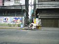
 Calesa, a Horse-Drawn Carriage
 -
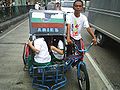 Pedicab ride to School
 -
 Busy street near Pritil Market


External links
| Topics |  | |
|---|---|---|
| Government | ||
| Districts | ||
| Mixed-use developments | ||
| Beaches | ||
| Legislative districts | ||