
Oxford, Alabama
Oxford, Alabama | |
|---|---|
 Downtown Oxford | |
 Seal | |
| Nickname: Crossroads to the Future | |
 Location in Calhoun County and Alabama | |
| Country | United States |
| State | Alabama |
| Counties | Calhoun, Talladega |
| Government | |
| • Mayor | Leon Smith |
| Area | |
| • Total | 31.0 sq mi (80.3 km2) |
| • Land | 30.7 sq mi (79.4 km2) |
| • Water | 0.3 sq mi (0.9 km2) |
| Elevation | 656 ft (200 m) |
| Population (2010) | |
| • Total | 21,348 |
| • Density | 690/sq mi (270/km2) |
| Time zone | UTC-6 (Central) |
| • Summer (DST) | UTC-5 (Central) |
| ZIP code | 36203 |
| Area code | 256/938 |
| FIPS code | 01-57576 |
| GNIS feature ID | 0160330 |
| Website | www |
Oxford is a city in Calhoun and Talladega counties in the U.S. state of Alabama. The population was 14,592 at the 2000 census. Oxford is one of two principal cities of and included in the Anniston-Oxford Metropolitan Statistical Area. 21,348 residents lived in the city according to the 2010 Census, an increase of 46.3% since the 2000 Census.
Geography
Oxford is located at 33°35′49″N 80°50′19″W / 33.59694°N 80.83861°W (33.597105, -85.838881).Template:GR
According to the U.S. Census Bureau, the city has a total area of 31.0 square miles (80.3 km2), of which 30.7 square miles (79.4 km2) is land and 0.35 square miles (0.9 km2), or 1.07%, is water.[2]
Oxford lies among the foothills at the southern end of the Blue Ridge Mountains. Nearby Cheaha Mountain is Alabama's highest point and offers expansive views of the surrounding wilderness and the city below. Much of the city's southern border is shared with the Talladega National Forest.
Major bodies of water include Oxford Lake, Lake Hillabee, Snows Creek and Choccolocco Creek, which bisects the city.

History
Founded in the early 1850s, Oxford was the first city in Calhoun County to be incorporated. When the town was formed, it was originally named "Lick skillet". The name was later changed to "Oxford" due to the presence of a narrow crossing of Chocolocco Creek that allowed farmers to ford cattle from one side of the creek to the other. Since 1970 Oxford has annexed large amounts of land to the south, including the communities of Coldwater and Bynum. In 1970 it was all in Calhoun County, but today it includes areas in Talladega County.[3]
Government
Oxford features a mayor-council form of government, though the mayor actually dictates the daily running of the city. Mayor Leon Smith is currently serving his seventh term, having been elected to the post in 1984. The five-member council includes Phil Gardner (Place 1), June Land Reaves (Place 2), Mitch Key (Place 3), Chris Spurlin (Place 4), and Steven Waits (Place 5). Spurlin serves as the council president. The mayor and city council members are elected to four-year terms (coinciding with presidential election years).
Oxford Police Department
The city maintains a fifty-man police department. The agency is divided into a Uniform Division, a Criminal Investigation Division, and a Special Investigations Division. The department also has an Emergency Services Unit and a Traffic Homicide Unit. An Honor Guard was recently created for special ceremonies.[4]
The department is equipped with a military-surplus armored vehicle, sniper and assault rifles as well as military-style helmets. The department is headed by Chief Bill Partridge. [5]
Education
Oxford's public schools are administered by the Oxford City School System. There are currently four elementary schools, one middle school, and one high school. A new Freshman Academy building, for the ninth grade of Oxford High School, opened in January 2009. A new Oxford High School building opened in August 2010. The official Board of Education website is Oxford City Schools.
Oxford High School has an approximate enrollment of 1,002 students and is classified as a Class 6A school. Oxford City Schools offer excellent educational opportunities.
The privately operated Trinity Christian Academy is located in southwestern Oxford.
Economy
The city's growth in recent years can be attributed mainly to the presence of Interstate 20 and Oxford's central location between Atlanta and Birmingham. The Quintard Mall is the only fully enclosed shopping mall between Birmingham and Douglasville, Georgia. Several other shopping centers dot the landscape of Oxford with the most recent being the construction of the Oxford Exchange, which is just off exit 188 on Interstate 20.
Transportation
Major highways passing through Oxford include:
- Interstate 20
- US Highway 78
- US Highway 431
- State Route 21
- State Route 202
Demographics
| Census | Pop. | Note | %± |
|---|---|---|---|
| 1870 | 1,147 | — | |
| 1880 | 780 | −32.0% | |
| 1890 | 1,473 | 88.8% | |
| 1900 | 1,372 | −6.9% | |
| 1910 | 1,090 | −20.6% | |
| 1920 | 1,108 | 1.7% | |
| 1930 | 1,206 | 8.8% | |
| 1940 | 1,393 | 15.5% | |
| 1950 | 1,697 | 21.8% | |
| 1960 | 3,603 | 112.3% | |
| 1970 | 4,361 | 21.0% | |
| 1980 | 8,939 | 105.0% | |
| 1990 | 9,362 | 4.7% | |
| 2000 | 14,592 | 55.9% | |
| 2010 | 21,348 | 46.3% | |

As of the censusTemplate:GR of 2000, there were 14,592 people, 5,734 households, and 4,231 families residing in the city. The population density was 800.1 people per square mile (308.9/km²). There were 6,280 housing units at an average density of 340.5 per square mile (131.5/km²). The racial makeup of the city was 87.46% White, 9.88% Black or African American, 0.38% Native American, 0.62% Asian, 0.03% Pacific Islander, 0.78% from other races, and 0.85% from two or more races. 1.93% of the population were Hispanic or Latino of any race.
There were 5,734 households out of which 34.1% had children under the age of 18 living with them, 59.6% are married couples living together, 11.5% had a female householder with no husband present, and 26.2% were non-families. 23.4% of all households were made up of individuals and 9.4% had someone living alone who was 65 years of age or older. The average household size was 2.51 and the average family size was 2.97.
In the city the population was spread out with 24.8% under the age of 18, 8.1% from 18 to 24, 29.5% from 25 to 44, 23.6% from 45 to 64, and 14.0% who were 65 years of age or older. The median age was 38 years. For every 100 females there were 91.1 males. For every 100 females age 18 and over, there were 87.6 males.
The median income for a household in the city was $40,397, and the median income for a family was $47,891. Males had a median income of $34,838 versus $21,897 for females. The per capita income for the city was $28,923. About 6.8% of families and 9.4% of the population were below the poverty line, including 13.3% of those under age 18 and 10.1% of those age 65 or over.
Points of interest
- Quintard Mall
- Oxford Exchange
- Oxford Lake Park
Media
- org/truth/ Truth Radio WTBJ-FM 91.3 (Christian Radio)
- WTDR-FM 92.7 (Country)
- WVOK-FM 97.9 (Adult Contemporary)
- WVOK-AM 1580 (Oldies)
- The Anniston Star (25,000 circulation daily newspaper)
- Oxford Independent (weekly newspaper)
- Insight (a bi-monthly entertainment and event paper serving Oxford and Calhoun county)
References
- ^ "2010 Census Redistricting Data (Public Law 94-171) Summary File". American FactFinder. United States Census Bureau. Retrieved 26 March 2012.
- ^ "Geographic Identifiers: 2010 Demographic Profile Data (G001): Oxford city, Alabama". U.S. Census Bureau, American Factfinder. Retrieved January 22, 2013.
- ^ Old borders based on Andriot, John L. Township Atlas of the United States (McLean, Virginia: Andriot Associates, 1979) p. 17
- ^ www.oxfordpd.org
- ^ Small-Town Cops Pile Up on Useless Military Gear, by Lorenzo Francechi-Biccierai, Wired Magazine Danger Room, 26 June 2012
External links
Municipalities and communities of Calhoun County, Alabama, United States | ||
|---|---|---|
| Cities | 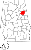 | |
| Towns | ||
| CDPs | ||
| Unincorporated communities | ||
| Ghost town | ||
| Footnotes | ‡This populated place also has portions in an adjacent county or counties | |
Municipalities and communities of Talladega County, Alabama, United States | ||
|---|---|---|
| Cities | 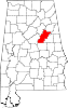 | |
| Towns | ||
| CDPs | ||
| Unincorporated communities | ||
| Ghost town | ||
| Footnotes | ‡This populated place also has portions in an adjacent county or counties | |