Aaba
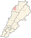
Aaba (Arabic: عابا) is a village in the Koura District of Lebanon, whose inhabitants are Greek Orthodox and other confessions.[1] It is located 240 metres above sea level and has an area of 0.16 square kilometers.[2] In 1953, Aaba had a population of 288 living in 31 households.[3]
References[edit]
- ^ "Municipal and ikhtiyariah elections in Northern Lebanon" (PDF). The Monthly. March 2010. p. 23. Archived (PDF) from the original on 3 June 2016. Retrieved 29 October 2016.
- ^ Aaba, Localiban
- ^ Sawaya, Salah Michel (March 1953). Household Income and Expenditure in Al-Kura, Lebanon (PDF). Scholarworks (M.A.). Beirut, Lebanon: Economics Dept., American University of Beirut, Lebanon. hdl:10938/3411. Archived from the original (PDF) on 24 March 2023. Retrieved 2023-03-24.
External links[edit]
34°21′N 35°50′E / 34.350°N 35.833°E

