Fundura
Fundura | |
|---|---|
Settlement | |
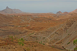
 View of Fundura and its surrounding area | |
| Coordinates: 15°09′53″N 23°41′57″W / 15.1648°N 23.6992°W | |
| Country | Cape Verde |
| Island | Santiago |
| Municipality | Santa Catarina |
| Civil parish | Santa Catarina |
| Population (2010)[1] | |
| • Total | 1,070 |
| ID | 72153 |
Fundura is a village in the northwestern part of the island of Santiago, Cape Verde. It is part of the municipality of Santa Catarina. In 2010 its population was 1,070. It is located about 8 km north of Assomada, on the road to Tarrafal (EN1-ST01).
References[edit]
- ^ "2010 Census results". Instituto Nacional de Estatística Cabo Verde (in Portuguese). 24 November 2016.

