
List of tributaries of Larrys Creek: Difference between revisions
update GNIS references to shorter form |
Seond Fork lead expanded, add images |
||
| (21 intermediate revisions by the same user not shown) | |||
| Line 1: | Line 1: | ||
[[Image:Larrys Creek Watershed Map.PNG|thumb|300px|right|Map of the Larrys Creek watershed, showing inhabited places and major tributaries]] |
[[Image:Larrys Creek Watershed Map.PNG|thumb|300px|right|Map of the Larrys Creek watershed, showing inhabited places and major tributaries]] |
||
This is a '''list of tributaries of Larrys Creek''', which is a 22.9 mile (36.9 km) long [[tributary]] of the [[West Branch Susquehanna River]] in [[Lycoming County, Pennsylvania|Lycoming County]] in the [[U.S. state]] of [[Pennsylvania]]. [[Larrys Creek]] is part of the [[Chesapeake Bay]] [[drainage basin]], its watershed drains 89.1 square miles (230.8 km²) in six [[Township (Pennsylvania)|townships]] and a [[borough (United States)|borough]]. |
This is a '''list of tributaries of Larrys Creek''', which is a 22.9 mile (36.9 km) long [[tributary]] of the [[West Branch Susquehanna River]] in [[Lycoming County, Pennsylvania|Lycoming County]] in the [[U.S. state]] of [[Pennsylvania]]. [[Larrys Creek]] is part of the [[Chesapeake Bay]] [[drainage basin]], its watershed drains 89.1 square miles (230.8 km²) in six [[Township (Pennsylvania)|townships]] and a [[borough (United States)|borough]]. The 42 named tributaries are presented in three lists. |
||
Larrys Creek itself has 18 named tributaries, and these are the subject of the first list. The First Fork and Second Fork of Larrys Creek are the two main tributaries and they have multiple tributaries of their own. The second list gives the eight named tributaries of the First Fork, and the third list gives the nine named tributaries of the Second Fork. Finally there are seven named streams in the watershed which are tributaries of tributaries of the three main branches and they are presented after each list (one for Larrys Creek itself, two for the First Fork, and four for the Second Fork). The names of streams which have at least one named tributary of their own are marked with an asterisk. |
|||
The creek has eighteen tributaries which are either named or in named features. The major smaller streams in the Larrys Creek watershed include the First and Second Forks of Larrys Creek, Roaring Run, Lawshe Run, and Canoe Run. The Second Fork of Larrys Creek is the largest tributary, with a watershed of 24.9 square miles (64.5 km²) or 28.0% of the total watershed. The First Fork is next largest, with a watershed of 17.6 square miles (45.6 km²) or 19.8% of the total. Roaring Run accounts for 5.7% of the total watershed (5.1 square miles or 13.2 km²) and other tributaries are less than 5% of the total.<ref name="river miles">{{cite book |
|||
Each list follows the same format: the first column in each list gives the name. The tributaries are either named streams or are unnamed streams in named features (valleys, i.e. [[Valley#Hollows|hollow]], [[Cove (Appalachian Mountains)|cove]], or [[Swale (geographical feature)|swale]]). Tributaries which are themselves unnamed, but which are in a named feature are given the name of the feature in quotation marks (example: "Pond Hollow"). The first column also notes whether the tributary enters on the [[right bank]] or [[left bank]]. The second column in each list gives the river miles, which is the distance from the mouth of the tributary to the mouth of Larrys Creek (or the First or Second Fork). The third column gives the area of the [[drainage basin]] or watershed. The next four columns give the latitude and longitude and the elevation of the mouth and source of each tributary, and the final column has remarks, mostly about location. |
|||
==Tributaries== |
|||
Larrys Creek rises in Cogan House Township and flows southwest under the [[Cogan House Covered Bridge]], which is on the [[National Register of Historic Places]] and one of only three remaining in Lycoming County. It flows south through [[Pennsylvania State Game Lands]] No. 114, then through Mifflin and Anthony Townships and the borough of Salladasburg. There it receives the Second Fork, and just south of Salladasburg the First Fork joins the creek - these drain parts of Pine, Cogan House, Cummings, and Mifflin Townships. Piatt Township is the last municipality the creek flows through and it enters the West Branch Susquehanna River there. |
|||
The five largest direct tributaries in the Larrys Creek watershed are the First and Second Forks of Larrys Creek, Roaring Run, Wendell Run and Wolf Run. The Second Fork of Larrys Creek is the largest tributary, with a watershed of 24.9 square miles (64.5 km²) or 28.0% of the total watershed. The First Fork is next largest, with a watershed of 17.6 square miles (45.6 km²) or 19.8% of the total. Roaring Run accounts for 5.7% of the total watershed (5.1 square miles or 13.2 km²) and other tributaries are less than 5% of the total.<ref name="river miles">{{cite book |
|||
| last = Pennsylvania Department of Environmental Protection |
| last = Pennsylvania Department of Environmental Protection |
||
| coauthors = Bureau of Watershed Management, Division of Water Use Planning |
| coauthors = Bureau of Watershed Management, Division of Water Use Planning |
||
| Line 11: | Line 18: | ||
| accessdate = 2008-02-19 |
| accessdate = 2008-02-19 |
||
| year = 2001 |
| year = 2001 |
||
}}</ref> |
}}</ref> |
||
{|style="margin: 1em auto 1em auto" |
|||
Tributaries which themselves unnamed, but which are in a named feature are given the name of the feature in quotation marks (example: "Pond Hollow"). River miles refer to the distance from the mouth of the tributary to the mouth of Larrys Creek. |
|||
<gallery> |
|||
Image:Larrys Creek Covered Bridge.JPG|<center>''[[Cogan House Covered Bridge]]''</center> |
|||
<!-- <ref>{{cite web | work = [[Geographic Names Information System]] | publisher = [[United States Geological Survey]] | date = [[August 2]], [[1979]] | url ={{Gnis3|}} | title = " " | accessdate =2008-03-03}}</ref> --> |
|||
Image:Second Fork Larrys Creek.JPG|<center>''Second Fork <br>Larrys Creek''</center> |
|||
Image:Larrys Creek in Piatt Township.JPG|<center>''Larrys Creek in Piatt Township''</center> |
|||
Image:Larrys Creek Railroad Bridge .JPG|<center>''Larrys Creek Railroad Bridge'' |
|||
</center> |
|||
</gallery> |
|||
|} |
|||
{|class="wikitable sortable" style="width:100%" |
{|class="wikitable sortable" style="width:100%" |
||
| Line 21: | Line 34: | ||
| author = Pennsylvania Department of Conservation and Natural Resources | title = Tiadaghton State Forest Map |
| author = Pennsylvania Department of Conservation and Natural Resources | title = Tiadaghton State Forest Map |
||
| url = http://www.dcnr.state.pa.us/forestry/stateforests/maps/fd12_map.pdf | format = PDF | accessdate = 2006-11-18}}</ref> |
| url = http://www.dcnr.state.pa.us/forestry/stateforests/maps/fd12_map.pdf | format = PDF | accessdate = 2006-11-18}}</ref> |
||
! width= |
! width= |'''River<br> Miles<br> (km)<ref name="river miles"/>''' |
||
! width= |
! width= |'''Watershed<br>Area''' in square<br> miles (km²)<ref name="river miles"/> |
||
! width= |
! width= |'''Mouth<br> Coordinates'''<ref name="river miles"/> |
||
! width= |
! width= |'''Mouth<br> Elevation<br> in feet (m)''' |
||
! width= |
! width= |'''Source<br> Coordinates''' |
||
! width= |
! width= |'''Source<br> Elevation<br> in feet (m)''' |
||
! width= |
! width= class="unsortable"|'''Remarks''' |
||
|-- |
|-- |
||
|| [[ |
|| [[River delta|Mouth]] || {{nts|0}} mi<br> (0 km) || {{nts|89.1}} mi²<br> (230.8 km²) || {{coor dms|41|13|00|N|77|13|13|W|}} || {{nts|515}} ft<br> (157 m)<ref name="Streams II">{{cite book | last = Shaw | first = Lewis C. | others = Prepared in Cooperation with the United States Department of the Interior Geological Survey | title = Pennsylvania Gazetteer of Streams Part II (Water Resources Bulletin No. 16) | date = June, 1984 | edition = 1st Edition | publisher = Commonwealth of Pennsylvania, Department of Environmental Resources | location = Harrisburg, PA }} (no ISBN)</ref> |
||
|| See below || See below || [[West Branch Susquehanna River]] in [[Piatt Township, Pennsylvania|Piatt Township]] |
|| See below || See below || Larrys Creek enters the [[West Branch Susquehanna River]] in [[Piatt Township, Pennsylvania|Piatt Township]] at the hamlet of Larrys Creek. |
||
|-- |
|-- |
||
|| Seeley Run,<br>left bank || {{nts|1.82}} mi<br> (2.93 km) || {{nts|1.46}} mi²<br> (3.78 km²) || {{coor dms|41|14|26|N|77|12|56|W|}} || {{nts|554}} ft<br> (169 m) || {{coor dms|41|15|56|N|77|12|23|W|}}<ref>{{cite web | work = [[Geographic Names Information System]] | publisher = [[United States Geological Survey]] | date = [[August 2]], [[1979]] | url ={{Gnis3|1193315}} | title = "Seeley Run" | accessdate =2007-10-18}}</ref>|| 1005 feet<br>(306 m) || Mouth at the village of Larryville in Piatt Township, source in [[Mifflin Township, Lycoming County, Pennsylvania|Mifflin Township]] |
|| Seeley Run,<br>left bank || {{nts|1.82}} mi<br> (2.93 km) || {{nts|1.46}} mi²<br> (3.78 km²) || {{coor dms|41|14|26|N|77|12|56|W|}} || {{nts|554}} ft<br> (169 m) || {{coor dms|41|15|56|N|77|12|23|W|}}<ref>{{cite web | work = [[Geographic Names Information System]] | publisher = [[United States Geological Survey]] | date = [[August 2]], [[1979]] | url ={{Gnis3|1193315}} | title = "Seeley Run" | accessdate =2007-10-18}}</ref>|| 1005 feet<br>(306 m) || Mouth at the village of Larryville in [[Piatt Township, Pennsylvania|Piatt Township]], source in [[Mifflin Township, Lycoming County, Pennsylvania|Mifflin Township]] |
||
|-- |
|-- |
||
|| Canoe Run,<br>right bank || {{nts|2.82}} mi<br> (4.54 km) || {{nts|2.11}} mi²<br> (5.46 km²) || {{coor dms|41|14|50|N|77|13|35|W|}} || {{nts|577}} ft<br> (176 m) || {{coor dms|41|15|21|N|77|15|57|W|}}<ref>{{cite web | work = [[Geographic Names Information System]] | publisher = [[United States Geological Survey]] | date = [[August 2]], [[1979]] | url ={{Gnis3|1171176}} | title = "Canoe Run" | accessdate =2007-10-18}}</ref>|| 928 feet<br>(283 m)|| Entirely within Piatt Township |
|| Canoe Run,<br>right bank || {{nts|2.82}} mi<br> (4.54 km) || {{nts|2.11}} mi²<br> (5.46 km²) || {{coor dms|41|14|50|N|77|13|35|W|}} || {{nts|577}} ft<br> (176 m) || {{coor dms|41|15|21|N|77|15|57|W|}}<ref>{{cite web | work = [[Geographic Names Information System]] | publisher = [[United States Geological Survey]] | date = [[August 2]], [[1979]] | url ={{Gnis3|1171176}} | title = "Canoe Run" | accessdate =2007-10-18}}</ref>|| 928 feet<br>(283 m)|| Entirely within [[Piatt Township, Pennsylvania|Piatt Township]] |
||
|-- |
|-- |
||
|| First Fork<br>Larrys Creek,<br>right bank || {{nts|4.20}} mi<br> (6.76 km) || {{nts|17.60}} mi²<br> (45.58 km²) || {{coor dms|41|15|54|N|77|13|57|W|}} ||{{nts|617}} ft<br> (188 m) || {{coor dms|41|22|14|N|77|17|45|W|}}<ref>{{cite web | work = [[Geographic Names Information System]] | publisher = [[United States Geological Survey]] | date = [[August 2]], [[1979]] | url ={{Gnis3|1174784}} | title = "First Fork Larrys Creek" | accessdate =2007-10-29}}</ref>|| {{nts|2040}} feet<br>(622 m)|| Mouth just south of Salladasburg in Piatt Township, source in [[Cummings Township, Pennsylvania|Cummings Township]] |
|| First Fork<br>Larrys Creek*,<br>right bank || {{nts|4.20}} mi<br> (6.76 km) || {{nts|17.60}} mi²<br> (45.58 km²) || {{coor dms|41|15|54|N|77|13|57|W|}} ||{{nts|617}} ft<br> (188 m) || {{coor dms|41|22|14|N|77|17|45|W|}}<ref name = "first">{{cite web | work = [[Geographic Names Information System]] | publisher = [[United States Geological Survey]] | date = [[August 2]], [[1979]] | url ={{Gnis3|1174784}} | title = "First Fork Larrys Creek" | accessdate =2007-10-29}}</ref>|| {{nts|2040}} feet<br>(622 m)|| Mouth just south of [[Salladasburg, Pennsylvania|Salladasburg]] in [[Piatt Township, Pennsylvania|Piatt Township]], source in [[Cummings Township, Pennsylvania|Cummings Township]] |
||
|-- |
|-- |
||
|| Second Fork<br>Larrys Creek,<br>right bank || {{nts|5.76}} mi<br> (9.27 km) || {{nts|24.90}} mi²<br> (64.49 km²) || {{coor dms|41|16|53|N|77|13|24|W|}} || {{nts|666}} ft<br> (203 m)|| {{coor dms|41|24|34|N|77|13|19|W|}}<ref>{{cite web | work = [[Geographic Names Information System]] | publisher = [[United States Geological Survey]] | date = [[August 2]], [[1979]] | url ={{Gnis3|1199964}} | title = "Second Fork Larrys Creek" | accessdate =2007-10-29}}</ref> ||{{nts|1670}} feet<br>(509 m) || Mouth in [[Salladasburg, Pennsylvania|Salladasburg]], source in [[Cogan House Township, Pennsylvania|Cogan House Township]] near the village of White Pine |
|| Second Fork<br>Larrys Creek*,<br>right bank || {{nts|5.76}} mi<br> (9.27 km) || {{nts|24.90}} mi²<br> (64.49 km²) || {{coor dms|41|16|53|N|77|13|24|W|}} || {{nts|666}} ft<br> (203 m)|| {{coor dms|41|24|34|N|77|13|19|W|}}<ref name = "second">{{cite web | work = [[Geographic Names Information System]] | publisher = [[United States Geological Survey]] | date = [[August 2]], [[1979]] | url ={{Gnis3|1199964}} | title = "Second Fork Larrys Creek" | accessdate =2007-10-29}}</ref> ||{{nts|1670}} feet<br>(509 m) || Mouth in [[Salladasburg, Pennsylvania|Salladasburg]], source in [[Cogan House Township, Pennsylvania|Cogan House Township]] near the village of White Pine |
||
|-- |
|-- |
||
|| Mash Run,<br>right bank || {{nts|9.54}} mi<br> (15.35 km) || {{nts|1.19}} mi²<br> (3.08 km²) || {{coor dms|41|19|21|N|77|11|28|W|}} || {{nts|873}} ft<br> (266 m)|| {{coor dms|41|19|03|N|77|12|56|W|}}<ref>{{cite web | work = [[Geographic Names Information System]] | publisher = [[United States Geological Survey]] | date = [[August 2]], [[1979]] | url ={{Gnis3|1180524}} | title = "Mash Run" | accessdate =2007-10-29}}</ref> ||{{nts|1635}} feet<br>(498 m)|| Mouth in [[Anthony Township, Lycoming County, Pennsylvania|Anthony Township]], source in Mifflin Township |
|| Mash Run,<br>right bank || {{nts|9.54}} mi<br> (15.35 km) || {{nts|1.19}} mi²<br> (3.08 km²) || {{coor dms|41|19|21|N|77|11|28|W|}} || {{nts|873}} ft<br> (266 m)|| {{coor dms|41|19|03|N|77|12|56|W|}}<ref>{{cite web | work = [[Geographic Names Information System]] | publisher = [[United States Geological Survey]] | date = [[August 2]], [[1979]] | url ={{Gnis3|1180524}} | title = "Mash Run" | accessdate =2007-10-29}}</ref> ||{{nts|1635}} feet<br>(498 m)|| Mouth in [[Anthony Township, Lycoming County, Pennsylvania|Anthony Township]], source in [[Mifflin Township, Lycoming County, Pennsylvania|Mifflin Township]], just north of Harris Point |
||
|-- |
|-- |
||
|| "Pond Hollow",<br> left bank || {{nts|9.90}} mi<br> (15.93 km) || {{nts|0.40}} mi²<br> (1.04 km²) || {{coor dms|41|19|40|N|77|11|15|W|}} || {{nts|919}} ft<br> (260 m) || {{coor dms|41|20|08|N|77|10|35|W|}}<ref>{{cite web | work = [[Geographic Names Information System]] | publisher = [[United States Geological Survey]] | date = [[August 2]], [[1979]] | url ={{Gnis3|1184238}} | title = "Pond Hollow" | accessdate =2007-10-29}}</ref> ||{{nts|1690}} feet<br>(515 m) || Entirely in Anthony Township |
|| "Pond Hollow",<br> left bank || {{nts|9.90}} mi<br> (15.93 km) || {{nts|0.40}} mi²<br> (1.04 km²) || {{coor dms|41|19|40|N|77|11|15|W|}} || {{nts|919}} ft<br> (260 m) || {{coor dms|41|20|08|N|77|10|35|W|}}<ref>{{cite web | work = [[Geographic Names Information System]] | publisher = [[United States Geological Survey]] | date = [[August 2]], [[1979]] | url ={{Gnis3|1184238}} | title = "Pond Hollow" | accessdate =2007-10-29}}</ref> ||{{nts|1690}} feet<br>(515 m) || Entirely in [[Anthony Township, Lycoming County, Pennsylvania|Anthony Township]], on the west side of Coal Mountain |
||
|-- |
|-- |
||
|| "Spook Hollow",<br>right bank || {{nts|10.38}} mi<br> (16.70 km) || {{nts|0.77}} mi²<br> (1.99 km²) || {{coor dms|41|19|57|N|77|11|26|W|}} || {{nts|935}} ft<br> (285 m) ||{{coor dms|41|20|24|N|77|12|47|W|}}<ref>{{cite web | work = [[Geographic Names Information System]] | publisher = [[United States Geological Survey]] | date = [[August 2]], [[1979]] | url ={{Gnis3|1188189}} | title = "Spook Hollow" | accessdate =2007-10-29}}</ref> ||{{nts|1640}} feet<br>(500 m) || Mouth in Anthony Township, source in Mifflin Township in [[Pennsylvania State Game Lands]] (SGL) No. 114 |
|| "Spook Hollow",<br>right bank || {{nts|10.38}} mi<br> (16.70 km) || {{nts|0.77}} mi²<br> (1.99 km²) || {{coor dms|41|19|57|N|77|11|26|W|}} || {{nts|935}} ft<br> (285 m) ||{{coor dms|41|20|24|N|77|12|47|W|}}<ref>{{cite web | work = [[Geographic Names Information System]] | publisher = [[United States Geological Survey]] | date = [[August 2]], [[1979]] | url ={{Gnis3|1188189}} | title = "Spook Hollow" | accessdate =2007-10-29}}</ref> ||{{nts|1640}} feet<br>(500 m) || Mouth in [[Anthony Township, Lycoming County, Pennsylvania|Anthony Township]], source in [[Mifflin Township, Lycoming County, Pennsylvania|Mifflin Township]] in [[Pennsylvania State Game Lands]] (SGL) No. 114 |
||
|-- |
|-- |
||
|| Roaring Run,<br> left bank || {{nts|10.40}} mi<br> (16.74 km) || {{nts|5.11}} mi²<br> (13.23 km²) || {{coor dms|41|20| |
|| Roaring Run,<br> left bank || {{nts|10.40}} mi<br> (16.74 km) || {{nts|5.11}} mi²<br> (13.23 km²) || {{coor dms|41|20|01|N|77|11|22|W|}} || {{nts|937}} ft<br> (286 m) ||{{coor dms|41|23|27|N|77|10|43|W|}}<ref>{{cite web | work = [[Geographic Names Information System]] | publisher = [[United States Geological Survey]] | date = [[August 2]], [[1979]] | url ={{Gnis3|1185185}} | title = "Roaring Run" | accessdate =2007-10-29}}</ref> ||{{nts|1795}} feet<br>(547 m) || Mouth in [[Anthony Township, Lycoming County, Pennsylvania|Anthony Township]], source in [[Cogan House Township, Pennsylvania|Cogan House Township]], on the west side of Coal Mountain |
||
|-- |
|-- |
||
|| "Cramer Hollow",<br>right bank || {{nts|11.28}} mi<br> (18.15 km) || {{nts|0.37}} mi²<br> (0.96 km²) || {{coor dms|41|20|37|N|77|11|47|W|}} || {{nts|984}} ft<br> (300 m) || {{coor dms|41|20|32|N|77|12|55|W|}}<ref>{{cite web | work = [[Geographic Names Information System]] | publisher = [[United States Geological Survey]] | date = [[August 2]], [[1979]] | url ={{Gnis3|1172613}} | title = "Cramer Hollow" | accessdate =2007-10-29}}</ref> ||{{nts|1605}} feet<br>(489 m) || Mouth in Anthony Township, source in Mifflin Township in SGL No. 114 |
|| "Cramer Hollow",<br>right bank || {{nts|11.28}} mi<br> (18.15 km) || {{nts|0.37}} mi²<br> (0.96 km²) || {{coor dms|41|20|37|N|77|11|47|W|}} || {{nts|984}} ft<br> (300 m) || {{coor dms|41|20|32|N|77|12|55|W|}}<ref>{{cite web | work = [[Geographic Names Information System]] | publisher = [[United States Geological Survey]] | date = [[August 2]], [[1979]] | url ={{Gnis3|1172613}} | title = "Cramer Hollow" | accessdate =2007-10-29}}</ref> ||{{nts|1605}} feet<br>(489 m) || Mouth in [[Anthony Township, Lycoming County, Pennsylvania|Anthony Township]], source in [[Mifflin Township, Lycoming County, Pennsylvania|Mifflin Township]] in [[Pennsylvania State Game Lands|SGL]] No. 114 |
||
|-- |
|-- |
||
|| "Pot Lick Hollow",<br> left bank || {{nts|11.56}} mi<br> (18.60 km) || {{nts|0.41}} mi²<br> (1.06 km²) || {{coor dms|41|20|51|N|77|11|49|W|}} || {{nts|1027}} ft<br> (313 m) || {{coor dms|41|21|29|N|77|11| |
|| "Pot Lick Hollow",<br> left bank || {{nts|11.56}} mi<br> (18.60 km) || {{nts|0.41}} mi²<br> (1.06 km²) || {{coor dms|41|20|51|N|77|11|49|W|}} || {{nts|1027}} ft<br> (313 m) || {{coor dms|41|21|29|N|77|11|05|W|}}<ref>{{cite web | work = [[Geographic Names Information System]] | publisher = [[United States Geological Survey]] | date = [[August 2]], [[1979]] | url ={{Gnis3|1184320}} | title = "Pot Lick Hollow" | accessdate =2007-10-29}}</ref> ||{{nts|1700}} feet<br>(518 m) || Mouth in [[Mifflin Township, Lycoming County, Pennsylvania|Mifflin Township]], source in [[Cogan House Township, Pennsylvania|Cogan House Township]], entirely in [[Pennsylvania State Game Lands|SGL]] No. 114, on the west side of Coal Mountain |
||
|-- |
|-- |
||
|| "Match Pine Hollow",<br>right bank || {{nts|11.99}} mi<br> (19.30 km) || {{nts|0.22}} mi²<br> (0.57 km²) || {{coor dms|41|21| |
|| "Match Pine Hollow",<br>right bank || {{nts|11.99}} mi<br> (19.30 km) || {{nts|0.22}} mi²<br> (0.57 km²) || {{coor dms|41|21|05|N|77|12|08|W|}} || {{nts|1033}} ft<br> (315 m) || {{coor dms|41|21|19|N|77|12|55|W|}}<ref>{{cite web | work = [[Geographic Names Information System]] | publisher = [[United States Geological Survey]] | date = [[August 2]], [[1979]] | url ={{Gnis3|1180542}} | title = "Match Pine Hollow" | accessdate =2007-10-29}}</ref> ||{{nts|1680}} feet<br>(514 m) || Entirely in [[Mifflin Township, Lycoming County, Pennsylvania|Mifflin Township]], mouth in [[Pennsylvania State Game Lands|SGL]] No. 114, on the west side of Coal Mountain |
||
|-- |
|-- |
||
|| "Watt Hollow",<br> left bank || {{nts|12.34}} mi<br> (19.86 km) || {{nts|0.40}} mi²<br> (1.04 km²) || {{coor dms|41|21|22|N|77|12|13|W|}} || {{nts|1083}} ft<br> (330 m) || {{coor dms|41|22| |
|| "Watt Hollow",<br> left bank || {{nts|12.34}} mi<br> (19.86 km) || {{nts|0.40}} mi²<br> (1.04 km²) || {{coor dms|41|21|22|N|77|12|13|W|}} || {{nts|1083}} ft<br> (330 m) || {{coor dms|41|22|08|N|77|11|31|W|}}<ref>{{cite web | work = [[Geographic Names Information System]] | publisher = [[United States Geological Survey]] | date = [[August 2]], [[1979]] | url ={{Gnis3|1190696}} | title = "Watt Hollow" | accessdate =2007-11-09}}</ref> ||{{nts|1770}} feet<br>(539 m) || Mouth at the border of [[Mifflin Township, Lycoming County, Pennsylvania|Mifflin]] and [[Cogan House Township, Pennsylvania|Cogan House Townships]], source in Cogan House Township, mouth in [[Pennsylvania State Game Lands|SGL]] No. 114 |
||
|-- |
|-- |
||
|| Long Run,<br>right bank || {{nts|12.58}} mi<br> (20.25 km) || {{nts|1.85}} mi²<br> (4.79 km²) || {{coor dms|41|21|33|N|77|12|20|W|}} || {{nts|1122}} ft<br> (342 m) ||{{coor dms|41|22|51|N|77|13| |
|| Long Run,<br>right bank || {{nts|12.58}} mi<br> (20.25 km) || {{nts|1.85}} mi²<br> (4.79 km²) || {{coor dms|41|21|33|N|77|12|20|W|}} || {{nts|1122}} ft<br> (342 m) ||{{coor dms|41|22|51|N|77|13|02|W|}}<ref>{{cite web | work = [[Geographic Names Information System]] | publisher = [[United States Geological Survey]] | date = [[August 2]], [[1979]] | url ={{Gnis3|1179895}} | title = "Long Run" | accessdate =2007-11-09}}</ref> ||{{nts|1885}} feet<br>(575 m) || Entirely in [[Cogan House Township, Pennsylvania|Cogan House Township]] |
||
|-- |
|-- |
||
|| Wendell Run,<br>right bank || {{nts|16.20}} mi<br> (26.07 km) || {{nts|2.89}} mi²<br> (7.49 km²) || {{coor dms|41|24|14|N|77|11|40|W|}} || {{nts|1283}} ft<br> (391 m) ||{{coor dms|41|26|13|N|77|11|47|W|}}<ref>{{cite web | work = [[Geographic Names Information System]] | publisher = [[United States Geological Survey]] | date = [[August 2]], [[1979]] | url ={{Gnis3|1199758}} | title = "Wendell Run" | accessdate =2007-11-09}}</ref> ||{{nts|1525}} feet<br>(465 m) || Entirely in Cogan House Township, mouth just upstream of [[Cogan House Covered Bridge]] |
|| Wendell Run*,<br>right bank || {{nts|16.20}} mi<br> (26.07 km) || {{nts|2.89}} mi²<br> (7.49 km²) || {{coor dms|41|24|14|N|77|11|40|W|}} || {{nts|1283}} ft<br> (391 m) ||{{coor dms|41|26|13|N|77|11|47|W|}}<ref>{{cite web | work = [[Geographic Names Information System]] | publisher = [[United States Geological Survey]] | date = [[August 2]], [[1979]] | url ={{Gnis3|1199758}} | title = "Wendell Run" | accessdate =2007-11-09}}</ref> ||{{nts|1525}} feet<br>(465 m) || Entirely in [[Cogan House Township, Pennsylvania|Cogan House Township]], mouth just upstream of [[Cogan House Covered Bridge]] |
||
|-- |
|-- |
||
|| Crayton Hollow<br> Run, left bank || {{nts|16.88}} mi<br> (27.17 km) || {{nts|0.38}} mi²<br> (0.98 km²) || {{coor dms|41|24|37|N|77|11|14|W|}} || {{nts|1322}} ft<br> (403 m) ||{{coor dms|41|24|02|N|77|10|40|W|}}<ref>{{cite web | work = [[Geographic Names Information System]] | publisher = [[United States Geological Survey]] | date = [[August 2]], [[1979]] | url ={{Gnis3|1198619}} | title = "Crayton Hollow Run" | accessdate =2007-11-09}}</ref> ||{{nts|1780}} feet<br>(543 m) || Entirely in Cogan House Township |
|| Crayton Hollow<br> Run, left bank || {{nts|16.88}} mi<br> (27.17 km) || {{nts|0.38}} mi²<br> (0.98 km²) || {{coor dms|41|24|37|N|77|11|14|W|}} || {{nts|1322}} ft<br> (403 m) ||{{coor dms|41|24|02|N|77|10|40|W|}}<ref>{{cite web | work = [[Geographic Names Information System]] | publisher = [[United States Geological Survey]] | date = [[August 2]], [[1979]] | url ={{Gnis3|1198619}} | title = "Crayton Hollow Run" | accessdate =2007-11-09}}</ref> ||{{nts|1780}} feet<br>(543 m) || Entirely in [[Cogan House Township, Pennsylvania|Cogan House Township]], on the north side of Buckhorn Mountain |
||
|-- |
|-- |
||
|| Wolf Run,<br>right bank || {{nts|17.96}} mi<br> (28.90 km) || {{nts|2.22}} mi²<br> (5.75 km²) || {{coor dms|41|24|52|N|77|10|24|W|}} || {{nts|1352}} ft<br> (412 m) ||{{coor dms|41|27|07|N|77|10|36|W|}}<ref>{{cite web | work = [[Geographic Names Information System]] | publisher = [[United States Geological Survey]] | date = [[August 2]], [[1979]] | url ={{Gnis3|1199804}} | title = "Wolf Run" | accessdate =2007-11-09}}</ref> ||{{nts|1635}} feet<br>(498 m) || Entirely in Cogan House Township |
|| Wolf Run,<br>right bank || {{nts|17.96}} mi<br> (28.90 km) || {{nts|2.22}} mi²<br> (5.75 km²) || {{coor dms|41|24|52|N|77|10|24|W|}} || {{nts|1352}} ft<br> (412 m) ||{{coor dms|41|27|07|N|77|10|36|W|}}<ref>{{cite web | work = [[Geographic Names Information System]] | publisher = [[United States Geological Survey]] | date = [[August 2]], [[1979]] | url ={{Gnis3|1199804}} | title = "Wolf Run" | accessdate =2007-11-09}}</ref> ||{{nts|1635}} feet<br>(498 m) || Entirely in [[Cogan House Township, Pennsylvania|Cogan House Township]] |
||
|-- |
|-- |
||
|| Dibber Hollow<br> Run, left bank || {{nts|18.42}} mi<br> (29.64 km) || {{nts|0.33}} mi²<br> (0.85 km²) || {{coor dms|41|24|59|N|77|10| |
|| Dibber Hollow<br> Run, left bank || {{nts|18.42}} mi<br> (29.64 km) || {{nts|0.33}} mi²<br> (0.85 km²) || {{coor dms|41|24|59|N|77|10|01|W|}} || {{nts|1358}} ft<br> (414 m) ||{{coor dms|41|24|24|N|77|09|43|W|}}<ref>{{cite web | work = [[Geographic Names Information System]] | publisher = [[United States Geological Survey]] | date = [[August 2]], [[1979]] | url ={{Gnis3|1198653}} | title = "Dibber Hollow Run" | accessdate =2007-11-09}}</ref> ||{{nts|1740}} feet<br>(530 m) || Entirely in [[Cogan House Township, Pennsylvania|Cogan House Township]], on the north side of Green and Buckhorn Mountains, with the mouth just downstream of village of Cogan House |
||
|-- |
|-- |
||
|| Birch Run,<br>left bank || {{nts|19.15}} mi<br> (30.82 km) || {{nts|0.74}} mi²<br> (1.92 km²) || {{coor dms|41|25|16|N|77| |
|| Birch Run,<br>left bank || {{nts|19.15}} mi<br> (30.82 km) || {{nts|0.74}} mi²<br> (1.92 km²) || {{coor dms|41|25|16|N|77|09|15|W|}} || {{nts|1394}} ft<br> (425 m) || {{coor dms|41|24|18|N|77|09|04|W|}}<ref>{{cite web | work = [[Geographic Names Information System]] | publisher = [[United States Geological Survey]] | date = [[August 2]], [[1979]] | url ={{Gnis3|1198446}} | title = "Birch Run" | accessdate =2007-11-09}}</ref> ||{{nts|1770}} feet<br>(539 m) || Entirely in [[Cogan House Township, Pennsylvania|Cogan House Township]], on the north side of Green Mountain with the mouth just upstream of the village of Cogan House |
||
|-- |
|-- |
||
|| [[Source (river)|Source]] || {{nts|22.9}} mi<br> (36.9 km) || {{nts|0}} mi²<br> (0 km²) || See above || See above ||{{coor dms|41|27|13|N|77| |
|| [[Source (river or stream)|Source]] || {{nts|22.9}} mi<br> (36.9 km) || {{nts|0}} mi²<br> (0 km²) || See above || See above ||{{coor dms|41|27|13|N|77|08|12|W|}} ||{{nts|1740}} ft<br> (530 m)<ref name="Streams II"/> || The source of Larrys Creek is in [[Cogan House Township, Pennsylvania|Cogan House Township]], just south of the hamlet of Steam Valley. |
||
|} |
|} |
||
Wendell Run, itself a tributary of Larrys Creek, has one named tributary: Buck Run. |
|||
<!-- First Fork tribs |
|||
{|class="wikitable" style="width:100%" |
|||
|| Buck Run,<br>left bank (of <br>Wendell Run)|| {{nts|1.40}} mi<br> (2.25 km) || {{nts|0.45}} mi²<br> (1.17 km²) || {{coor dms|41|25|26|N|77|11|55|W|}} || {{nts|1411}} ft<br> (430 m) || {{coor dms|41|25|55|N|77|11|12|W|}}<ref>{{cite web | work = [[Geographic Names Information System]] | publisher = [[United States Geological Survey]] | date = [[August 2]], [[1979]] | url ={{Gnis3|1198492}} | title = "Buck Run" | accessdate =2008-03-04}}</ref>|| 1600 feet<br>(488 m) || Entirely in [[Cogan House Township, Pennsylvania|Cogan House Township]] |
|||
|-- |
|||
|} |
|||
==First Fork tributaries== |
|||
The First Fork is the second largest tributary and has its source in Cummings Township. It flows south-southeast into Mifflin Township, where it joins Larrys Creek just south of Salladasburg, 4.2 miles (6.8 km) from the mouth. Much of the First Fork is protected as part of the Ogontz Lodge, a private hunting and fishing club. The four largest tributaries are: Tarkiln Run with a watershed of 2.71 square miles (7.02 km²) or 15.4% of the First Fork watershed; Mud Run with 2.22 square miles (5.75 km² or 12.6%); Dog Run with 1.82 square miles (4.71 km² or 10.3%); and Marsh Run with 0.96 square miles (2.49 km² or 5.5%). All other tributaries are less than 5%.<ref name="river miles"/> |
|||
{|class="wikitable sortable" style="width:100%" |
|||
! width=|'''Name,<br> bank''' |
|||
! width= |'''River<br> Miles<br> (km)''' |
|||
! width= |'''Watershed Area'''<br>in square miles (km²) |
|||
! width= |'''Mouth<br> Coordinates''' |
|||
! width= |'''Mouth<br> Elevation<br> in feet (m)''' |
|||
! width= |'''Source<br> Coordinates''' |
|||
! width= |'''Source<br> Elevation<br> in feet (m)''' |
|||
! width= class="unsortable"|'''Remarks''' |
|||
|-- |
|||
|| [[Mouth (river)|Mouth]] || {{nts|0}} mi<br> (0 km) || {{nts|17.60}} mi²<br> (45.58 km²) || {{coor dms|41|15|54|N|77|13|57|W|}} ||{{nts|617}} ft<br> (188 m)<ref name = "first"/> || See below || See below || The First Fork enters Larrys Creek just south of [[Salladasburg, Pennsylvania|Salladasburg]] in [[Piatt Township, Pennsylvania|Piatt Township]]. |
|||
|-- |
|||
|| Mud Run,<br>right bank || {{nts|0.32}} mi<br> (0.51 km) || {{nts|2.22}} mi²<br> (5.75 km²) || {{coor dms|41|16|01|N|77|14|12|W|}} || {{nts|643}} ft<br> (196 m) || {{coor dms|41|16|22|N|77|16|47|W|}}<ref>{{cite web | work = [[Geographic Names Information System]] | publisher = [[United States Geological Survey]] | date = [[August 2]], [[1979]] | url ={{Gnis3|1182035}} | title = "Mud Run" | accessdate =2008-03-04}}</ref>|| {{nts|1000}} feet<br>(305 m)|| Entirely in [[Mifflin Township, Lycoming County, Pennsylvania|Mifflin Township]] |
|||
|-- |
|||
|| Tarkiln Run*,<br>right bank || {{nts|2.82}} mi<br> (4.54 km) || {{nts|2.71}} mi²<br> (7.02 km²) || {{coor dms|41|16|52|N|77|16|20|W|}} || {{nts|827}} ft<br> (252 m) || {{coor dms|41|18|12|N|77|18|26|W|}}<ref>{{cite web | work = [[Geographic Names Information System]] | publisher = [[United States Geological Survey]] | date = [[August 2]], [[1979]] | url ={{Gnis3|1189284}} | title = "Tarkiln Run" | accessdate =2008-03-04}}</ref>|| {{nts|1785}} feet<br>(544 m) || Mouth in [[Mifflin Township, Lycoming County, Pennsylvania|Mifflin Township]], source in [[Cummings Township, Pennsylvania|Cummings Township]], starts on the west side of Fishery Point |
|||
|-- |
|||
|| Marsh Run,<br>left bank || {{nts|3.88}} mi<br> (6.24 km) || {{nts|0.96}} mi²<br> (2.49 km²) || {{coor dms|41|17|41|N|77|16|03|W|}} || {{nts|948}} ft<br> (289 m) || {{coor dms|41|18|38|N|77|15|40|W|}}<ref>{{cite web | work = [[Geographic Names Information System]] | publisher = [[United States Geological Survey]] | date = [[August 2]], [[1979]] | url ={{Gnis3|1180456}} | title = "Marsh Run" | accessdate =2008-03-04}}</ref>|| {{nts|1775}} feet<br>(541 m) || Entirely in [[Mifflin Township, Lycoming County, Pennsylvania|Mifflin Township]], on the west side of Puterbaugh Mountain |
|||
|-- |
|||
|| Buckhorn Run,<br>left bank || {{nts|4.80}} mi<br> (7.72 km) || {{nts|0.80}} mi²<br> (2.07 km²) || {{coor dms|41|18|17|N|77|16|33|W|}} || {{nts|1066}} ft<br> (325 m) || {{coor dms|41|19|13|N|77|16|08|W|}}<ref>{{cite web | work = [[Geographic Names Information System]] | publisher = [[United States Geological Survey]] | date = [[August 2]], [[1979]] | url ={{Gnis3|1170566}} | title = "Buckhorn Run" | accessdate =2008-03-04}}</ref>|| {{nts|1635}} feet<br>(498 m) || Entirely in [[Cummings Township, Pennsylvania|Cummings Township]], on the west side of Puterbaugh Mountain |
|||
|-- |
|||
|| "Pond Lick Cove",<br>right bank || {{nts|5.16}} mi<br> (8.30 km) || {{nts|0.21}} mi²<br> (0.54 km²) || {{coor dms|41|18|27|N|77|16|50|W|}} || {{nts|1119}} ft<br> (341 m) || {{coor dms|41|18|36|N|77|17|43|W|}}<ref>{{cite web | work = [[Geographic Names Information System]] | publisher = [[United States Geological Survey]] | date = [[August 2]], [[1979]] | url ={{Gnis3|1184239}} | title = "Pond Lick Cove" | accessdate =2008-03-04}} Note: ''The Pennsylvania Gazetteer of Streams'' lists this as "Pond Lick Cove Run" (i.e. as a named stream).</ref>|| {{nts|1810}} feet<br>(552 m) || Entirely in [[Cummings Township, Pennsylvania|Cummings Township]] |
|||
|-- |
|||
|| Dog Run*,<br>left bank || {{nts|5.88}} mi<br> (9.46 km) || {{nts|1.82}} mi²<br> (4.71 km²) || {{coor dms|41|19|00|N|77|17|07|W|}} || {{nts|1220}} ft<br> (372 m) || {{coor dms|41|20|34|N|77|16|47|W|}}<ref>{{cite web | work = [[Geographic Names Information System]] | publisher = [[United States Geological Survey]] | date = [[August 2]], [[1979]] | url ={{Gnis3|1173345}} | title = "Dog Run" | accessdate =2008-03-04}}</ref>|| {{nts|1675}} feet<br>(511 m) || Entirely in [[Cummings Township, Pennsylvania|Cummings Township]], on the west side of Puterbaugh Mountain |
|||
|-- |
|||
|| "Hickory Swale",<br>right bank || {{nts|6.30}} mi<br> (10.14 km) || {{nts|0.45}} mi²<br> (1.17 km²) || {{coor dms|41|19|08|N|77|17|32|W|}} || {{nts|1309}} ft<br> (399 m) || {{coor dms|41|18|58|N|77|18|35|W|}}<ref>{{cite web | work = [[Geographic Names Information System]] | publisher = [[United States Geological Survey]] | date = [[August 2]], [[1979]] | url ={{Gnis3|1176980}} | title = "Hickory Swale" | accessdate =2008-03-04}} Note: ''The Pennsylvania Gazetteer of Streams'' lists this as a stream named "Hickory Swale" (not an unnamed stream in a named feature).</ref>|| {{nts|1925}} feet<br>(587 m) || Entirely in [[Cummings Township, Pennsylvania|Cummings Township]] |
|||
|-- |
|||
|| "Jacobs Hollow",<br>left bank || {{nts|7.00}} mi<br> (11.27 km) || {{nts|0.34}} mi²<br> (0.88 km²) || {{coor dms|41|19|40|N|77|17|57|W|}} || {{nts|1430}} ft<br> (436 m) || {{coor dms|41|20|07|N|77|17|28|W|}}<ref>{{cite web | work = [[Geographic Names Information System]] | publisher = [[United States Geological Survey]] | date = [[August 2]], [[1979]] | url ={{Gnis3|1177964}} | title = "Jacobs Hollow" | accessdate =2008-03-04}}</ref>|| {{nts|1760}} feet<br>(536 m) || Entirely in [[Cummings Township, Pennsylvania|Cummings Township]], just south of Little Round Top |
|||
|-- |
|||
|| [[Source (river or stream)|Source]] || ca. {{nts|9.7}} mi<br> (15.6 km) || {{nts|0}} mi²<br> (0 km²) || See above || See above || {{coor dms|41|22|14|N|77|17|45|W|}}<ref name = "first"/> || {{nts|2040}} feet<br>(622 m)|| The source of the First Fork is in [[Cummings Township, Pennsylvania|Cummings Township]], north of Cummings Spring and Little Round Top. |
|||
|} |
|||
There are two named tributaries of the First Fork which have their own named tributary: Tarkiln Run has Ritter Run; and Dog Run has Little Dog Run. |
|||
{|class="wikitable" style="width:100%" |
|||
|| Ritter Run,<br>right bank (of<br>Tarkiln Run)|| {{nts|0.74}} mi<br> (1.19 km) || {{nts|1.17}} mi²<br> (3.03 km²) || {{coor dms|41|16|59|N|77|17|02|W|}} || {{nts|984}} ft<br> (300 m) || {{coor dms|41|17|53|N|77|18|19|W|}}<ref>{{cite web | work = [[Geographic Names Information System]] | publisher = [[United States Geological Survey]] | date = [[August 2]], [[1979]] | url ={{Gnis3|1185120}} | title = "Ritter Run" | accessdate =2008-03-04}}</ref>|| 1700 feet<br>(518 m) || Entirely in [[Cummings Township, Pennsylvania|Cummings Township]] |
|||
|-- |
|||
|| Little Dog Run,<br>left bank (of<br> Dog Run) || {{nts|0.28}} mi<br> (0.45 km) || {{nts|0.63}} mi²<br> (1.63 km²) || {{coor dms|41|19|12|N|77|16|57|W|}} || {{nts|1293}} ft<br> (394 m) || {{coor dms|41|19|57|N|77|16|23|W|}}<ref>{{cite web | work = [[Geographic Names Information System]] | publisher = [[United States Geological Survey]] | date = [[August 2]], [[1979]] | url ={{Gnis3|1179528}} | title = "Little Dog Run" | accessdate =2008-03-04}}</ref>|| 1810 feet<br>(552 m) || Entirely in [[Cummings Township, Pennsylvania|Cummings Township]], on the west side of Puterbaugh Mountain |
|||
|-- |
|||
|} |
|||
==Second Fork tributaries== |
|||
The Second Fork is the largest tributary and rises in Cogan House Township near the village of White Pine. It runs south through the village of Brookside, then a few miles through Cummings Township, and last through Mifflin Township and Salladasburg, where it joins Larrys Creek 5.8 miles (9.3 km) from the mouth. [[Pennsylvania Route 287]] follows the Second Fork for its entire length and over 6000 acres (2,430 ha) along it belongs to the private "Larrys Creek Fish and Game Club". The three largest tributaries are: Lawshe Run with a watershed of 3.39 square miles (8.78 km²) or 13.6% of the Second Fork watershed; Funston Run with 2.50 square miles (6.48 km² or 10.0%); and Little Harbor Run with 2.14 square miles (5.54 km² or 8.6%). All other tributaries are less than 5%.<ref name="river miles"/> |
|||
{|class="wikitable sortable" style="width:100%" |
{|class="wikitable sortable" style="width:100%" |
||
! width="*" |'''Name,<br> bank''' |
! width="*" |'''Name,<br> bank''' |
||
| Line 83: | Line 143: | ||
! width="*" class="unsortable"|'''Remarks''' |
! width="*" class="unsortable"|'''Remarks''' |
||
|-- |
|-- |
||
|| |
|| Second Fork<br>Larrys Creek,<br>right bank || {{nts|5.76}} mi<br> (9.27 km) || {{nts|24.90}} mi²<br> (64.49 km²) || {{coor dms|41|16|53|N|77|13|24|W|}} || {{nts|666}} ft<br> (203 m)<ref name = "second"/>|| See below || See below || The Second Fork enters Larrys Creek in the borough of [[Salladasburg, Pennsylvania|Salladasburg]]. |
||
| |
|-- |
||
|| Joes Run,<br>right bank || {{nts|0.68}} mi<br> (1.09 km) || {{nts|0.86}} mi²<br> (2.23 km²) || {{coor dms|41|17|18|N|77|13|49|W|}} || {{nts|702}} ft<br> (214 m) || {{coor dms|41|18|00|N|77|14|59|W|}}<ref>{{cite web | work = [[Geographic Names Information System]] | publisher = [[United States Geological Survey]] | date = [[August 2]], [[1979]] | url ={{Gnis3|1178096}} | title = "Joes Run" | accessdate =2008-03-04}}</ref>|| {{nts|1480}} feet<br>(451 m) || Entirely in [[Mifflin Township, Lycoming County, Pennsylvania|Mifflin Township]], mouth is just north of [[Salladasburg, Pennsylvania|Salladasburg]], starts on the south side of Puterbaugh Mountain |
|||
|-- |
|||
|| "Kline Hollow",<br>right bank || {{nts|2.54}} mi<br> (4.09 km) || {{nts|0.55}} mi²<br> (1.42 km²) || {{coor dms|41|18|46|N|77|14|06|W|}} || {{nts|830}} ft<br> (253 m) || {{coor dms|41|18|51|N|77|14|58|W|}}<ref>{{cite web | work = [[Geographic Names Information System]] | publisher = [[United States Geological Survey]] | date = [[August 2]], [[1979]] | url ={{Gnis3|1178585}} | title = "Kline Hollow" | accessdate =2008-03-04}}</ref>|| {{nts|1600}} feet<br>(488 m) || Entirely in [[Mifflin Township, Lycoming County, Pennsylvania|Mifflin Township]], on the east side of Puterbaugh Mountain |
|||
|-- |
|||
|| Little Harbor Run*,<br>left bank || {{nts|3.22}} mi<br> (5.18 km) || {{nts|2.14}} mi²<br> (5.54 km²) || {{coor dms|41|19|13|N|77|14|12|W|}} || {{nts|873}} ft<br> (266 m) || {{coor dms|41|21|00|N|77|13|02|W|}}<ref>{{cite web | work = [[Geographic Names Information System]] | publisher = [[United States Geological Survey]] | date = [[August 2]], [[1979]] | url ={{Gnis3|1179559}} | title = "Little Harbor Run" | accessdate =2008-03-04}}</ref>|| {{nts|1500}} feet<br>(457 m) || Entirely in [[Mifflin Township, Lycoming County, Pennsylvania|Mifflin Township]], north of Clapp Point<ref> Note: The USGS GNIS coordinates show "Little Sandy Hollow" as a tributary of Little Harbor Run, and the watershed areas in the ''Pennsylvania Gazetteer of Streams'' agree. The river miles do not agree, and appear to have been swapped for these two streams in the Gazetteer. </ref> |
|||
|-- |
|||
|| Harbor Run,<br>right bank || {{nts|3.54}} mi<br> (5.70 km) || {{nts|0.60}} mi²<br> (1.55 km²) || {{coor dms|41|19|24|N|77|14|27|W|}} || {{nts|896}} ft<br> (273 m) || {{coor dms|41|19|20|N|77|15|59|W|}}<ref>{{cite web | work = [[Geographic Names Information System]] | publisher = [[United States Geological Survey]] | date = [[August 2]], [[1979]] | url ={{Gnis3|1176501}} | title = "Harbor Run" | accessdate =2008-03-04}}</ref>|| {{nts|1645}} feet<br>(501 m) || Mouth in [[Mifflin Township, Lycoming County, Pennsylvania|Mifflin Township]], source in [[Cummings Township, Pennsylvania|Cummings Township]], on the east side of Puterbaugh Mountain |
|||
|-- |
|||
|| "De France Hollow",<br>left bank || {{nts|5.42}} mi<br> (8.72 km) || {{nts|0.76}} mi²<br> (1.97 km²) || {{coor dms|41|20|53|N|77|14|49|W|}} || {{nts|1050}} ft<br> (320 m) || {{coor dms|41|21|30|N|77|13|36|W|}}<ref>{{cite web | work = [[Geographic Names Information System]] | publisher = [[United States Geological Survey]] | date = [[August 2]], [[1979]] | url ={{Gnis3|1173007}} | title = "De France Hollow" | accessdate =2008-03-04}}</ref>|| {{nts|1685}} feet<br>(514 m) || Mouth in [[Cummings Township, Pennsylvania|Cummings Township]], part in [[Mifflin Township, Lycoming County, Pennsylvania|Mifflin Township]], source in [[Cogan House Township, Pennsylvania|Cogan House Township]] |
|||
|-- |
|||
|| Funston Run*,<br>right bank || {{nts|5.52}} mi<br> (8.88 km) || {{nts|2.50}} mi²<br> (6.48 km²) || {{coor dms|41|20|55|N|77|14|54|W|}} || {{nts|1053}} ft<br> (321 m) || {{coor dms|41|21|05|N|77|15|37|W|}}<ref>{{cite web | work = [[Geographic Names Information System]] | publisher = [[United States Geological Survey]] | date = [[August 2]], [[1979]] | url ={{Gnis3|1200083}} | title = "Funston Run" | accessdate =2008-03-04}}</ref>|| {{nts|1184}} feet<br>(361 m) || Entirely in [[Cummings Township, Pennsylvania|Cummings Township]], north of Henson Ridge; a variant name is Francis Run |
|||
|-- |
|||
|| "Cold Spring Hollow",<br>left bank || {{nts|5.94}} mi<br> (9.56 km) || {{nts|0.67}} mi²<br> (1.74 km²) || {{coor dms|41|21|14|N|77|15|02|W|}} || {{nts|1099}} ft<br> (335 m) || {{coor dms|41|21|48|N|77|13|52|W|}}<ref>{{cite web | work = [[Geographic Names Information System]] | publisher = [[United States Geological Survey]] | date = [[August 2]], [[1979]] | url ={{Gnis3|1198492}} | title = "Cold Spring Hollow" | accessdate =2008-03-04}}</ref>|| {{nts|1680}} feet<br>(512 m) || Mouth in [[Cummings Township, Pennsylvania|Cummings Township]], source in [[Cogan House Township, Pennsylvania|Cogan House Township]] |
|||
|-- |
|||
|| Lawshe Run*,<br>right bank || {{nts|6.58}} mi<br> (10.59 km) || {{nts|3.39}} mi²<br> (8.78 km²) || {{coor dms|41|21|43|N|77|15|10|W|}} || {{nts|1112}} ft<br> (339 m) || {{coor dms|41|23|38|N|77|17|09|W|}}<ref>{{cite web | work = [[Geographic Names Information System]] | publisher = [[United States Geological Survey]] | date = [[August 2]], [[1979]] | url ={{Gnis3|1179060}} | title = "Lawshe Run" | accessdate =2008-03-04}}</ref>|| {{nts|1675}} feet<br>(511 m) || Mouth and source in [[Cogan House Township, Pennsylvania|Cogan House Township]], part in [[Cummings Township, Pennsylvania|Cummings Township]] |
|||
|-- |
|||
|| "Thompson Hollow",<br>left bank || {{nts|7.04}} mi<br> (11.33 km) || {{nts|0.55}} mi²<br> (1.42 km²) || {{coor dms|41|22|07|N|77|15|11|W|}} || {{nts|1178}} ft<br> (359 m) || {{coor dms|41|22|04|N|77|14|07|W|}}<ref>{{cite web | work = [[Geographic Names Information System]] | publisher = [[United States Geological Survey]] | date = [[August 2]], [[1979]] | url ={{Gnis3|1189503}} | title = "Thompson Hollow" | accessdate =2008-03-04}}</ref>|| {{nts|1795}} feet<br>(547 m) || Entirely in [[Cogan House Township, Pennsylvania|Cogan House Township]] |
|||
|-- |
|||
|| [[Source (river or stream)|Source]] || {{nts|4.20}} mi<br> (6.76 km) || {{nts|0}} mi²<br> (0 km²) || See above || See above || {{coor dms|41|24|34|N|77|13|19|W|}}<ref name = "second"/> ||{{nts|1670}} feet<br>(509 m) || The source of the Second Fork is in [[Cogan House Township, Pennsylvania|Cogan House Township]] south of the village of White Pine. |
|||
|} |
|||
There are four named tributaries of the Second Fork which have their own named tributaries: Funston Run is formed by the [[confluence (geography)|confluence]] of Right Fork Funston Run with Left Fork Funston Run; Little Harbor Run has "Little Sandy Hollow"; and Lawshe Run has "Bear Hollow". |
|||
{|class="wikitable" style="width:100%" |
|||
|| Right Fork <br>Funston Run,<br>right bank|| {{nts|0.72}} mi<br> (1.16 km) || {{nts|1.00}} mi²<br> (2.59 km²) || {{coor dms|41|21|05|N|77|15|37|W|}} || {{nts|1184}} ft<br> (361 m) || {{coor dms|41|22|01|N|77|16|52|W|}}<ref>{{cite web | work = [[Geographic Names Information System]] | publisher = [[United States Geological Survey]] | date = [[August 2]], [[1979]] | url ={{Gnis3|1185075}} | title = "Right Fork Funston Run" | accessdate =2008-03-04}}</ref>|| 1910 feet<br>(582 m) || Entirely in [[Cummings Township, Pennsylvania|Cummings Township]], north of Henson Ridge |
|||
|-- |
|||
|| Left Fork <br>Funston Run,<br>left bank || {{nts|0.72}} mi<br> (1.16 km) || {{nts|1.06}} mi²<br> (2.75 km²) || {{coor dms|41|21|05|N|77|15|37|W|}} || {{nts|1184}} ft<br> (361 m) || {{coor dms|41|21|43|N|77|17|13|W|}}<ref>{{cite web | work = [[Geographic Names Information System]] | publisher = [[United States Geological Survey]] | date = [[August 2]], [[1979]] | url ={{Gnis3|1179142}} | title = "Left Fork Funston Run" | accessdate =2008-03-04}}</ref>|| 1905 feet<br>(581 m) || Entirely in [[Cummings Township, Pennsylvania|Cummings Township]], north of Henson Ridge |
|||
|-- |
|||
|| "Little Sandy<br> Hollow", left <br>bank (of Little <br>Harbor Run) || {{nts|0.06}} mi<br> (0.10 km) || {{nts|0.66}} mi²<br> (1.71 km²) || {{coor dms|41|19|18|N|77|14|12|W|}} || {{nts|915}} ft<br> (279 m) || {{coor dms|41|20|09|N|77|12|48|W|}}<ref>{{cite web | work = [[Geographic Names Information System]] | publisher = [[United States Geological Survey]] | date = [[August 2]], [[1979]] | url ={{Gnis3|1179667}} | title = "Little Sandy Hollow" | accessdate =2008-03-04}}</ref>|| {{nts|1610}} feet<br>(491 m) || Entirely in [[Mifflin Township, Lycoming County, Pennsylvania|Mifflin Township]], source in [[Pennsylvania State Game Lands]] (SGL) No. 114, north of Clapp Point |
|||
|-- |
|||
|| "Bear Hollow",<br>left bank (of<br>Lawshe Run) || {{nts|1.42}} mi<br> (2.29 km) || {{nts|1.27}} mi²<br> (3.29 km²) || {{coor dms|41|22|33|N|77|16|16|W}} || {{nts|1296}} ft<br> (395 m) || {{coor dms|41|22|45|N|77|17|47|W|}}<ref>{{cite web | work = [[Geographic Names Information System]] | publisher = [[United States Geological Survey]] | date = [[August 2]], [[1979]] | url ={{Gnis3|1198373}} | title = "Bear Hollow" | accessdate =2008-03-04}}</ref>|| 2100 feet<br>(640 m) || Entirely in [[Cogan House Township, Pennsylvania|Cogan House Township]] |
|||
|-- |
|||
|} |
|||
==See also== |
==See also== |
||
{{Commonscat|Larrys Creek}} |
|||
*[[List of rivers in Pennsylvania]] |
*[[List of rivers in Pennsylvania]] |
||
| Line 94: | Line 185: | ||
==External links== |
==External links== |
||
{{Commonscat|Larrys Creek}} |
|||
*{{cite web | url = http://www.lyco.org/lccd/lib/lccd/lycoming-watersheds-lg.gif | title = "Watersheds of Lycoming County" |
*{{cite web | url = http://www.lyco.org/lccd/lib/lccd/lycoming-watersheds-lg.gif | title = "Watersheds of Lycoming County" |
||
| accessdate = 2007-10-13 | publisher = [[Lycoming County, Pennsylvania|County of Lycoming, Pennsylvania]] | work = Map}} |
| accessdate = 2007-10-13 | publisher = [[Lycoming County, Pennsylvania|County of Lycoming, Pennsylvania]] | work = Map}} |
||
Revision as of 05:55, 5 March 2008

This is a list of tributaries of Larrys Creek, which is a 22.9 mile (36.9 km) long tributary of the West Branch Susquehanna River in Lycoming County in the U.S. state of Pennsylvania. Larrys Creek is part of the Chesapeake Bay drainage basin, its watershed drains 89.1 square miles (230.8 km²) in six townships and a borough. The 42 named tributaries are presented in three lists.
Larrys Creek itself has 18 named tributaries, and these are the subject of the first list. The First Fork and Second Fork of Larrys Creek are the two main tributaries and they have multiple tributaries of their own. The second list gives the eight named tributaries of the First Fork, and the third list gives the nine named tributaries of the Second Fork. Finally there are seven named streams in the watershed which are tributaries of tributaries of the three main branches and they are presented after each list (one for Larrys Creek itself, two for the First Fork, and four for the Second Fork). The names of streams which have at least one named tributary of their own are marked with an asterisk.
Each list follows the same format: the first column in each list gives the name. The tributaries are either named streams or are unnamed streams in named features (valleys, i.e. hollow, cove, or swale). Tributaries which are themselves unnamed, but which are in a named feature are given the name of the feature in quotation marks (example: "Pond Hollow"). The first column also notes whether the tributary enters on the right bank or left bank. The second column in each list gives the river miles, which is the distance from the mouth of the tributary to the mouth of Larrys Creek (or the First or Second Fork). The third column gives the area of the drainage basin or watershed. The next four columns give the latitude and longitude and the elevation of the mouth and source of each tributary, and the final column has remarks, mostly about location.
Tributaries
Larrys Creek rises in Cogan House Township and flows southwest under the Cogan House Covered Bridge, which is on the National Register of Historic Places and one of only three remaining in Lycoming County. It flows south through Pennsylvania State Game Lands No. 114, then through Mifflin and Anthony Townships and the borough of Salladasburg. There it receives the Second Fork, and just south of Salladasburg the First Fork joins the creek - these drain parts of Pine, Cogan House, Cummings, and Mifflin Townships. Piatt Township is the last municipality the creek flows through and it enters the West Branch Susquehanna River there.
The five largest direct tributaries in the Larrys Creek watershed are the First and Second Forks of Larrys Creek, Roaring Run, Wendell Run and Wolf Run. The Second Fork of Larrys Creek is the largest tributary, with a watershed of 24.9 square miles (64.5 km²) or 28.0% of the total watershed. The First Fork is next largest, with a watershed of 17.6 square miles (45.6 km²) or 19.8% of the total. Roaring Run accounts for 5.7% of the total watershed (5.1 square miles or 13.2 km²) and other tributaries are less than 5% of the total.[1]
-

-

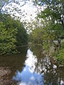
Second Fork
Larrys Creek -
Larrys Creek in Piatt Township -

Larrys Creek Railroad Bridge


| Name, bank[2][3] |
River Miles (km)[1] |
Watershed Area in square miles (km²)[1] |
Mouth Coordinates[1] |
Mouth Elevation in feet (m) |
Source Coordinates |
Source Elevation in feet (m) |
Remarks |
|---|---|---|---|---|---|---|---|
| Mouth | 0 mi (0 km) |
89.1 mi² (230.8 km²) |
41°13′00″N 77°13′13″W / 41.21667°N 77.22028°W | 515 ft (157 m)[4] |
See below | See below | Larrys Creek enters the West Branch Susquehanna River in Piatt Township at the hamlet of Larrys Creek. |
| Seeley Run, left bank |
1.82 mi (2.93 km) |
1.46 mi² (3.78 km²) |
41°14′26″N 77°12′56″W / 41.24056°N 77.21556°W | 554 ft (169 m) |
41°15′56″N 77°12′23″W / 41.26556°N 77.20639°W[5] | 1005 feet (306 m) |
Mouth at the village of Larryville in Piatt Township, source in Mifflin Township |
| Canoe Run, right bank |
2.82 mi (4.54 km) |
2.11 mi² (5.46 km²) |
41°14′50″N 77°13′35″W / 41.24722°N 77.22639°W | 577 ft (176 m) |
41°15′21″N 77°15′57″W / 41.25583°N 77.26583°W[6] | 928 feet (283 m) |
Entirely within Piatt Township |
| First Fork Larrys Creek*, right bank |
4.20 mi (6.76 km) |
17.60 mi² (45.58 km²) |
41°15′54″N 77°13′57″W / 41.26500°N 77.23250°W | 617 ft (188 m) |
41°22′14″N 77°17′45″W / 41.37056°N 77.29583°W[7] | 2,040 feet (622 m) |
Mouth just south of Salladasburg in Piatt Township, source in Cummings Township |
| Second Fork Larrys Creek*, right bank |
5.76 mi (9.27 km) |
24.90 mi² (64.49 km²) |
41°16′53″N 77°13′24″W / 41.28139°N 77.22333°W | 666 ft (203 m) |
41°24′34″N 77°13′19″W / 41.40944°N 77.22194°W[8] | 1,670 feet (509 m) |
Mouth in Salladasburg, source in Cogan House Township near the village of White Pine |
| Mash Run, right bank |
9.54 mi (15.35 km) |
1.19 mi² (3.08 km²) |
41°19′21″N 77°11′28″W / 41.32250°N 77.19111°W | 873 ft (266 m) |
41°19′03″N 77°12′56″W / 41.31750°N 77.21556°W[9] | 1,635 feet (498 m) |
Mouth in Anthony Township, source in Mifflin Township, just north of Harris Point |
| "Pond Hollow", left bank |
9.90 mi (15.93 km) |
0.40 mi² (1.04 km²) |
41°19′40″N 77°11′15″W / 41.32778°N 77.18750°W | 919 ft (260 m) |
41°20′08″N 77°10′35″W / 41.33556°N 77.17639°W[10] | 1,690 feet (515 m) |
Entirely in Anthony Township, on the west side of Coal Mountain |
| "Spook Hollow", right bank |
10.38 mi (16.70 km) |
0.77 mi² (1.99 km²) |
41°19′57″N 77°11′26″W / 41.33250°N 77.19056°W | 935 ft (285 m) |
41°20′24″N 77°12′47″W / 41.34000°N 77.21306°W[11] | 1,640 feet (500 m) |
Mouth in Anthony Township, source in Mifflin Township in Pennsylvania State Game Lands (SGL) No. 114 |
| Roaring Run, left bank |
10.40 mi (16.74 km) |
5.11 mi² (13.23 km²) |
41°20′01″N 77°11′22″W / 41.33361°N 77.18944°W | 937 ft (286 m) |
41°23′27″N 77°10′43″W / 41.39083°N 77.17861°W[12] | 1,795 feet (547 m) |
Mouth in Anthony Township, source in Cogan House Township, on the west side of Coal Mountain |
| "Cramer Hollow", right bank |
11.28 mi (18.15 km) |
0.37 mi² (0.96 km²) |
41°20′37″N 77°11′47″W / 41.34361°N 77.19639°W | 984 ft (300 m) |
41°20′32″N 77°12′55″W / 41.34222°N 77.21528°W[13] | 1,605 feet (489 m) |
Mouth in Anthony Township, source in Mifflin Township in SGL No. 114 |
| "Pot Lick Hollow", left bank |
11.56 mi (18.60 km) |
0.41 mi² (1.06 km²) |
41°20′51″N 77°11′49″W / 41.34750°N 77.19694°W | 1,027 ft (313 m) |
41°21′29″N 77°11′05″W / 41.35806°N 77.18472°W[14] | 1,700 feet (518 m) |
Mouth in Mifflin Township, source in Cogan House Township, entirely in SGL No. 114, on the west side of Coal Mountain |
| "Match Pine Hollow", right bank |
11.99 mi (19.30 km) |
0.22 mi² (0.57 km²) |
41°21′05″N 77°12′08″W / 41.35139°N 77.20222°W | 1,033 ft (315 m) |
41°21′19″N 77°12′55″W / 41.35528°N 77.21528°W[15] | 1,680 feet (514 m) |
Entirely in Mifflin Township, mouth in SGL No. 114, on the west side of Coal Mountain |
| "Watt Hollow", left bank |
12.34 mi (19.86 km) |
0.40 mi² (1.04 km²) |
41°21′22″N 77°12′13″W / 41.35611°N 77.20361°W | 1,083 ft (330 m) |
41°22′08″N 77°11′31″W / 41.36889°N 77.19194°W[16] | 1,770 feet (539 m) |
Mouth at the border of Mifflin and Cogan House Townships, source in Cogan House Township, mouth in SGL No. 114 |
| Long Run, right bank |
12.58 mi (20.25 km) |
1.85 mi² (4.79 km²) |
41°21′33″N 77°12′20″W / 41.35917°N 77.20556°W | 1,122 ft (342 m) |
41°22′51″N 77°13′02″W / 41.38083°N 77.21722°W[17] | 1,885 feet (575 m) |
Entirely in Cogan House Township |
| Wendell Run*, right bank |
16.20 mi (26.07 km) |
2.89 mi² (7.49 km²) |
41°24′14″N 77°11′40″W / 41.40389°N 77.19444°W | 1,283 ft (391 m) |
41°26′13″N 77°11′47″W / 41.43694°N 77.19639°W[18] | 1,525 feet (465 m) |
Entirely in Cogan House Township, mouth just upstream of Cogan House Covered Bridge |
| Crayton Hollow Run, left bank |
16.88 mi (27.17 km) |
0.38 mi² (0.98 km²) |
41°24′37″N 77°11′14″W / 41.41028°N 77.18722°W | 1,322 ft (403 m) |
41°24′02″N 77°10′40″W / 41.40056°N 77.17778°W[19] | 1,780 feet (543 m) |
Entirely in Cogan House Township, on the north side of Buckhorn Mountain |
| Wolf Run, right bank |
17.96 mi (28.90 km) |
2.22 mi² (5.75 km²) |
41°24′52″N 77°10′24″W / 41.41444°N 77.17333°W | 1,352 ft (412 m) |
41°27′07″N 77°10′36″W / 41.45194°N 77.17667°W[20] | 1,635 feet (498 m) |
Entirely in Cogan House Township |
| Dibber Hollow Run, left bank |
18.42 mi (29.64 km) |
0.33 mi² (0.85 km²) |
41°24′59″N 77°10′01″W / 41.41639°N 77.16694°W | 1,358 ft (414 m) |
41°24′24″N 77°09′43″W / 41.40667°N 77.16194°W[21] | 1,740 feet (530 m) |
Entirely in Cogan House Township, on the north side of Green and Buckhorn Mountains, with the mouth just downstream of village of Cogan House |
| Birch Run, left bank |
19.15 mi (30.82 km) |
0.74 mi² (1.92 km²) |
41°25′16″N 77°09′15″W / 41.42111°N 77.15417°W | 1,394 ft (425 m) |
41°24′18″N 77°09′04″W / 41.40500°N 77.15111°W[22] | 1,770 feet (539 m) |
Entirely in Cogan House Township, on the north side of Green Mountain with the mouth just upstream of the village of Cogan House |
| Source | 22.9 mi (36.9 km) |
0 mi² (0 km²) |
See above | See above | 41°27′13″N 77°08′12″W / 41.45361°N 77.13667°W | 1,740 ft (530 m)[4] |
The source of Larrys Creek is in Cogan House Township, just south of the hamlet of Steam Valley. |
Wendell Run, itself a tributary of Larrys Creek, has one named tributary: Buck Run.
| Buck Run, left bank (of Wendell Run) |
1.40 mi (2.25 km) |
0.45 mi² (1.17 km²) |
41°25′26″N 77°11′55″W / 41.42389°N 77.19861°W | 1,411 ft (430 m) |
41°25′55″N 77°11′12″W / 41.43194°N 77.18667°W[23] | 1600 feet (488 m) |
Entirely in Cogan House Township |
First Fork tributaries
The First Fork is the second largest tributary and has its source in Cummings Township. It flows south-southeast into Mifflin Township, where it joins Larrys Creek just south of Salladasburg, 4.2 miles (6.8 km) from the mouth. Much of the First Fork is protected as part of the Ogontz Lodge, a private hunting and fishing club. The four largest tributaries are: Tarkiln Run with a watershed of 2.71 square miles (7.02 km²) or 15.4% of the First Fork watershed; Mud Run with 2.22 square miles (5.75 km² or 12.6%); Dog Run with 1.82 square miles (4.71 km² or 10.3%); and Marsh Run with 0.96 square miles (2.49 km² or 5.5%). All other tributaries are less than 5%.[1]
| Name, bank |
River Miles (km) |
Watershed Area in square miles (km²) |
Mouth Coordinates |
Mouth Elevation in feet (m) |
Source Coordinates |
Source Elevation in feet (m) |
Remarks |
|---|---|---|---|---|---|---|---|
| Mouth | 0 mi (0 km) |
17.60 mi² (45.58 km²) |
41°15′54″N 77°13′57″W / 41.26500°N 77.23250°W | 617 ft (188 m)[7] |
See below | See below | The First Fork enters Larrys Creek just south of Salladasburg in Piatt Township. |
| Mud Run, right bank |
0.32 mi (0.51 km) |
2.22 mi² (5.75 km²) |
41°16′01″N 77°14′12″W / 41.26694°N 77.23667°W | 643 ft (196 m) |
41°16′22″N 77°16′47″W / 41.27278°N 77.27972°W[24] | 1,000 feet (305 m) |
Entirely in Mifflin Township |
| Tarkiln Run*, right bank |
2.82 mi (4.54 km) |
2.71 mi² (7.02 km²) |
41°16′52″N 77°16′20″W / 41.28111°N 77.27222°W | 827 ft (252 m) |
41°18′12″N 77°18′26″W / 41.30333°N 77.30722°W[25] | 1,785 feet (544 m) |
Mouth in Mifflin Township, source in Cummings Township, starts on the west side of Fishery Point |
| Marsh Run, left bank |
3.88 mi (6.24 km) |
0.96 mi² (2.49 km²) |
41°17′41″N 77°16′03″W / 41.29472°N 77.26750°W | 948 ft (289 m) |
41°18′38″N 77°15′40″W / 41.31056°N 77.26111°W[26] | 1,775 feet (541 m) |
Entirely in Mifflin Township, on the west side of Puterbaugh Mountain |
| Buckhorn Run, left bank |
4.80 mi (7.72 km) |
0.80 mi² (2.07 km²) |
41°18′17″N 77°16′33″W / 41.30472°N 77.27583°W | 1,066 ft (325 m) |
41°19′13″N 77°16′08″W / 41.32028°N 77.26889°W[27] | 1,635 feet (498 m) |
Entirely in Cummings Township, on the west side of Puterbaugh Mountain |
| "Pond Lick Cove", right bank |
5.16 mi (8.30 km) |
0.21 mi² (0.54 km²) |
41°18′27″N 77°16′50″W / 41.30750°N 77.28056°W | 1,119 ft (341 m) |
41°18′36″N 77°17′43″W / 41.31000°N 77.29528°W[28] | 1,810 feet (552 m) |
Entirely in Cummings Township |
| Dog Run*, left bank |
5.88 mi (9.46 km) |
1.82 mi² (4.71 km²) |
41°19′00″N 77°17′07″W / 41.31667°N 77.28528°W | 1,220 ft (372 m) |
41°20′34″N 77°16′47″W / 41.34278°N 77.27972°W[29] | 1,675 feet (511 m) |
Entirely in Cummings Township, on the west side of Puterbaugh Mountain |
| "Hickory Swale", right bank |
6.30 mi (10.14 km) |
0.45 mi² (1.17 km²) |
41°19′08″N 77°17′32″W / 41.31889°N 77.29222°W | 1,309 ft (399 m) |
41°18′58″N 77°18′35″W / 41.31611°N 77.30972°W[30] | 1,925 feet (587 m) |
Entirely in Cummings Township |
| "Jacobs Hollow", left bank |
7.00 mi (11.27 km) |
0.34 mi² (0.88 km²) |
41°19′40″N 77°17′57″W / 41.32778°N 77.29917°W | 1,430 ft (436 m) |
41°20′07″N 77°17′28″W / 41.33528°N 77.29111°W[31] | 1,760 feet (536 m) |
Entirely in Cummings Township, just south of Little Round Top |
| Source | ca. 9.7 mi (15.6 km) |
0 mi² (0 km²) |
See above | See above | 41°22′14″N 77°17′45″W / 41.37056°N 77.29583°W[7] | 2,040 feet (622 m) |
The source of the First Fork is in Cummings Township, north of Cummings Spring and Little Round Top. |
There are two named tributaries of the First Fork which have their own named tributary: Tarkiln Run has Ritter Run; and Dog Run has Little Dog Run.
| Ritter Run, right bank (of Tarkiln Run) |
0.74 mi (1.19 km) |
1.17 mi² (3.03 km²) |
41°16′59″N 77°17′02″W / 41.28306°N 77.28389°W | 984 ft (300 m) |
41°17′53″N 77°18′19″W / 41.29806°N 77.30528°W[32] | 1700 feet (518 m) |
Entirely in Cummings Township |
| Little Dog Run, left bank (of Dog Run) |
0.28 mi (0.45 km) |
0.63 mi² (1.63 km²) |
41°19′12″N 77°16′57″W / 41.32000°N 77.28250°W | 1,293 ft (394 m) |
41°19′57″N 77°16′23″W / 41.33250°N 77.27306°W[33] | 1810 feet (552 m) |
Entirely in Cummings Township, on the west side of Puterbaugh Mountain |
Second Fork tributaries
The Second Fork is the largest tributary and rises in Cogan House Township near the village of White Pine. It runs south through the village of Brookside, then a few miles through Cummings Township, and last through Mifflin Township and Salladasburg, where it joins Larrys Creek 5.8 miles (9.3 km) from the mouth. Pennsylvania Route 287 follows the Second Fork for its entire length and over 6000 acres (2,430 ha) along it belongs to the private "Larrys Creek Fish and Game Club". The three largest tributaries are: Lawshe Run with a watershed of 3.39 square miles (8.78 km²) or 13.6% of the Second Fork watershed; Funston Run with 2.50 square miles (6.48 km² or 10.0%); and Little Harbor Run with 2.14 square miles (5.54 km² or 8.6%). All other tributaries are less than 5%.[1]
| Name, bank |
River Miles (km) |
Watershed Area in square miles (km²) |
Mouth Coordinates |
Mouth Elevation in feet (m) |
Source Coordinates |
Source Elevation in feet (m) |
Remarks |
|---|---|---|---|---|---|---|---|
| Second Fork Larrys Creek, right bank |
5.76 mi (9.27 km) |
24.90 mi² (64.49 km²) |
41°16′53″N 77°13′24″W / 41.28139°N 77.22333°W | 666 ft (203 m)[8] |
See below | See below | The Second Fork enters Larrys Creek in the borough of Salladasburg. |
| Joes Run, right bank |
0.68 mi (1.09 km) |
0.86 mi² (2.23 km²) |
41°17′18″N 77°13′49″W / 41.28833°N 77.23028°W | 702 ft (214 m) |
41°18′00″N 77°14′59″W / 41.30000°N 77.24972°W[34] | 1,480 feet (451 m) |
Entirely in Mifflin Township, mouth is just north of Salladasburg, starts on the south side of Puterbaugh Mountain |
| "Kline Hollow", right bank |
2.54 mi (4.09 km) |
0.55 mi² (1.42 km²) |
41°18′46″N 77°14′06″W / 41.31278°N 77.23500°W | 830 ft (253 m) |
41°18′51″N 77°14′58″W / 41.31417°N 77.24944°W[35] | 1,600 feet (488 m) |
Entirely in Mifflin Township, on the east side of Puterbaugh Mountain |
| Little Harbor Run*, left bank |
3.22 mi (5.18 km) |
2.14 mi² (5.54 km²) |
41°19′13″N 77°14′12″W / 41.32028°N 77.23667°W | 873 ft (266 m) |
41°21′00″N 77°13′02″W / 41.35000°N 77.21722°W[36] | 1,500 feet (457 m) |
Entirely in Mifflin Township, north of Clapp Point[37] |
| Harbor Run, right bank |
3.54 mi (5.70 km) |
0.60 mi² (1.55 km²) |
41°19′24″N 77°14′27″W / 41.32333°N 77.24083°W | 896 ft (273 m) |
41°19′20″N 77°15′59″W / 41.32222°N 77.26639°W[38] | 1,645 feet (501 m) |
Mouth in Mifflin Township, source in Cummings Township, on the east side of Puterbaugh Mountain |
| "De France Hollow", left bank |
5.42 mi (8.72 km) |
0.76 mi² (1.97 km²) |
41°20′53″N 77°14′49″W / 41.34806°N 77.24694°W | 1,050 ft (320 m) |
41°21′30″N 77°13′36″W / 41.35833°N 77.22667°W[39] | 1,685 feet (514 m) |
Mouth in Cummings Township, part in Mifflin Township, source in Cogan House Township |
| Funston Run*, right bank |
5.52 mi (8.88 km) |
2.50 mi² (6.48 km²) |
41°20′55″N 77°14′54″W / 41.34861°N 77.24833°W | 1,053 ft (321 m) |
41°21′05″N 77°15′37″W / 41.35139°N 77.26028°W[40] | 1,184 feet (361 m) |
Entirely in Cummings Township, north of Henson Ridge; a variant name is Francis Run |
| "Cold Spring Hollow", left bank |
5.94 mi (9.56 km) |
0.67 mi² (1.74 km²) |
41°21′14″N 77°15′02″W / 41.35389°N 77.25056°W | 1,099 ft (335 m) |
41°21′48″N 77°13′52″W / 41.36333°N 77.23111°W[41] | 1,680 feet (512 m) |
Mouth in Cummings Township, source in Cogan House Township |
| Lawshe Run*, right bank |
6.58 mi (10.59 km) |
3.39 mi² (8.78 km²) |
41°21′43″N 77°15′10″W / 41.36194°N 77.25278°W | 1,112 ft (339 m) |
41°23′38″N 77°17′09″W / 41.39389°N 77.28583°W[42] | 1,675 feet (511 m) |
Mouth and source in Cogan House Township, part in Cummings Township |
| "Thompson Hollow", left bank |
7.04 mi (11.33 km) |
0.55 mi² (1.42 km²) |
41°22′07″N 77°15′11″W / 41.36861°N 77.25306°W | 1,178 ft (359 m) |
41°22′04″N 77°14′07″W / 41.36778°N 77.23528°W[43] | 1,795 feet (547 m) |
Entirely in Cogan House Township |
| Source | 4.20 mi (6.76 km) |
0 mi² (0 km²) |
See above | See above | 41°24′34″N 77°13′19″W / 41.40944°N 77.22194°W[8] | 1,670 feet (509 m) |
The source of the Second Fork is in Cogan House Township south of the village of White Pine. |
There are four named tributaries of the Second Fork which have their own named tributaries: Funston Run is formed by the confluence of Right Fork Funston Run with Left Fork Funston Run; Little Harbor Run has "Little Sandy Hollow"; and Lawshe Run has "Bear Hollow".
| Right Fork Funston Run, right bank |
0.72 mi (1.16 km) |
1.00 mi² (2.59 km²) |
41°21′05″N 77°15′37″W / 41.35139°N 77.26028°W | 1,184 ft (361 m) |
41°22′01″N 77°16′52″W / 41.36694°N 77.28111°W[44] | 1910 feet (582 m) |
Entirely in Cummings Township, north of Henson Ridge |
| Left Fork Funston Run, left bank |
0.72 mi (1.16 km) |
1.06 mi² (2.75 km²) |
41°21′05″N 77°15′37″W / 41.35139°N 77.26028°W | 1,184 ft (361 m) |
41°21′43″N 77°17′13″W / 41.36194°N 77.28694°W[45] | 1905 feet (581 m) |
Entirely in Cummings Township, north of Henson Ridge |
| "Little Sandy Hollow", left bank (of Little Harbor Run) |
0.06 mi (0.10 km) |
0.66 mi² (1.71 km²) |
41°19′18″N 77°14′12″W / 41.32167°N 77.23667°W | 915 ft (279 m) |
41°20′09″N 77°12′48″W / 41.33583°N 77.21333°W[46] | 1,610 feet (491 m) |
Entirely in Mifflin Township, source in Pennsylvania State Game Lands (SGL) No. 114, north of Clapp Point |
| "Bear Hollow", left bank (of Lawshe Run) |
1.42 mi (2.29 km) |
1.27 mi² (3.29 km²) |
41°22′33″N 77°16′16″W / 41.37583°N 77.27111°W | 1,296 ft (395 m) |
41°22′45″N 77°17′47″W / 41.37917°N 77.29639°W[47] | 2100 feet (640 m) |
Entirely in Cogan House Township |
See also
References
- ^ a b c d e f Pennsylvania Department of Environmental Protection (2001). Pennsylvania Gazetteer of Streams (PDF). Prepared in Cooperation with the United States Department of the Interior Geological Survey. Retrieved 2008-02-19.
{{cite book}}: Unknown parameter|coauthors=ignored (|author=suggested) (help) - ^ Pennsylvania Department of Transportation, Bureau of Planning and Research, Geographic Information Division. "2007 General Highway Map Lycoming County Pennsylvania" (PDF). Retrieved 2007-08-05.
{{cite news}}: CS1 maint: multiple names: authors list (link) - ^ Pennsylvania Department of Conservation and Natural Resources. "Tiadaghton State Forest Map" (PDF). Retrieved 2006-11-18.
- ^ a b Shaw, Lewis C. (June, 1984). Pennsylvania Gazetteer of Streams Part II (Water Resources Bulletin No. 16). Prepared in Cooperation with the United States Department of the Interior Geological Survey (1st Edition ed.). Harrisburg, PA: Commonwealth of Pennsylvania, Department of Environmental Resources.
{{cite book}}:|edition=has extra text (help); Check date values in:|date=(help) (no ISBN) - ^ ""Seeley Run"". Geographic Names Information System. United States Geological Survey. August 2, 1979. Retrieved 2007-10-18.
{{cite web}}: Check date values in:|date=(help) - ^ ""Canoe Run"". Geographic Names Information System. United States Geological Survey. August 2, 1979. Retrieved 2007-10-18.
{{cite web}}: Check date values in:|date=(help) - ^ a b c ""First Fork Larrys Creek"". Geographic Names Information System. United States Geological Survey. August 2, 1979. Retrieved 2007-10-29.
{{cite web}}: Check date values in:|date=(help) - ^ a b c ""Second Fork Larrys Creek"". Geographic Names Information System. United States Geological Survey. August 2, 1979. Retrieved 2007-10-29.
{{cite web}}: Check date values in:|date=(help) - ^ ""Mash Run"". Geographic Names Information System. United States Geological Survey. August 2, 1979. Retrieved 2007-10-29.
{{cite web}}: Check date values in:|date=(help) - ^ ""Pond Hollow"". Geographic Names Information System. United States Geological Survey. August 2, 1979. Retrieved 2007-10-29.
{{cite web}}: Check date values in:|date=(help) - ^ ""Spook Hollow"". Geographic Names Information System. United States Geological Survey. August 2, 1979. Retrieved 2007-10-29.
{{cite web}}: Check date values in:|date=(help) - ^ ""Roaring Run"". Geographic Names Information System. United States Geological Survey. August 2, 1979. Retrieved 2007-10-29.
{{cite web}}: Check date values in:|date=(help) - ^ ""Cramer Hollow"". Geographic Names Information System. United States Geological Survey. August 2, 1979. Retrieved 2007-10-29.
{{cite web}}: Check date values in:|date=(help) - ^ ""Pot Lick Hollow"". Geographic Names Information System. United States Geological Survey. August 2, 1979. Retrieved 2007-10-29.
{{cite web}}: Check date values in:|date=(help) - ^ ""Match Pine Hollow"". Geographic Names Information System. United States Geological Survey. August 2, 1979. Retrieved 2007-10-29.
{{cite web}}: Check date values in:|date=(help) - ^ ""Watt Hollow"". Geographic Names Information System. United States Geological Survey. August 2, 1979. Retrieved 2007-11-09.
{{cite web}}: Check date values in:|date=(help) - ^ ""Long Run"". Geographic Names Information System. United States Geological Survey. August 2, 1979. Retrieved 2007-11-09.
{{cite web}}: Check date values in:|date=(help) - ^ ""Wendell Run"". Geographic Names Information System. United States Geological Survey. August 2, 1979. Retrieved 2007-11-09.
{{cite web}}: Check date values in:|date=(help) - ^ ""Crayton Hollow Run"". Geographic Names Information System. United States Geological Survey. August 2, 1979. Retrieved 2007-11-09.
{{cite web}}: Check date values in:|date=(help) - ^ ""Wolf Run"". Geographic Names Information System. United States Geological Survey. August 2, 1979. Retrieved 2007-11-09.
{{cite web}}: Check date values in:|date=(help) - ^ ""Dibber Hollow Run"". Geographic Names Information System. United States Geological Survey. August 2, 1979. Retrieved 2007-11-09.
{{cite web}}: Check date values in:|date=(help) - ^ ""Birch Run"". Geographic Names Information System. United States Geological Survey. August 2, 1979. Retrieved 2007-11-09.
{{cite web}}: Check date values in:|date=(help) - ^ ""Buck Run"". Geographic Names Information System. United States Geological Survey. August 2, 1979. Retrieved 2008-03-04.
{{cite web}}: Check date values in:|date=(help) - ^ ""Mud Run"". Geographic Names Information System. United States Geological Survey. August 2, 1979. Retrieved 2008-03-04.
{{cite web}}: Check date values in:|date=(help) - ^ ""Tarkiln Run"". Geographic Names Information System. United States Geological Survey. August 2, 1979. Retrieved 2008-03-04.
{{cite web}}: Check date values in:|date=(help) - ^ ""Marsh Run"". Geographic Names Information System. United States Geological Survey. August 2, 1979. Retrieved 2008-03-04.
{{cite web}}: Check date values in:|date=(help) - ^ ""Buckhorn Run"". Geographic Names Information System. United States Geological Survey. August 2, 1979. Retrieved 2008-03-04.
{{cite web}}: Check date values in:|date=(help) - ^ ""Pond Lick Cove"". Geographic Names Information System. United States Geological Survey. August 2, 1979. Retrieved 2008-03-04.
{{cite web}}: Check date values in:|date=(help) Note: The Pennsylvania Gazetteer of Streams lists this as "Pond Lick Cove Run" (i.e. as a named stream). - ^ ""Dog Run"". Geographic Names Information System. United States Geological Survey. August 2, 1979. Retrieved 2008-03-04.
{{cite web}}: Check date values in:|date=(help) - ^ ""Hickory Swale"". Geographic Names Information System. United States Geological Survey. August 2, 1979. Retrieved 2008-03-04.
{{cite web}}: Check date values in:|date=(help) Note: The Pennsylvania Gazetteer of Streams lists this as a stream named "Hickory Swale" (not an unnamed stream in a named feature). - ^ ""Jacobs Hollow"". Geographic Names Information System. United States Geological Survey. August 2, 1979. Retrieved 2008-03-04.
{{cite web}}: Check date values in:|date=(help) - ^ ""Ritter Run"". Geographic Names Information System. United States Geological Survey. August 2, 1979. Retrieved 2008-03-04.
{{cite web}}: Check date values in:|date=(help) - ^ ""Little Dog Run"". Geographic Names Information System. United States Geological Survey. August 2, 1979. Retrieved 2008-03-04.
{{cite web}}: Check date values in:|date=(help) - ^ ""Joes Run"". Geographic Names Information System. United States Geological Survey. August 2, 1979. Retrieved 2008-03-04.
{{cite web}}: Check date values in:|date=(help) - ^ ""Kline Hollow"". Geographic Names Information System. United States Geological Survey. August 2, 1979. Retrieved 2008-03-04.
{{cite web}}: Check date values in:|date=(help) - ^ ""Little Harbor Run"". Geographic Names Information System. United States Geological Survey. August 2, 1979. Retrieved 2008-03-04.
{{cite web}}: Check date values in:|date=(help) - ^ Note: The USGS GNIS coordinates show "Little Sandy Hollow" as a tributary of Little Harbor Run, and the watershed areas in the Pennsylvania Gazetteer of Streams agree. The river miles do not agree, and appear to have been swapped for these two streams in the Gazetteer.
- ^ ""Harbor Run"". Geographic Names Information System. United States Geological Survey. August 2, 1979. Retrieved 2008-03-04.
{{cite web}}: Check date values in:|date=(help) - ^ ""De France Hollow"". Geographic Names Information System. United States Geological Survey. August 2, 1979. Retrieved 2008-03-04.
{{cite web}}: Check date values in:|date=(help) - ^ ""Funston Run"". Geographic Names Information System. United States Geological Survey. August 2, 1979. Retrieved 2008-03-04.
{{cite web}}: Check date values in:|date=(help) - ^ ""Cold Spring Hollow"". Geographic Names Information System. United States Geological Survey. August 2, 1979. Retrieved 2008-03-04.
{{cite web}}: Check date values in:|date=(help) - ^ ""Lawshe Run"". Geographic Names Information System. United States Geological Survey. August 2, 1979. Retrieved 2008-03-04.
{{cite web}}: Check date values in:|date=(help) - ^ ""Thompson Hollow"". Geographic Names Information System. United States Geological Survey. August 2, 1979. Retrieved 2008-03-04.
{{cite web}}: Check date values in:|date=(help) - ^ ""Right Fork Funston Run"". Geographic Names Information System. United States Geological Survey. August 2, 1979. Retrieved 2008-03-04.
{{cite web}}: Check date values in:|date=(help) - ^ ""Left Fork Funston Run"". Geographic Names Information System. United States Geological Survey. August 2, 1979. Retrieved 2008-03-04.
{{cite web}}: Check date values in:|date=(help) - ^ ""Little Sandy Hollow"". Geographic Names Information System. United States Geological Survey. August 2, 1979. Retrieved 2008-03-04.
{{cite web}}: Check date values in:|date=(help) - ^ ""Bear Hollow"". Geographic Names Information System. United States Geological Survey. August 2, 1979. Retrieved 2008-03-04.
{{cite web}}: Check date values in:|date=(help)
External links
- ""Watersheds of Lycoming County"". Map. County of Lycoming, Pennsylvania. Retrieved 2007-10-13.
- Lycoming County Economic Development and Planning Services, GIS Division (2005). "Lycoming County, Pennsylvania" (PDF). Map. Retrieved 2007-09-17. Note: Official Lycoming County Map showing cities, boroughs, townships, villages, county roads, rivers, and some streams
- ""Susquehanna River Basin Commission: A water management agency serving the Susquehanna River Watershed"". Susquehanna River Basin Commission. Retrieved 2007-10-13.


