
Torrington, Wyoming
Torrington | |
|---|---|
 Sign at western entrance to Torrington | |
| Country | United States |
| State | Wyoming |
| County | Goshen |
| Government | |
| • Mayor | Mike Varney |
| Area | |
| • Total | 4.62 sq mi (11.97 km2) |
| • Land | 4.62 sq mi (11.97 km2) |
| • Water | 0 sq mi (0 km2) |
| Elevation | 4,104 ft (1,251 m) |
| Population | |
| • Total | 6,501 |
| • Estimate (2011[3]) | 6,690 |
| • Density | 1,407.1/sq mi (543.3/km2) |
| Time zone | UTC-7 (Mountain (MST)) |
| • Summer (DST) | UTC-6 (MDT) |
| ZIP code | 82240 |
| Area code | 307 |
| FIPS code | 56-77530Template:GR |
| GNIS feature ID | 1595642Template:GR |
| Website | www.city-of-torrington.org |
Torrington is a city in, and the county seat of Goshen County, Wyoming, United States.Template:GR The population was 6,501 at the 2010 census. Torrington is the home of Eastern Wyoming College.
Former Wyoming Governor Stanley K. Hathaway (although he was born in Nebraska, and grew up near Huntley, Wyoming) resided and practiced law for many years in Torrington prior to being elected Governor, and he and his wife Roberta "Bobby" Hathaway are now interred there at Torrington's Valley View Cemetery.[4]
History
The city was founded by W.G. Curtis and named by him for his home town of Torrington, Connecticut.[5] Originally a watering and coaling station for the Chicago, Burlington & Quincy Railroad (CB&Q), the blossoming town soon became the main source of civilization for nearby residents. With a post office (established in 1889) and several businesses, it became a central area of trade for that region of Wyoming. The town site was surveyed April 21, 1900 by Ashland B. Smith of the Lincoln Land Company of Nebraska, and in June the land was sold to its residents for one dollar by the president of the real estate extension of the CB&Q. Torrington was incorporated in 1908. The town continued to grow. By 1910, Torrington had achieved a population of 155. The newspaper, The Torrington Telegraph, was established in 1911. The same year, Goshen County was organized. [6]
When Goshen County was created from part of the northern end of Laramie County in 1911, Torrington and Lingle competed for the title of county seat. Torrington was eventually selected after its residents were able to raise sufficient funds for a courthouse, which was constructed in 1913.
Geography and climate
Torrington is located at 42°4′0″N 104°10′57″W / 42.06667°N 104.18250°W (42.066542, -104.182471)Template:GR.
The city is situated on the North Platte River.
According to the United States Census Bureau, the city has a total area of 4.62 square miles (11.97 km2), all of it land.[1] Its elevation is 4104 feet, 1251 meters.
Torrington has a semi-arid climate (Köppen climate classification BSk).
| Climate data for Torrington | |||||||||||||
|---|---|---|---|---|---|---|---|---|---|---|---|---|---|
| Month | Jan | Feb | Mar | Apr | May | Jun | Jul | Aug | Sep | Oct | Nov | Dec | Year |
| Record high °F (°C) | 70 (21) |
75 (24) |
85 (29) |
91 (33) |
100 (38) |
105 (41) |
111 (44) |
105 (41) |
101 (38) |
92 (33) |
83 (28) |
77 (25) |
111 (44) |
| Mean daily maximum °F (°C) | 39.5 (4.2) |
45.0 (7.2) |
52.0 (11.1) |
61.2 (16.2) |
71.0 (21.7) |
82.4 (28.0) |
89.1 (31.7) |
87.3 (30.7) |
77.7 (25.4) |
65.4 (18.6) |
49.2 (9.6) |
41.0 (5.0) |
63.4 (17.5) |
| Daily mean °F (°C) | 24.9 (−3.9) |
30.0 (−1.1) |
37.5 (3.1) |
46.0 (7.8) |
56.2 (13.4) |
66.3 (19.1) |
72.3 (22.4) |
70.2 (21.2) |
59.8 (15.4) |
47.6 (8.7) |
34.0 (1.1) |
26.2 (−3.2) |
47.6 (8.7) |
| Mean daily minimum °F (°C) | 10.3 (−12.1) |
14.9 (−9.5) |
23.0 (−5.0) |
30.7 (−0.7) |
41.3 (5.2) |
50.2 (10.1) |
55.5 (13.1) |
53.1 (11.7) |
41.9 (5.5) |
29.7 (−1.3) |
18.8 (−7.3) |
11.3 (−11.5) |
31.7 (−0.2) |
| Record low °F (°C) | −39 (−39) |
−33 (−36) |
−26 (−32) |
−17 (−27) |
11 (−12) |
29 (−2) |
39 (4) |
32 (0) |
14 (−10) |
−9 (−23) |
−23 (−31) |
−43 (−42) |
−43 (−42) |
| Average precipitation inches (mm) | 0.31 (7.9) |
0.40 (10) |
0.70 (18) |
1.68 (43) |
2.54 (65) |
2.09 (53) |
1.78 (45) |
1.19 (30) |
1.27 (32) |
0.95 (24) |
0.57 (14) |
4.00 (102) |
17.48 (443.9) |
| Source 1: NOAA (normals, 1971–2000) [7] | |||||||||||||
| Source 2: The Weather Channel (Records) [8] | |||||||||||||
Demographics
| Census | Pop. | Note | %± |
|---|---|---|---|
| 1910 | 155 | — | |
| 1920 | 1,301 | 739.4% | |
| 1930 | 1,811 | 39.2% | |
| 1940 | 2,344 | 29.4% | |
| 1950 | 3,247 | 38.5% | |
| 1960 | 4,188 | 29.0% | |
| 1970 | 4,237 | 1.2% | |
| 1980 | 5,441 | 28.4% | |
| 1990 | 5,651 | 3.9% | |
| 2000 | 5,776 | 2.2% | |
| 2010 | 6,501 | 12.6% | |
2010 census
As of the census[2] of 2010, there were 6,501 people, 2,527 households, and 1,506 families residing in the city. The population density was 1,407.1 inhabitants per square mile (543.3/km2). There were 2,717 housing units at an average density of 588.1 per square mile (227.1/km2). The racial makeup of the city was 93.2% White, 1.0% African American, 0.9% Native American, 0.5% Asian, 0.2% Pacific Islander, 3.0% from other races, and 1.3% from two or more races. Hispanic or Latino of any race were 11.3% of the population.
There were 2,527 households out of which 26.0% had children under the age of 18 living with them, 44.8% were married couples living together, 10.2% had a female householder with no husband present, 4.6% had a male householder with no wife present, and 40.4% were non-families. 34.5% of all households were made up of individuals and 16.1% had someone living alone who was 65 years of age or older. The average household size was 2.21 and the average family size was 2.83.
The median age in the city was 41.4 years. 19.8% of residents were under the age of 18; 11.1% were between the ages of 18 and 24; 23.2% were from 25 to 44; 26.8% were from 45 to 64; and 19.3% were 65 years of age or older. The gender makeup of the city was 52.5% male and 47.5% female.
2000 census
As of the censusTemplate:GR of 2000, there were 5,776 people, 2,436 households, and 1,522 families residing in the city. The population density was 1,617.4 people per square mile (624.7/km²). There were 2,644 housing units at an average density of 740.4 per square mile (286.0/km²). The racial makeup of the city was 93.49% White, 0.31% African American, 0.90% Native American, 0.29% Asian, 0.10% Pacific Islander, 3.65% from other races, and 1.25% from two or more races. Hispanic or Latino of any race were 9.47% of the population.
There were 2,436 households out of which 26.7% had children under the age of 18 living with them, 49.9% were married couples living together, 9.9% had a female householder with no husband present, and 37.5% were non-families. 32.3% of all households were made up of individuals and 17.3% had someone living alone who was 65 years of age or older. The average household size was 2.26 and the average family size was 2.86.
In the city the population was spread out with 23.3% under the age of 18, 9.6% from 18 to 24, 23.1% from 25 to 44, 22.9% from 45 to 64, and 21.0% who were 65 years of age or older. The median age was 41 years. For every 100 females there were 93.0 males. For every 100 females age 18 and over, there were 87.1 males.
The median income for a household in the city was $30,136, and the median income for a family was $40,750. Males had a median income of $31,058 versus $20,101 for females. The per capita income for the city was $16,026. About 9.3% of families and 13.3% of the population were below the poverty line, including 16.0% of those under age 18 and 11.3% of those age 65 or over.
Government and infrastructure
The United States Postal Service operates the Torrington Post Office.[10]
The Wyoming Department of Corrections Wyoming Medium Correctional Institution is located in Torrington.[11][12][13] WMCI, a facility of the Wyoming Department of Corrections, serves as an intake center for men who are not sentenced to death. The grand opening and ribbon cutting occurred on January 6, 2010.[14]
Education
Public education in the city of Torrington is provided by Goshen County School District #1. Zoned campuses include Lincoln Elementary School (grades K-2), Trail Elementary School (grades 3-5), Torrington Middle School (grades 6-8), Torrington High School (grades 9-12).
Other towns and communities included in the consolidated Goshen County School District include Lingle, LaGrange, Huntley, and Yoder, among others.
Notable people
- Stanley K. Hathaway - 27th Governor of Wyoming, 1967–1975; 40th U.S. Secretary of the Interior, 1975.
- Delores Jean Flury - Mrs. Wyoming, 1949[15]
- Lexie Madden - Miss Wyoming, 2012.
References
- ^ a b "US Gazetteer files 2010". United States Census Bureau. Retrieved 2012-12-14.
{{cite web}}: External link in|publisher= - ^ a b "American FactFinder". United States Census Bureau. Retrieved 2012-12-14.
{{cite web}}: External link in|publisher= - ^ "Population Estimates". United States Census Bureau. Retrieved 2013-01-04.
{{cite web}}: External link in|publisher= - ^ Sally Vanderpoel, "Stan Hathaway: A Biography", ISBN 0-9742860-1-X, Jan. 2003. [1]
- ^ http://www.wyomingtalesandtrails.com/torrington.html
- ^ http://www.wyomingtalesandtrails.com/torrington.html
- ^ "Climatography of the United States NO.81" (PDF). National Oceanic and Atmospheric Administration. Retrieved January 13, 2011.
- ^ "Monthly Averages for Torrington, WY". The Weather Channel. Retrieved January 13, 2011.
- ^ "Climate Data Online Extremes Products". National Oceanic and Atmospheric Administration. Retrieved June 3, 2012.
- ^ "Post Office Location - TORRINGTON." U.S. Census Bureau. Retrieved on December 12, 2010.
- ^ "Torrington city, Wyoming." U.S. Census Bureau. Retrieved on December 12, 2010.
- ^ "Wyoming Medium Correctional Institution (WMCI)." Goshen County GIS Department. 2009. Retrieved on December 12, 2010.
- ^ "Contact Institutions." Wyoming Department of Corrections. Retrieved on August 22, 2010. "7076 Road 55F Torrington, WY 82240"
- ^ "Wyoming Medium Correctional Institution." Wyoming Department of Corrections. Retrieved on August 22, 2010.
- ^ "The Denver Post", "Mrs. Delores Jean Flury, 27, from Torrington, Wyo., Chosen as 'Mrs. Wyoming of 1949'; Will Compete in Mrs. America Contest in Asbury Park, N.J." - Sept. 5, 1949.
External links
Municipalities and communities of Goshen County, Wyoming, United States | ||
|---|---|---|
| City | 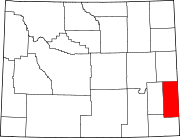 | |
| Towns | ||
| CDPs | ||
| Unincorporated community | ||