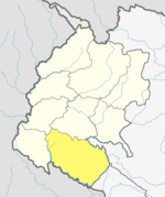
Bardagoriya Rural Municipality
This article possibly contains original research. (March 2019) |
This article needs additional citations for verification. (March 2019) |
Bardagoriya Rural Municipality
बर्गगोरिया | |
|---|---|
| Lua error in Module:Location_map at line 526: Unable to find the specified location map definition: "Module:Location map/data/Nepal Sudurpashchim Pradesh" does not exist. | |
| Coordinates: 28°39′N 81°02′E / 28.65°N 81.04°E | |
| Country | |
| Province | Sudurpashchim Pradesh |
| District | Kailali District |
| Government | |
| • Chairman | Baliram Chaudhary (Nepali Congress) |
| • Vice-Chairman | Bhagwati Chaudhary ( Nepal Communist Party (Maoist) |
| Area | |
| • Total | 77.3 km2 (29.8 sq mi) |
| Population (2011) | |
| • Total | 32,683 |
| • Density | 420/km2 (1,100/sq mi) |
| Time zone | UTC+5:45 (NST) |
| Post code | 10900 |
| Area code | 091 |
| Website | http://bardgoriyamun.gov.np |
Bardagoriya is a rural municipality in Kailali District of Nepal.[1] Bardagoriya Rural Municipality lies 65 km east of Dhangadhi and 605 km west of the capital, Kathmandu. It is surrounded by Ghodaghodi Municipality to the west, Lamki Chuha Municipality to the east, Joshipur Rural Municipality to the south and Mohanyal to the north. Bauniya Bazar is its largest market.
Public Services
Bardagoriya Rural Municipality is connected to the Mahendra Highway, which is the longest highway of Nepal, where transport includes auto rickshaws, public minibuses and public city buses. Karnali River Yatayat and Sudurpachim Yatayat provides regular bus services provides regular service in Kailali District.
Bardagoriya Rural Municipality has many private and government schools and high schools.
Land Seizure
On July 31, 2019, 43 bigha and 17 kathha (roughly 297,000 m²) of land was seized by the revolutionary Communist Party of Nepal under the name of Tharuwan Autonomous Province Bardagoriya People’s Council Nepal.[2]
See also
References
- ^ "Eastern parts of Kailali inundated". The Himalayan Times. Retrieved August 13, 2017.
- ^ "CPN cadres seize land". The Himalayan Times. August 1, 2019. Retrieved October 11, 2019.

