Chanistsqali
Appearance
| Chanistsqali | |
|---|---|
 Chanistsqali | |
| Native name | ჭანისწყალი (Georgian) |
| Location | |
| Country | Georgia |
| Physical characteristics | |
| Mouth | Khobi |
• coordinates | 42°21′55″N 41°54′49″E / 42.3653°N 41.9135°E |
| Length | 63 km (39 mi) |
| Basin size | 315 km2 (122 sq mi) |
| Basin features | |
| Progression | Khobi→ Black Sea |
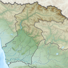
The Chanistsqali (Georgian: ჭანისწყალი) also spelled as Chanistskali[1] is a river in the historic Mengrelia province of Samegrelo-Zemo Svaneti in western Georgia. It flows through the town Tsalenjikha, and passes through the municipalities Tsalenjikha, Chkhorotsqu, Zugdidi and Khobi. It discharges into the river Khobi near the village Narazeni, north of the town Khobi.
References
[edit]Wikimedia Commons has media related to Chanistskali.
- ^ Tielidze L., Gobejishvili R., Maruashvili L., Chikhradze N. Western Georgia (Kolkheti) Intermountain Plain In: Tielidze L. (eds) Geomorphology of Georgia. Geography of the Physical Environment. 2019 Springer, Cham. ISBN 978-3-319-77763-4 https://doi.org/10.1007/978-3-319-77764-1_11


