Hever, Kent
| Hever | |
|---|---|
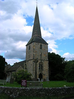
 St Peter's Hever, the parish church | |
Location within Kent | |
| Population | 1,231 (2011)[1] |
| OS grid reference | TQ4744 |
| Civil parish |
|
| District | |
| Shire county | |
| Region | |
| Country | England |
| Sovereign state | United Kingdom |
| Post town | Edenbridge |
| Postcode district | TN8 |
| Dialling code | 01732 |
| Police | Kent |
| Fire | Kent |
| Ambulance | South East Coast |
| UK Parliament | |
Hever village is a village and civil parish in the Sevenoaks District of Kent, England. The parish is located on the River Eden, a tributary of the River Medway, east of Edenbridge. It is 5 miles (8 km) by 1-mile (1.6 km) in extent, and 3,062 acres (12.39 km2) in area. The parish includes the villages of Four Elms, Hever itself, and Markbeech, and has a population of 1,136,[2] increasing to 1,231 at the 2011 Census.[1]
The place-name 'Hever' may come from 'Heanyfre', meaning 'high edge',[3] which is attested in Saxon charter S175 of 814, referring to an altogether different place.
Hever contains Hever Castle, the childhood home of Anne Boleyn, second wife of King Henry VIII.
There are three parish churches, one at each village. All are one united benefice. In the parish church of St Peter is the tomb of Thomas Boleyn, the father of Anne Boleyn and grandfather of Queen Elizabeth I.
Hever railway station is 1.2 miles (1.9 km) west of the village by total road distance. It is on the Oxted line between Uckfield and Oxted, with services often continuing to London Bridge.
References
- ^ a b "Civil Parish population 2011". Neighbourhood Statistics. Office for National Statistics. Retrieved 18 September 2016.
- ^ Office for National Statistics : Census 2001 : Parish headcounts : Sevenoaks Retrieved 15 November 2009
- ^ Eilert Ekwall, Concise Oxford Dictionary of English Place-names, p.237.
External links


