Bam Airport
Appearance
Bam Airport | |||||||||||
|---|---|---|---|---|---|---|---|---|---|---|---|
| Summary | |||||||||||
| Owner | Government of Iran | ||||||||||
| Operator | Iran Airports Company | ||||||||||
| Location | Bam, Iran | ||||||||||
| Elevation AMSL | 3,231 ft / 985 m | ||||||||||
| Coordinates | 29°05′03.01″N 58°27′00.15″E / 29.0841694°N 58.4500417°E | ||||||||||
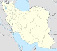
| Map | |||||||||||
 | |||||||||||
| Runways | |||||||||||
| |||||||||||
Source: World Aero Data[1] | |||||||||||
Bam Airport is an airport to the east of Bam, Iran (IATA: BXR, ICAO: OIKM).[2]
Airlines and destinations
| Airlines | Destinations |
|---|---|
| Mahan Air | Tehran–Mehrabad |
| Qeshm Air | Tehran–Mehrabad |
References
- ^ "Archived copy". Archived from the original on 2007-11-11. Retrieved 2007-09-26.
{{cite web}}: CS1 maint: archived copy as title (link) - ^ "List of all airports in Iran". The Airport Authority. Retrieved 2019-01-02.

