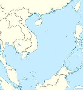
Whitsun Reef
| Disputed reef | |
|---|---|
 Whitsun Reef in 2011. Sand banks along the north shore are visible. | |
| Other names | Whitson Reef Whitsum Reef Julian Felipe Reef (Philippine English) Bahura ng Julian Felipe (Filipino) 牛轭礁 Niú è jiāo (Chinese) Đá Ba Đầu (Vietnamese) |
| Geography | |
| Location | South China Sea |
| Coordinates | 9°59′38″N 114°39′27″E / 9.99389°N 114.65750°E |
| Claimed by | |
Whitsun Reef, also known as Whitson Reef, Whitsum Reef, and Julian Felipe Reef (Tagalog: Bahura ng Julian Felipe; Mandarin Chinese: 牛轭礁; pinyin: Niú è jiāo; Vietnamese: Đá Ba Đầu), is a reef at the northeast extreme limit of the Union Banks in the Spratly Islands of the South China Sea. It is the largest reef of the Union Banks.[1]
Topography
The reef is V-shaped with an area of about 10 km2 (3.9 sq mi).[1] Until at least the 1990s,[2] it was above the water only during low tide; at other times the reef could be detected by the pattern of breaking waves.[3] At the end of the 20th century, small sand dunes had developed on the reef making a territorial claim possible (an International Court of Justice judgment in 2012 stated that “low-tide elevations cannot be appropriated").[4] The development of the dunes could have occurred naturally, but it was rumoured that the island was being built up by Vietnam and China.[2]
Territorial disputes
As of 2016, the reef was unclaimed; reports to the contrary (Chinese control) were based on a confusion.[4] However, due to the reef's strategic importance it was expected that the reef would be occupied "soon".[2]
On 21 March 2021, about 220 Chinese fishing ships were moored at the reef[5] ostensibly taking shelter due to the sea conditions.[6] The Philippines considers the reef to be within its exclusive economic zone and continental shelf and protested the Chinese presence.[6] Vietnam, which also claims the reef, also protested against Chinese presence in the area.[7]
See also
References
- ^ a b Hancox, David; Prescott, Victor (1995). A Geographical Description of the Spratly Islands and an Account of Hydrographic Surveys amongst Those Islands. Maritime Briefings. Vol. 1. University of Durham, International Boundaries Research Unit. p. 11. ISBN 978-1897643181.
{{cite book}}: CS1 maint: multiple names: authors list (link) - ^ a b c Khan, Asif; Ullah, Maseeh (2018). "South China Sea Dispute Under Law of Sea" (PDF). SSRN (3239127).
- ^ Sailing Directions 161 (Enroute) - South China Sea and the Gulf of Thailand (13 ed.). Bethesda, Maryland: National Geospatial-Intelligence Agency. 2011. p. 11.
- ^ a b Vuving, Alexander L (May 6, 2016). "South China Sea: Who Occupies What in the Spratlys?". The Diplomat.
- ^ Philippine Defense Chief Asks Chinese Flotilla to Leave Reef // Associated Press, March 21, 2021.
- ^ a b Newman, Scott (22 March 2021). "Philippines Calls On China To Remove Massive Fishing Fleet At Disputed Reef". NPR. Retrieved 23 March 2021.
- ^ "Vietnam Joins Opposition to Chinese Activity Near Disputed Sea Reef". Voice of America. 7 April 2021. Retrieved 7 April 2021.
External links
- Our World Flashpoint: South China Sea, BBC, film documentary, July 2015.
- Whitsun Reef (Union Reefs)

