Kashmar County
Kashmar County
Persian: شهرستان کاشمر | |
|---|---|
County | |
 Emamzadeh Hamzah | |
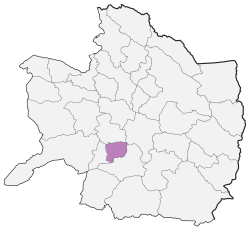
 Location of Kashmar County in Razavi Khorasan province | |
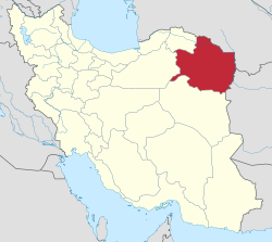
 Location of Razavi Khorasan province in Iran | |
| Coordinates: 35°12′N 58°34′E / 35.200°N 58.567°E[1] | |
| Country | |
| Province | Razavi Khorasan |
| Capital | Kashmar |
| Districts | Central, Farah Dasht |
| Area | |
| • Total | 1,152 km2 (445 sq mi) |
| Population (2016)[2] | |
| • Total | 168,664 |
| • Density | 150/km2 (380/sq mi) |
| Time zone | UTC+3:30 (IRST) |
| Kashmar County at GEOnet Names Server | |
Kashmar County (Persian: شهرستان کاشمر, Ŝahrestāne Kāŝmar) is in Razavi Khorasan province, Iran. Its capital is the city of Kashmar.[3]
At the 2006 census, the county's population was 146,536 in 39,554 households.[4] The following census in 2011 counted 157,149 people in 46,726 households.[5] At the 2016 census, the county's population was 168,664 in 52,778 households.[2]
Administrative divisions
The population history of Kashmar County's administrative divisions over three consecutive censuses is shown in the following table. The latest census shows two districts, five rural districts, and two cities.[2]
In 2018, Qaleh-ye Bala Rural District and Rezqabad Rural District were established in the newly formed Farah Dasht District. In addition, Kuhsorkh District was separated from the county in the establishment of Kuhsorkh County.[6] The villages of Farg and Qaleh-ye Bala were merged to form the new city of Farg Qaleh.[7]
| Administrative Divisions | 2006[4] | 2011[5] | 2016[2] |
|---|---|---|---|
| Central District | 119,507 | 130,891 | 143,650 |
| Bala Velayat RD | 26,581 | 28,188 | 28,610 |
| Pain Velayat RD | 11,399 | 12,503 | 12,758 |
| Kashmar (city) | 81,527 | 90,200 | 102,282 |
| Farah Dasht District1 | |||
| Qaleh-ye Bala RD1 | |||
| Rezqabad RD1 | |||
| Farg Qaleh (city)2 | |||
| Kuhsorkh District3 | 27,029 | 26,258 | 25,014 |
| Barkuh RD | 11,963 | 11,692 | 11,357 |
| Barrud RD | 4,684 | 3,947 | 3,586 |
| Takab RD | 5,772 | 4,857 | 4,384 |
| Rivash (city) | 4,610 | 5,762 | 5,687 |
| Total | 146,536 | 157,149 | 168,664 |
| RD: Rural District 1Established after the 2016 census[6] 2Became a city after the 2016 census[7] 3Became a part of Kuhsorkh County after the 2016 census[6] | |||
References
- ^ OpenStreetMap contributors (1 May 2023). "Kashmar County" (Map). OpenStreetMap. Retrieved 1 May 2023.
- ^ a b c d "Census of the Islamic Republic of Iran, 1395 (2016)". AMAR (in Persian). The Statistical Center of Iran. p. 09. Archived from the original (Excel) on 2 April 2022. Retrieved 19 December 2022.
- ^ Habibi, Hassan (21 June 1369). "Approval of the organization and chain of citizenship of the elements and units of the divisions of Khorasan province, centered in Mashhad". Islamic Parliament Research Center (in Persian). Ministry of Interior, Defense Political Commission of the Government Board. Archived from the original on 17 November 2015. Retrieved 6 January 2024.
- ^ a b "Census of the Islamic Republic of Iran, 1385 (2006)". AMAR (in Persian). The Statistical Center of Iran. p. 09. Archived from the original (Excel) on 20 September 2011. Retrieved 25 September 2022.
- ^ a b "Census of the Islamic Republic of Iran, 1390 (2011)". Syracuse University (in Persian). The Statistical Center of Iran. p. 09. Archived from the original (Excel) on 20 January 2023. Retrieved 19 December 2022.
- ^ a b c "Notification of the establishment of Kuhsorkh County in Razavi Khorasan province". Cabinet Office (in Persian). Ministry of Interior, Board of Ministers. Archived from the original on 25 October 2022. Retrieved 1 May 2023.
- ^ a b Jahangiri, Ishaq (27 December 2019). "Letter of approval regarding country divisions in Kashmar County, Razavi Khorasan province". Qavanin (in Persian). Ministry of Interior, Council of Ministers. Archived from the original on 1 May 2023. Retrieved 1 May 2023.

