
Tsovagyugh
40°37′59″N 44°57′08″E / 40.63306°N 44.95222°E
Tsovagyugh Ծովագյուղ | |
|---|---|
 Tsovagyugh from the Sevan highway, 2010 | |
 Tsovagyugh Ծովագյուղ | |
| Coordinates: 40°37′59″N 44°57′08″E / 40.63306°N 44.95222°E | |
| Country | Armenia |
| Province | Gegharkunik |
| Population (2008) | |
| • Total | 4,189 |
Tsovagyugh (Armenian: Ծովագյուղ formerly known as Karatap and Chibukhlu until 1935), is a major village in the Gegharkunik Province of Armenia. The ruins of a church are in the village, and upon an egg-shaped hill to the northeast are the remains of an Iron Age fort. [1]
Gallery
-
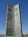 World War II memorial at Tsovagyugh

See also
References
- ^ Kiesling, Brady; Kojian, Raffi (2005). Rediscovering Armenia: Guide (2nd ed.). Yerevan: Matit Graphic Design Studio. p. 83. ISBN 99941-0-121-8.
- Tsovagyugh at GEOnet Names Server
- World Gazeteer: Armenia – World-Gazetteer.com
- Report of the results of the 2001 Armenian Census, Statistical Committee of Armenia
- Kiesling, Brady (June 2000). Rediscovering Armenia: An Archaeological/Touristic Gazetteer and Map Set for the Historical Monuments of Armenia (PDF). Archived (PDF) from the original on 6 November 2021.

This article about a location in Gegharkunik Province, Armenia is a stub. You can help Wikipedia by expanding it. |