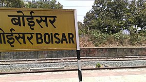
Boisar railway station
Appearance
This article possibly contains original research. (February 2019) |
| Mumbai Suburban Railway station | |||||||||||
 | |||||||||||
| General information | |||||||||||
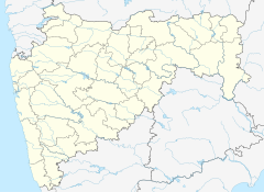
| Location | Boisar India | ||||||||||
| Coordinates | 19°48′N 72°45′E / 19.8°N 72.75°E | ||||||||||
| Elevation | 15.300 metres (50.20 ft) | ||||||||||
| Owned by | Ministry of Railways, Indian Railways | ||||||||||
| Line(s) | Western Line | ||||||||||
| Platforms | 3 | ||||||||||
| Tracks | 5 | ||||||||||
| Bus routes | Mumbai - Ahmadabad route | ||||||||||
| Construction | |||||||||||
| Structure type | Standard on-ground station | ||||||||||
| Platform levels | 1 | ||||||||||
| Parking | free parking | ||||||||||
| Bicycle facilities | Yes | ||||||||||
| Other information | |||||||||||
| Station code | BOR | ||||||||||
| Fare zone | Western Railways | ||||||||||
| History | |||||||||||
| Electrified | yes | ||||||||||
| Services | |||||||||||
| |||||||||||
| |||||||||||
Boisar railway station is a railway station on the Western line of the Mumbai Suburban Railway network. It is also a terminus for the Boisar - Vasai Road line.
The Station is the main mode of transportation for population here. In the last decade five new local train trains were introduced for route Dahanu Road to Virar/Churchgate and two for route Bhiwandi to Boisar. Many express trains stops at the station. The Mumbai to Ahmadabad bullet train will pass through the station.


