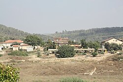
Ta'oz
Appearance
Ta'oz
| |
|---|---|
 | |
| Coordinates: 31°48′5.4″N 34°58′16.32″E / 31.801500°N 34.9712000°E | |
| Country | Israel |
| District | Jerusalem |
| Council | Mateh Yehuda |
| Affiliation | Hapoel HaMizrachi |
| Founded | 1950 |
| Founded by | Yemenite Jews |
| Population (2022)[1] | 657 |
Ta'oz (Template:Lang-he-n, lit. Stronghold) is a moshav in central Israel. Located to the northwest of Beit Shemesh with an area of 1,500 dunams, it falls under the jurisdiction of Mateh Yehuda Regional Council. In 2022 it had a population of 657.[1]
History
The village was established in 1950 by immigrants from Yemen. When the majority of these abandoned the village on account of security reasons, the village absorbed immigrants from Cochin, which now make-up the majority of its residents. Its name is taken [2][3][4] from Psalms 89:14 as the name of neighbouring moshav Tarum;
Thine is an arm with might; strong is Thy hand, and exalted is Thy right hand.
References
- ^ a b "Regional Statistics". Israel Central Bureau of Statistics. Retrieved 21 March 2024.
- ^ Carta's Official Guide to Israel and Complete Gazetteer to all Sites in the Holy Land. (3rd edition 1993) Jerusalem, Carta, p.431, ISBN 965-220-186-3
- ^ Yizhaqi, Arie (ed.): Madrich Israel (Israel Guide: An Encyclopedia for the Study of the Land), Vol.9: Judaea, Jerusalem 1980, Keter Press, p.390 (in Hebrew)
- ^ Bitan, Hanna: 1948-1998: Fifty Years of 'Hityashvut': Atlas of Names of Settlements in Israel, Jerusalem 1999, Carta, p.71, ISBN 965-220-423-4 (in Hebrew)

