Abraham's Woods
This is an old revision of this page, as edited by Ser Amantio di Nicolao (talk | contribs) at 18:46, 5 January 2020 (→References: add authority control). The present address (URL) is a permanent link to this revision, which may differ significantly from the current revision.
| Abraham's Woods | |
|---|---|
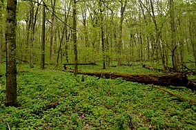
 Abraham's Woods in April 2012 | |
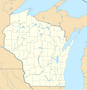
Map of Wisconsin | |
| Location | Green County, Wisconsin |
| Coordinates | 42°40′58″N 89°29′02″W / 42.68278°N 89.48389°W / 42.68278; -89.48389 |
| Area | 40 acres (16 ha) |
| Governing body | University of Wisconsin-Madison |
| Designated | 1973 |
Abraham's Woods is a 40-acre (16 ha) forest in Green County, Wisconsin owned by the University of Wisconsin-Madison.[1][2] It was designated a Wisconsin State Natural Area in 1961 and a National Natural Landmark in 1973.
Description
Abraham's Woods features certain vegetation that is rare in southern Wisconsin.[3] Trees found in the woods include the sugar maple, basswood, red oak, bitternut hickory, hackberry, butternut tree, slippery elm and white oak. A sandstone ridge surrounds the woods, creating a natural amphitheatre facing the east. Other plants that can be found in Abraham's Woods include the dogtooth violet, the wood nettle, the yellow jewelweed, the false rue anemone and the Dutchman's breeches. Additionally, it is home to an active great blue heron rookery.
References
- ^ "Abraham's Woods (No. 38)". Wisconsin Department of Natural Resources. Retrieved 2012-01-19.
- ^ Lang, Jean M. "The outlying properties of the University of Wisconsin-Madison Arboretum: Abraham's woods". University of Wisconsin-Madison Arboretum. pp. 6–17. Retrieved 2013-03-31.
- ^ "Abraham's Woods". National Park Service. Retrieved 2012-01-19.
This article about a location in Green County, Wisconsin is a stub. You can help Wikipedia by expanding it. |

