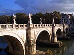
Roman Bridge (Trier)
Appearance
Roman Bridge Römerbrücke | |
|---|---|
 | |
| Coordinates | 49°45′07″N 6°37′35″E / 49.7519°N 6.6265°E |
| Crosses | Moselle |
| Locale | Trier, Rhineland-Palatinate, Germany |
| Characteristics | |
| Material | Stone |
| History | |
| Construction end | 2nd century AD |
| Official name | Moselle Bridge |
| Part of | Roman Monuments, Cathedral of St Peter and Church of Our Lady in Trier |
| Criteria | Cultural: (i), (iii), (iv), (vi) |
| Reference | 367-002 |
| Inscription | 1986 (10th Session) |
| Location | |
 | |
The Roman Bridge (German: Römerbrücke) is an ancient structure in Trier, Germany, over the Moselle. It is the oldest standing bridge in the country. The nine bridge pillars date from the 2nd century AD. The upper part was renewed twice, in the early 12th and in the early 18th century, after suffering destruction in war. It is designated as part of the Roman Monuments, Cathedral of St. Peter and Church of Our Lady in Trier UNESCO World Heritage Site.
Historical views
-
Emperor's Maneuver, parade of the 8th (Rhenish) Cuirassiers (1893)
-
Etching by Fritz Quant (c. 1910)
-
Postcard (1910)
Further reading
- O'Connor, Colin (1993), Roman Bridges, Cambridge University Press, p. 141 (T11), ISBN 0-521-39326-4
See also
External links
![]() Media related to Römerbrücke (Trier) at Wikimedia Commons
Media related to Römerbrücke (Trier) at Wikimedia Commons
- Trier Roman Bridge at Structurae
- Traianus – Technical investigation of Roman public works
- Site of the Römerbrücke in Google Maps
Categories:
- Bridges in Germany
- Roman bridges
- Deck arch bridges
- Stone bridges in Germany
- Bridges completed in the 2nd century
- Buildings and structures in Trier
- History of Trier
- Ancient Roman buildings and structures in Germany
- Rhineland-Palatinate building and structure stubs
- European bridge (structure) stubs
- Germany transport stubs
- German building and structure stubs


