Four Square Mile, Colorado
Appearance
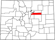
Four Square Mile is a census-designated place (CDP) in Arapahoe County, Colorado, United States. Somewhat smaller than four square miles in size, as suggested by its name, the CDP is surrounded by Denver on the north, west, and south and by Aurora on the east. The CDP includes Sullivan, which was defined as a populated place by the U.S. Geological Survey in the late 1970s and early 1980s,[1] but is now, along with the rest of Four Square Mile, nearly undistinguishable from the surrounding urban development of Denver and Aurora.
Demographics
This section is empty. You can help by adding to it. (January 2019) |
| Census | Pop. | Note | %± |
|---|---|---|---|
| U.S. Decennial Census[2] | |||
See also
- Outline of Colorado
- State of Colorado
References
- ^ "GNIS Detail - Sullivan". geonames.usgs.gov. Retrieved 2020-01-08.
- ^ "Census of Population and Housing". Census.gov. Retrieved June 4, 2016.
External links
Wikimedia Commons has media related to Four Square Mile, Colorado.
- "Four Square Mile Census Designated Place". Geographic Names Information System. United States Geological Survey. Retrieved 2020-01-07.

