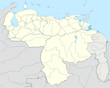
Tomás de Heres Airport
Tomás de Heres Airport Aeropuerto Nacional Tomas de Heres | |||||||||||||||
|---|---|---|---|---|---|---|---|---|---|---|---|---|---|---|---|
 Jimmy Angel's airplane | |||||||||||||||
| Summary | |||||||||||||||
| Airport type | Public | ||||||||||||||
| Serves | Ciudad Bolívar, Venezuela | ||||||||||||||
| Elevation AMSL | 197 ft / 60 m | ||||||||||||||
| Coordinates | 8°07′20″N 63°32′10″W / 8.12222°N 63.53611°W | ||||||||||||||
| Map | |||||||||||||||
 | |||||||||||||||
| Runways | |||||||||||||||
| |||||||||||||||
Tomás de Heres Airport (Template:Lang-es, (IATA: CBL, ICAO: SVCB)) is an airport serving Ciudad Bolívar, the capital of the Bolívar state of Venezuela.
The airport is named in honor of Tomás de Heres (es), a hero of Latin American independence and governor of Venezuela's former Guayana Province.
The Ciudad Bolivar VOR-DME (Ident: CBL) is located on the field.[4]
Airlines and destinations
| Airlines | Destinations |
|---|---|
| Rutaca Airlines | Caracas |
Accidents and incidents
On 25 January 2001, RUTACA Airlines Flight 225, operated by Douglas DC-3C YV-224-C crashed at Ciudad Bolívar killing all 24 on board plus one person on the ground. Another person on the ground was seriously injured. There were unconfirmed reports that a 25th person may have been on board the aircraft. The aircraft was on a non-scheduled domestic passenger flight from Tomás de Heres Airport to Del Caribe "Santiago Mariño" International Airport, Porlamar and had developed an engine problem shortly after take-off.[5][6]
See also
References
- ^ Rwy 12/30 Closed
- ^ Google Maps - Tomás de Heres
- ^ Airport information for CBL at Great Circle Mapper.
- ^ CBL VOR
- ^ "YV-224-C Accident description". Aviation Safety Network. Retrieved 21 June 2010.
- ^ "SINIESTRO DEL YV – 224C" (in Spanish). Rescate. Retrieved 21 June 2010.
External links
- Template:WAD
- OurAirports - Tomás de Heres
- SkyVector - Tomás de Heres
- OpenStreetMap - Ciudad Bolivar
- Accident history for CBL at Aviation Safety Network
![]() Media related to Tomás de Heres Airport at Wikimedia Commons
Media related to Tomás de Heres Airport at Wikimedia Commons

