Parker Peak
Appearance


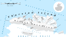
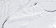
Parker Peak (72°18′S 97°24′W / 72.300°S 97.400°W) is a peak of the Walker Mountains rising at the base of Evans Peninsula on Thurston Island. It was delineated from air photos taken by U.S. Navy Squadron VX-6 in January 1960. It was named by the Advisory Committee on Antarctic Names (US-ACAN) for Alton N. Parker, an aviation pilot of the Byrd Antarctic Expedition in 1928–30.
See also
Maps
- Thurston Island – Jones Mountains. 1:500000 Antarctica Sketch Map. US Geological Survey, 1967.
- Antarctic Digital Database (ADD). Scale 1:250000 topographic map of Antarctica. Scientific Committee on Antarctic Research (SCAR). Since 1993, regularly upgraded and updated.
References
 This article incorporates public domain material from "Parker Peak". Geographic Names Information System. United States Geological Survey.

