Lower Basildon
| Lower Basildon | |
|---|---|
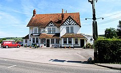
 Typical Building Style | |
Location within Berkshire | |
| OS grid reference | SU609787 |
| Civil parish | |
| Unitary authority | |
| Ceremonial county | |
| Region | |
| Country | England |
| Sovereign state | United Kingdom |
| Post town | READING |
| Postcode district | RG8 |
| Dialling code | 01491 |
| Police | Thames Valley |
| Fire | Royal Berkshire |
| Ambulance | South Central |
| UK Parliament | |
Lower Basildon is a small English village in the civil parish of Basildon, near Pangbourne, in the county of Berkshire. It has a parish church of St Bartholomew.[1]
Historic buildings
Basildon Park
The National Trust property, Basildon Park, is just above the church.[2]
Black and white
The village is well-known locally for the presence of a row of timber-framed "black-and-white" houses to the west. However, only one of these possesses a true timber frame. The remainder are built of brick, and clad with timber to resemble framing. These latter houses are said to have been designed by Edwin Lutyens, who had been commissioned to design workers' cottages for Basildon Park.
Grotto and wildlife
Basildon Grotto, or The Grotto House, is located 0.8 miles (1.3 km) to the west on the road to Streatley. The grotto was built in 1720 and consisted of a rock chamber filled with shells and a rock pool, but was later destroyed. The summer house was extended at the beginning of the 19th century by Arthur Smith MP.[3] It was until recently the headquarters of the Institute for Leisure and Amenity Management (ILAM), but it is now empty and for sale.[4]
To the south-east of the village is the wildlife garden Beale Park.[5]
Roman villa
The remains of a modest Roman villa were discovered here in 1839 during the construction of the Great Western Railway. The major finds were two superb mosaic floors, which were unfortunately destroyed almost immediately, although one was drawn in some detail beforehand by the antiquarian Charles Roach Smith. Nothing of the villa remains today.[6]
Amenities
Upper Basildon has a sub-post office (located in St Stephen's Church) and a pub-restaurant, The Red Lion.[7] Lower Basildon currently has a garage/shop and a motor repair business.
Notable people
The agriculturist Jethro Tull was born in the parish of Basildon and is buried in the churchyard of St Bartholomew's Church in Lower Basildon, under a modern gravestone incorrectly dated 1740 – he died in 1741.[8] Tull developed his ideas at a farm called Prosperous at Shalbourne, just south of Hungerford.[9]
References
- ^ Churches Conservation Trust. Retrieved 8 May 2014.
- ^ NT Basildon Park site. Retrieved 8 May 2014.
- ^ Christopher Winn: I Never Knew That about the River Thames (London: Ebury Press, 2010), p. 79.
- ^ Basildon Parish Plan draft Retrieved 8 May 2014.
- ^ Beale Park site. Retrieved 8 May 2014.
- ^ Berkshire History. Retrieved 8 May 2014.
- ^ Basildon, West Berkshire site. Retrieved 8 May 2014.
- ^ Winn, p. 79.
- ^ "Tull, Jethro" in Cuthbert W. Johnson: The Farmer's Encyclopædia, and Dictionary of Rural Affairs (London, 1844), pp. 1056–1057.

