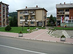
Rudnik (Gornji Milanovac)
Appearance
Rudnik
Рудник | |
|---|---|
Village | |
 | |
| Coordinates: 44°08′27″N 20°29′56″E / 44.14083°N 20.49889°E | |
| Country | |
| District | Moravica District |
| Municipality | Gornji Milanovac |
| Area | |
| • Total | 23.38 km2 (9.03 sq mi) |
| Elevation | 595 m (1,952 ft) |
| Population (2011) | |
| • Total | 1,490 |
| • Density | 64/km2 (170/sq mi) |
| Time zone | UTC+1 (CET) |
| • Summer (DST) | UTC+2 (CEST) |
Rudnik is a village in the municipality of Gornji Milanovac, Serbia. According to the 2011 census, the town has a population of 1,490 people.[1]
History
In 1363 it was under the control of Nikola Altmanović. It probably fell under the control of his uncle Vojislav Vojinović some years early and had been granted to Nikola as a vassal. [2]
References
- ^ Popis stanovništva, domaćinstava i Stanova 2002. Knjiga 1: Nacionalna ili etnička pripadnost po naseljima. Republika Srbija, Republički zavod za statistiku Beograd 2003. ISBN 86-84433-00-9
- ^ R. Mihaljčić, Kraj Srpskog Carstva, SKZ, Beograd. 1975. pp. 36.
44°08′27″N 20°29′56″E / 44.14083°N 20.49889°E
Wikimedia Commons has media related to Rudnik (Gornji Milanovac).


