From Wikipedia, the free encyclopedia
This list is of the Historic Sites of Japan located within the Prefecture of Iwate.[1]
National Historic Sites
As of 1 July 2019, thirty Sites have been designated as being of national significance (including three *Special Historic Sites).[2][3]
| Site
|
Municipality
|
Comments
|
Image
|
Coordinates
|
Type
|
Ref.
|
*Chūson-ji Precinct
中尊寺境内
Chūson-ji keidai
|
Hiraizumi
|
component of the UNESCO World Heritage Site Hiraizumi – Temples, Gardens and Archaeological Sites Representing the Buddhist Pure Land[4]
|
 Chūson-ji Precinct Chūson-ji Precinct
|
39°00′07″N 141°06′00″E / 39.00186419°N 141.10007091°E / 39.00186419; 141.10007091 (Chūson-ji Precinct)
|
3
|
[1]
|
*Muryōkō-in ruins
無量光院跡
Muryōkōin ato
|
Hiraizumi
|
component of the UNESCO World Heritage Site Hiraizumi – Temples, Gardens and Archaeological Sites Representing the Buddhist Pure Land[4]
|
 Muryōkō-in ruins Muryōkō-in ruins
|
38°59′35″N 141°06′57″E / 38.99293001°N 141.1158882°E / 38.99293001; 141.1158882 (Muryōkō-in ruins)
|
3
|
[2]
|
*Mōtsū-ji Precinct and associated Chinjusha
毛越寺境内 附 鎮守社跡
Mōtsūji keidai tsuketari chinjūsha ato
|
Hiraizumi
|
component of the UNESCO World Heritage Site Hiraizumi – Temples, Gardens and Archaeological Sites Representing the Buddhist Pure Land[4]
|
 Mōtsū-ji Precinct Mōtsū-ji Precinct
|
38°59′26″N 141°06′56″E / 38.99053116°N 141.11545706°E / 38.99053116; 141.11545706 (Mōtsū-ji Precinct)
|
3
|
[3]
|
Ayaorishinden Site
綾織新田遺跡
Ayaorishinden iseki
|
Tōno
|
Jōmon period settlement ruins
|
|
39°19′01″N 141°17′56″E / 39.31704513°N 141.29888505°E / 39.31704513; 141.29888505 (Ayaorishinden Site)
|
1
|
[4]
|
Ōshū Kaidō
奥州街道
Ōshū Kaidō
|
Ichinohe, Iwate
|
Edo period highway
|
|
40°14′20″N 141°28′07″E / 40.2388038°N 141.46854328°E / 40.2388038; 141.46854328 (Ōshū Kaidō)
|
6
|
[5]
|
Shimofunato Shell Mound
下船渡貝塚
Shimofunato kaizuka
|
Ōfunato
|
Jōmon period shell midden
|
|
39°02′16″N 141°43′09″E / 39.03776484°N 141.7190317°E / 39.03776484; 141.7190317 (Shimofunato Shell Mound)
|
1
|
[6]
|
Tsunozuka Kofun
角塚古墳
Tsunozuka kofun
|
Ōshū
|
Kofun period tumuli
|
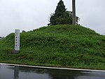 Tsunozuka Kofun Tsunozuka Kofun
|
39°08′29″N 141°05′37″E / 39.14136172°N 141.09374587°E / 39.14136172; 141.09374587 (Tsunozuka Kofun)
|
1
|
[7]
|
Kabayama Site
樺山遺跡
Kabayama iseki
|
Kitakami
|
Jōmon period settlement
|
 Kabayama Site Kabayama Site
|
39°14′32″N 141°07′48″E / 39.24234144°N 141.12987147°E / 39.24234144; 141.12987147 (Kabayama Site)
|
1
|
[8]
|
Hashino iron mining and smelting site
橋野高炉跡
Hashino kōro ato
|
Kamaishi
|
oldest Western-style blast furnace in Japan, built in 1858; influenced the development of the Yawata Steel Works and for this reason a component of the UNESCO World Heritage Site Sites of Japan’s Meiji Industrial Revolution: Iron and Steel, Shipbuilding and Coal Mining[5][6]
|
 Hashino Blast Furnace Site Hashino Blast Furnace Site
|
39°20′36″N 141°40′57″E / 39.34342274°N 141.6824396°E / 39.34342274; 141.6824396 (Hashino Blast Furnace Site)
|
6
|
[9]
|
Kinkeizan
金鶏山
Kinkeizan
|
Hiraizumi
|
component of the UNESCO World Heritage Site Hiraizumi – Temples, Gardens and Archaeological Sites Representing the Buddhist Pure Land[4]
|
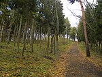 Kinkeizan Kinkeizan
|
38°59′36″N 141°06′33″E / 38.99335037°N 141.10920153°E / 38.99335037; 141.10920153 (Kinkeizan)
|
2,3
|
[10]
|
Kunohe Castle ruins
九戸城跡
Kunohe-jō ato
|
Ninohe
|
Muromachi period castle ruins
|
 Kunohe Castle ruins Kunohe Castle ruins
|
40°16′04″N 141°18′11″E / 40.26790019°N 141.30316196°E / 40.26790019; 141.30316196 (Kunohe Castle ruins)
|
2
|
[11]
|
Goshono Site
御所野遺跡
Goshono iseki
|
Ichinohe
|
submitted for inscription on the UNESCO World Heritage List as one of the Jōmon Archaeological Sites in Hokkaidō, Northern Tōhoku, and other regions[7][8]
|
 Goshono Site Goshono Site
|
40°11′53″N 141°18′23″E / 40.19815136°N 141.30645834°E / 40.19815136; 141.30645834 (Goshono Site)
|
1
|
[12]
|
Ezuriko Kofun Cluster
江釣子古墳群
Ezuriko kofun-gun
|
Kitakami
|
Kofun period tumuli
|
|
39°17′29″N 141°04′56″E / 39.29146211°N 141.08231253°E / 39.29146211; 141.08231253 (Ezuriko Kofun Cluster)
|
1
|
[13]
|
Former Residence of Takano Chōei
高野長英旧宅
Takano Chōei kyū-taku
|
Ōshū
|
Bakumatsu period rangaku scholar residence
|
|
39°08′30″N 141°08′28″E / 39.14161321°N 141.14100696°E / 39.14161321; 141.14100696 (Former Residence of Takano Chōei)
|
8
|
[14]
|
Kunimisan temple ruins
国見山廃寺跡
Kunimisan Haiji ato
|
Kitakami
|
Heian period temple ruins
|
 Kunimisan temple ruins Kunimisan temple ruins
|
39°15′48″N 141°08′32″E / 39.263443°N 141.14212°E / 39.263443; 141.14212 (Kunimisan temple ruins)
|
3
|
[15]
|
Honederamura Shōen ruins
骨寺村荘園遺跡
Honederamura shōen iseki
|
Ichinoseki
|
Heian period estate ruins
|
 Honederamura Shōen Site Honederamura Shōen Site
|
38°58′54″N 140°57′06″E / 38.9817021°N 140.95177743°E / 38.9817021; 140.95177743 (Honederamura Shōen Site)
|
6
|
[16]
|
Sakiyama Shell Mound
崎山貝塚
Sakiyama kaizuka
|
Miyako
|
Jōmon period shell midden
|
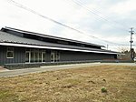 Sakiyama Shell Mound Sakiyama Shell Mound
|
39°40′29″N 141°57′41″E / 39.67463142°N 141.96144694°E / 39.67463142; 141.96144694 (Sakiyama Shell Mound)
|
1
|
[17]
|
Shiwa Castle ruins
志波城跡
Shiwa-jō ato
|
Morioka
|
Heian period castle ruins
|
 Shiwa Castle ruins Shiwa Castle ruins
|
39°41′08″N 141°06′22″E / 39.68555267°N 141.10624036°E / 39.68555267; 141.10624036 (Shiwa Castle ruins)
|
2
|
[18]
|
Morioka Castle
盛岡城跡
Morioka-jō ato
|
Morioka
|
Edo period castle
|
 Morioka Castle Morioka Castle
|
39°42′02″N 141°09′04″E / 39.70066353°N 141.15108067°E / 39.70066353; 141.15108067 (Morioka Castle)
|
2
|
[19]
|
Ōsuzukami Site
大清水上遺跡
Ōsuzukami iseki
|
Ōshū
|
Jōmon period settlement ruins
|
|
39°06′47″N 140°57′14″E / 39.11310698°N 140.95390454°E / 39.11310698; 140.95390454 (Ōsuzukami Site)
|
1
|
[20]
|
Ōhora Shell Mound
大洞貝塚
Ōhora kaizuka
|
Ōfunato
|
Jōmon period shell midden
|
|
39°04′01″N 141°44′40″E / 39.06681149°N 141.74457859°E / 39.06681149; 141.74457859 (Ōhora Shell Mound)
|
1
|
[21]
|
Takonoura Shell Mound
蛸ノ浦貝塚
Takonoura kaizuka
|
Ōfunato
|
Jōmon period shell midden
|
|
39°02′08″N 141°44′23″E / 39.0356528°N 141.7398608°E / 39.0356528; 141.7398608 (Takonoura Shell Mound)
|
1
|
[22]
|
Takkoku-no-Iwaya
達谷窟
Takkoku-no-Iwaya
|
Hiraizumi
|
Heian period Buddhist site
|
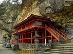 Takkoku-no-Iwaya Takkoku-no-Iwaya
|
38°58′08″N 141°03′29″E / 38.96901282°N 141.0581363°E / 38.96901282; 141.0581363 (Takkoku-no-Iwaya)
|
3
|
[23]
|
Isawa Castle Site
胆沢城跡
Isawa-jō ato
|
Ōshū
|
Heian period castle ruins
|
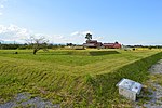 Isawa Castle Site Isawa Castle Site
|
39°10′51″N 141°08′07″E / 39.18075357°N 141.13514156°E / 39.18075357; 141.13514156 (Isawa Castle Site)
|
2
|
[24]
|
Nakazawahama Shell Mound
中沢浜貝塚
Nakazawahama kaizuka
|
Rikuzentakata
|
Jōmon period shell midden
|
|
38°57′16″N 141°41′39″E / 38.95441924°N 141.69403949°E / 38.95441924; 141.69403949 (Nakazawahama Shell Mound)
|
1
|
[25]
|
Tokutan Castle ruins
徳丹城跡
Tokutan-jō ato
|
Yahaba
|
Heian period castle ruins
|
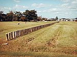 Tokutan Castle ruins Tokutan Castle ruins
|
39°36′28″N 141°10′21″E / 39.60777681°N 141.17236734°E / 39.60777681; 141.17236734 (Tokutan Castle ruins)
|
2
|
[26]
|
Nanbu-Date border mounds
南部領伊達領境塚
Nanbu-ryō Date-ryō
|
Kitakami, Kanegasaki
|
Edo period border markers
|
|
39°15′53″N 141°03′03″E / 39.26466287°N 141.05074033°E / 39.26466287; 141.05074033 (Nambu-Date border mounds)
|
2
|
[27]
|
Hatten Site
八天遺跡
Hatten iseki
|
Kitakami
|
Jōmon period settlement ruins
|
|
39°19′44″N 141°09′26″E / 39.32894584°N 141.15726166°E / 39.32894584; 141.15726166 (Hatten Site)
|
1
|
[28]
|
Yanagi-no-Gosho and Sites of Hiraizumi
柳之御所・平泉遺跡群
Yanagi-no-Gosho - Hiraizumi iseki-gun
|
Hiraizumi, Ōshū
|
designation includes the sites in Ōshū of Chōjagahara temple ruins (長者ヶ原廃寺跡) and Shirotoridate ruins (白鳥舘遺跡), which formed part of the original 2006 World Heritage nomination of "Hiraizumi - Cultural Landscape Associated with Pure Land Buddhist Cosmology"[9][10][11]
|
 Yanagi-no-Gosho Yanagi-no-Gosho
|
38°59′37″N 141°07′09″E / 38.993611°N 141.119167°E / 38.993611; 141.119167 (Yanagi-no-Gosho)
|
2
|
[29]
|
Tonomi Palisade ruins
鳥海柵跡
Tonomi-no-saku iseki
|
Kanegasaki
|
Heian period castle ruins
|
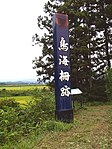 Tonomi Palisade ruins Tonomi Palisade ruins
|
39°11′17″N 141°06′42″E / 39.187978°N 141.111724°E / 39.187978; 141.111724 (Tonomi Palisade ruins)
|
2
|
[30]
|
This list is complete and up to date as of July 2019.
Prefectural Historic Sites
As of 1 May 2018, thirty-seven Sites have been designated as being of prefectural importance.[12]
This list is complete and up to date as of July 2019.
Municipal Historic Sites
As of 1 May 2018, a further one hundred and ninety-four Sites have been designated as being of municipal importance.[13]
See also
References
External links


