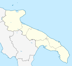
Zapponeta
Appearance
This article needs additional citations for verification. (March 2018) |
Zapponeta | |
|---|---|
| Comune di Zapponeta | |
| Coordinates: 41°27′N 15°57′E / 41.450°N 15.950°E | |
| Country | Italy |
| Region | Apulia |
| Province | Foggia (FG) |
| Government | |
| • Mayor | Vincenzo D'Aloisio |
| Area | |
• Total | 41.75 km2 (16.12 sq mi) |
| Elevation | 10 m (30 ft) |
| Population (31 December 2015)[2] | |
• Total | 3,396 |
| • Density | 81/km2 (210/sq mi) |
| Demonym | Zapponetani |
| Time zone | UTC+1 (CET) |
| • Summer (DST) | UTC+2 (CEST) |
| Postal code | 71030 |
| Dialing code | 0884 |
| Patron saint | Madonna della Misericordia |
| Saint day | September 12 |
| Website | Official website |
Zapponeta (Pugliese: Zappunòte) is a town and comune in the province of Foggia in the Apulia region of southeast Italy. Until 1975 it was a frazione of Manfredonia. It was founded in 1768 by baron Michele Zezza.
References
[edit]- ^ "Superficie di Comuni Province e Regioni italiane al 9 ottobre 2011". Italian National Institute of Statistics. Retrieved 16 March 2019.
- ^ All demographics and other statistics from the Italian statistical institute (Istat)


